Route 66 - Day #8
Saturday, April 18, 2026
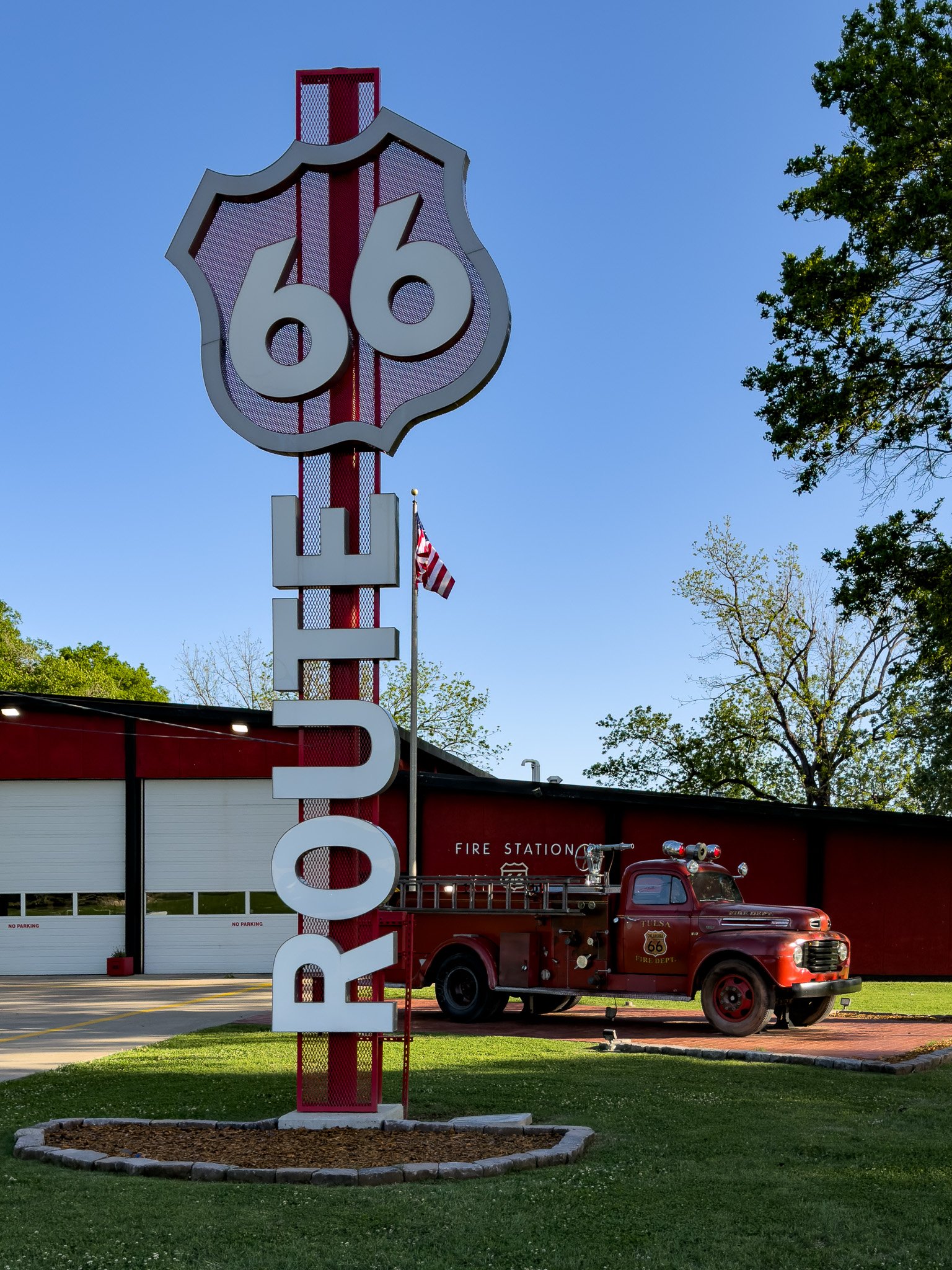
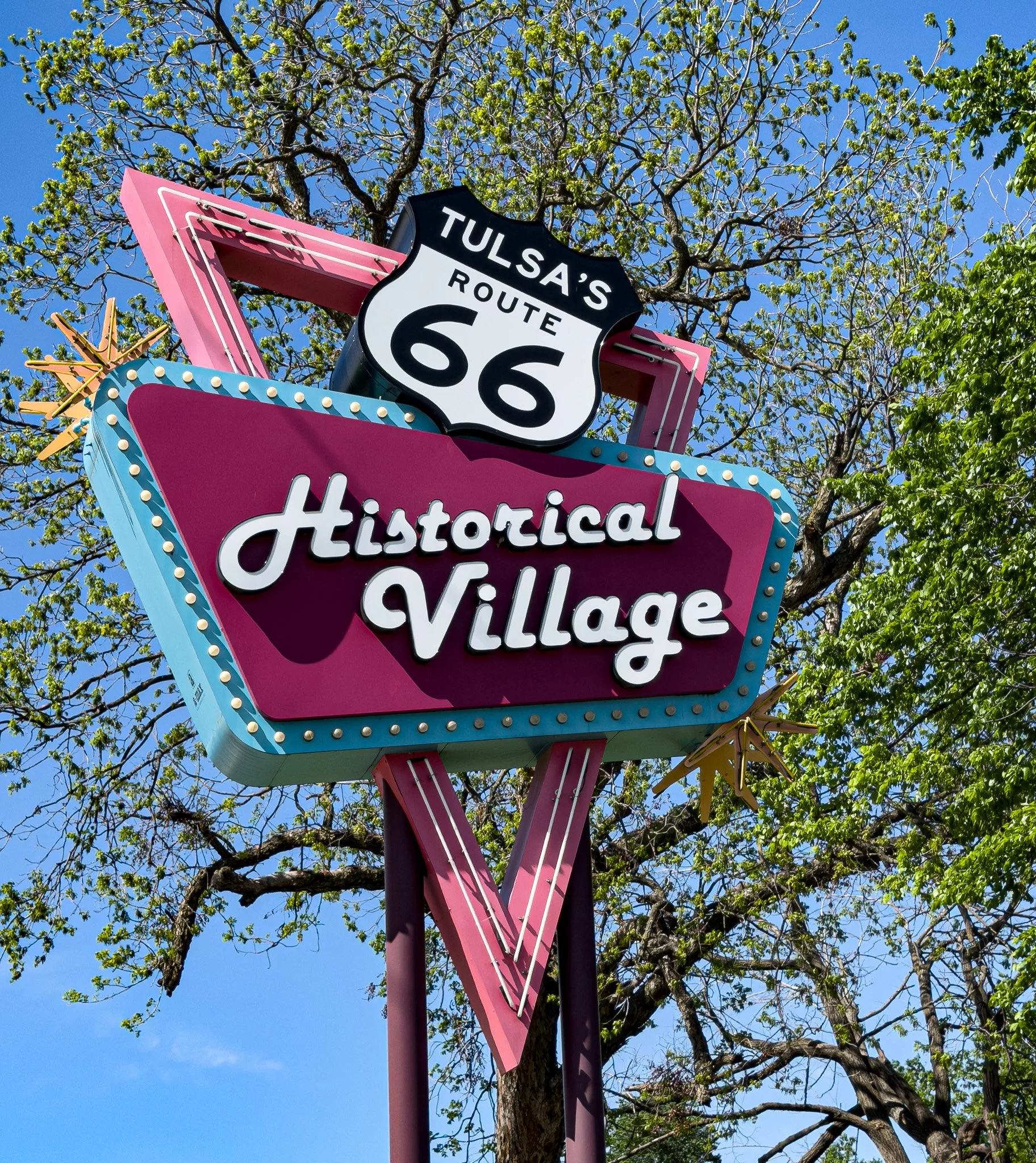
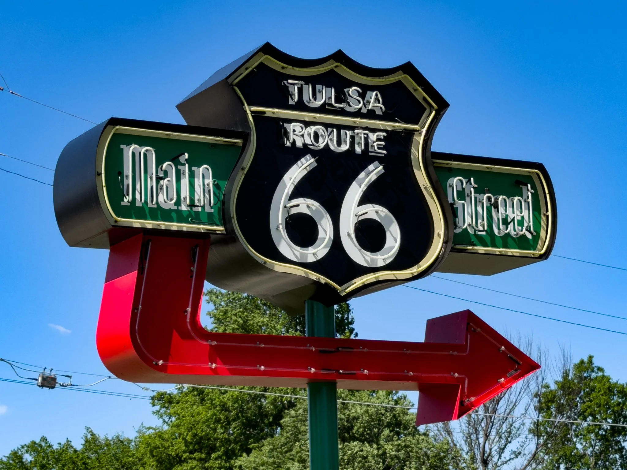
Tulsa really embraces their Route 66 heritage. Even the fire stations sport Route 66 signs.
Click on Image for Map.
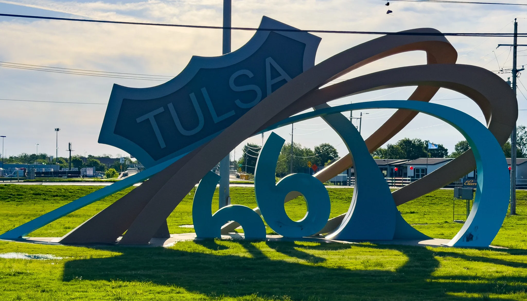
This sculpture in the middle of a traffic circle in Tulsa is called Route 66 Rising. Lucky it was a Saturday morning so we could stop in the middle of the traffic circle to snap this photo. Any week day and this wouldn’t have been possible.
Click on Image for Map.
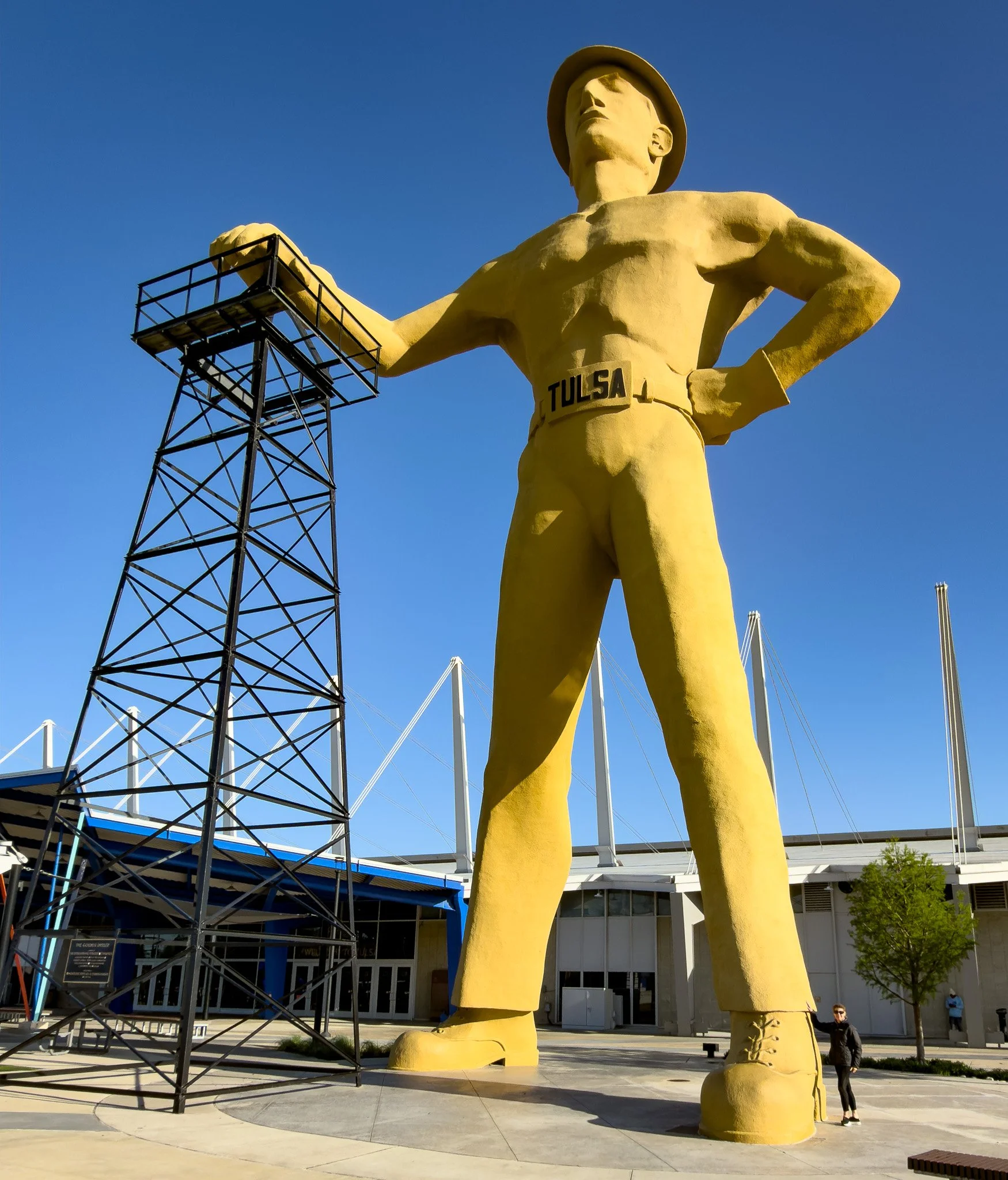
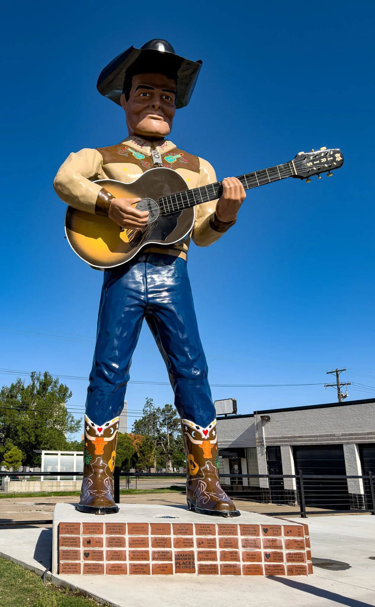
Now, THIS is a giant!!!
From ChatGPT:
The Golden Driller is a 76-foot-tall statue at Tulsa’s fairgrounds, depicting a rugged oil worker leaning on a derrick. First created for a 1953 petroleum exposition, it became permanent in 1966 and was named Oklahoma’s official state monument, symbolizing the city’s rich oil heritage.
Click on Image for Map.
Click on Image for Map.
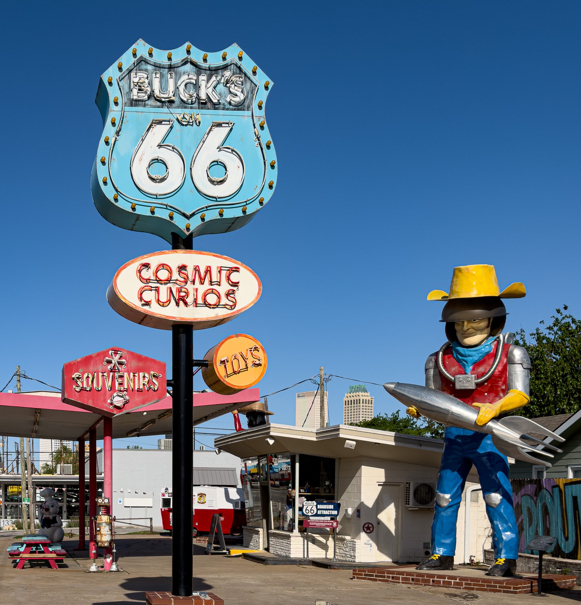
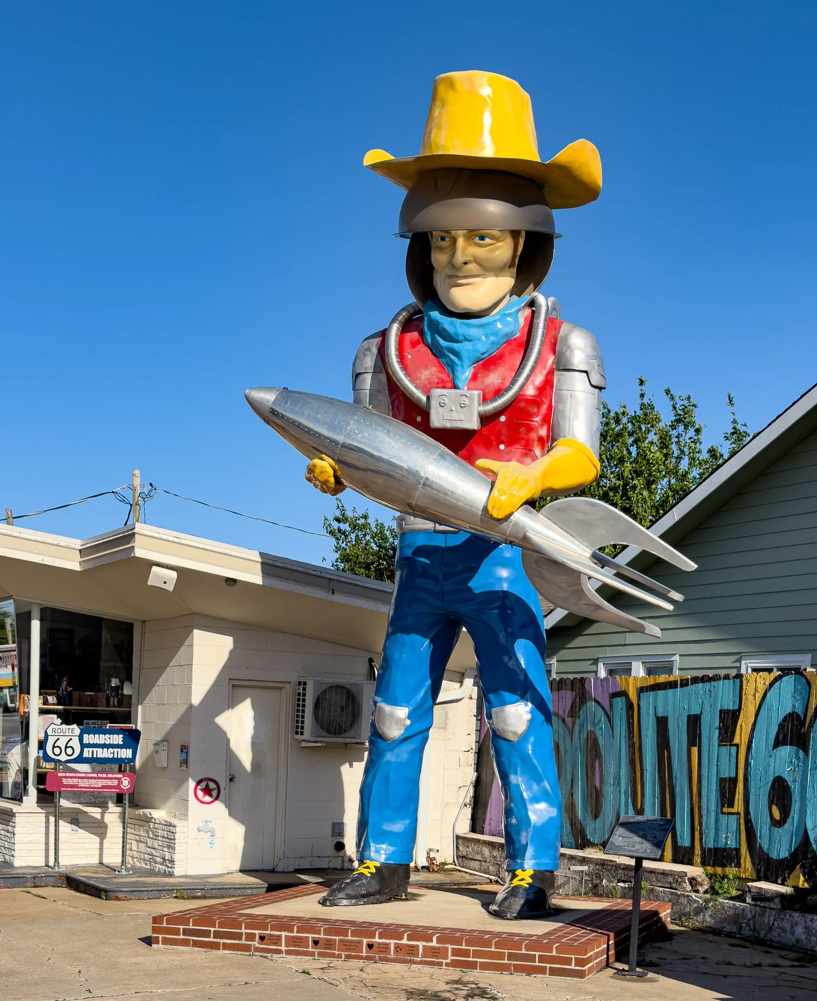
Next was a stop at Buck’s on 66 Cosmic Curios.
After the Golden Driller, these are some more “normal” size giants.
Click on Image for Map.
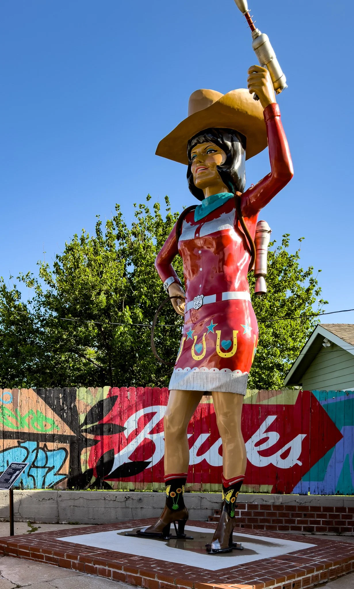
Tulsa really gets into the “giants.”
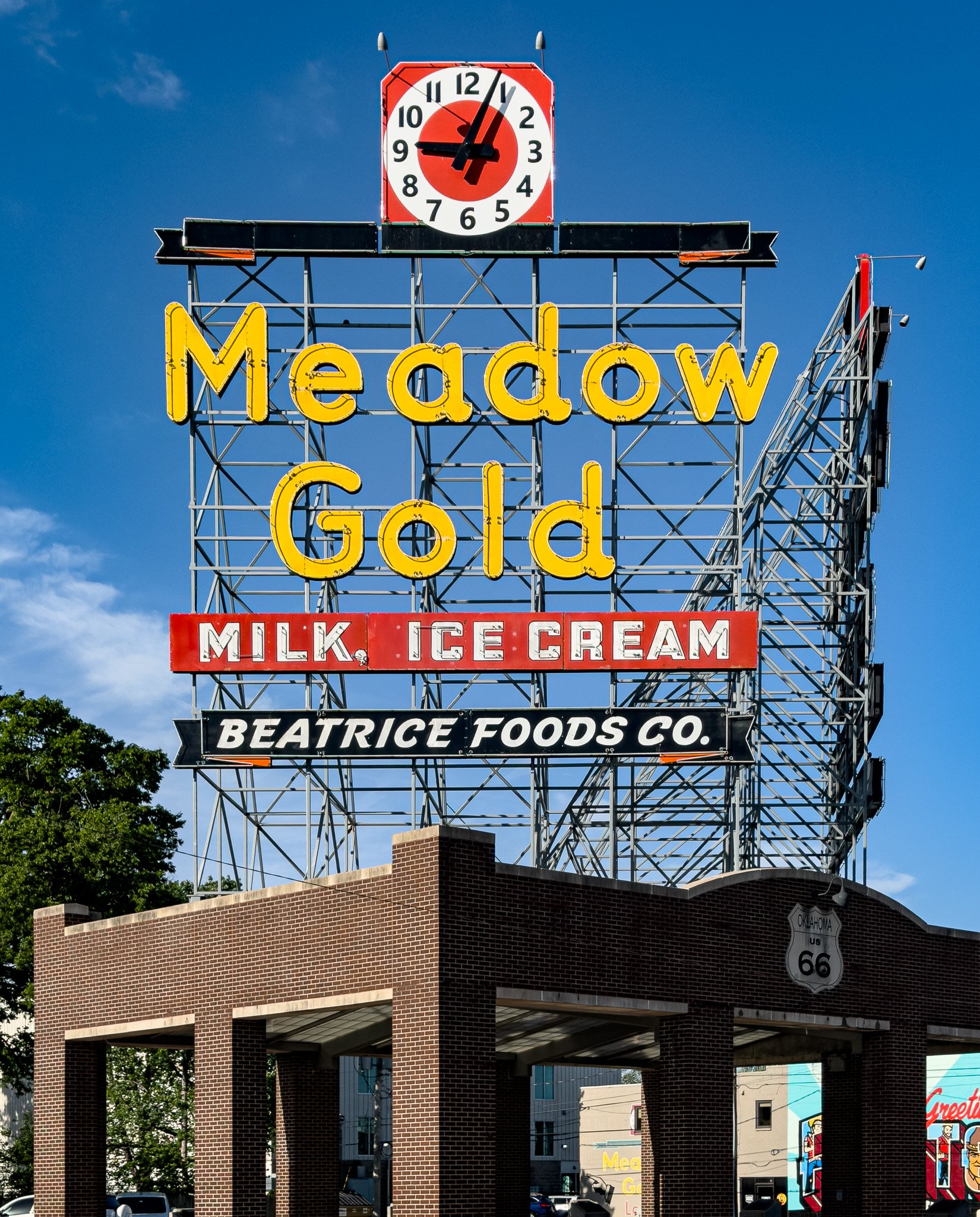
They also have some great neon. We just don’t get out at night to appreciate these neon signs enough.
Click on Image for Map.
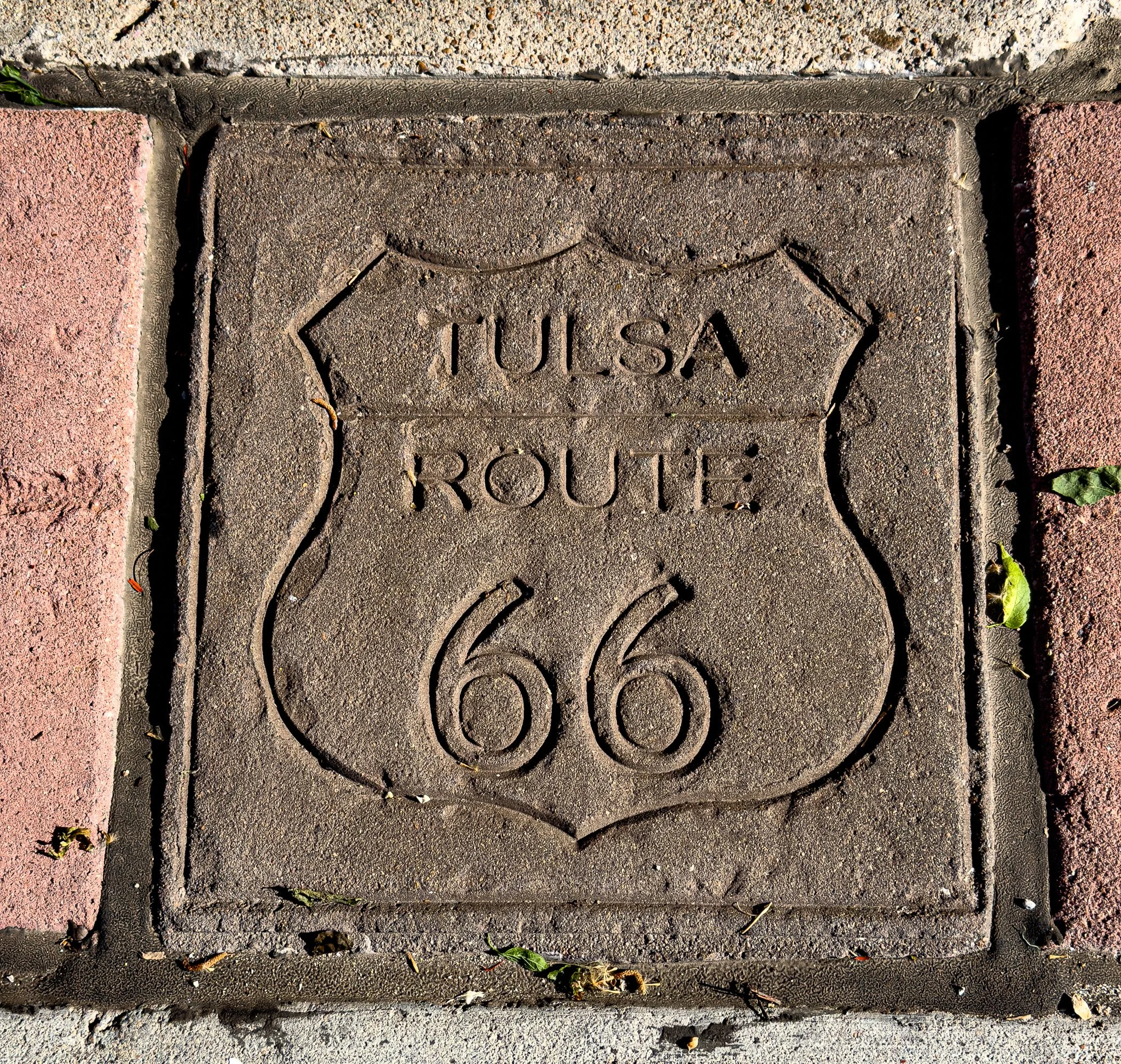
This section of Route 66 in Tulsa has these inlaid pavers every so often. Again, they REALLY embrace their Route 66 heritage. This is because, as we will see in the next several photos, it is where many believe the idea for Route 66 came from in the form of Cyrus Avery.
Click on Image for Map.
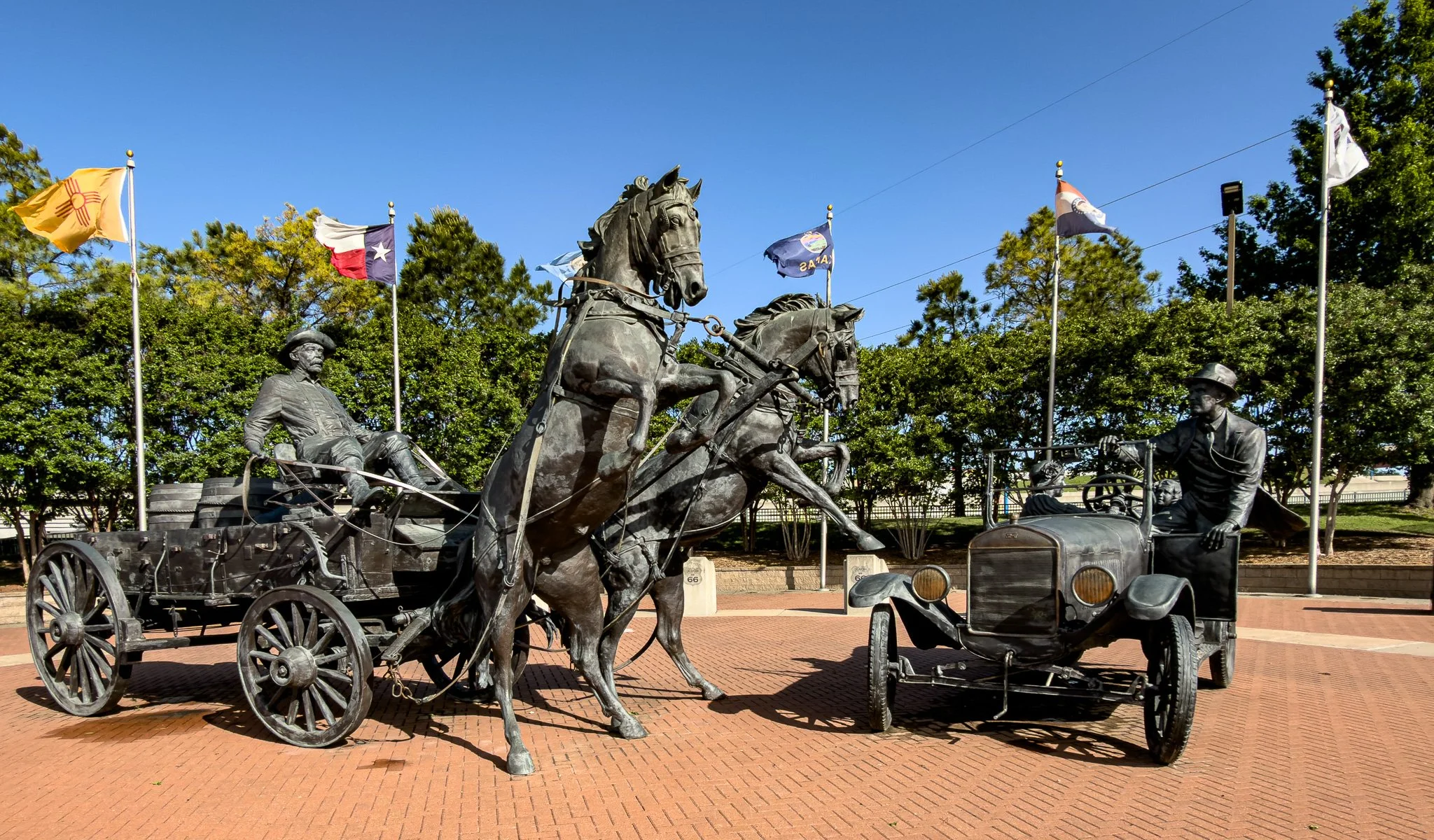
From ChatGPT:
The East Meets West sculpture at Cyrus Avery Park is a massive bronze installation depicting a dramatic encounter between Cyrus Avery’s Model T and a horse-drawn oil wagon. Unveiled in 2012, it symbolizes the transition from old to new—where rural life met modern transportation along historic Route 66.
Click on Image for Map.
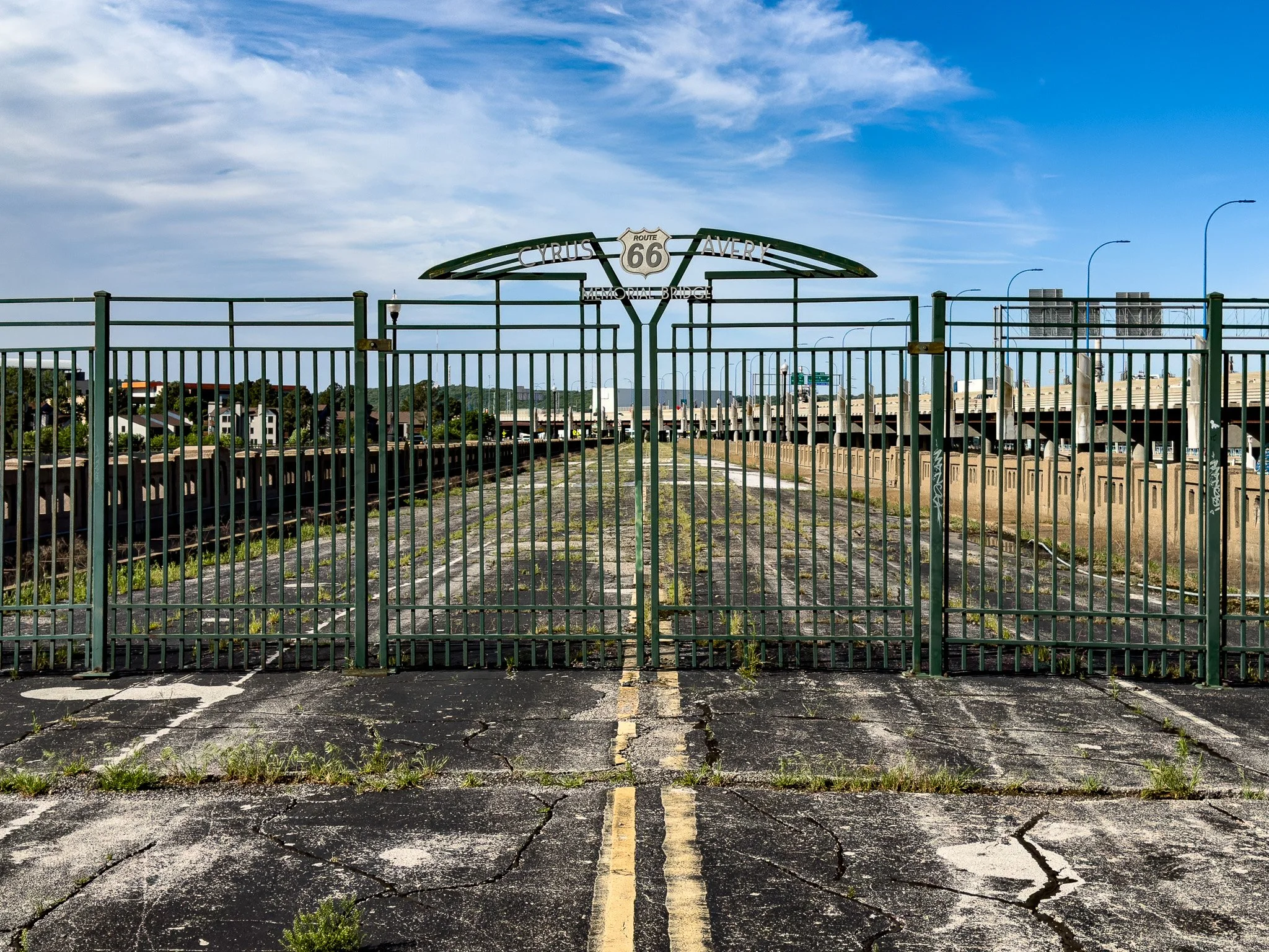
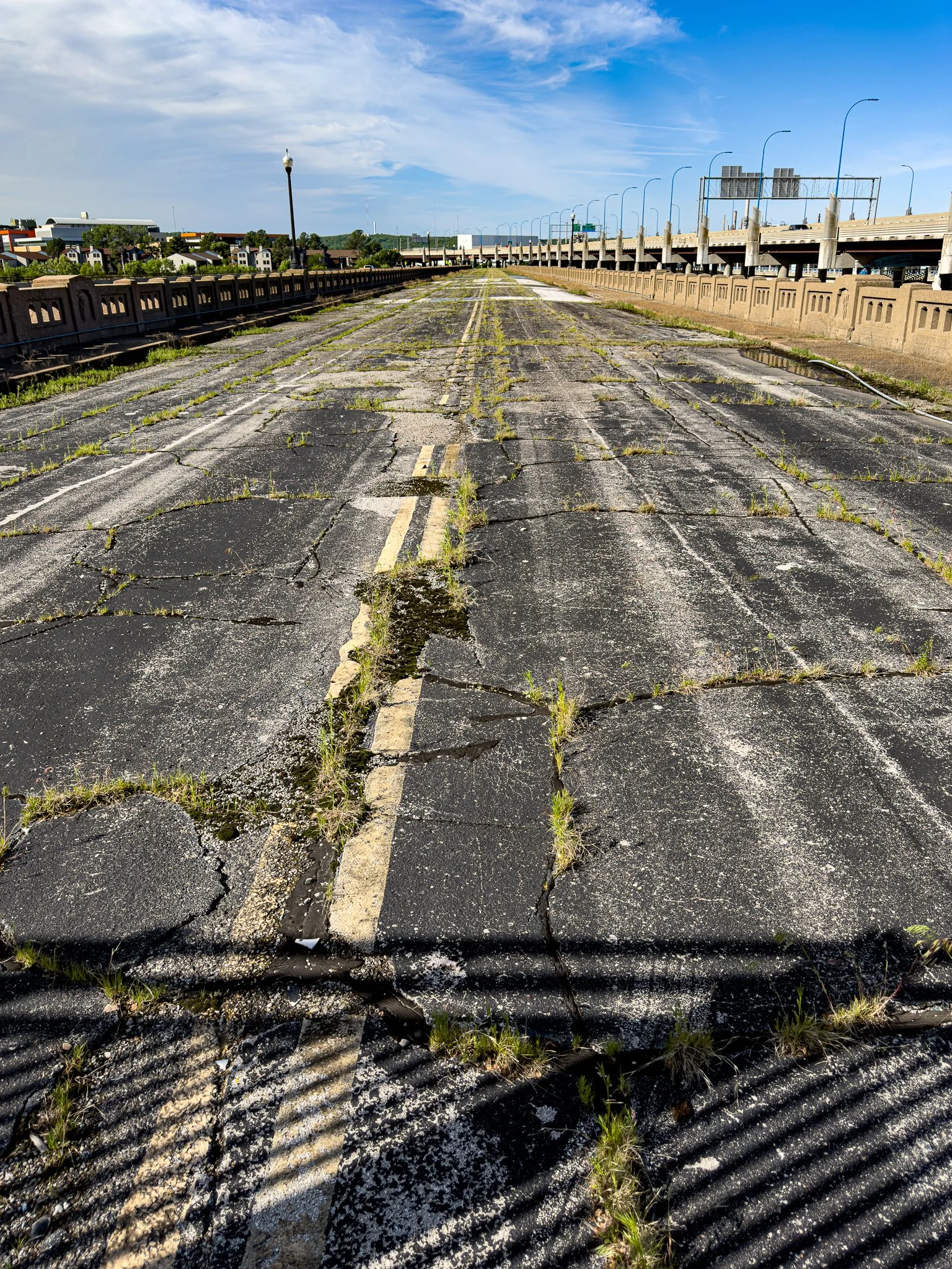
The Route 66 Cyrus Avery Memorial Bridge.
From ChatGPT:
The Cyrus Avery Memorial Bridge spans the Arkansas River along old U.S. Route 66 in Tulsa. Built in 1915, it became a key Route 66 crossing and was later restored as a pedestrian link. Named for Cyrus Avery, it anchors Avery Centennial Plaza, celebrating the highway’s legacy and Tulsa’s role in shaping America’s most famous road.
The Cyrus Avery Memorial Bridge carried vehicle traffic for decades but was effectively bypassed in 1948 when a newer U.S. Route 66 alignment opened nearby. It remained in limited local use until closing due to serious structural deterioration, and it has remained closed ever since because it’s considered unsafe to walk on.
Click on Image for Map.
From ChatGPT:
Cyrus Avery is called the Father of Route 66 because he championed routing the highway through Oklahoma, especially Tulsa, ensuring economic benefit. As a highway commissioner, he pushed for federal support, helped plan the alignment, and promoted paving and improvements, making Route 66 a vital cross-country corridor for travel and commerce.
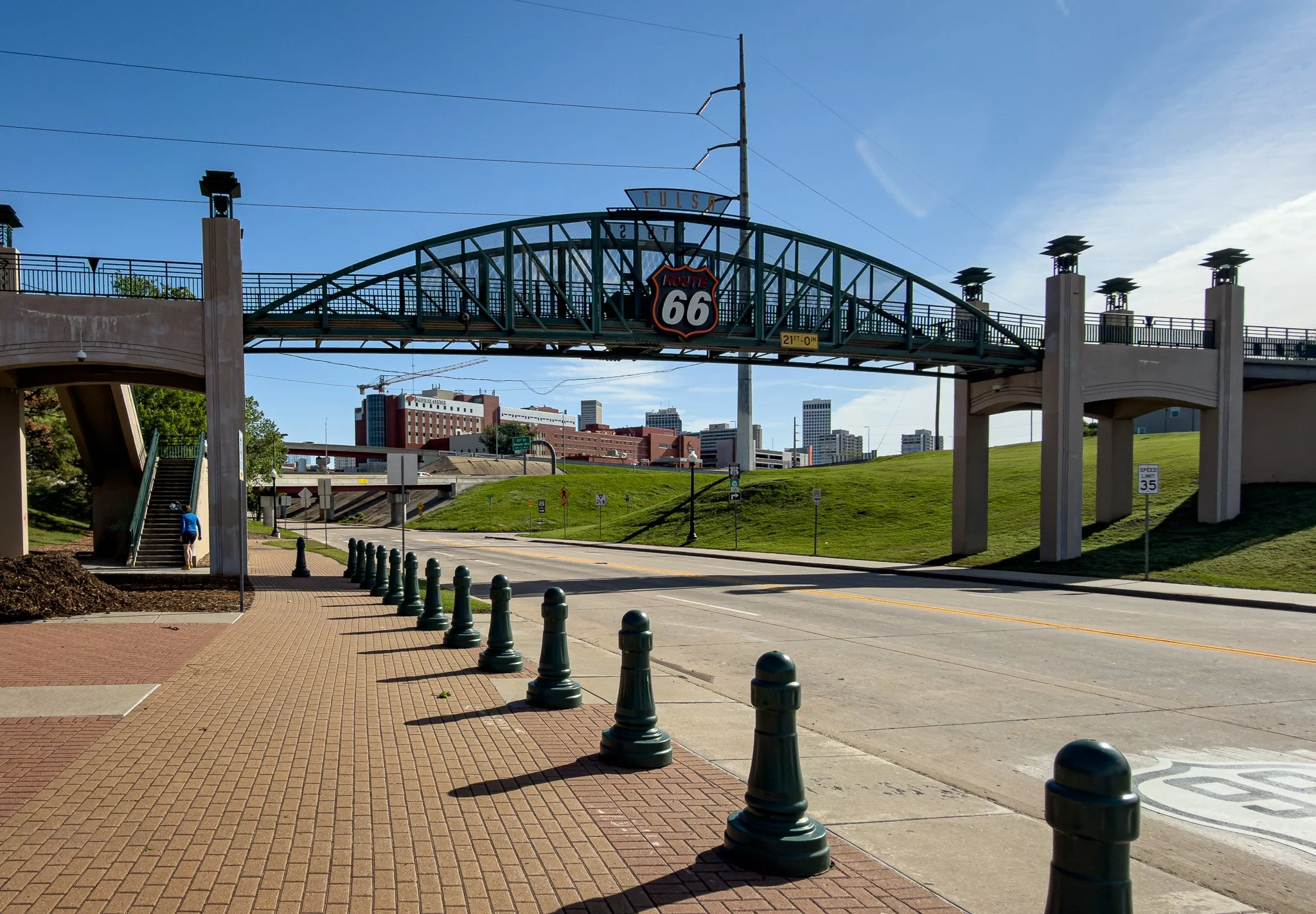
Pedestrian bridge giving visitors access to Cyrus Avery Centennial Plaza.
Click on Image for Map.
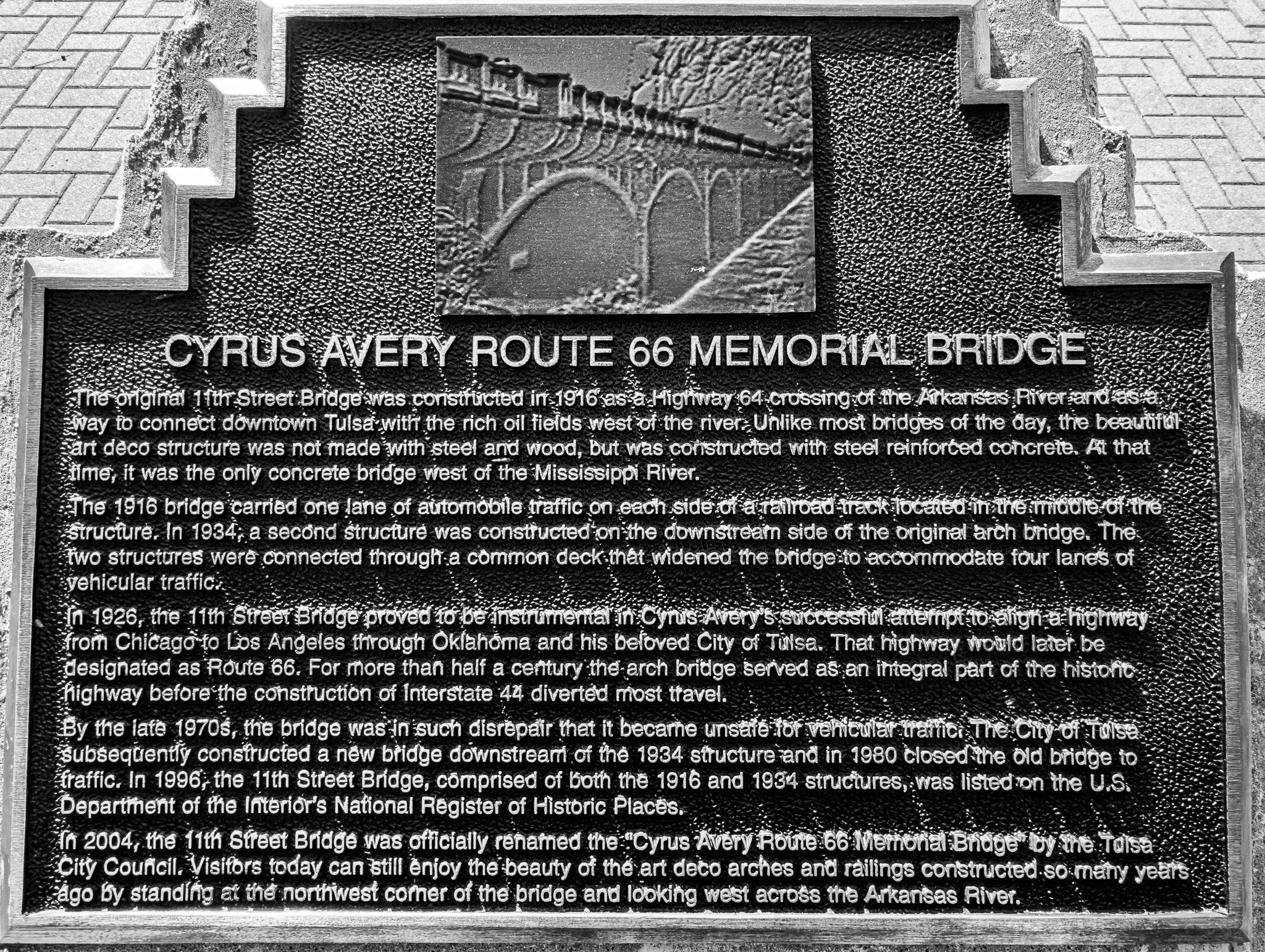
Maybe a bit difficult to read in this image, but worth it for a good history lesson.
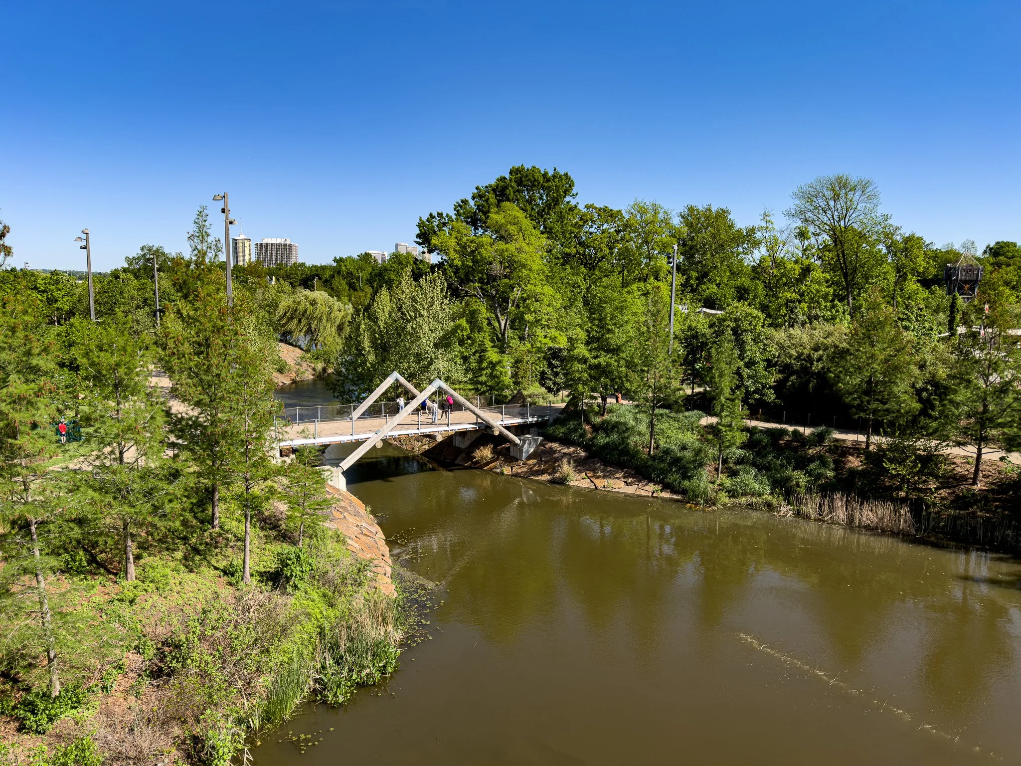
Tulsa has a public park called the Gathering Place. We walked for several miles on the paved, meandering paths. This photo was taken overlooking one small part of the park - and it does not do the beauty of this park near enough justice. This is the epitome of public city space. Well done Tulsa!!
From ChatGPT:
Gathering Place is a world-class public park along the Arkansas River, blending imaginative design with natural beauty. Opened in 2018, it features riverfront trails, playgrounds, gardens, art installations, and boathouses. Funded largely by the George Kaiser Family Foundation, it transformed Tulsa’s waterfront into a vibrant civic space. With free admission, it draws families, walkers, and travelers seeking relaxation, recreation, and scenic views, making it one of the most celebrated urban parks in the United States.
Click on Image for Map.
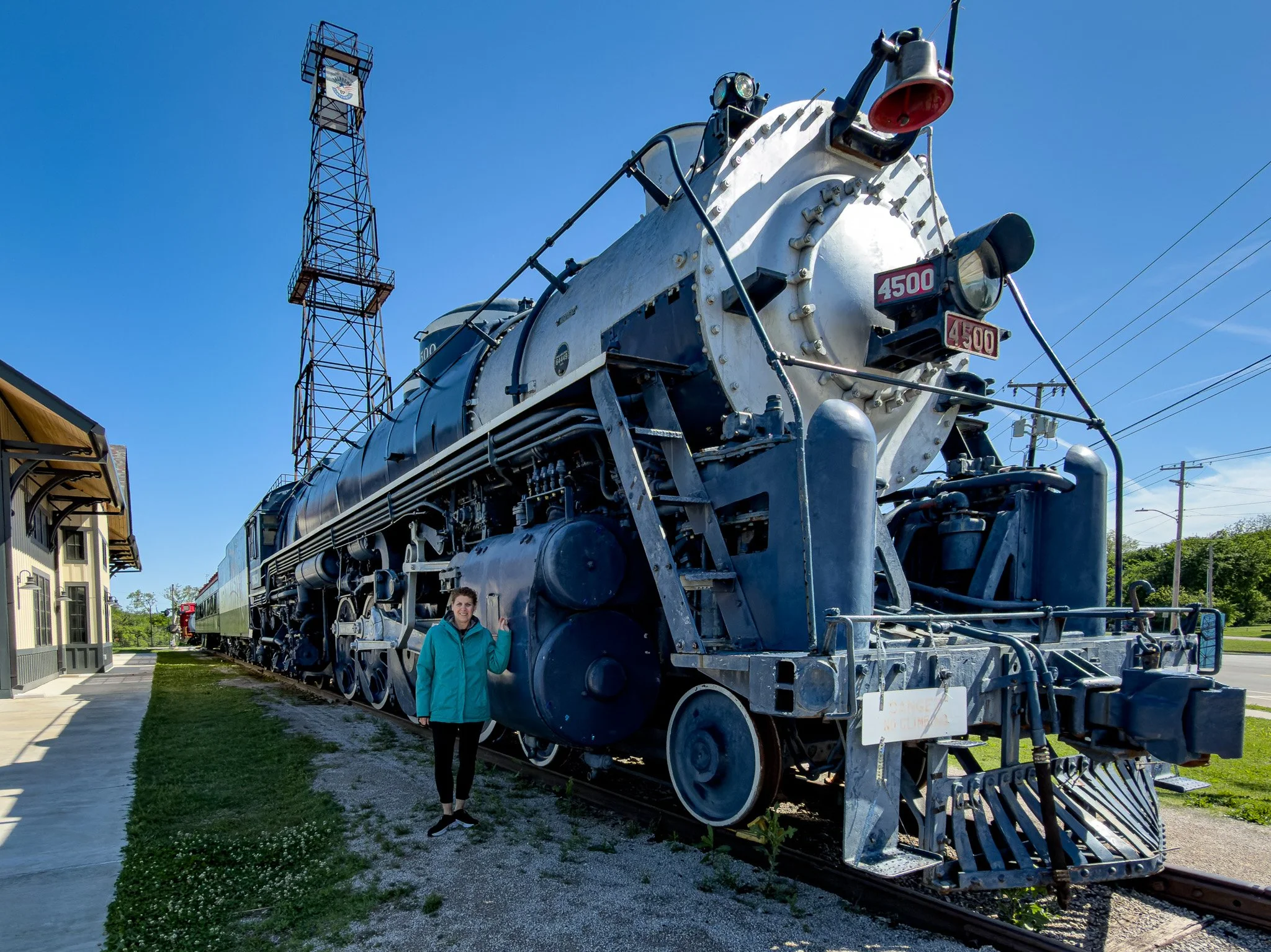
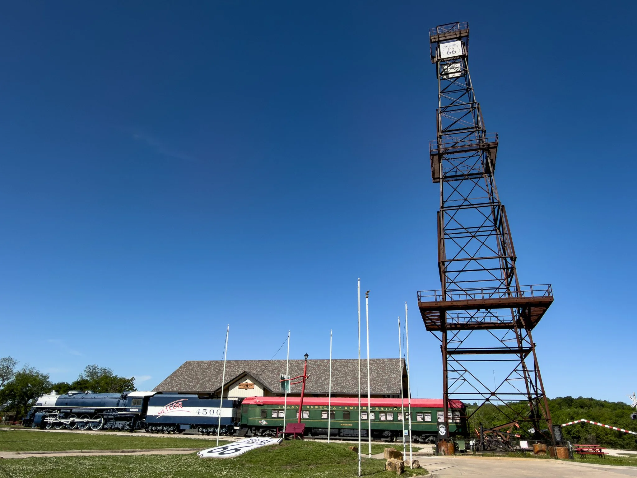
Tulsa is also very proud of its railroad and petrochemical history which is demonstrated at the Tulsa Route 66 Historical Village.
Click on Image for Map.
From ChatGPT:
Tulsa Route 66 Historical Village preserves Tulsa’s transportation heritage with restored structures and replicas. Highlights include the towering oil derrick, a vintage depot, and exhibits on railroads and U.S. Route 66. Located along the Arkansas River, it offers visitors a compact, educational stop celebrating the region’s oil, rail, and highway history.
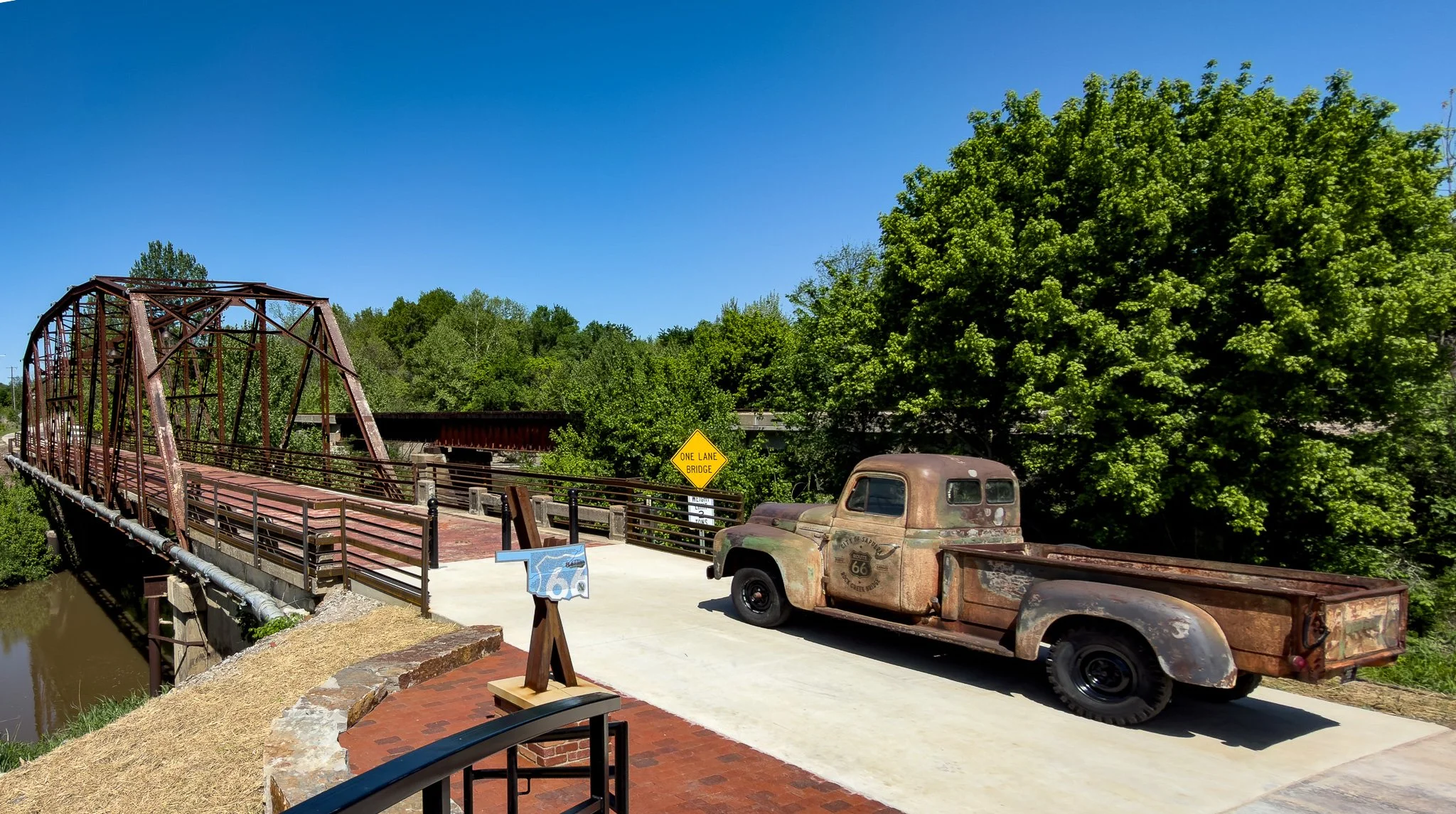
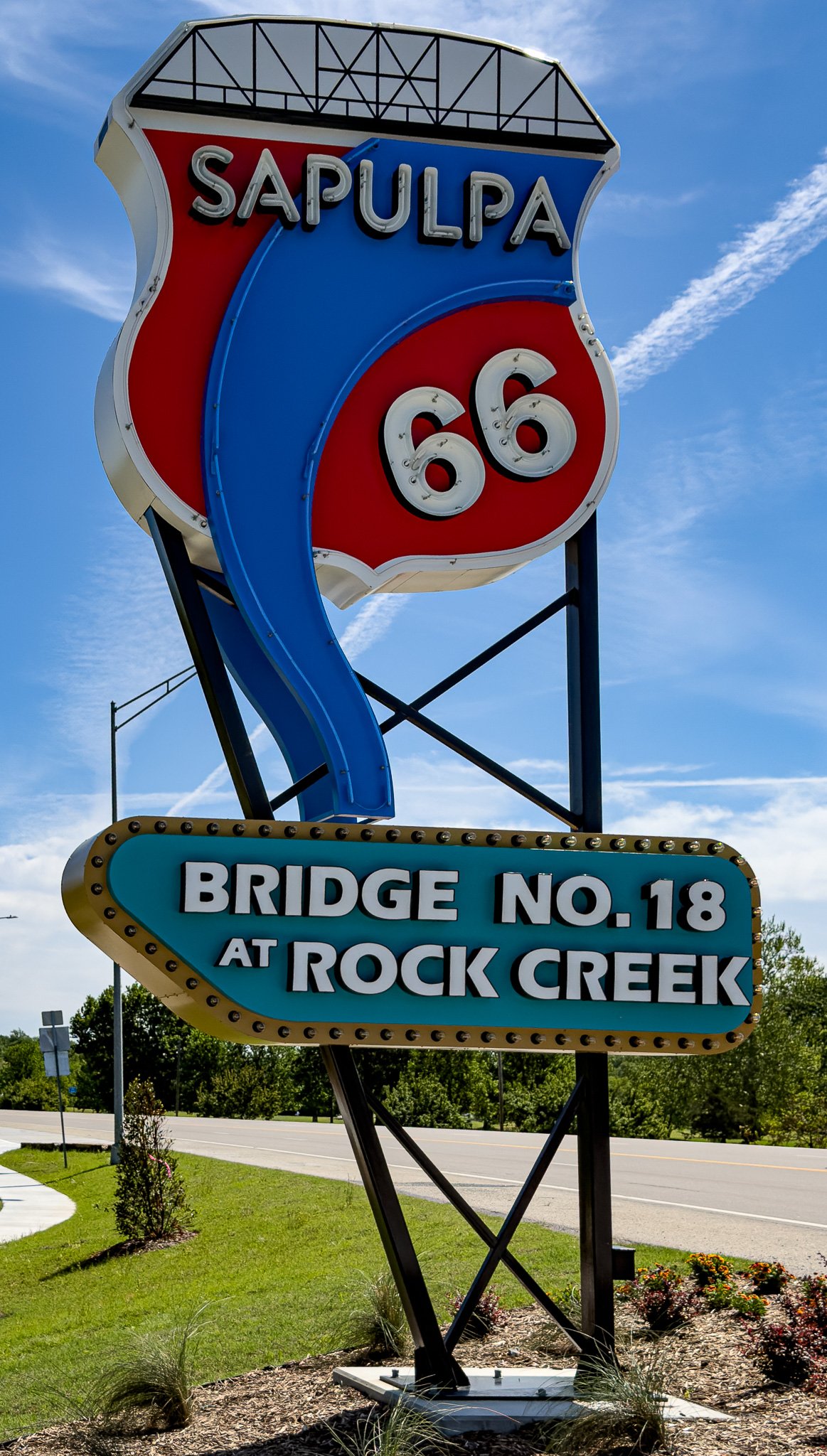
We had done an extensive amount of research for this trip, but somehow seemed to have missed this little gem. This is Bridge #18 at Rock Creek in Sapulpa, OK. We saw it driving by and made a U-Turn to take it in - glad we did!
Click on Image for Map.
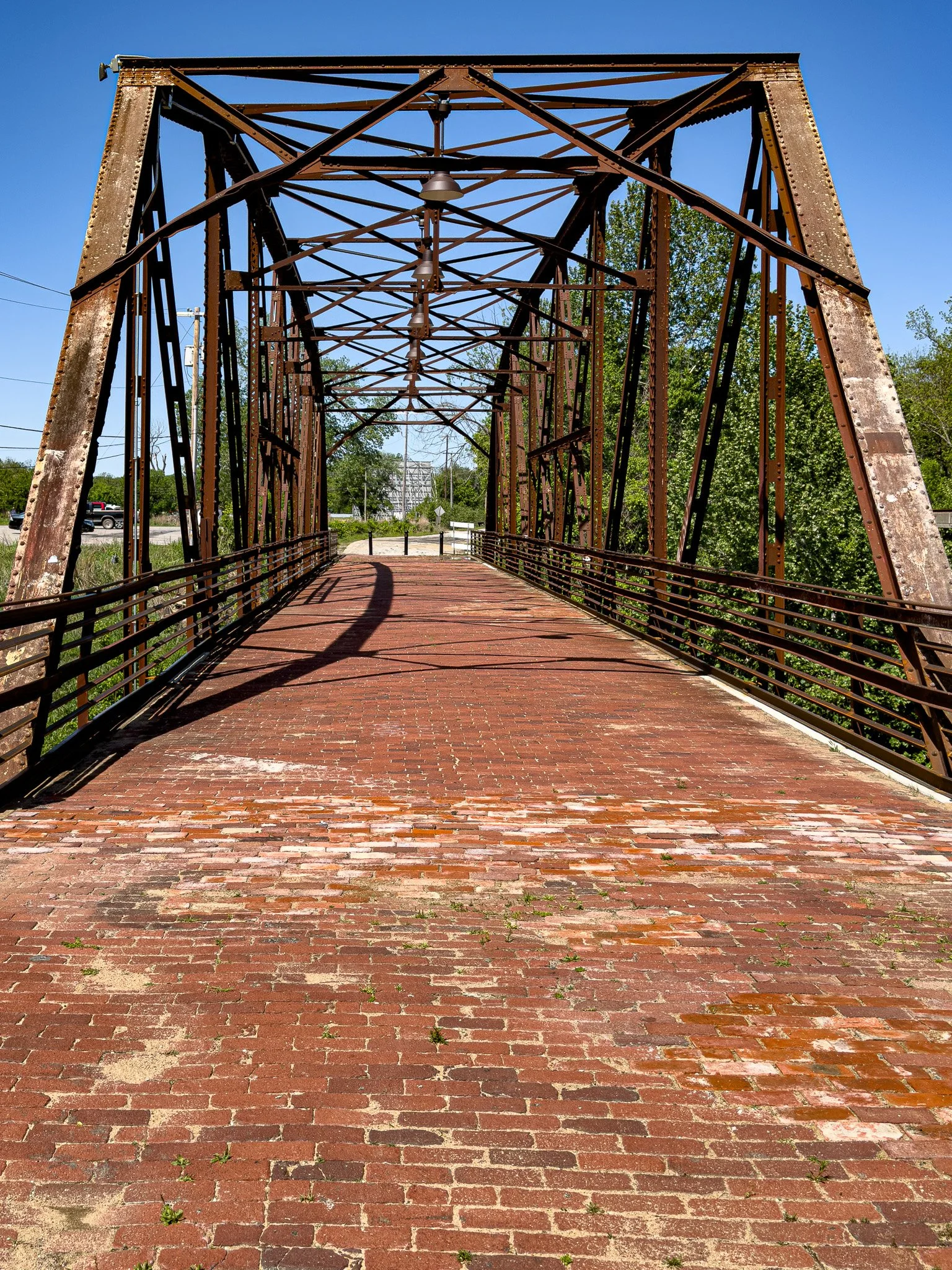
Bridge #18 is now pedestrian only, but these are the original bricks from when it was first built.
From ChatGPT:
Bridge #18 at Rock Creek is a classic 1924 steel Parker through-truss bridge along U.S. Route 66. Originally part of the Ozark Trail, it carried early Route 66 traffic until a 1952 realignment bypassed it. Notable for its rare brick deck, it is now closed to vehicles but remains a well-preserved historic landmark.
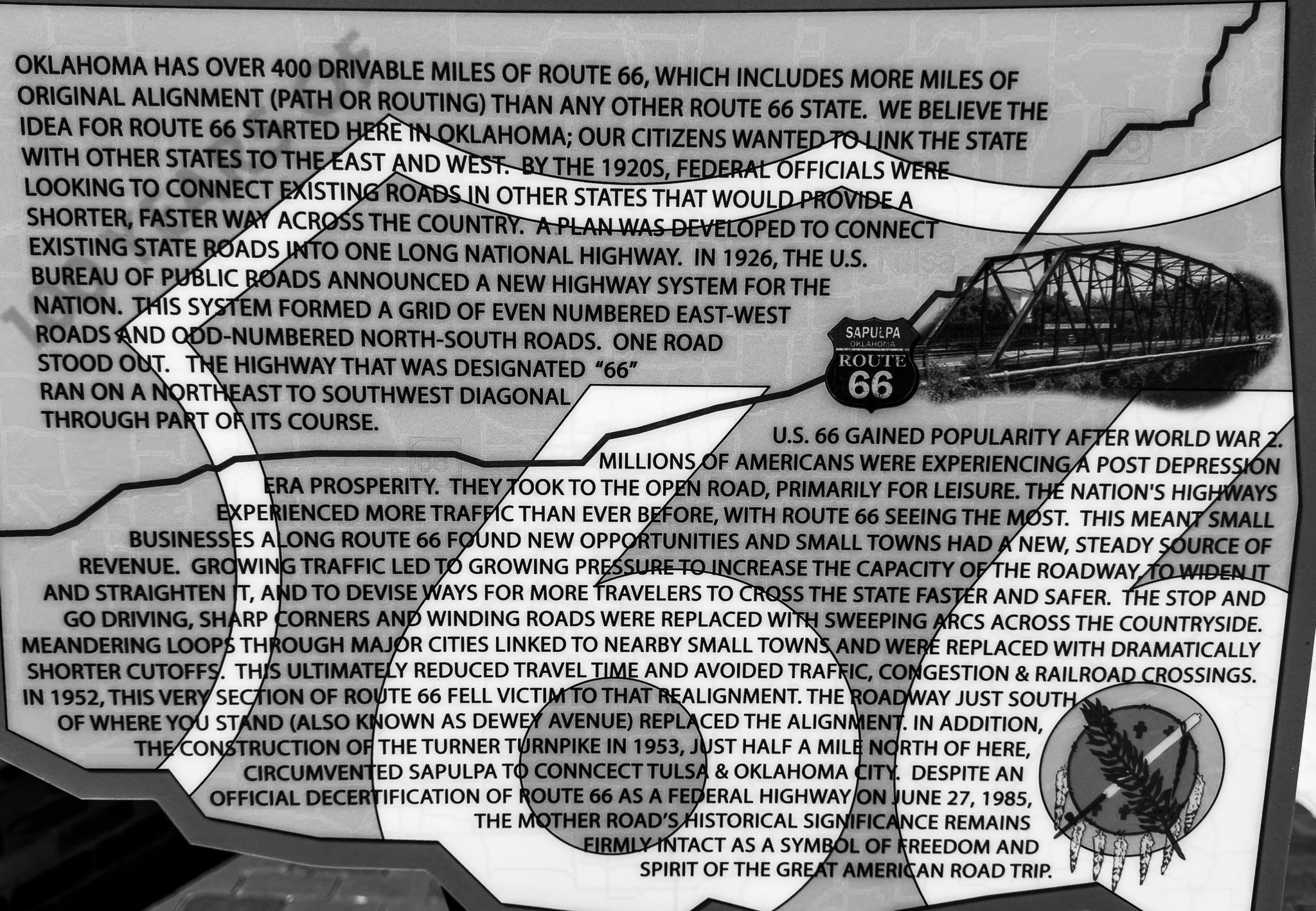
Some more fantastic history if you can find a way to make this readable on your screen.
I love reading all these plaques at the places we stop - and yes, it drives Lisa crazy!!
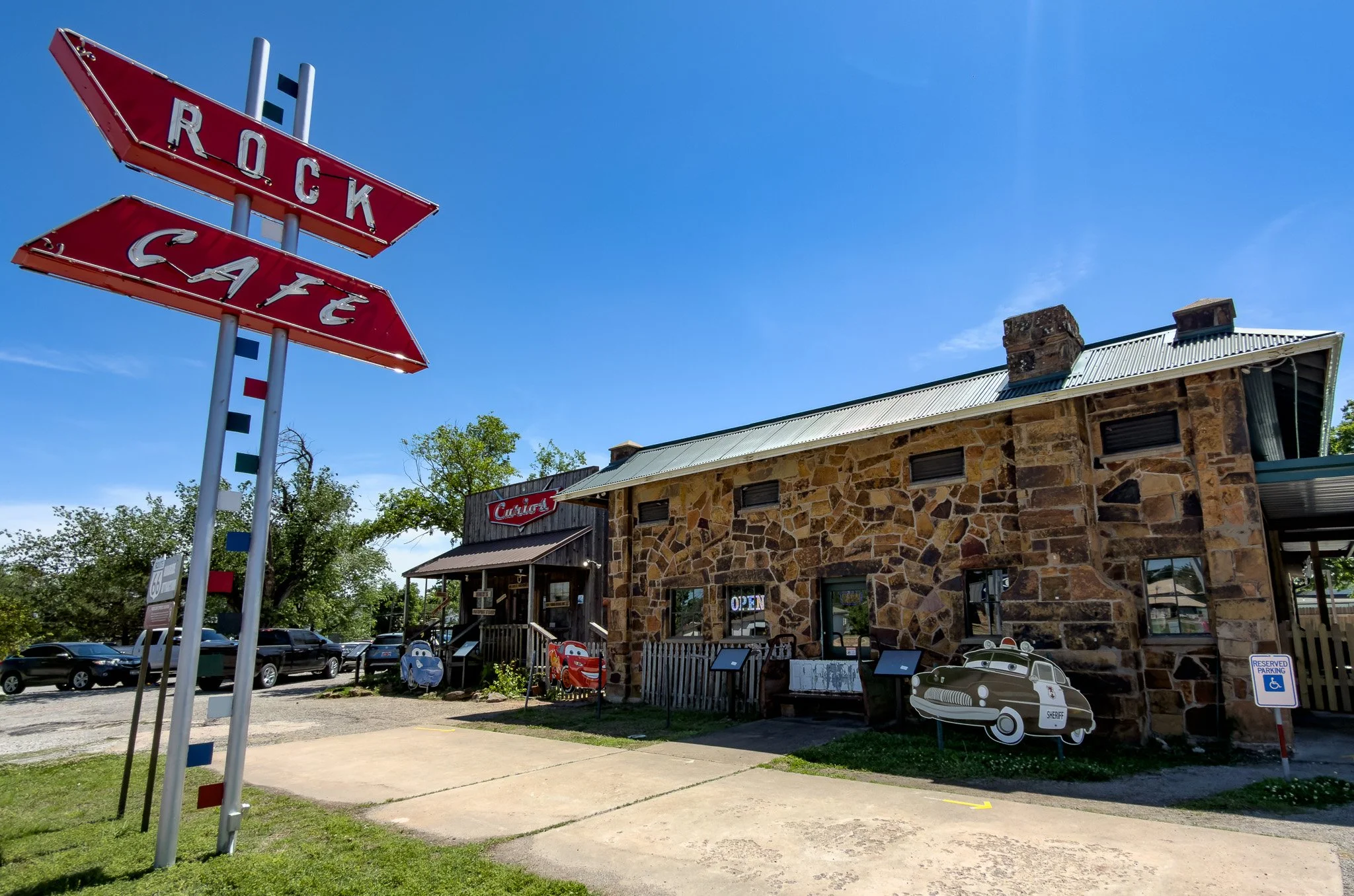
Lunch today was at the “Can’t Miss” Rock Cafe in Stroud, OK.
From ChatGPT:
Rock Cafe is one of Route 66’s most iconic diners, built in 1939 using sandstone from the highway itself, symbolically tying it to the road’s creation. It thrived as a 24-hour stop and Greyhound depot during the highway’s peak years. Surviving decline, fire, and restoration, it remains a living piece of Route 66 culture and even inspired the character Sally in Pixar’s Cars.
Click on Image for Map.
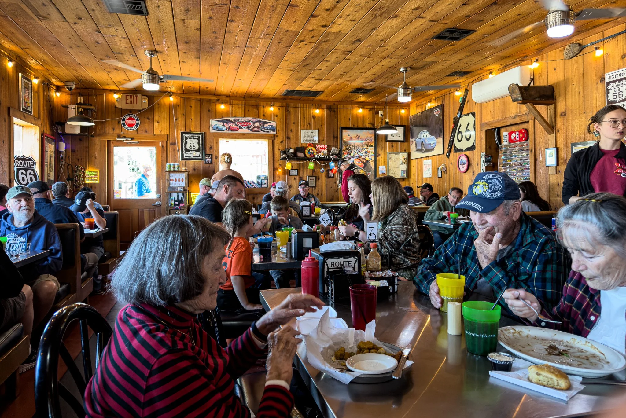
The inside of the Rock Cafe.
Here is a wonderful side story about how nice people have been on Route 66.
The woman on the bottom right of this image, with the fork in her hand, overheard Lisa and I talking with a server about our Route 66 trip. We were also looking at the back of their menu, which is a map that points out some of the state’s highlights and shows the road traversing the state. After they finished eating she asked where we were from and we exchanged pleasantries. I noticed she was digging in her change purse, but thought nothing of it as they were settling up their bill. However, a few moments later she returned and handed Lisa and I each a “smashed penny” from the machine (next to the door on the back left) that squeezes a penny into a souvenir. She said, “This is so you can remember your trip.” What a lovely gesture from a complete stranger.
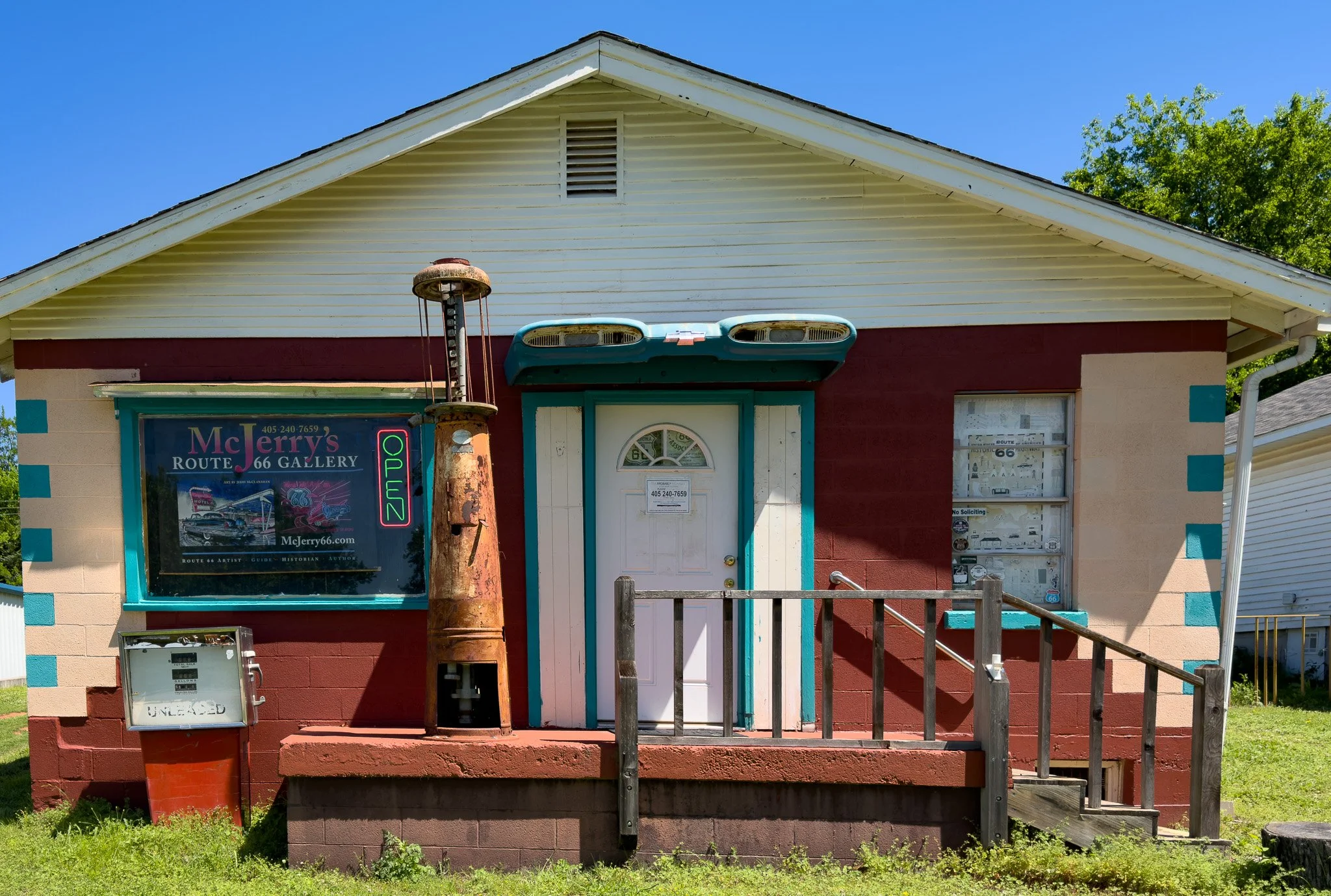
The gallery of Jerry McClanahan - and another great Route 66 story.
The “bible” of Route 66 trip planning is considered to be the EZ66 Guide for Travelers. The book is now in its sixth edition! The author of this book is Jerry McClanahan, an artist in Chandler, OK. Jerry has been driving the route for many years and has produced the BEST book for turn-by-turn trip planning and what to see on the route. His book was our primary source of information. In his book he gives his address and phone number and encourages people to stop by his gallery. When we stopped the sign on the door read, text me if the door is locked. So, we texted and over from his home next door he came. Jerry showed us his art and signed our book and personally marked-up our book with updates which have taken place since the last printing. We purchased two of his signed prints and plan to frame them. Just another great personality we have met on this trip. Thanks for the book Jerry!!
Click on Image for Map.
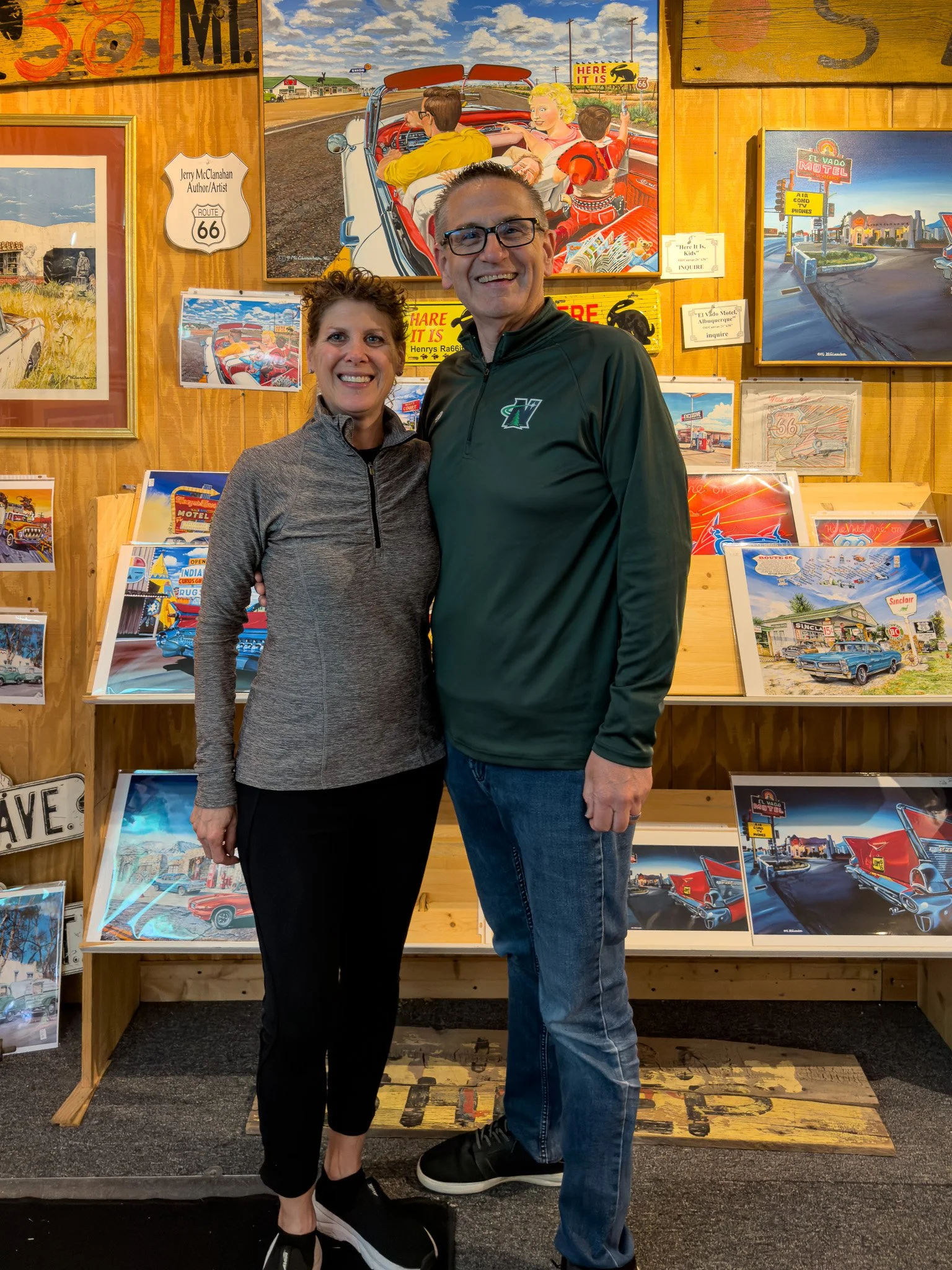
Jerry insisted we sign his guest book and took this photo of us in his gallery. The print directly behind my left elbow is the one I purchased - it is Gary’s Gay Parita.
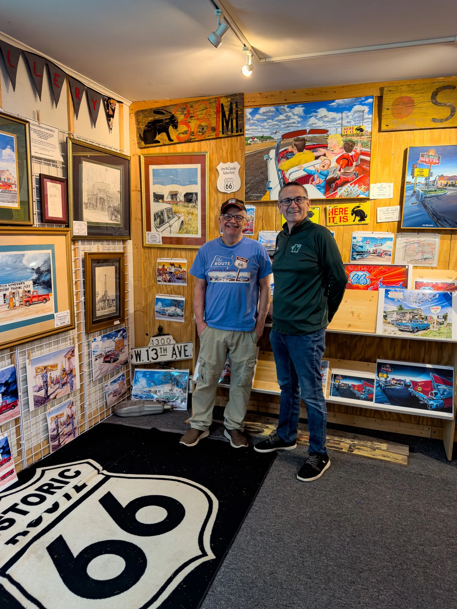
Me with Jerry himself; what a great guy!!
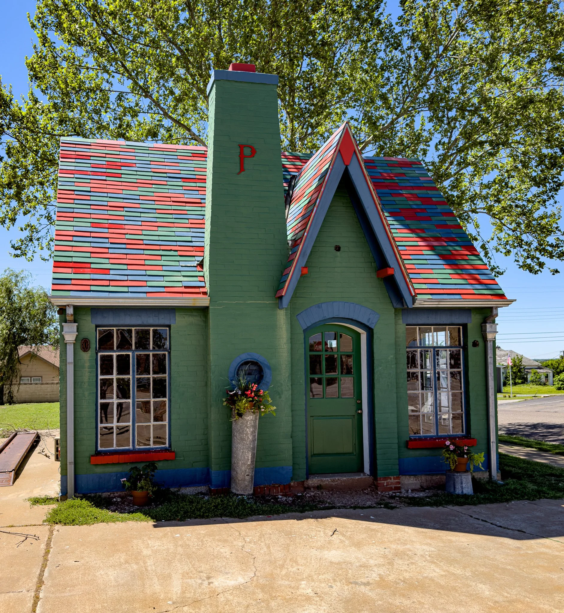
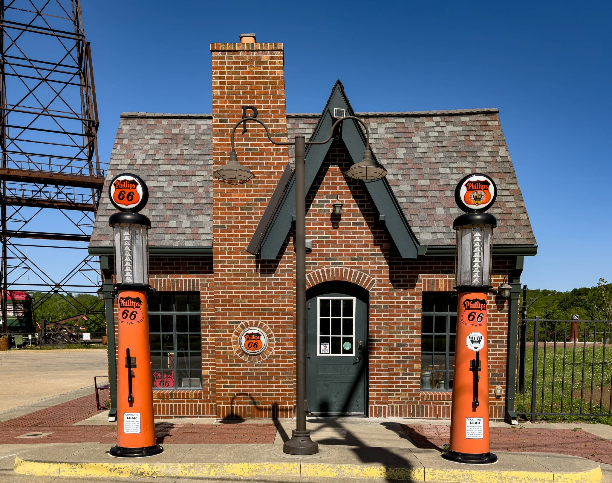
Phillips 66 station in Chandler, OK.
Click on Image for Map.
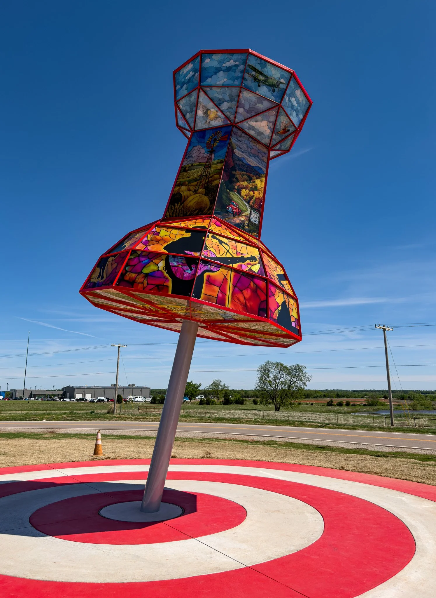
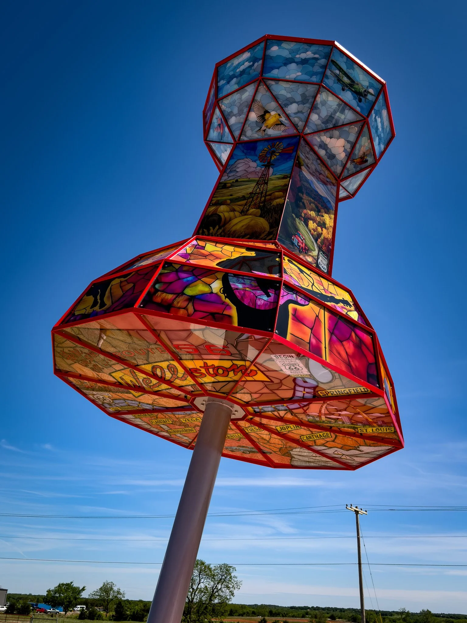
A brand new “giant” has been installed in Wellston, OK.
From ChatGPT:
Yes—this is a brand-new Route 66 roadside attraction, and it’s easy to miss because it hasn’t made it into many guidebooks yet.
The “push pin” monument in Wellston is a giant piece of folk art installed in March 2026. It’s roughly 25 feet tall and designed to look like a classic map push pin marking the town’s place on U.S. Route 66.
What makes it interesting is the detail: the surface is covered in Route 66-themed artwork—maps, symbols, and imagery tied to the Mother Road—and it’s internally lit so it glows at night. The top even features a large Route 66 shield, though you can’t easily see it from ground level.
It’s part of a newer trend of oversized, quirky roadside sculptures popping up along Oklahoma’s stretch of Route 66, giving small towns like Wellston a fresh way to draw travelers off the interstate.
Click on Image for Map.
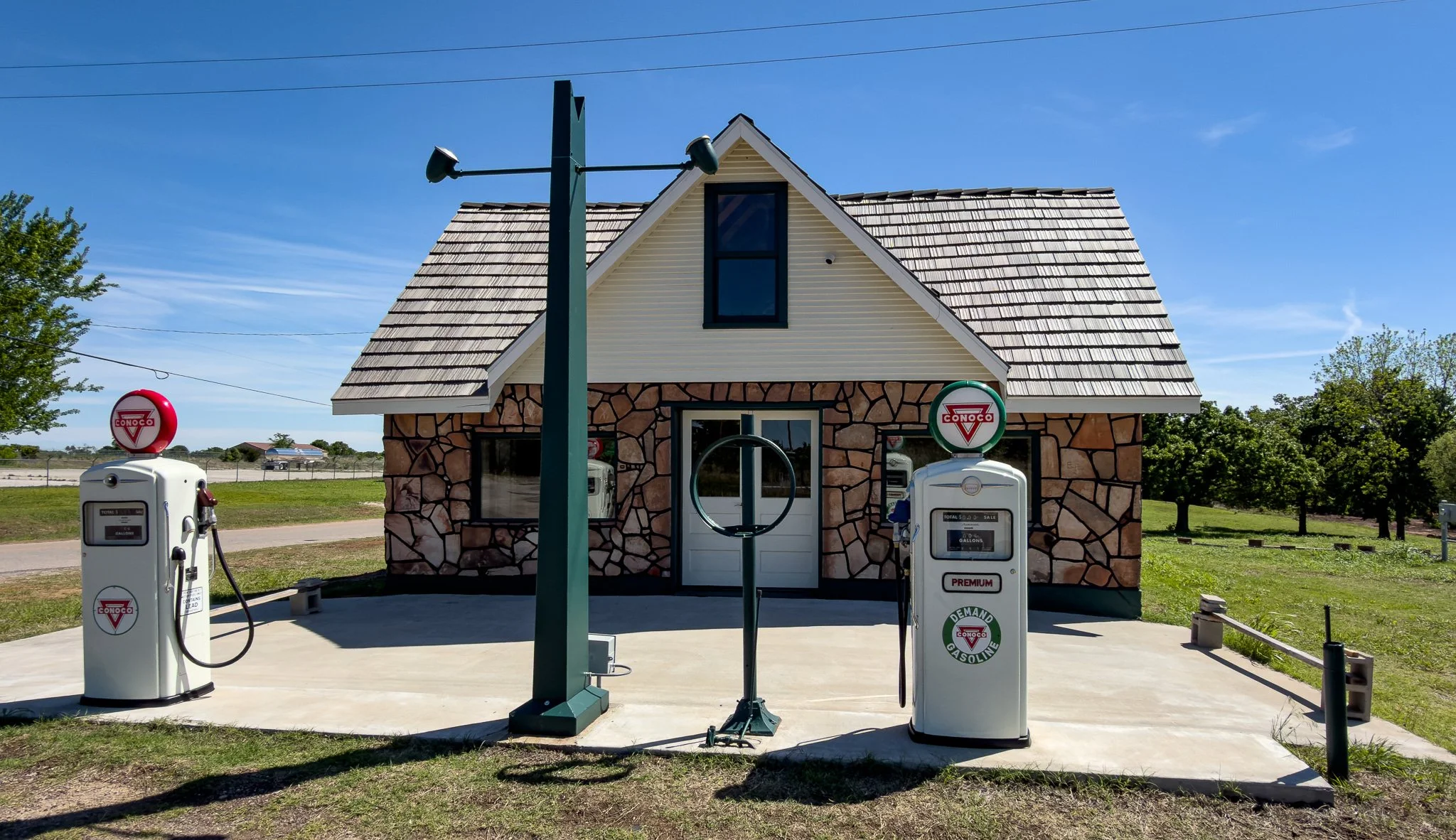
Historic Threatt Filling Station. Unfortunately, the Saturday we were there the station was closed.
From ChatGPT:
The Threatt Filling Station is a rare and significant Route 66 landmark, built around 1915. Owned by an African American family, it served as a safe haven for Black travelers during segregation, offering fuel, food, and rest. Listed on the National Register, it stands as a powerful symbol of resilience and entrepreneurship.
Click on Image for Map.
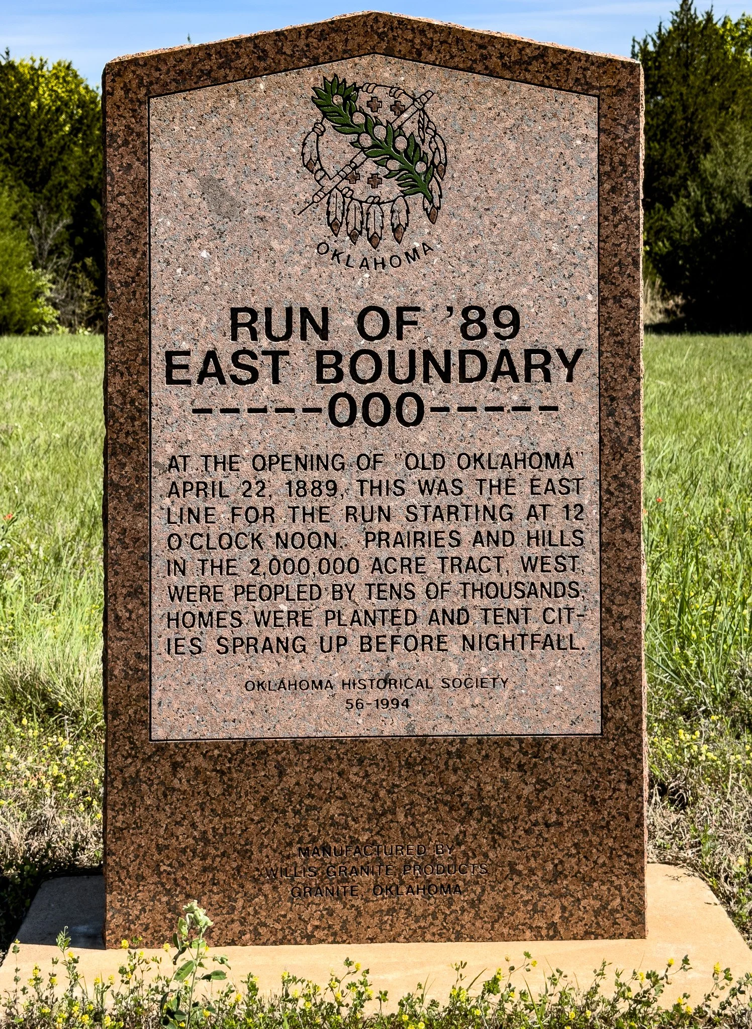
This marker shows the location of the “starting point” where at noon on April 22, 1889 the western part of Oklahoma was opened for settlement. Settlers charged forth from this spot in hopes of planting a “flag” in the ground and claiming a piece of land for themselves.
From ChatGPT:
The Land Run of 1889 marked the opening of unassigned lands in what is now Oklahoma to non-Native settlement. At noon on April 22, 1889, thousands of settlers raced across the border to claim 160-acre homesteads. Boomtowns like Oklahoma City sprang up almost overnight. The event symbolized opportunity and westward expansion, but also led to displacement of Native peoples and legal disputes over “sooner” claims. It remains a defining moment in Oklahoma’s history and identity, reflecting both ambition and conflict on the American frontier.
This historical event was dramatized in the 1992 film Far and Away, starring Tom Cruise and Nicole Kidman.
The movie’s climactic scene recreates the Land Run of 1889, showing settlers racing to claim land. While visually memorable, the depiction takes some liberties with history for dramatic effect.
Click on Image for Map.
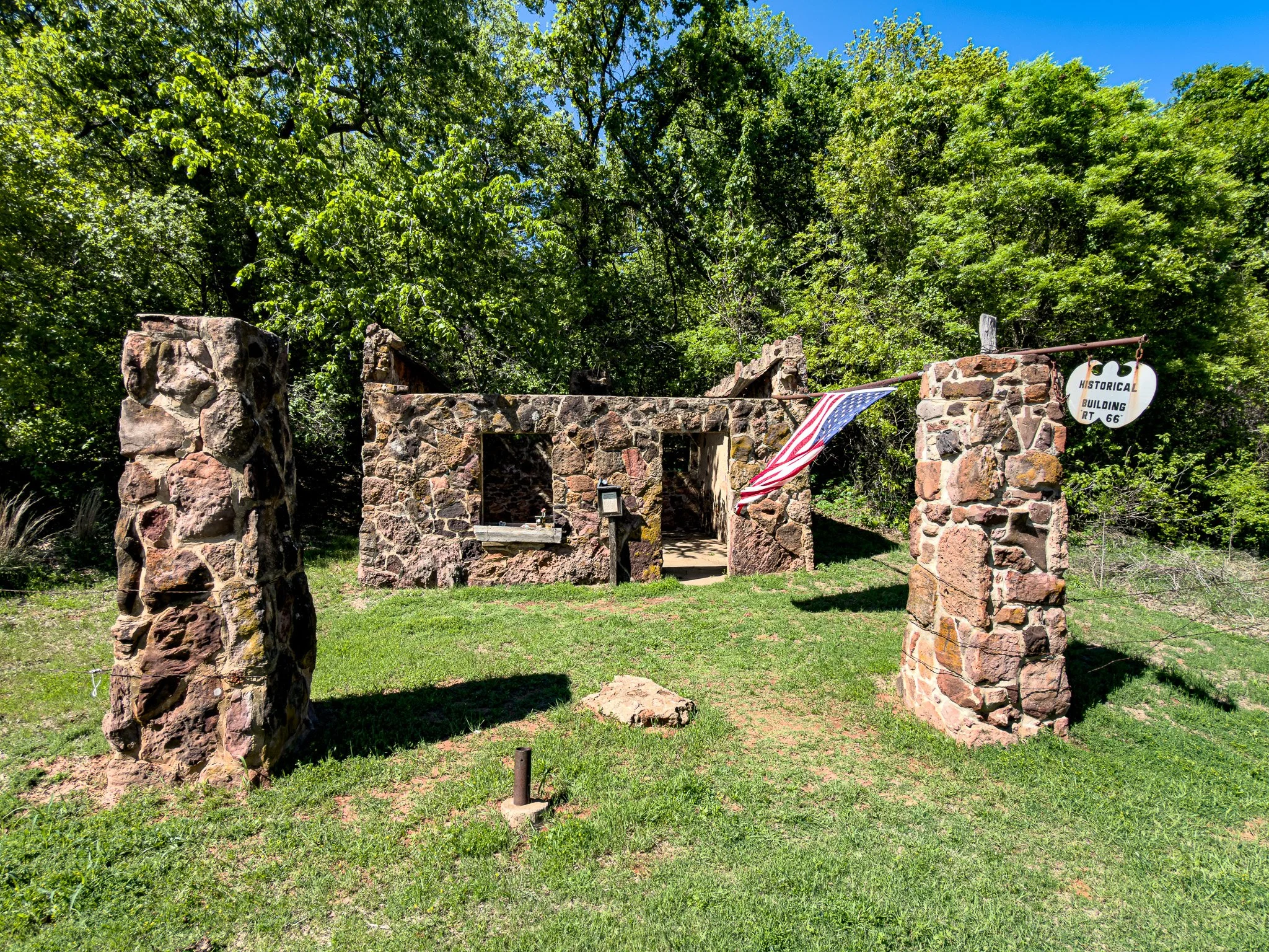
Just a short distance from the land run marker is this fascinating bit of Route 66 history - the Lawless Gas Station.
From ChatGPT:
The so-called “lawless” or abandoned gas station near Arcadia, Oklahoma—often referred to as the old Rock of Ages or Conoco station—has a story that sits somewhere between history and legend.
Built in the early 1920s along U.S. Route 66, it was a typical rural filling station. Local lore says that during the Great Depression, the struggling owners were approached by a traveling “salesman” who offered them counterfeit printing plates. A hidden back room was supposedly built where fake $10 bills were produced until one of the participants was caught, leading authorities back to the station and ending the operation.
Afterward, the station was abandoned. Years later—unrelated to the counterfeiting story—a dead body was reportedly discovered inside. The victim was never identified, and authorities couldn’t determine whether the person had been killed there or simply dumped at the site.
That said, there’s an important reality check: historians have found no solid documentation (newspaper reports, police records, etc.) confirming either the counterfeiting ring or the മൃതദ body story. Many researchers believe these details are part of long-standing Route 66 folklore rather than verified fact.
So what you’re seeing today is a classic Route 66 ruin—with a great story—but one that’s likely been embellished over decades of roadside storytelling.
Click on Image for Map.
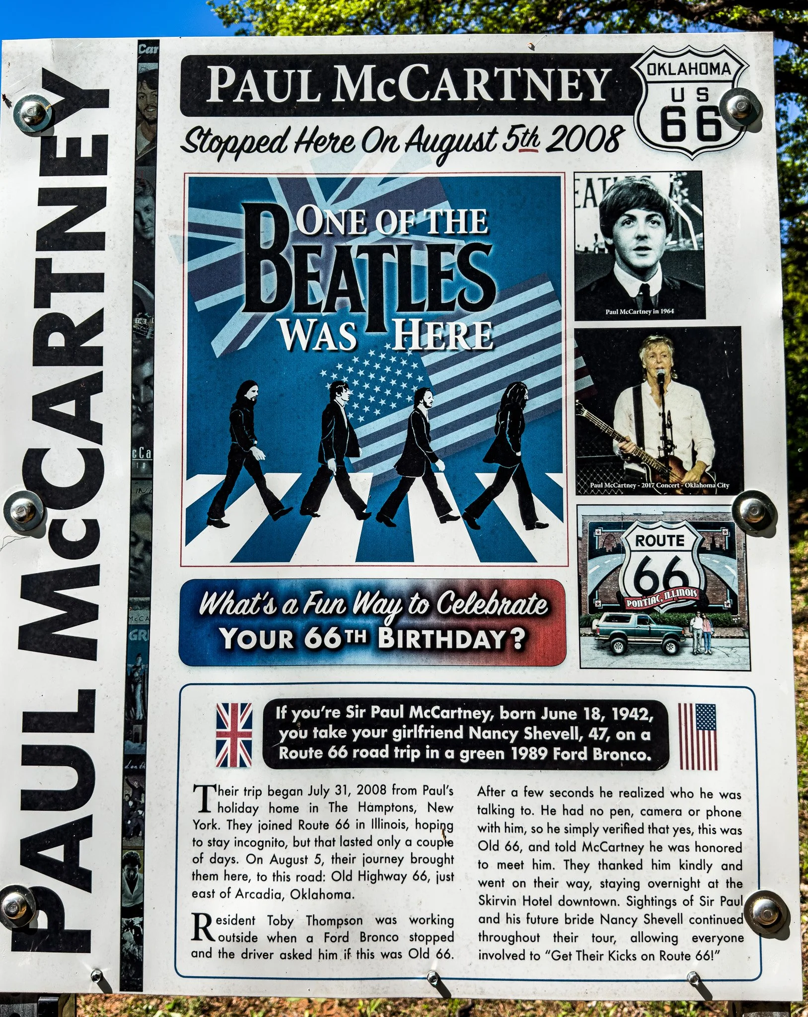
Sir Paul was here!
This sign is on a very “off the beaten path” part of old Route 66. Click on the Image to see where. It would be very easy to get lost in these parts when driving a 1989 Ford Bronco without GPS. The plaque tells the story from there….
Click on Image for Map.
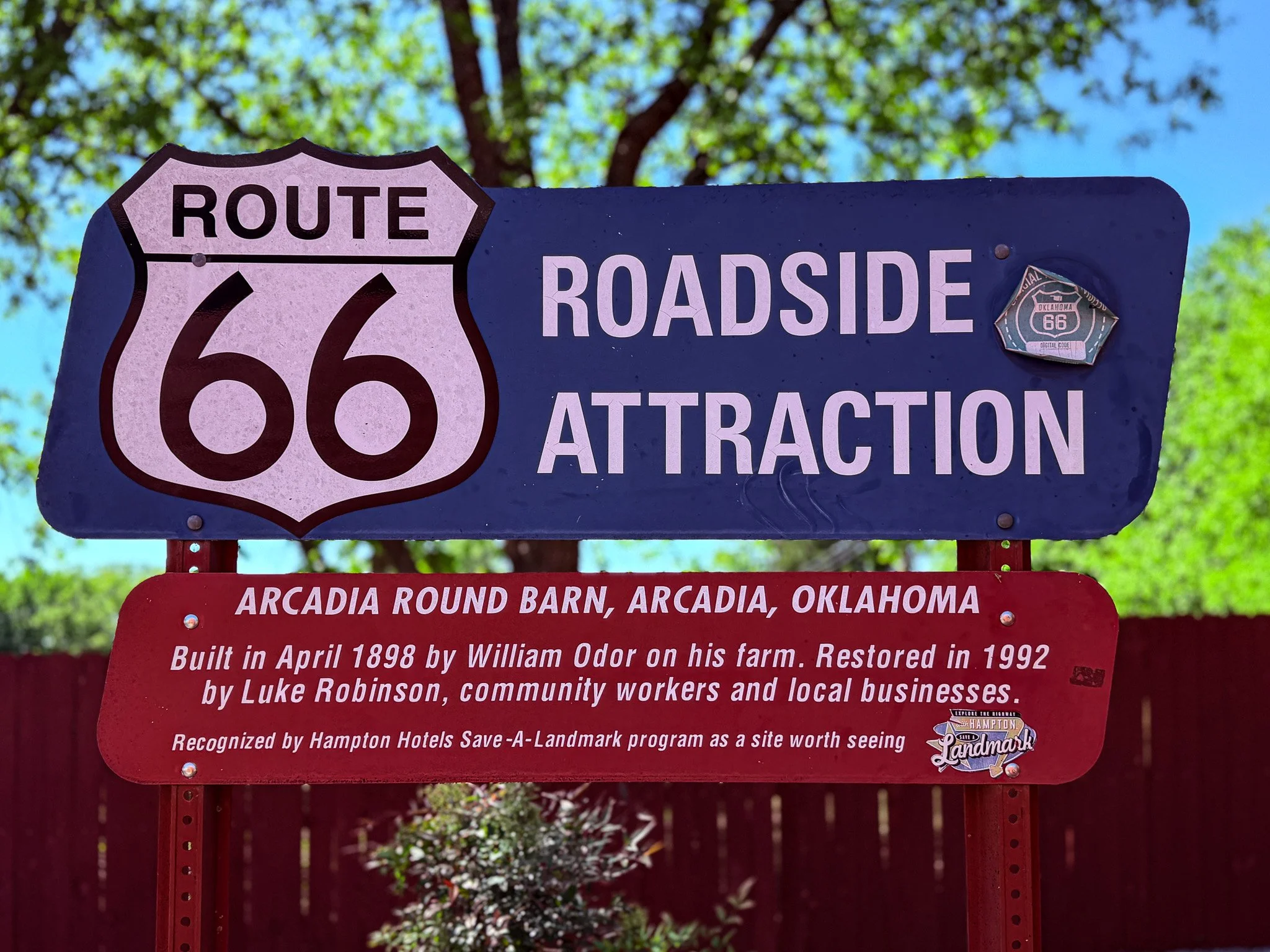
Arcadia Round Barn.
Click on Image for Map.
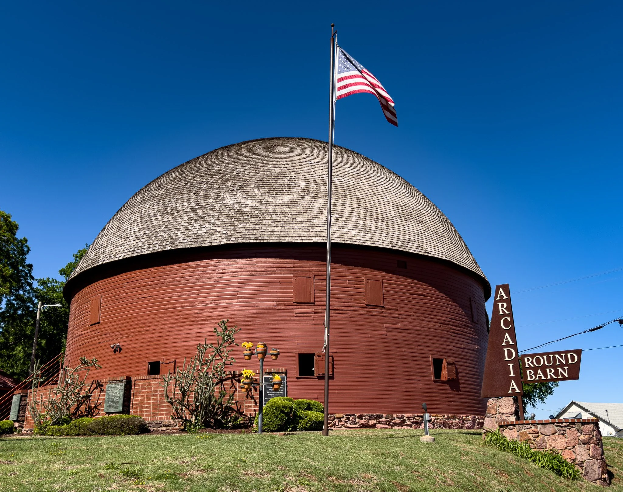
From ChatGPT:
The Arcadia Round Barn is one of the most unique landmarks on U.S. Route 66. Built in 1898 by farmer William H. Odor, it is the only true round barn in Oklahoma and a rare example in the United States. Its curved design used bent green oak timbers, creating a huge, open interior with remarkable acoustics.
After decades of use and later decline, the roof collapsed in 1988, but volunteers restored it by 1992. Today it serves as a museum, event space, and iconic roadside stop for Route 66 travelers.
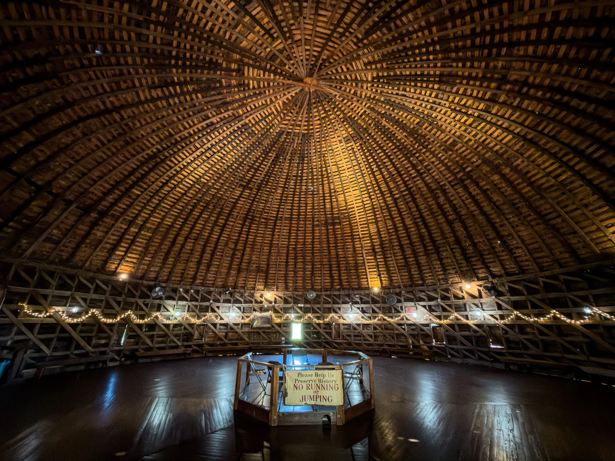
Inside the Round Barn.
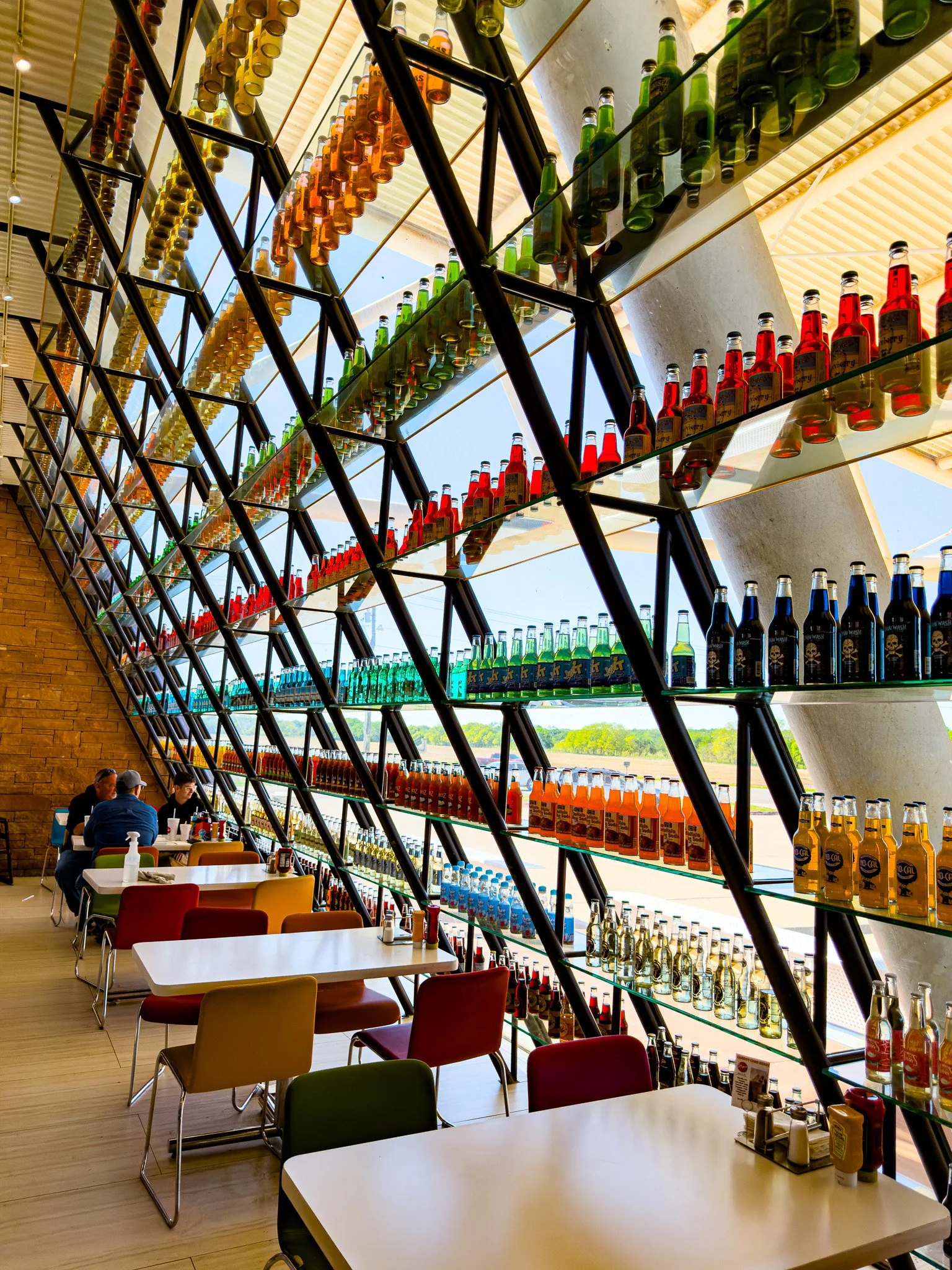
Inside Pop’s!
From ChatGPT:
Pops 66 Soda Ranch in Arcadia is one of the most famous modern stops on U.S. Route 66. Opened in 2007, it combines a restaurant, gas station, and convenience store with an eye-catching 66-foot illuminated soda bottle outside.
Inside, it’s best known for its huge soda selection—about 700 different types of soda, ranging from classic colas to unusual flavors like peanut butter, ranch, and even bacon-inspired varieties.
Visitors often treat it like a “soda tasting museum,” picking out six-packs to try on road trips. The combination of novelty drinks, Route 66 nostalgia, and the glowing bottle landmark has made it one of Oklahoma’s most popular roadside attractions.
Click on Image for Map.
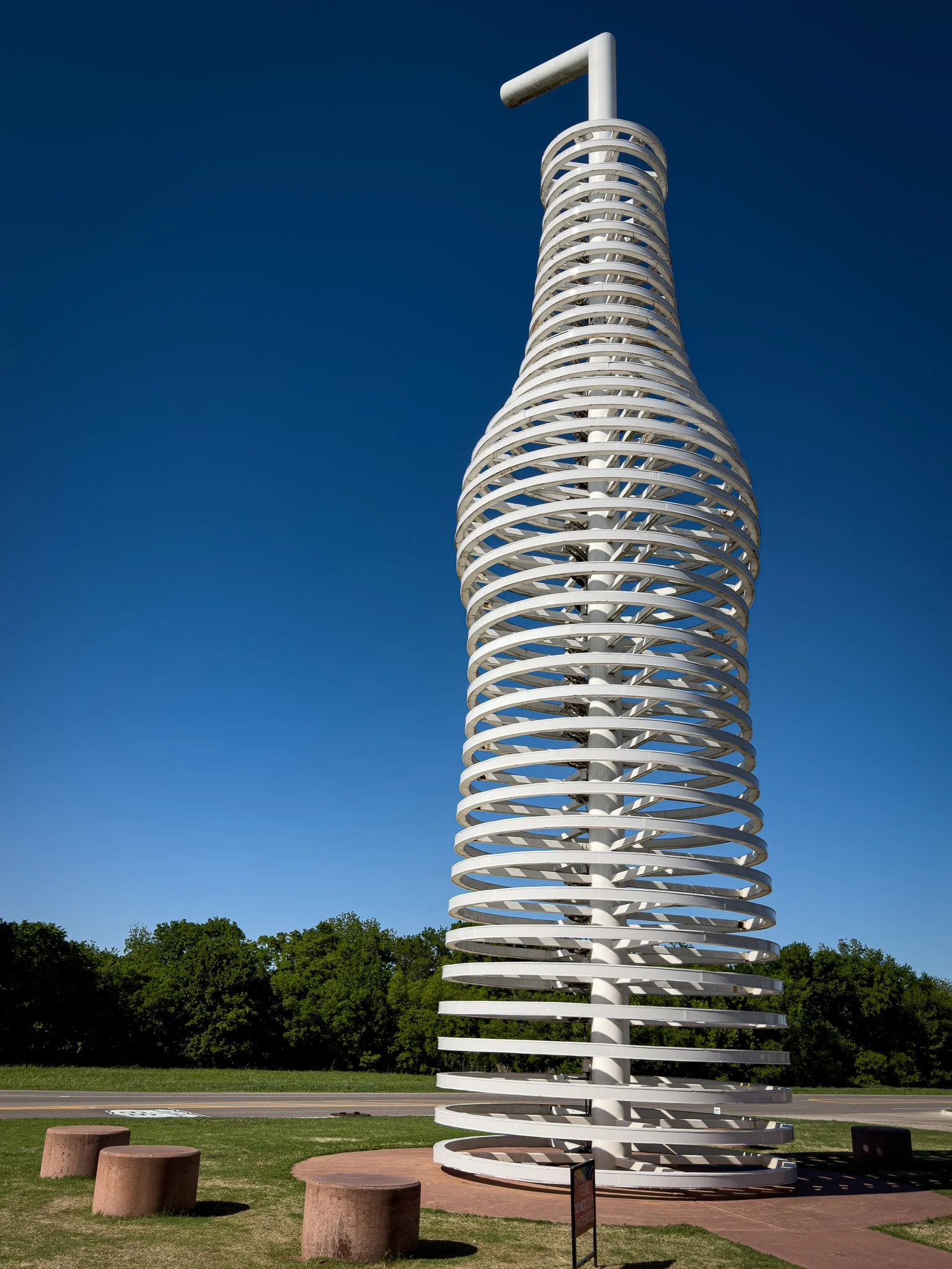
The 66-foot tall neon lighted soda bottle at Pop’s. We had intended to go back at night to check it out, but the timing just didn’t work out.
Lisa and I got three different sodas to try: Diet Cream Soda, Diet Butterscotch Cream Soda and a Chocolate Soda. The two cream sodas were VERY good - as yet, we have not tried the chocolate.