Michigan Trip Day #2
Sunday, August 31, 2025

Today we visited the Pictured Rocks Lakeshore. We started the day walking the Sand Point Marsh Trail. This was a nice boardwalk through the marsh. We also walked a few miles on the Lakeshore North Country Trail.
[Click on Image for Map]


The North Country Trail hugs the shoreline the entire distance of the peninsula and gives some great views of the lake below. This is the Miners Castle overlook.
[Click on Image for Map]

The kayak tours along the lakeshore. I can only imagine it must be amazing to see the shoreline from that vantage point. The red kayak is the guide and the customers are in the yellow ones.


This is the Miners Castle rock formation from the lower overlook. We will see this again from the lake when we take the boat tour later in the day.
[Click on Image for Map]

Further up the lakeshore we came to the area known as the Log Slide Overlook. Apparently, the loggers used to cut the trees and then slide them down these sandy banks to the water.
[Click on Image for Map]

Today, people enjoy running or sliding down these steep sandy embankments to the beach below. The signage at the top of the bank informs people considering the trip to the bottom that going down may take only seconds, but climbing back up on the soft and shifting sand could take an hour and is only for those in the appropriate physical shape. We watched some folks struggle their way back up and they were working hard!


As you can appreciate better in these photos, the embankment leading down to the water is not a trivial hill! And it is very steep in parts.


Looking the other direction from the Log Slide Overlook is this view of the Au Sable Lighthouse. This is about a 5 mile round-trip hike and we went about half way; however, because of the time we didn’t make the whole trip. That leaves us with a reason to return and do the whole thing next time. It is an easy and quite beautiful hike. Every so often the trail comes out onto the edge with a great view of the lake.

The reason we didn’t have time for the whole hike at Au Sable Lighthouse is because we had to get back into Munising, MI to get on our boat tour of the Pictured Rocks National Lakeshore. This is the East Channel Lighthouse from our tour boat. The rest of the photos for today were all taken from the water on our Sunset Spray Falls Cruise with Pictured Rocks Cruises.
[Click on Image for Map]

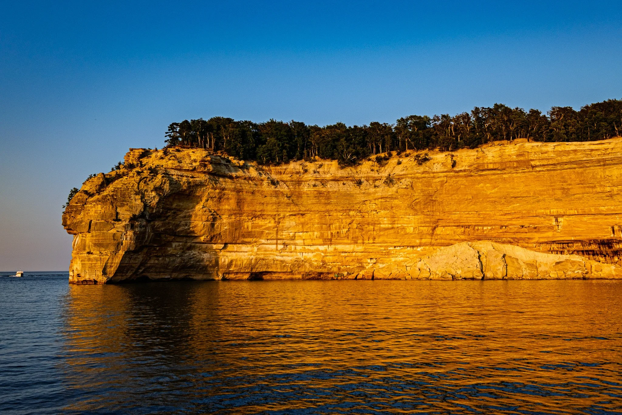
As you can see, the sunset cruise gave us some fantastic golden hour lighting on the shoreline.
[Click on Image for Map]

Indian Head Rock.
[Click on Image for Map]
Entrance to Chapel Cove.
[Click on Image for Map]

Spray Falls.
[Click on Image for Map]

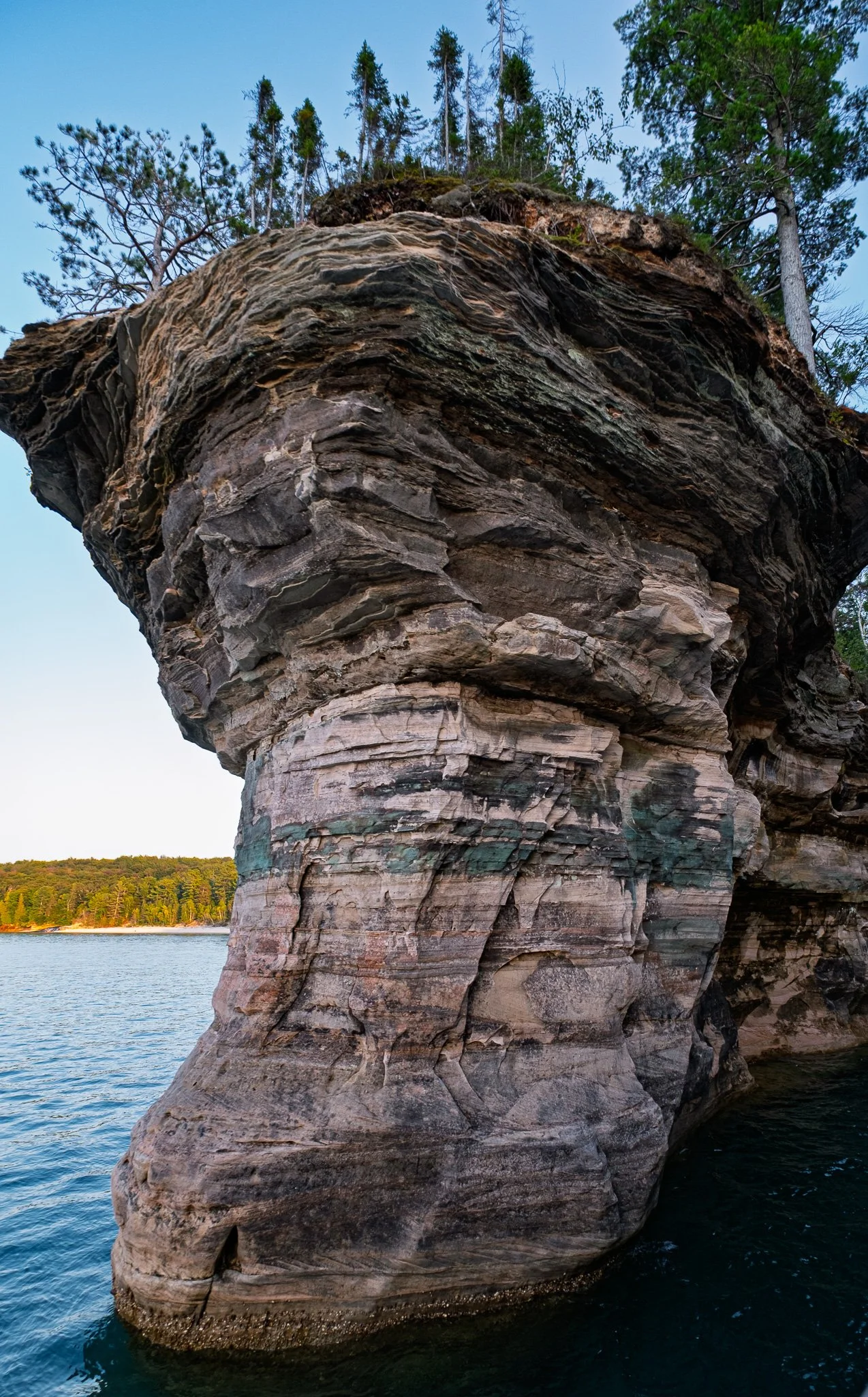
Chapel Rock used to be connected to the shore, however, erosion has separated the two. The tree on the top of the rock continues to survive despite having no soil because its roots are still connected to the main shoreline and appear suspended in the air. This was absolutely fascinating!
[Click on Image for Map]

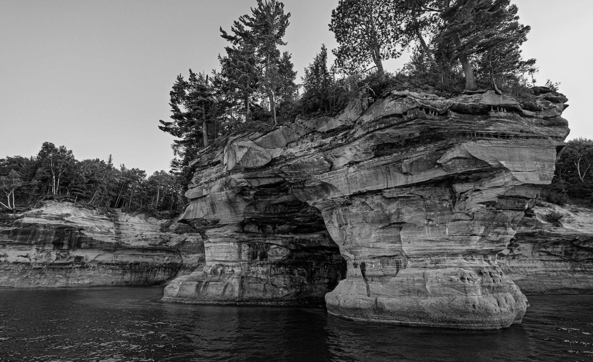

Small boats used to be able to pass under this arch. However, as the rock above has eroded and fallen into the water, this route is no longer passable.
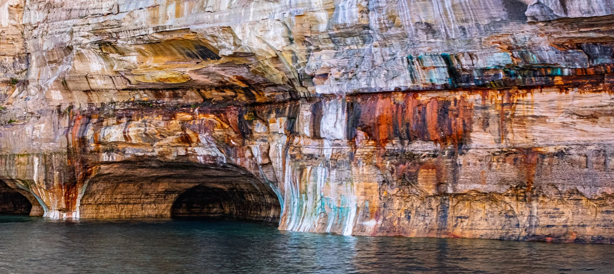
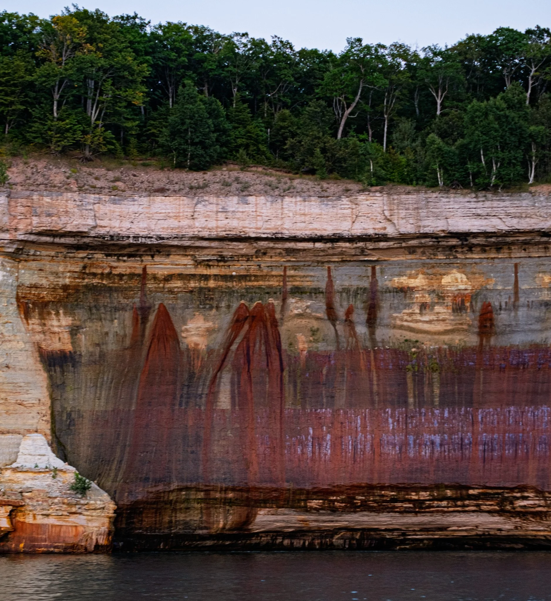
The different colors on the Pictured Rocks are due to various elements dissolved in the water.

The stone shoreline continues to slowly erode and fall into the lake. Our guide pointed out that during the winter months these rocks are covered in several FEET of ice from the spay coming off the lake. As the ice expands it develops cracks in the rock and when the spring thaw comes the rock pieces will fall into the lake.


With the sun about to dip below the horizon, the colors really popped.


More of the incredible colors made by dissolved elements in the ground water.

This is once again Miners Castle - which we saw earlier from the shoreline. The platform where the people are standing is where the shoreline photo was taken earlier in the day.
[Click on Image for Map]

Heading back into the dock at Munising, the light had faded and we worked our way back down under the cover to get out of the cool lake air. The captain at the wheel and instruments of the boat as we head into dock.