Great River Road Trip, Day #1
Sunday, May 4, 2025

Horseshoe Island as seen from the overlook at Mount Hosmer Park in Lansing, Iowa.
[Click on Image for Map]

New bridge being built between Lansing and Wisconsin. The start of the new bridge is on the left in front of the old bridge.
[Click on Image for Map]

Looking south down the main channel from the overlook at Hosmer Park in Lansing, Iowa.
[Click on Image for Map]

Limestone bluffs line both sides of the river here in the upper Mississippi. Below St. Louis these bluffs will be replaced by levees in the delta.
[Click on Image for Map]

Our next stop was a short stroll on the boardwalk at Effigy Mounds National Monument.
[Click on Image for Map]

Some photos just have to be in color; and a giant pink elephant has to be on that list. We have driven by the Casino Queen riverboat in Marquette, Iowa all these years, but have never stopped. On this trip we finally stopped and “donated” $5 to a slot machine.
[Click on Image for Map]

The Casino Queen is an old Mississippi River boat that is permanently docked in Marquette. This is the pilot house and smokestacks from the top deck.
[Click on Image for Map]

Looking up river from the Casino Queen riverboat.
[Click on Image for Map]

Looking south from the boat showcases the limestone bluffs that line the upper Mississippi River.
[Click on Image for Map]

Next was a stop at Pikes Peak State Park in Iowa. The railroad bridge in the center of the photo spans the Wisconsin River as it empties into the Mississippi. The next image explains the historical significance of this location.
[Click on Image for Map]

This is where white settlers first set foot in Iowa.
[Click on Map for Image]

The Pikes Peak overlook provides a short walk with several nice views of the river. Here we are looking south down the river.
[Click on Image for Map]

This is the view looking north. There are some barges parked along the islands in the center of the photo. You can just make out the bridge in Marquette on the far left.
[Click on Image for Map]

Our next stop was Lock & Dam #10 in Guttenberg, Iowa.
[Click on Image for Map]

Looking upriver from Lock & Dam #10.
[Click on Image for Map]

The Lockmaster’s House Heritage Museum was closed on Sundays so we could only view it from the outside.
[Click on Image for Map]

Guttenberg has a very nice riverwalk along the top of their levee that goes about a mile upriver from the Lock & Dam. We couldn’t have asked for a better day; the weather was just spectacular!
[Click on Image for Map]

Guttenberg takes pride in their quaint small river town. Here was a nice bit of green space on a small plot of land between two adjoining roads.
[Click on Image for Map]


Arriving in Dubuque, Iowa we stopped at Eagle Point Park. This is a view of Lock & Dam #11 from the overlook at Eagle Point Park. We were lucky enough to see a tug pushing south through the locks. This was a 3X5 tow; the first 9 had already cleared the south end of the lock and he was preparing to enter the chamber with the second set.
[Click on Image for Map]

The dam and the first 9 barges are visible in the lower portion of the image as they are clearing the south end of the locking chamber.
[Click on Image for Map]


The pelicans found this as fascinating as I did!
[Click on Image for Map]

Looking south down the river from Eagle Point Park overlook.
[Click on Image for Map]

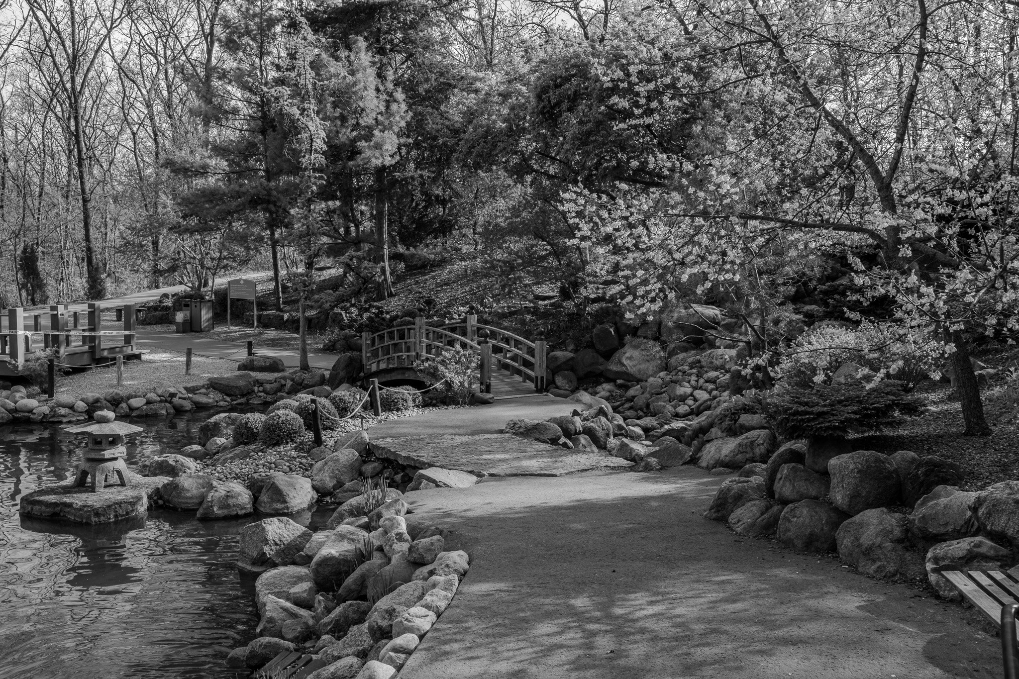
Next, we stopped at the Dubuque Arboretum & Botanical Gardens. The grounds are absolutely beautiful although the plants are getting a bit of late start this year, so not much was in bloom yet. This is the Koi pond and Japanese garden area.
[Click on Image for Map]

After checking-in to our hotel and grabbing some dinner downtown, we ended our day with a stroll along the Dubuque waterfront Mississippi Riverwalk. The perfect end to the perfect day!
[Click on Image for Map]

This glass structure juts out over the Riverwalk path; it is the Grand River Convention Center.
When you consider that the population of Dubuque is roughly half of that in Rochester, Lisa and I both agreed it is time for Rochester to really up their game if they want to compare themselves to a city like this. When you see Eagle Point Park, the Botanical Gardens and this Riverwalk and downtown, Dubuque makes Rochester look rather sad!
[Click on Image for Map]

Looking south from the Riverwalk. This bridge connects to East Dubuque, IL on the opposite side of the river.
[Click on Image for Map]

The old brewery building and the Dubuque Shot Tower in the background.
“The shot tower was constructed in 1856 to manufacture lead shot ammunition….” - Interpretive plaque on site.
[Click on Image for Map]

Just another view looking south from the Riverwalk.
[Click on Image for Map]

The Dubuque Marina and downtown in the background.
[Click on Image for Map]

The wall in the foreground is used for flood mitigation and the huge swinging doors will be closed to protect the marina and downtown waterfront when the Mississippi is running high. It would have been fascinating to see how this worked back in 2019 when we had such severe flooding all along the upper Mississippi.
[Click on Image for Map]