Route 66 - Day #18
Tuesday, April 28, 2026
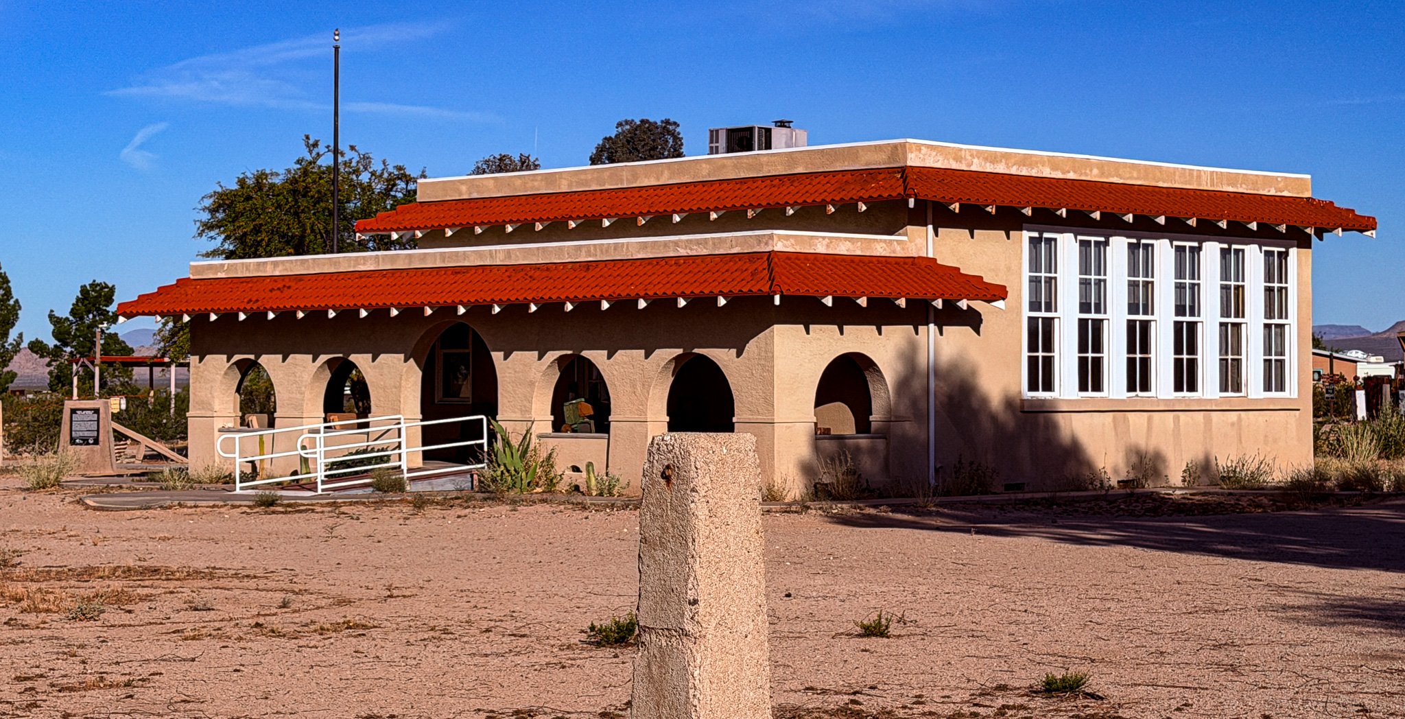
Our first stop today was at Goff Schoolhouse. We were not able to tour the building because we arrived before it was opened. However, we did get to walk the grounds.
From ChatGPT:
Built in 1914, the Goffs Schoolhouse served as a one-room school for children of miners, ranchers, and Santa Fe Railroad families along early Route 66. Designed in Mission Revival style, it also functioned as the town library and community center. After closing in 1937, it was restored and now operates as a museum and cultural center preserving Mojave Desert history.
Click on Image for Map.
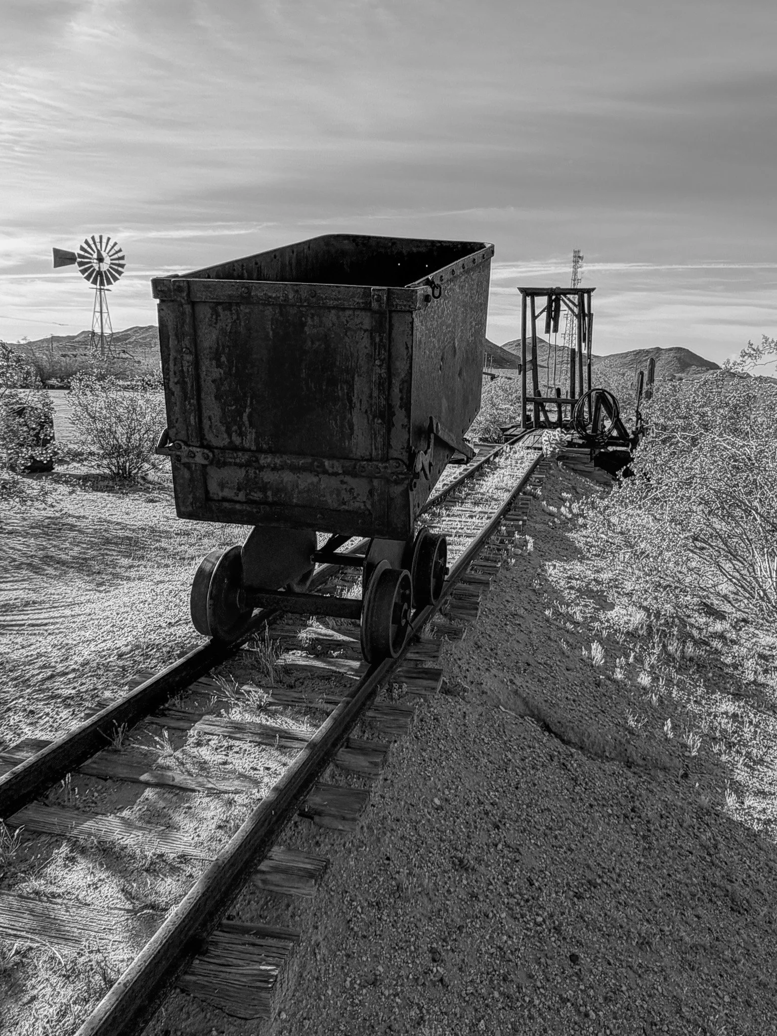
The grounds showcased mining artifacts from the town’s past.
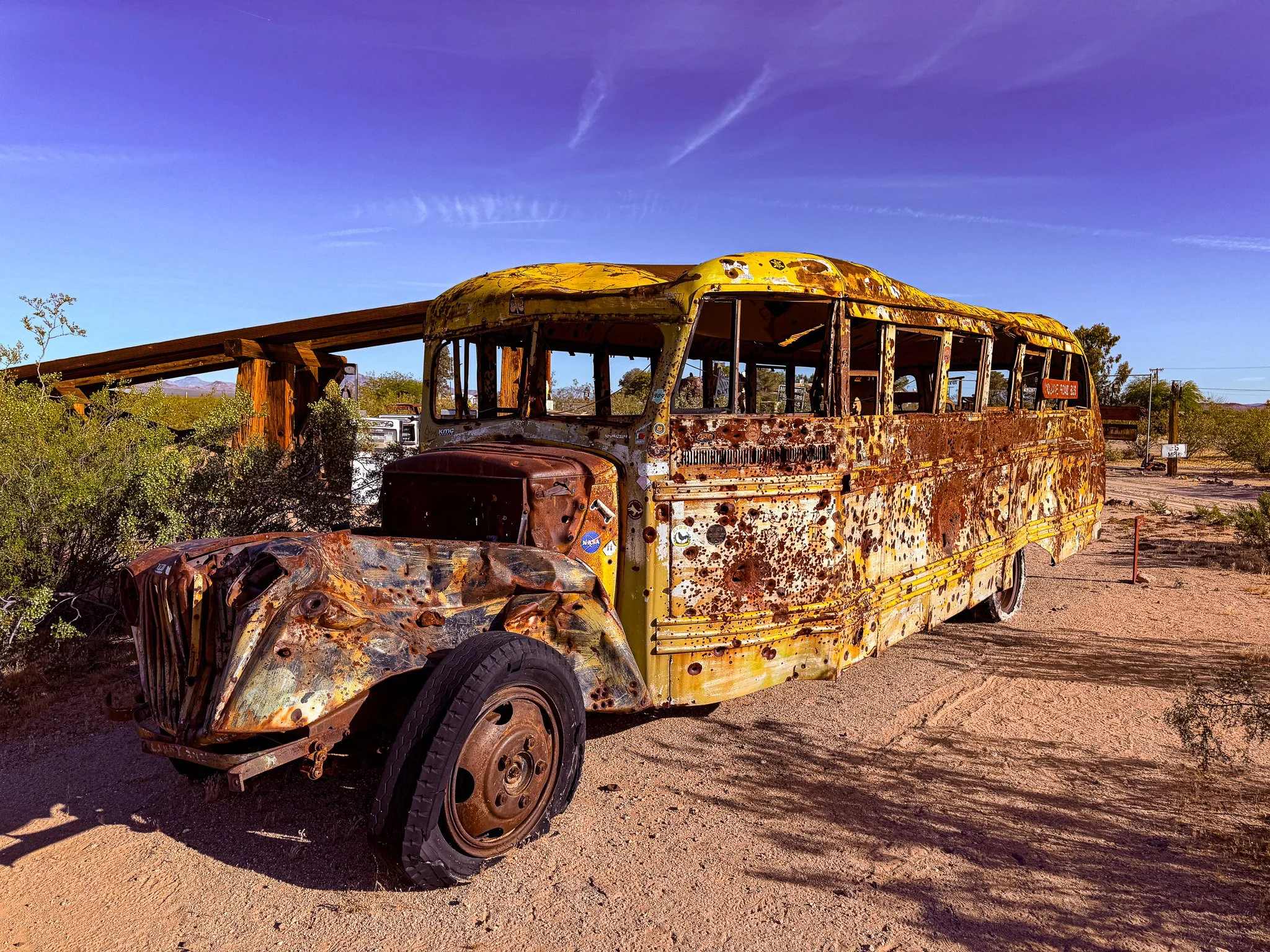
In the early 1940s, the US military used these grounds for training purposes. It appears they may have used this old school but for target practice. It is riddled with all different sized bullet holes.
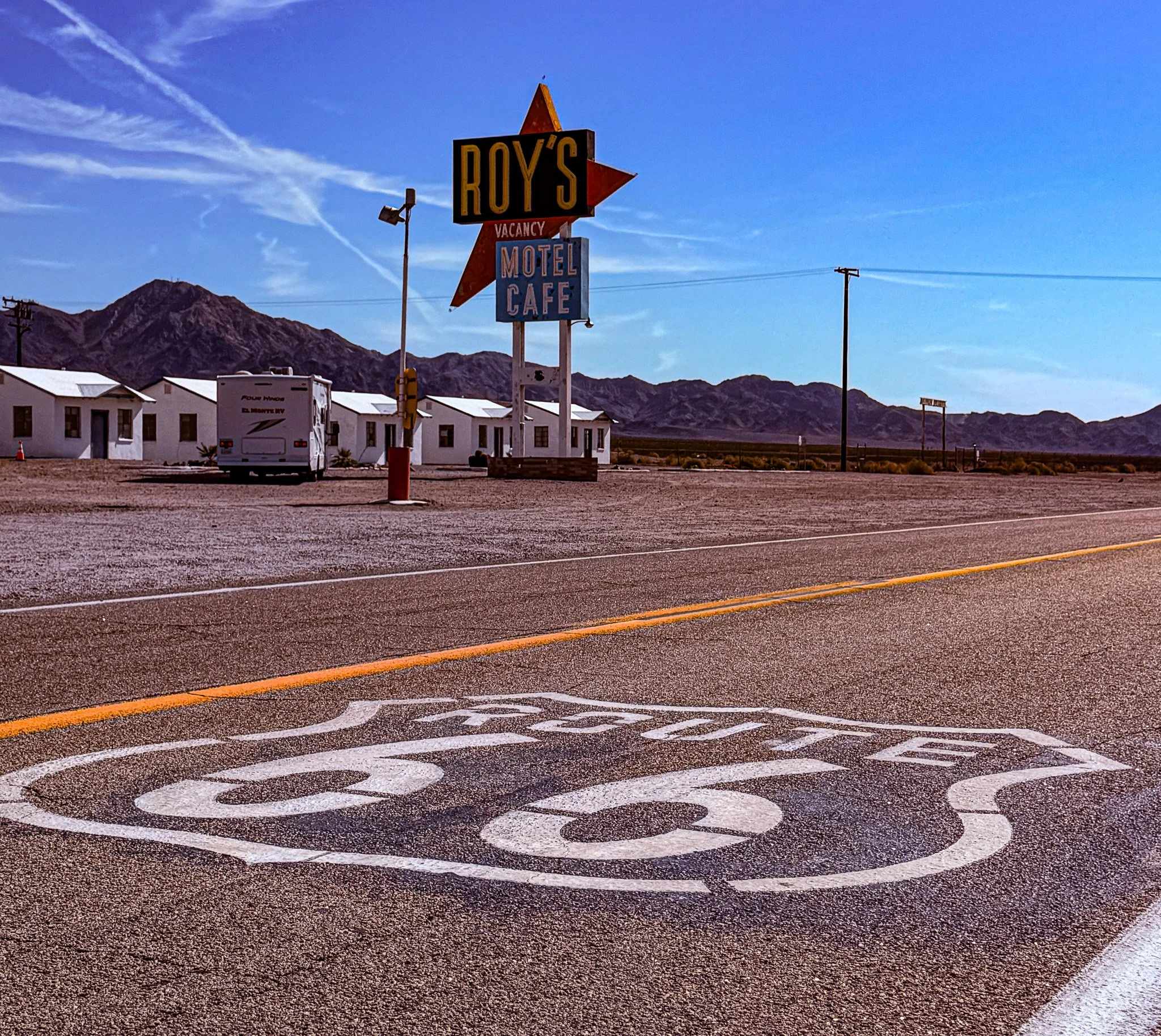
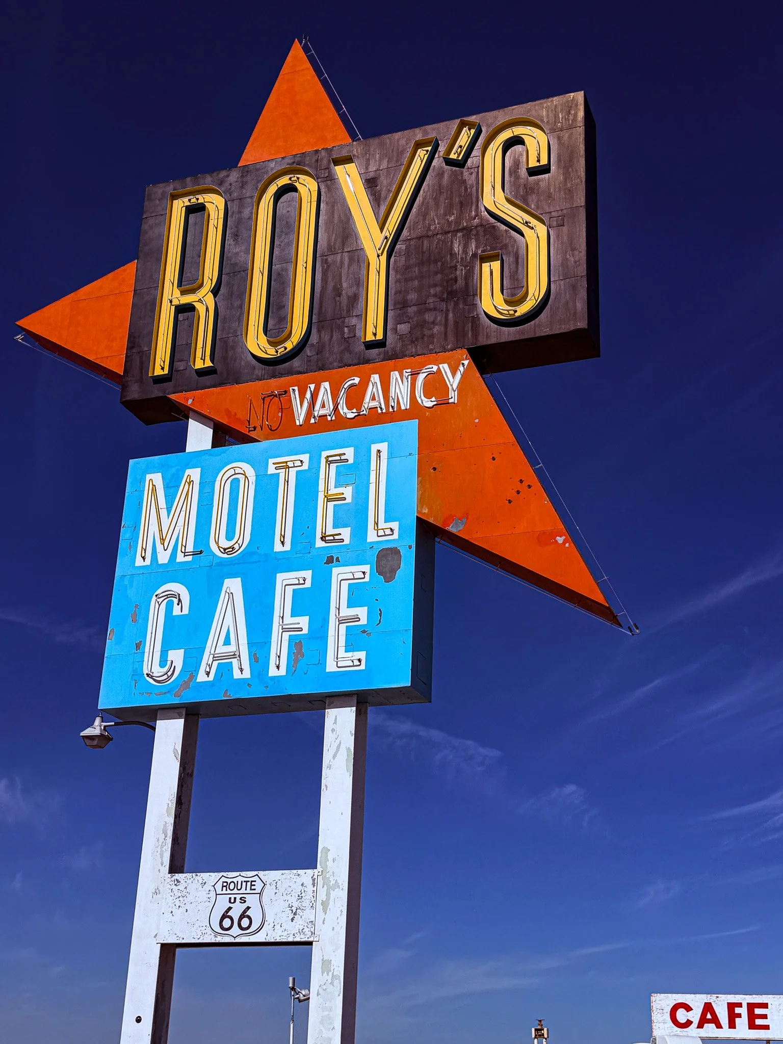
Our next stop was Roy’s Motel & Cafe. This is another one of those stops that is truly unmistakable and ranks right up there with the most photographed sites on the route.
Click on Image for Map.
From ChartGPT:
Opened in 1938 in the tiny desert town of Amboy, Roy’s Motel and Café became one of the most famous stops on historic Route 66. Its towering Googie-style neon sign welcomed travelers needing gas, food, and lodging across the Mojave. After Interstate 40 bypassed the town, Roy’s declined, but restoration efforts have kept it alive as an iconic roadside landmark and photo stop.
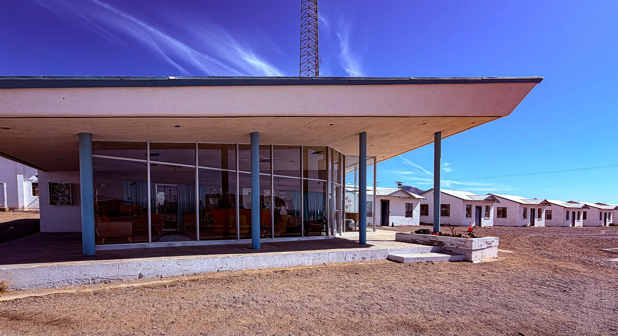
The motel is no longer operational but the office has been maintained inside with historical accuracy to the road’s hayday.
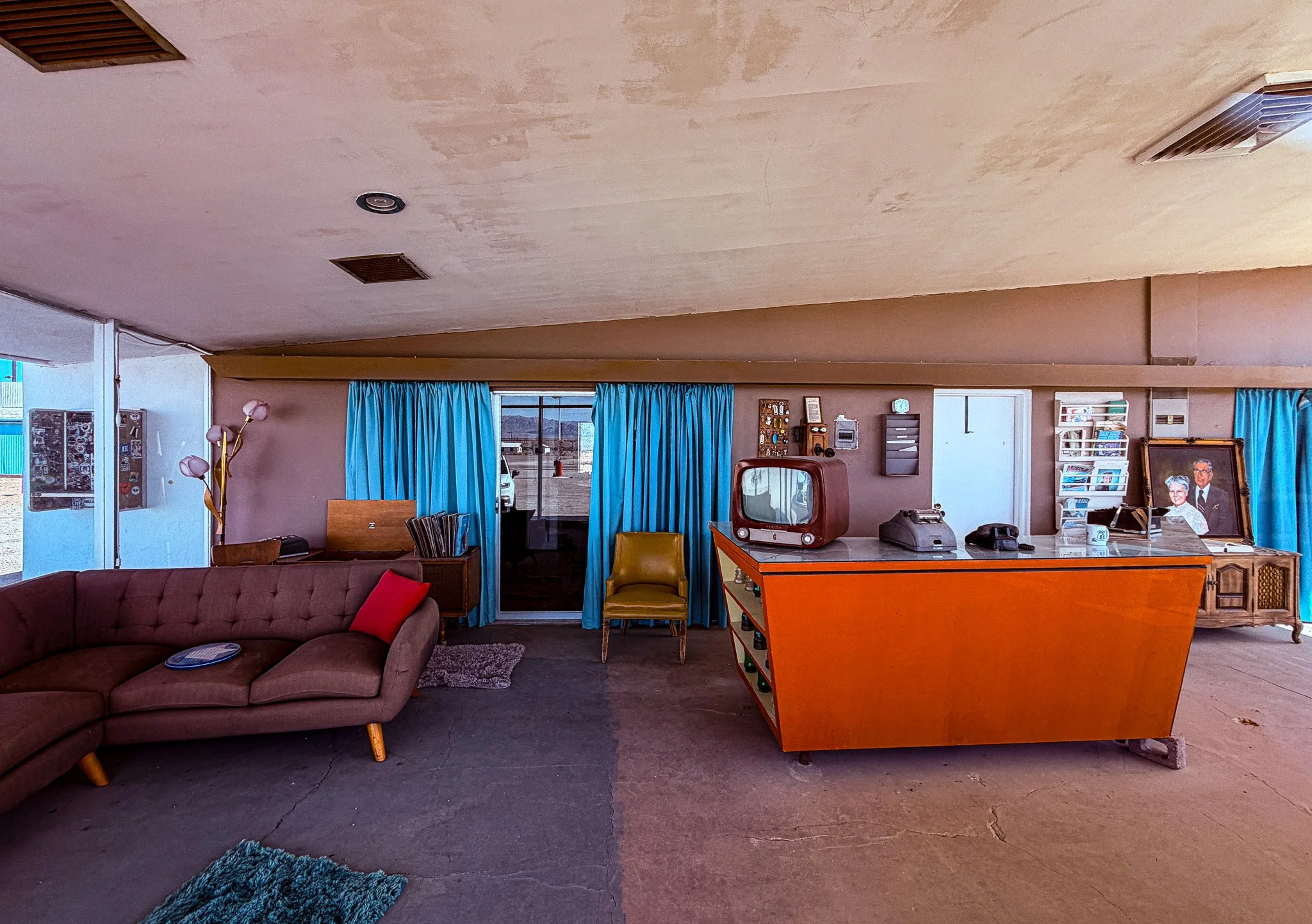
The interior of the office appears as though you could check in today if you wanted.
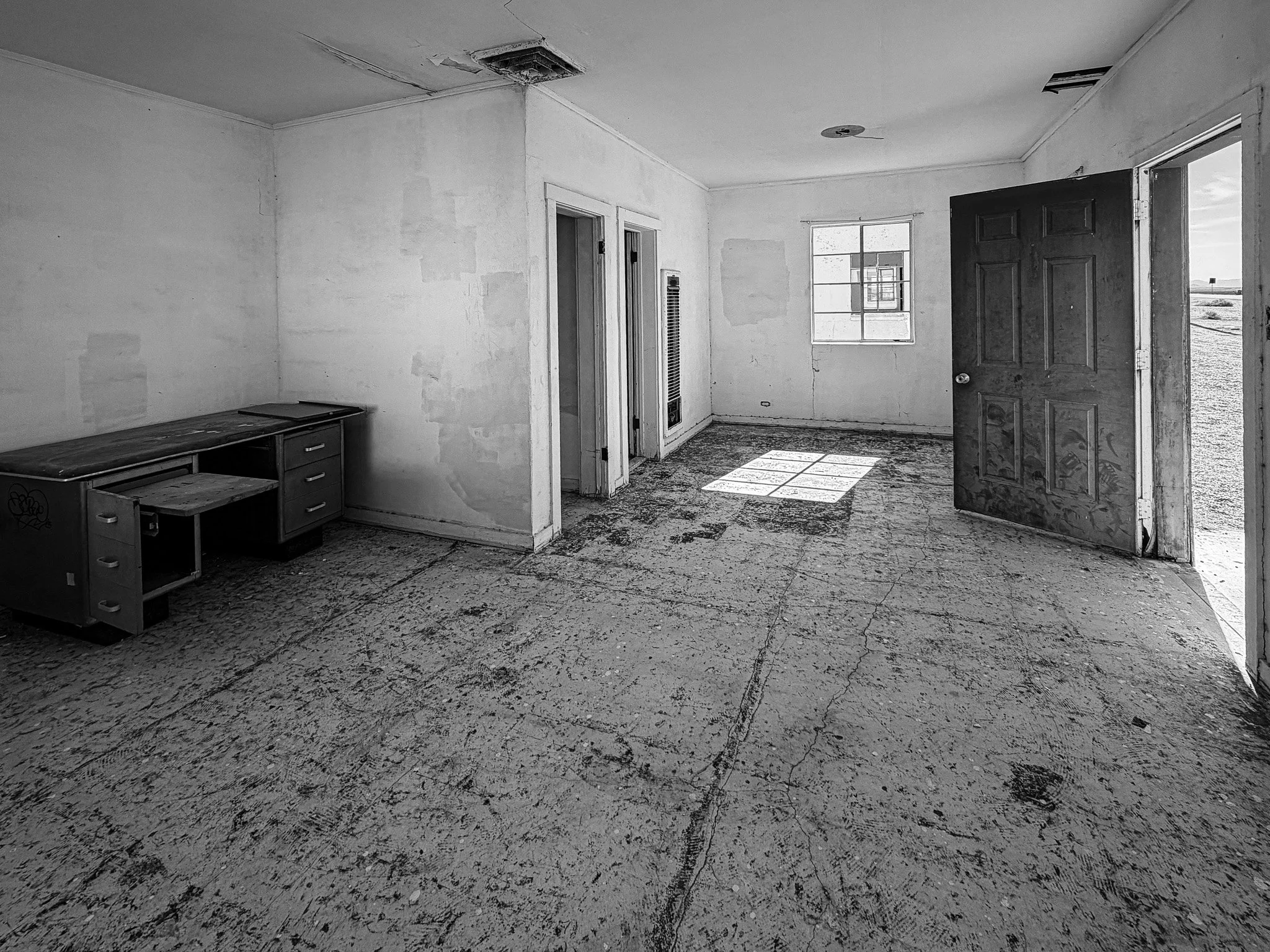
However, the cabins/rooms are no longer operational. The doors are open and many of the windows are gone and both time and vandals have done their fair share on these small little historic lodgings.
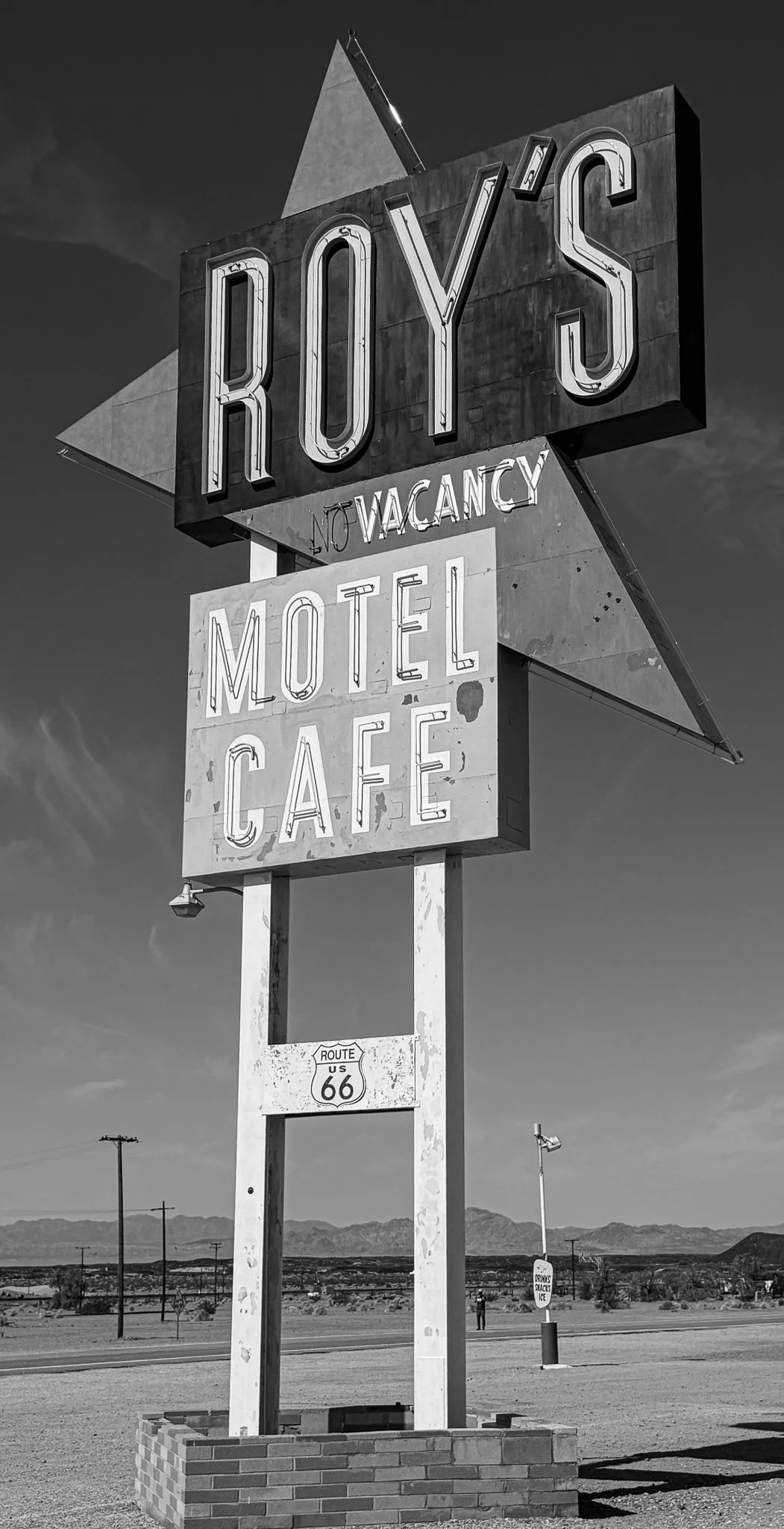
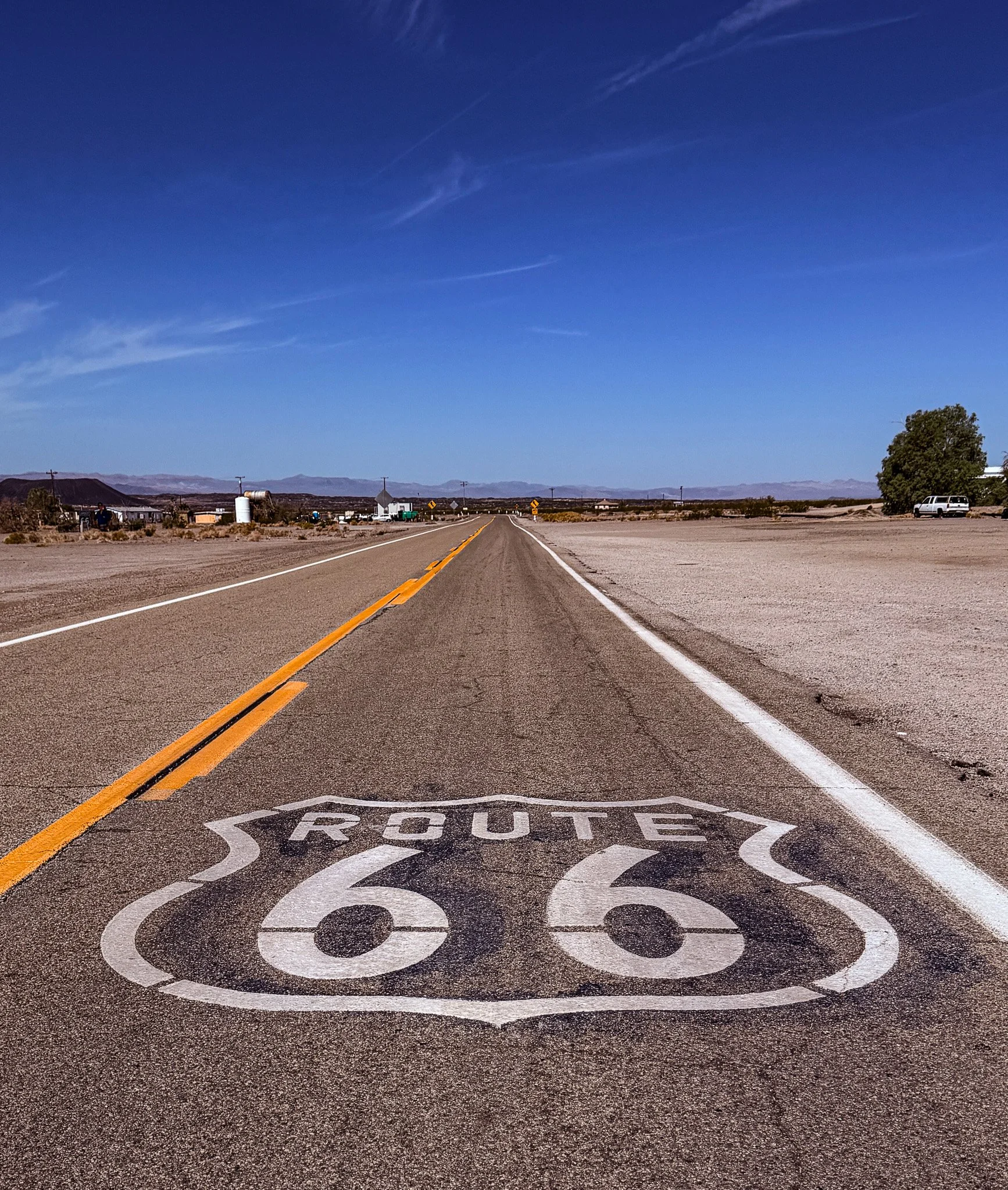
Directly in front of Roy’s are two Route 66 shields, one facing east and this one facing westward into the distant California hills.
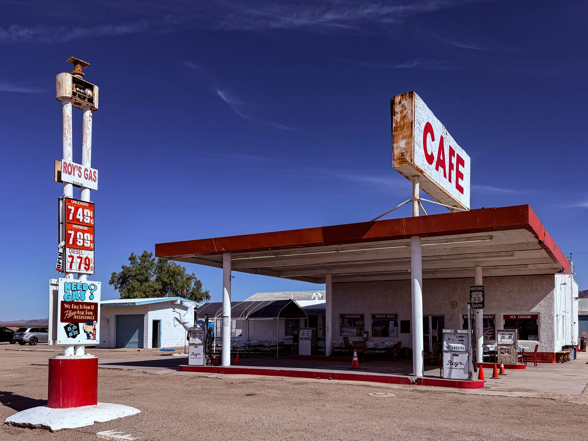
Roy’s Cafe still functions as a gift shop, sells gas, and appears to have some limited counter service for food. Check out those prices for gas out here in the middle of the desert. However, those are NOT the worst prices we saw today…. We saw some just off I-40 that were well above $9 per gallon!! Later in the day we took on some fuel and paid about $5.39 per gallon and actually felt good about that; it goes to show that everythnig is relative.
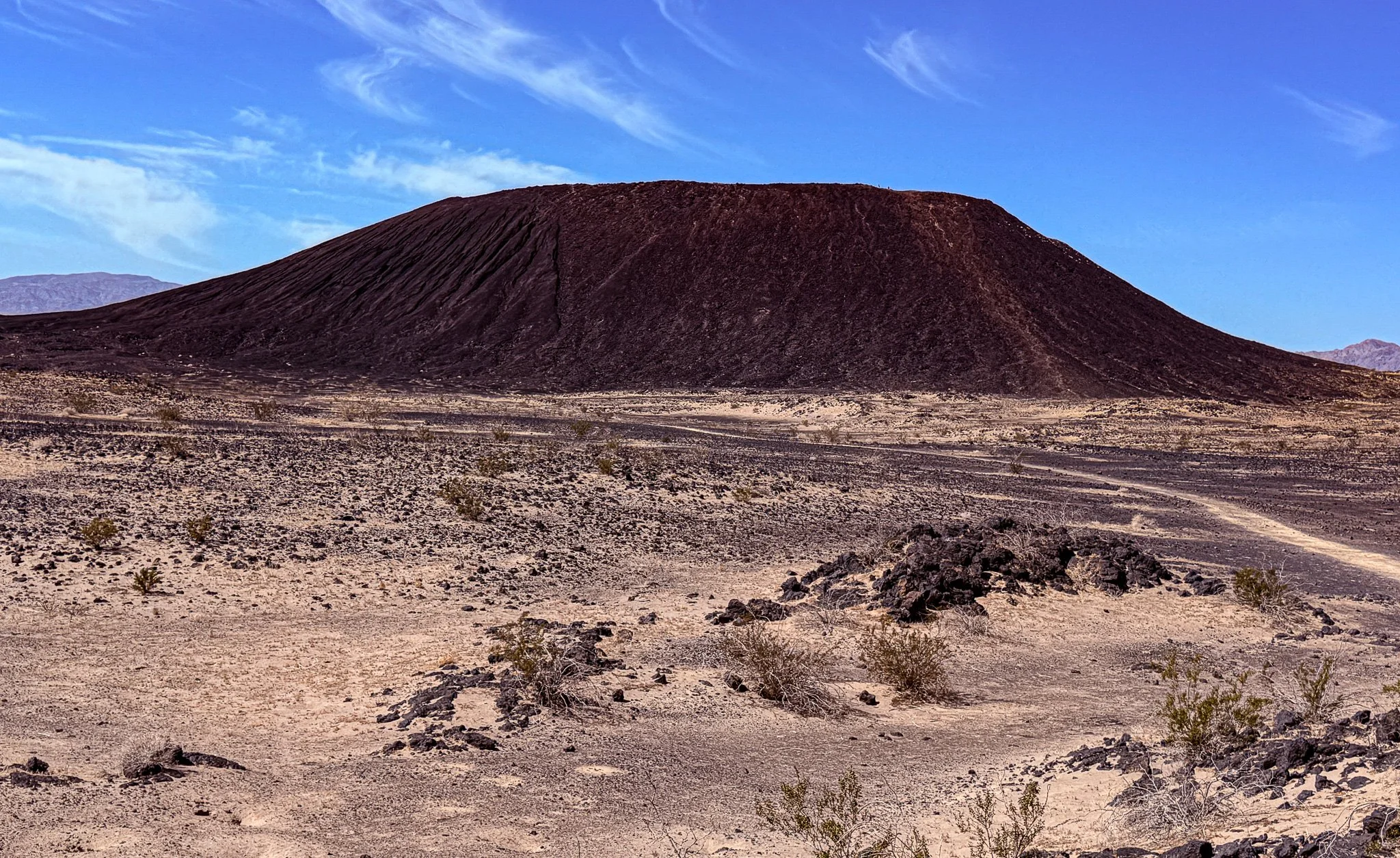
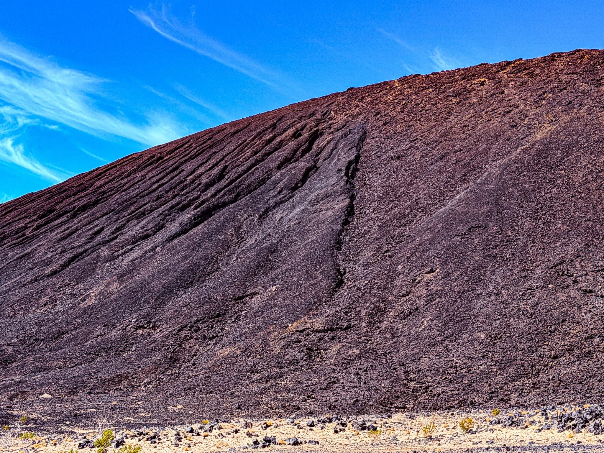
Our next stop was at Amboy Crater where we walked to the crater and then did the rim loop trial.
Click on Image for Map.
From ChatGPT:
Amboy Crater is a striking volcanic cinder cone rising from the Mojave Desert along historic Route 66 near Amboy, California. Formed about 10,000 years ago, it stands 250 feet above the desert floor and is surrounded by ancient lava fields. A hiking trail leads visitors to the rim, where sweeping views reveal the stark beauty of this rugged desert landscape.
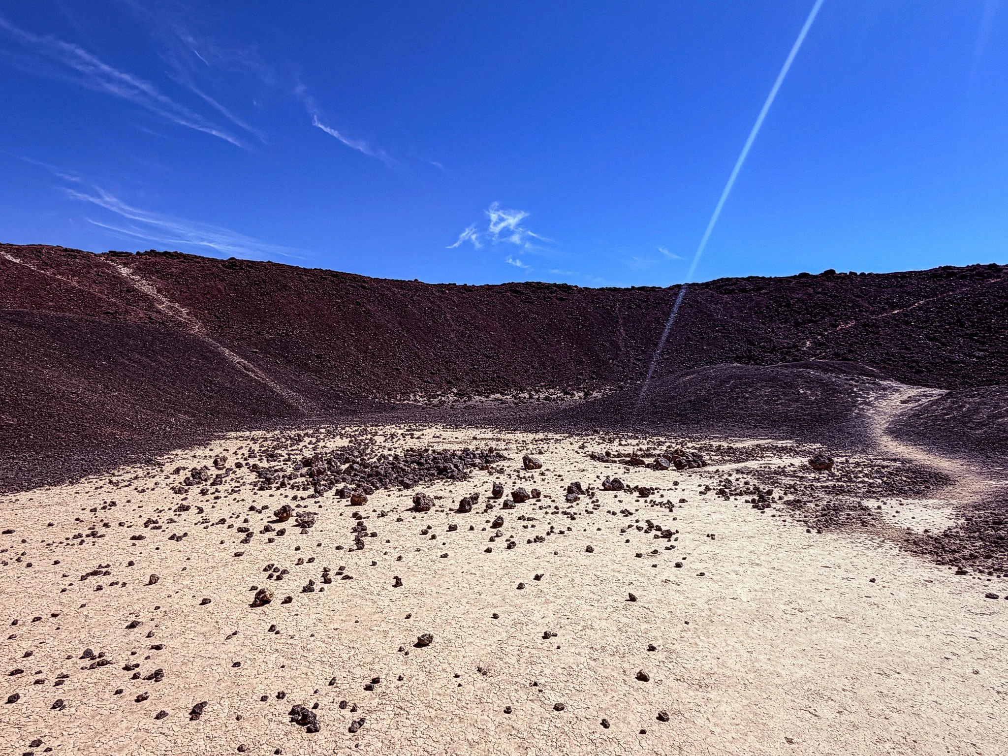
This is the view from down inside the cone of the crater.
Click on Image for Map.
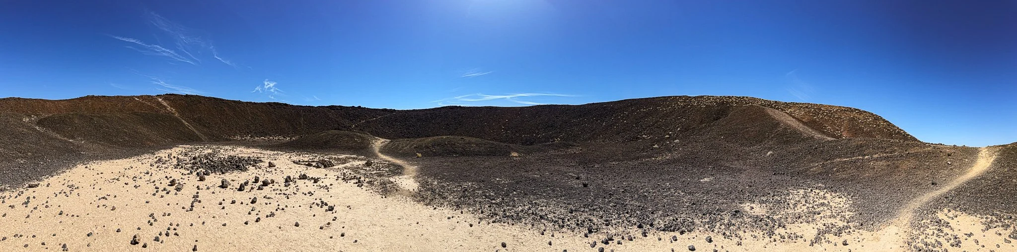
A panoramicview from inside the volcano.
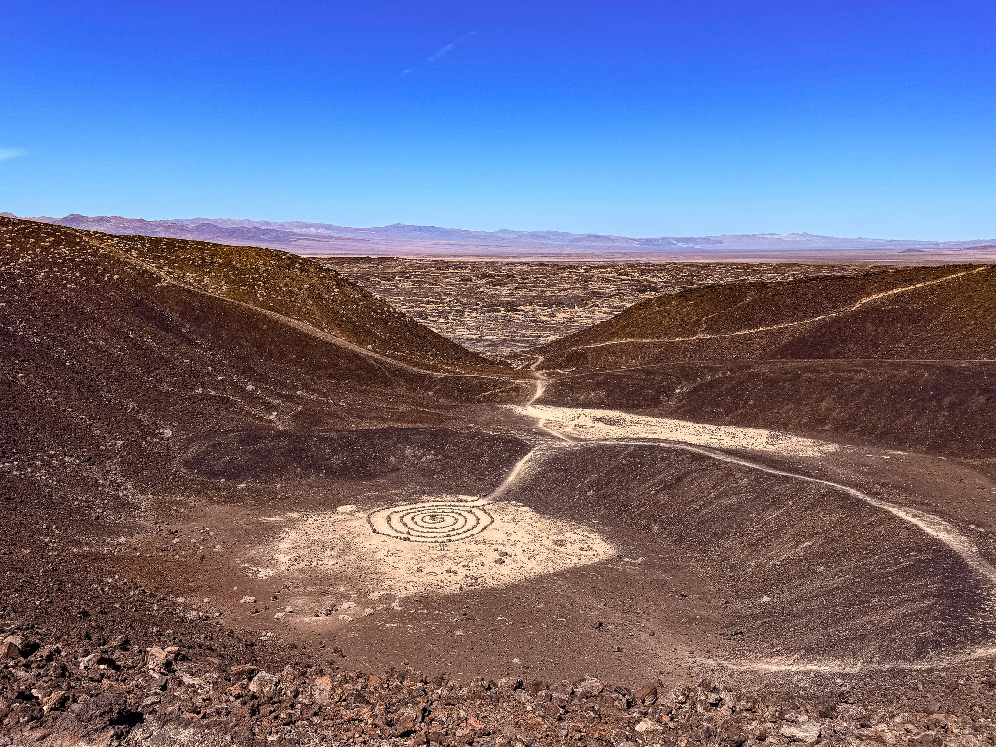
A view back down into the crater from the rim. You can see that when the volcano last erupted it blew out the west side of the cone and that is where the trail leads into the crater and then eventually up onto the rim.
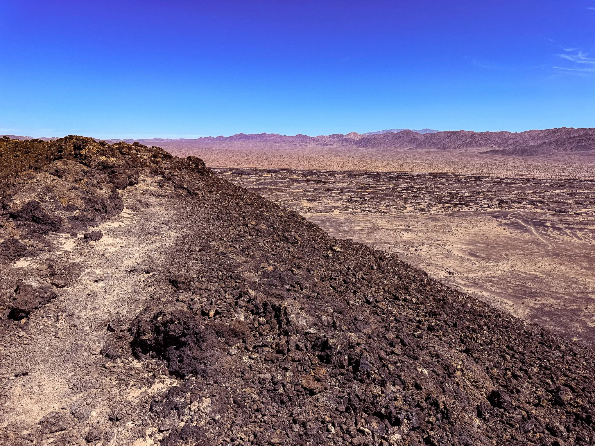
A view from the rim. Unfortunately, two dimensional photos of grand vistas like this are never able to do them proper justice. This was much more impressive when viewed live.
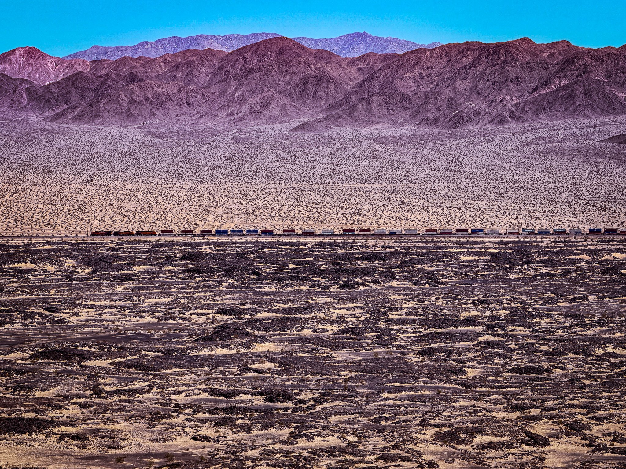
View of a distant train in front of the mountains from the rim.
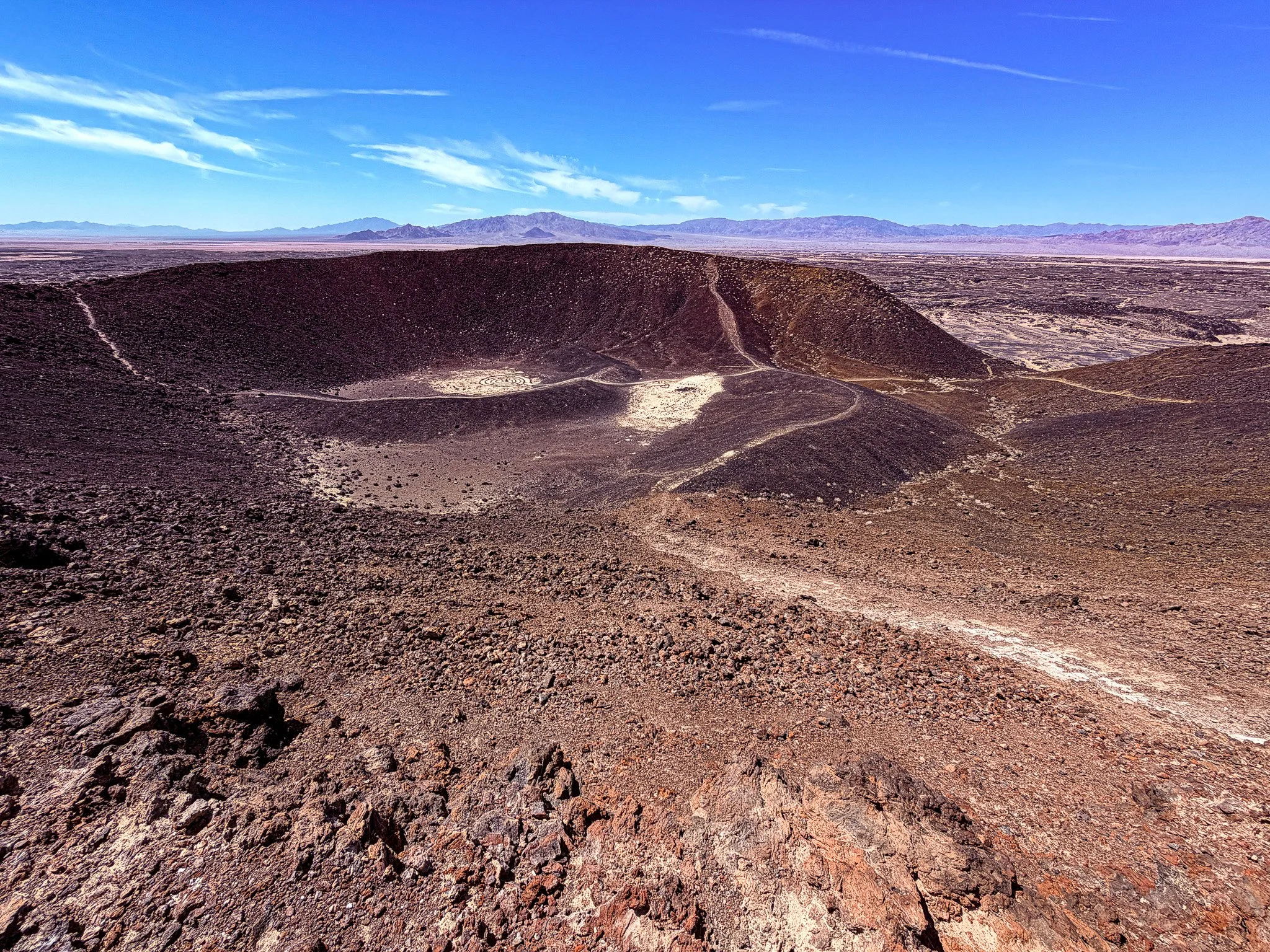
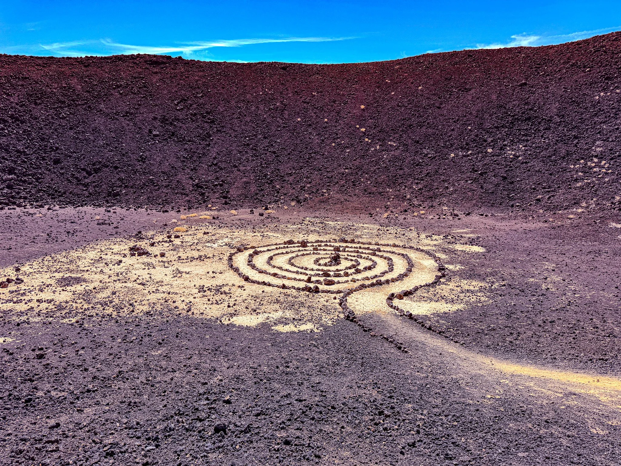
One last view into the crater from the rim before we head back down.
The total hike was about 3.5 miles. The signage at the parking areas says to do this hike on from October to April due to the extreme heat. At the end of April we can say that by the time we finished the hike it was getting a bit toasty.
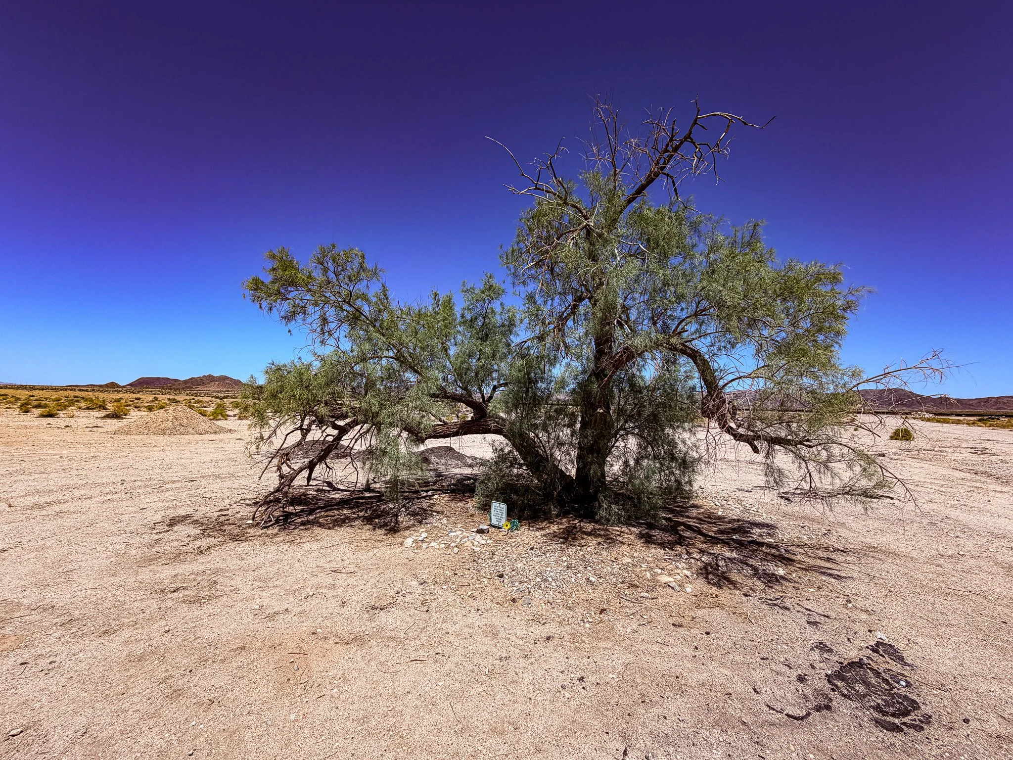
A photo of a single random tree in the middle of the desert. What’s up with that?
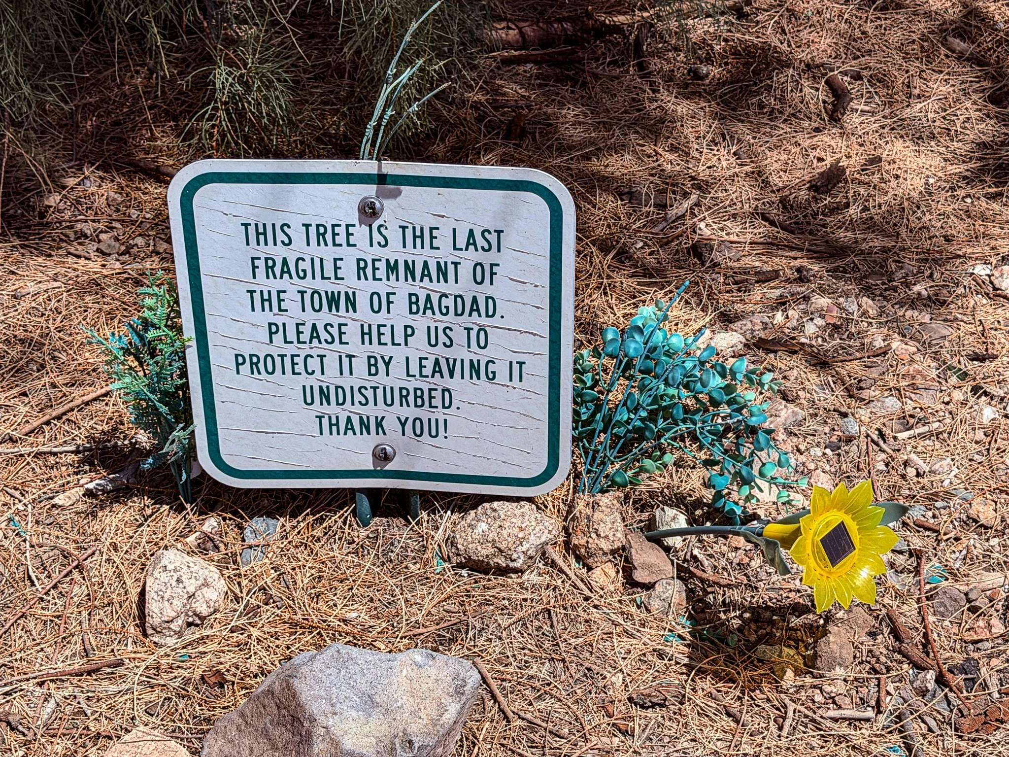
Well, this is the most ghostly of the ghost towns along Route 66. It is all that remains of the town of Bagdad.
Click on Image for Map.
From ChatGPT:
The single tree standing at the site of old Bagdad has become a quiet symbol of survival and remembrance. Bagdad was once a small but busy Route 66 town serving miners, railroad workers, and travelers, but it faded after Interstate 40 bypassed it. When the remaining buildings were demolished, that lone tree was left behind as the last visible landmark of the vanished town. Today, it marks where life once thrived and reminds travelers of how quickly Route 66 communities could rise—and disappear.
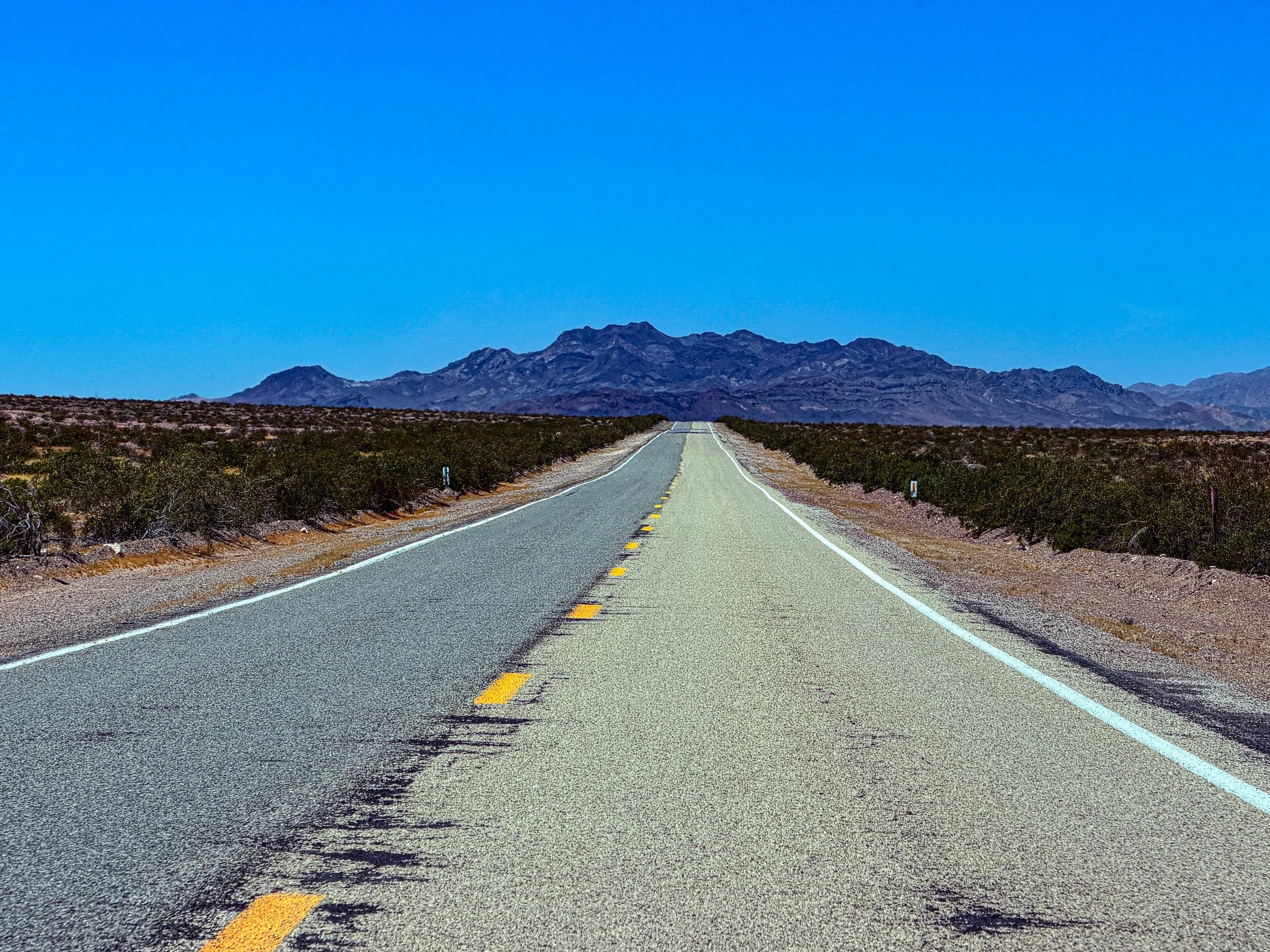
Here in the desert, the road can stretch on for miles.
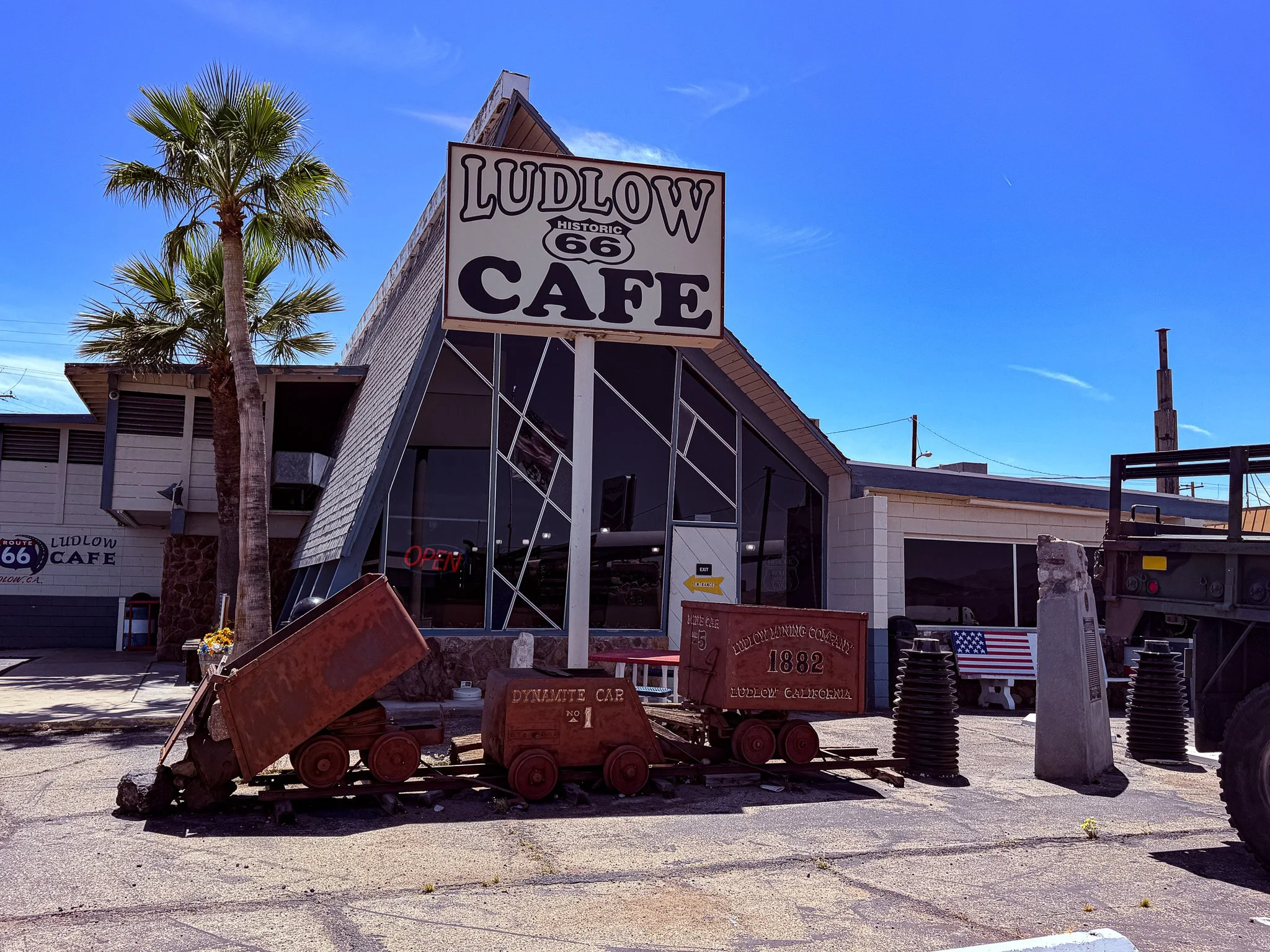
Lunch today was at the Ludlow Cafe, another Route 66 classic.
Click on Image for Map.
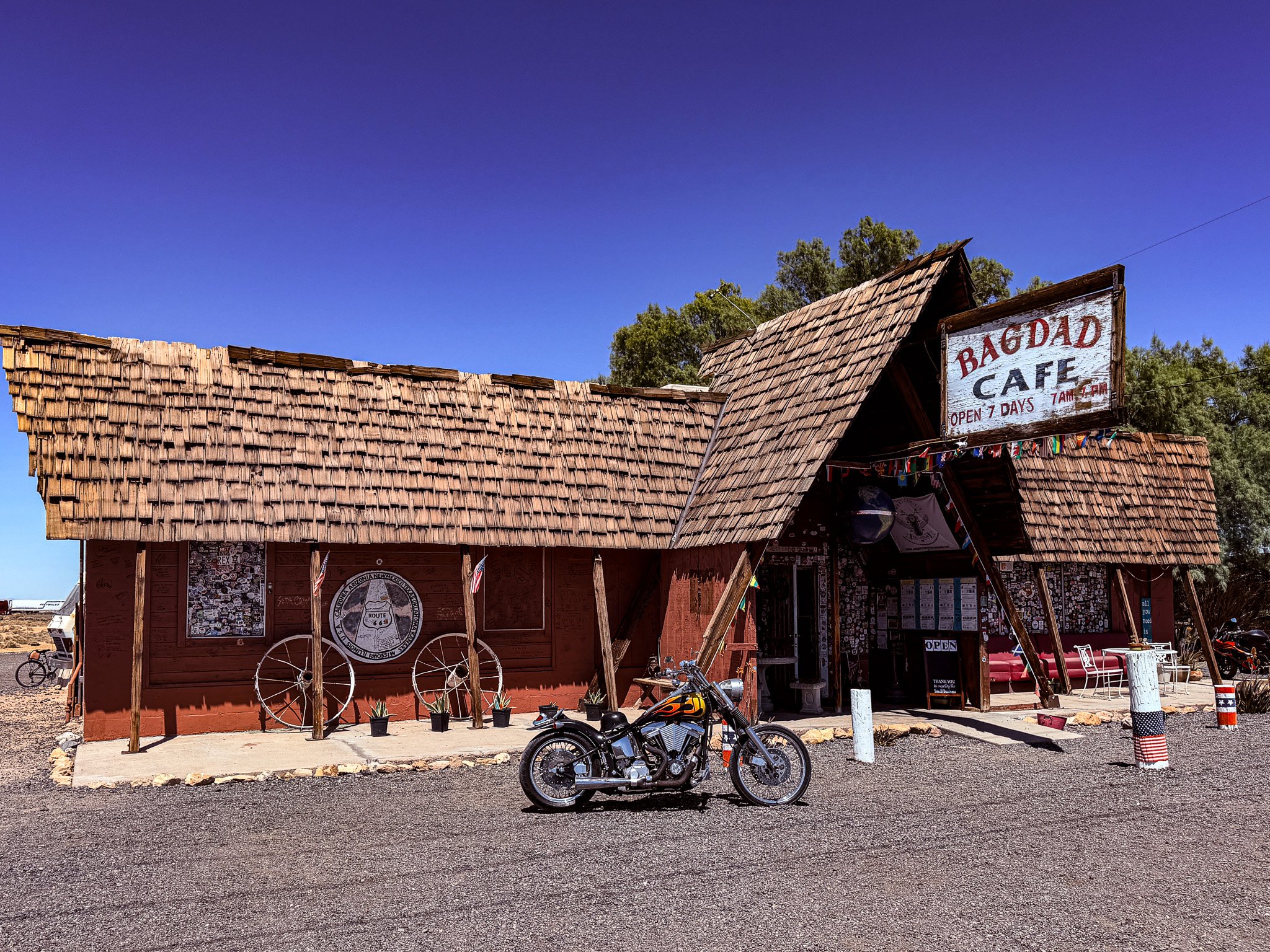
Next stop was the Bagdad Cafe.
From ChatGPT:
Bagdad Cafe on historic Route 66 in Newberry Springs, California, became famous after the 1987 film Bagdad Cafe was filmed there. Originally called the Sidewinder Café, it was renamed after the movie gained a cult following. Today, travelers stop for photos, souvenirs, and Route 66 nostalgia. Its colorful décor, international visitors, and desert setting make it one of the most memorable roadside landmarks on the Mother Road.
Click on Image for Map.

Inside the old Bagdad Cafe. The woman that owned the place died this past January.
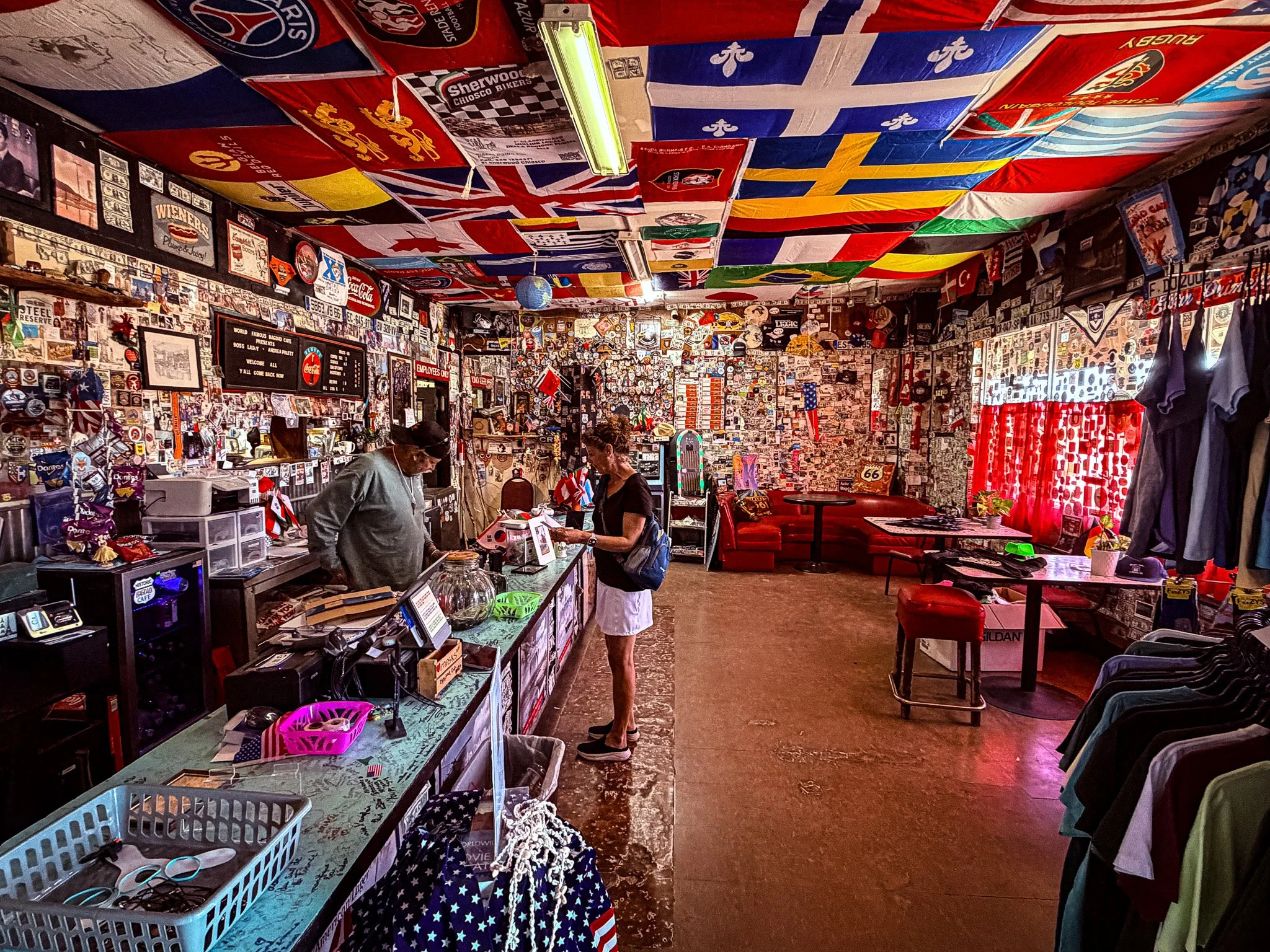
But we think this place will live on in her memory. It is another very popular stop for tourists on the route.
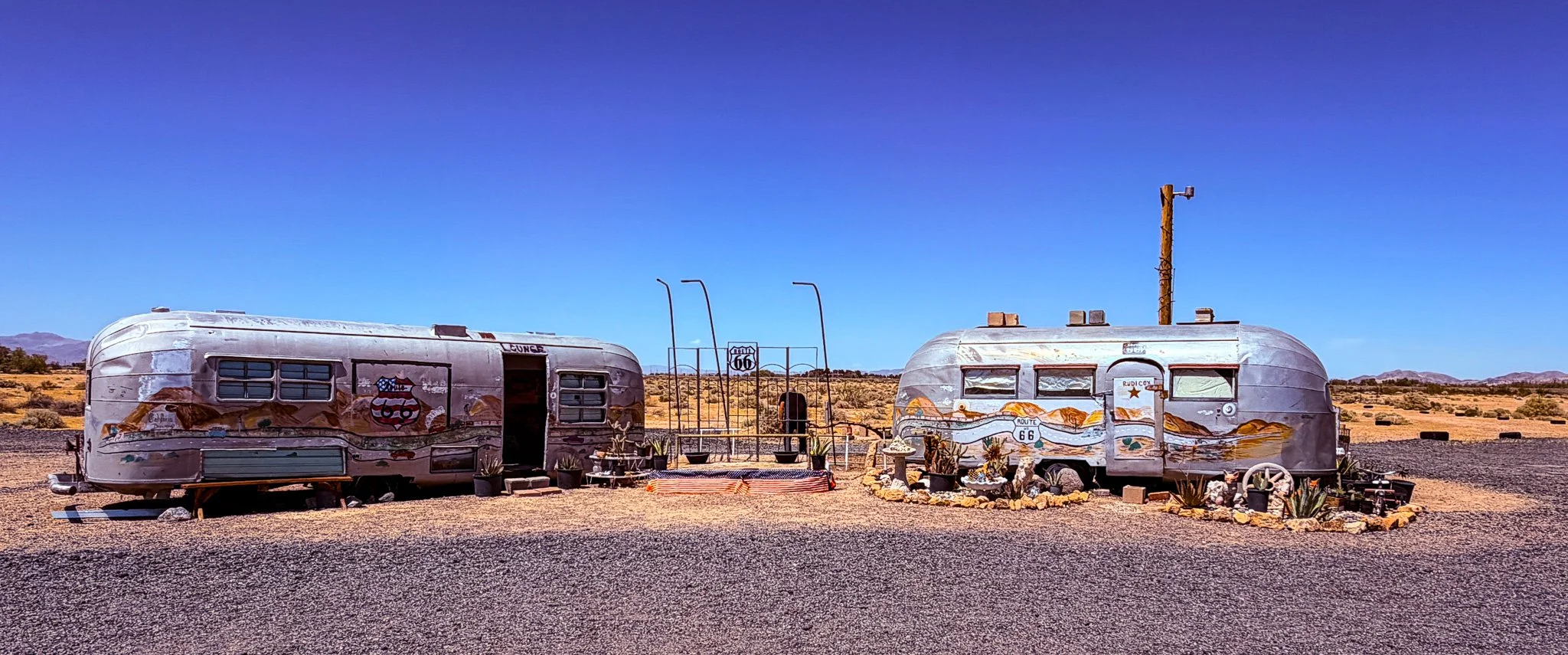
Out behind the Bagdad Cafe.
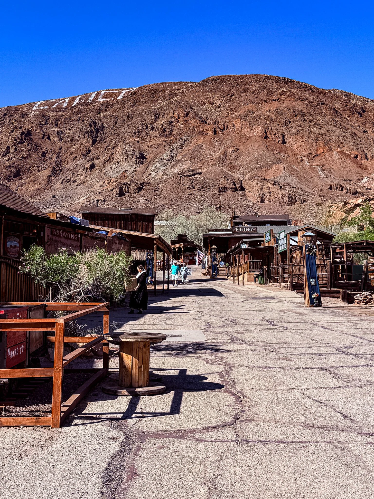
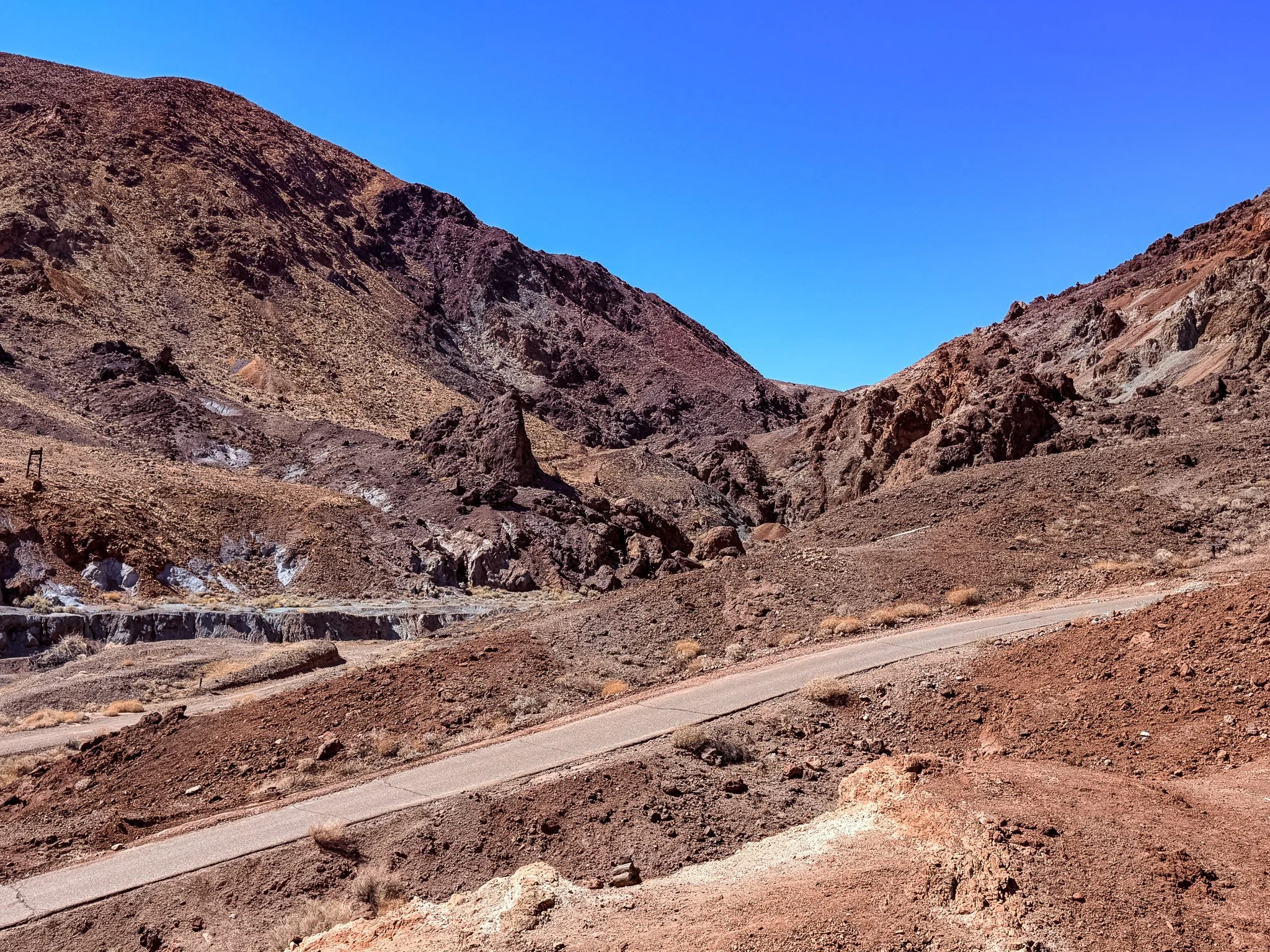
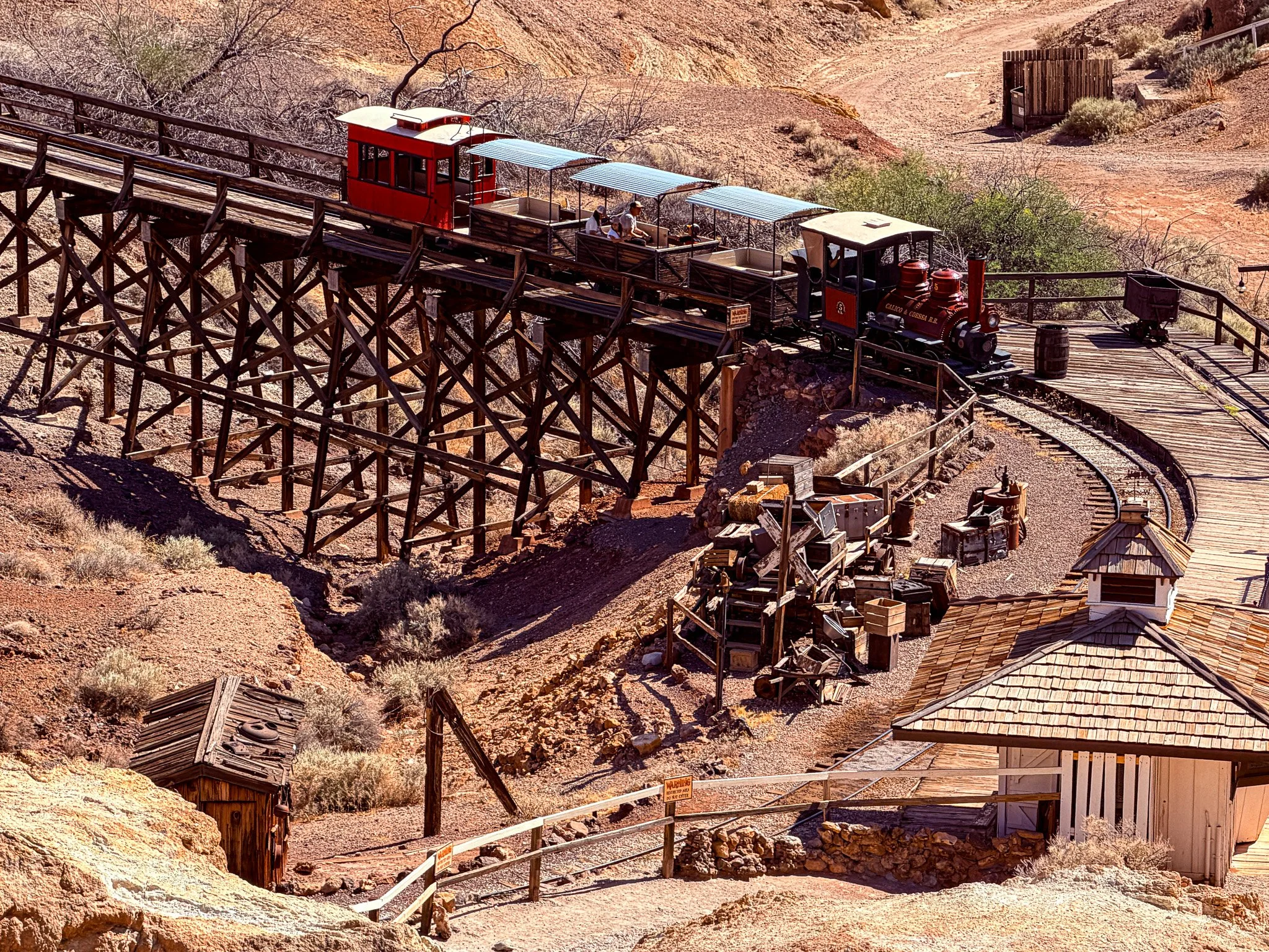
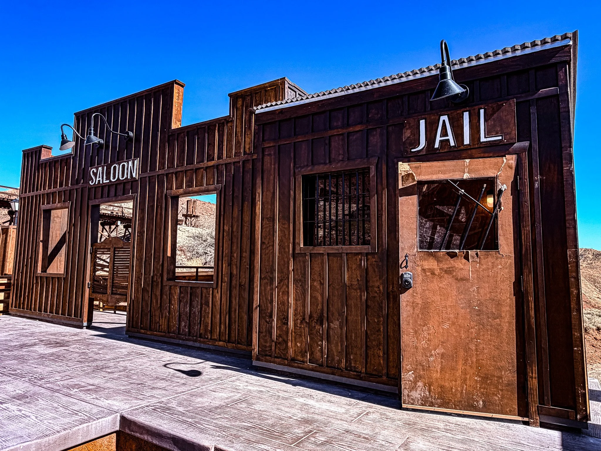
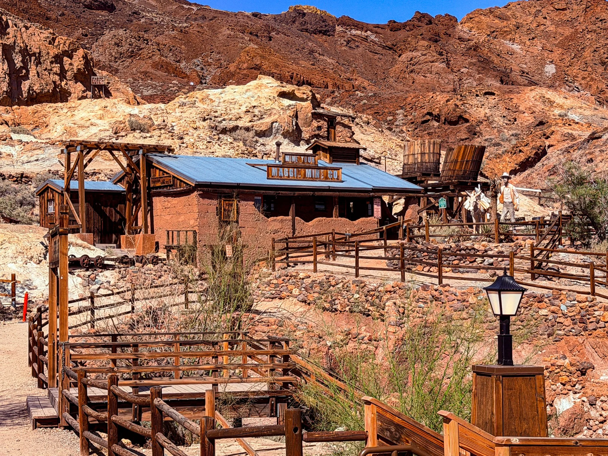
Our final stop for the way was a visit to Calico Ghost Town.
From ChatGPT:
Calico Ghost Town began as a silver mining boomtown in 1881 during California’s largest silver strike. At its peak, it had over 500 mines, saloons, stores, and a lively population. When silver prices collapsed in the 1890s, Calico was abandoned and became a ghost town. Restored by Walter Knott of Knott's Berry Farm fame, it is now a county park where visitors can explore old buildings, mines, and Wild West history.
Click on Image for Map.
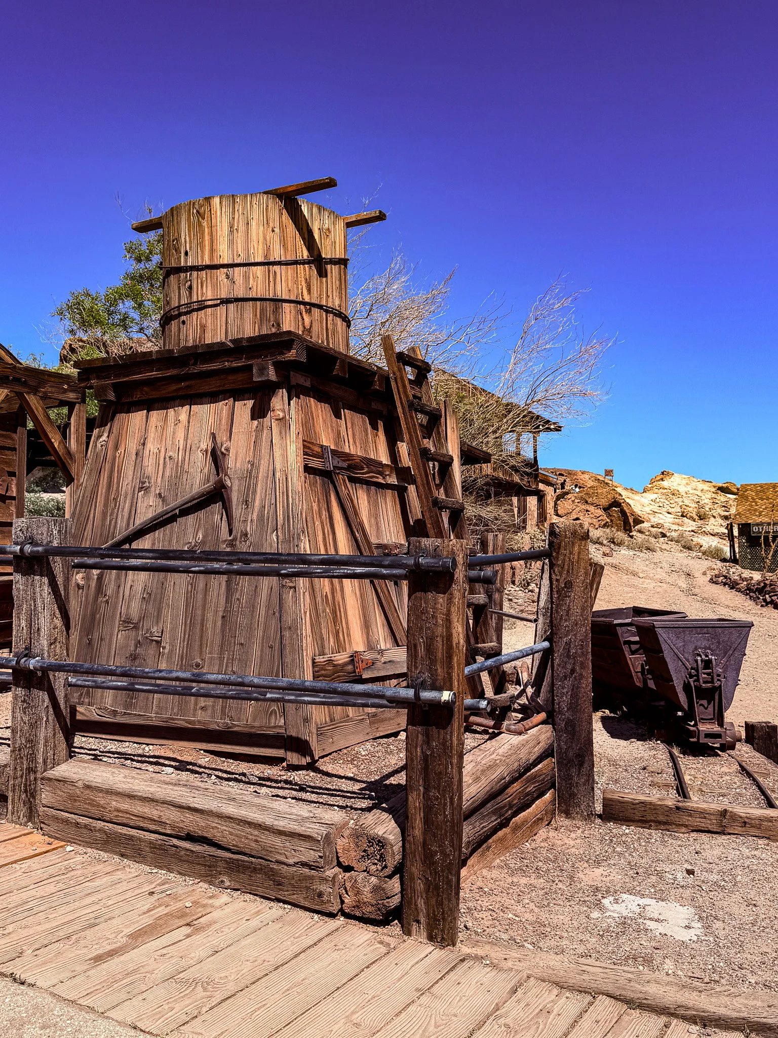
Looking at old photos in some of the buildings, they have actually done a reasonable job of recreating what the old mining town actually looked like. However, it is now completely commercialized with gift shops, restaurants and even a train ride.
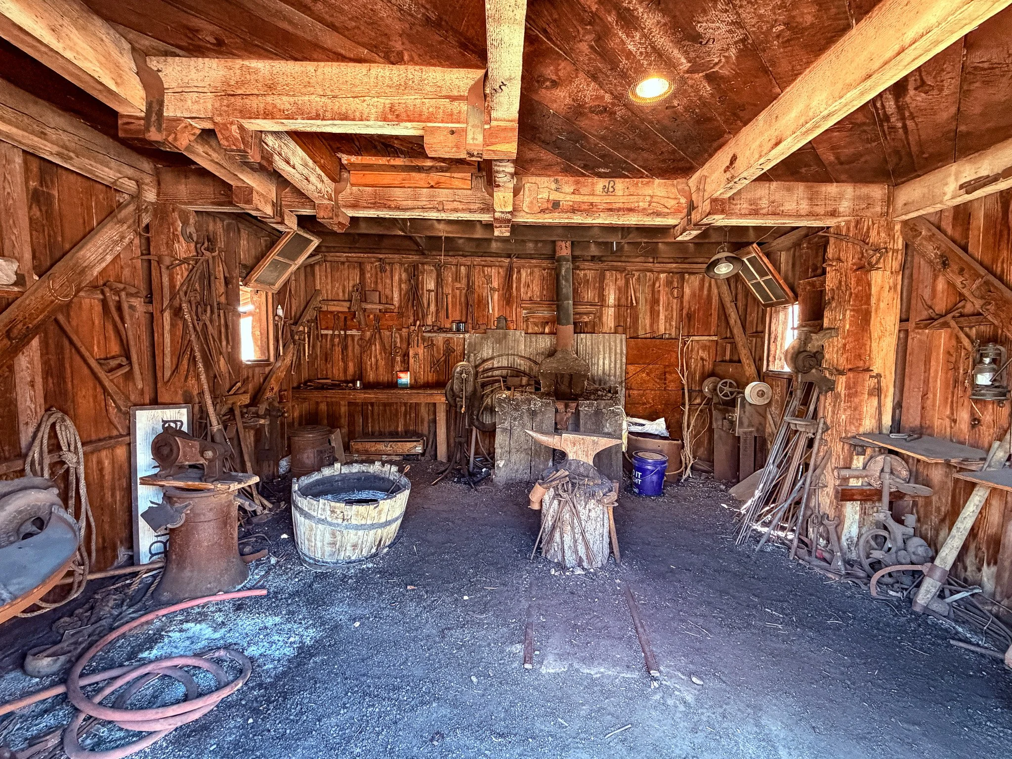
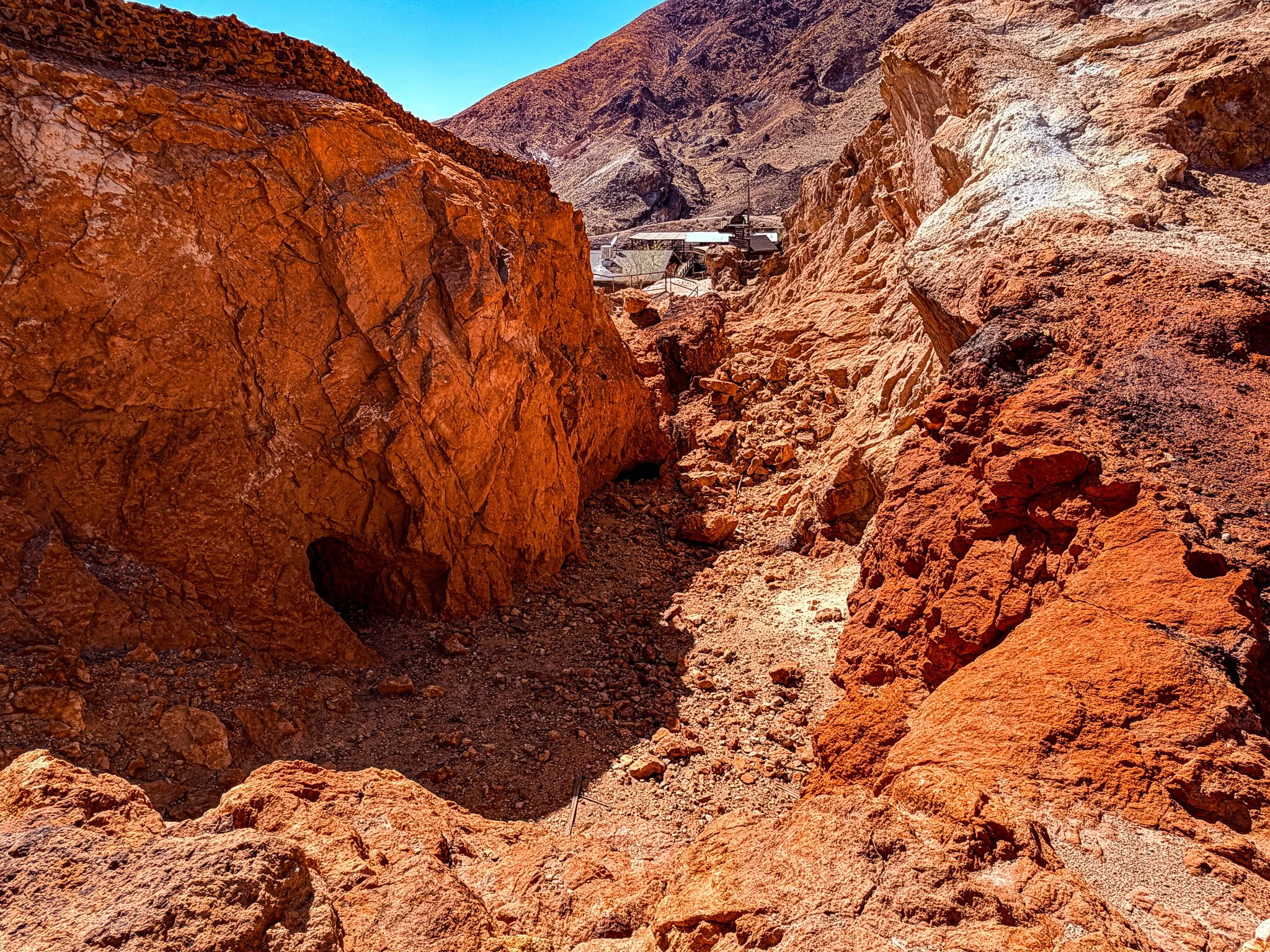
These were some tough places to live back when the mines were active. We read that some of the mines extended 500 feet under these mountains.
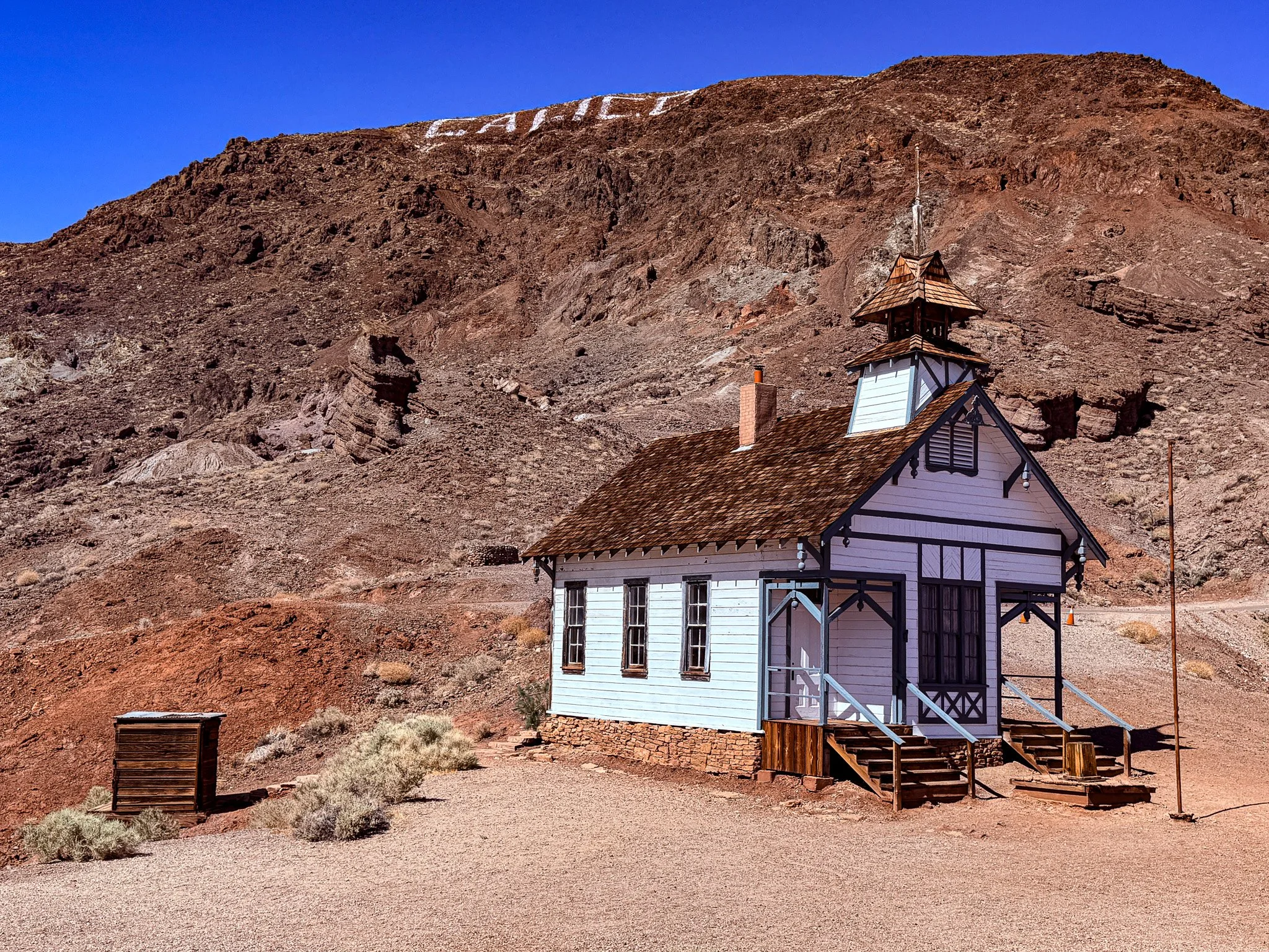
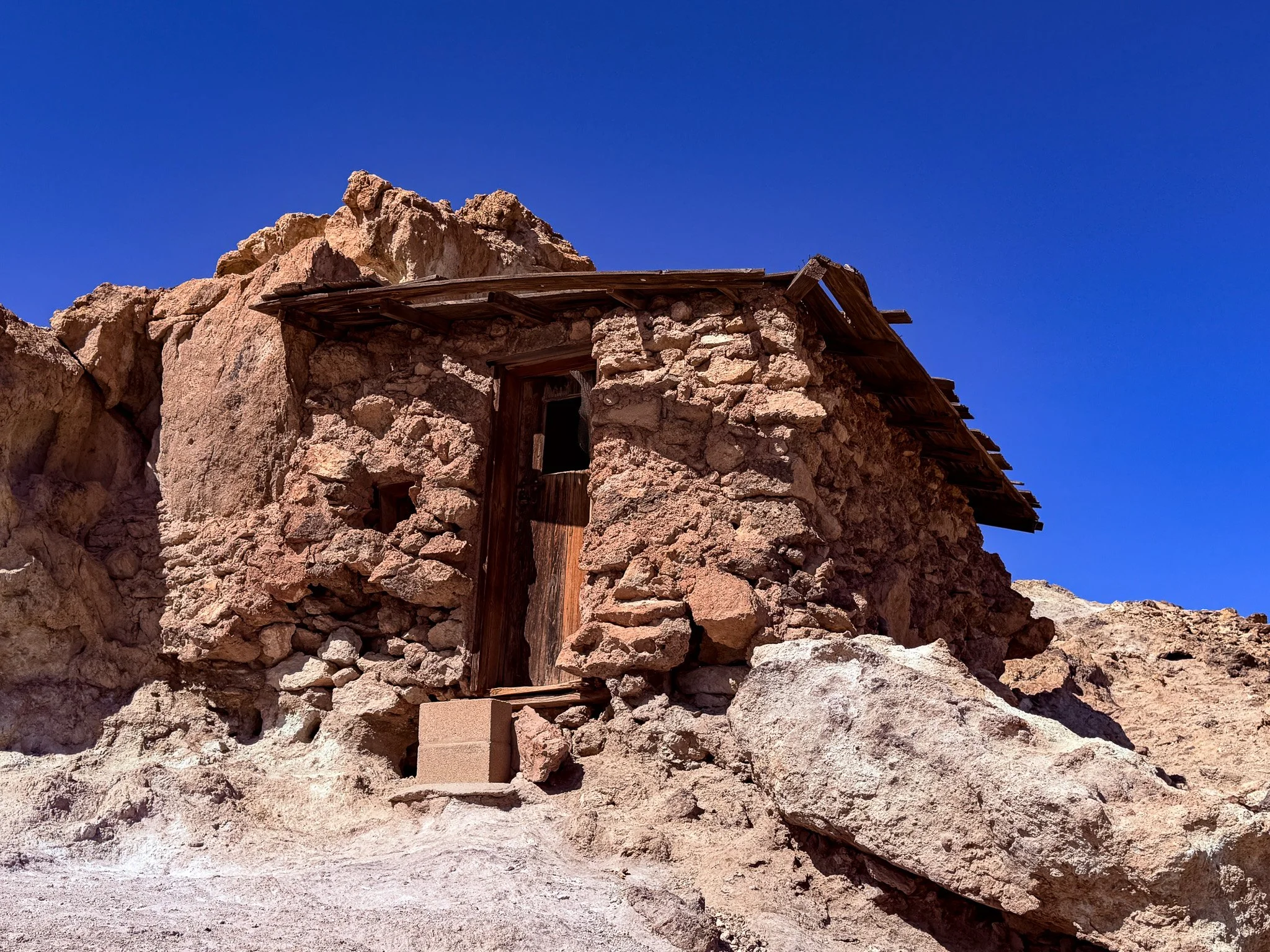
At the very top of the village was this school house. Although this is a recreation, from looking at photos it sits exactly where the original did and looks the very same.
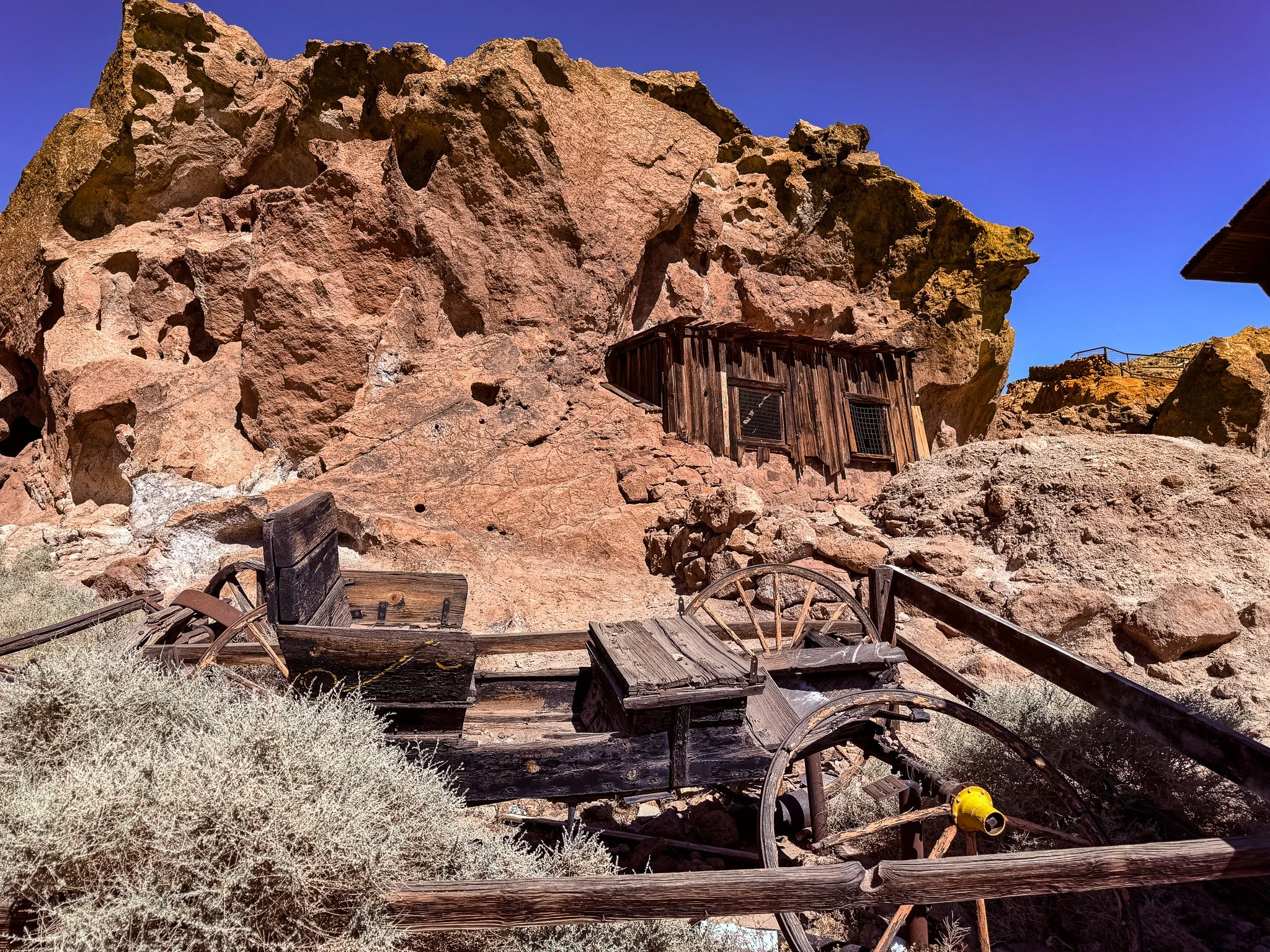
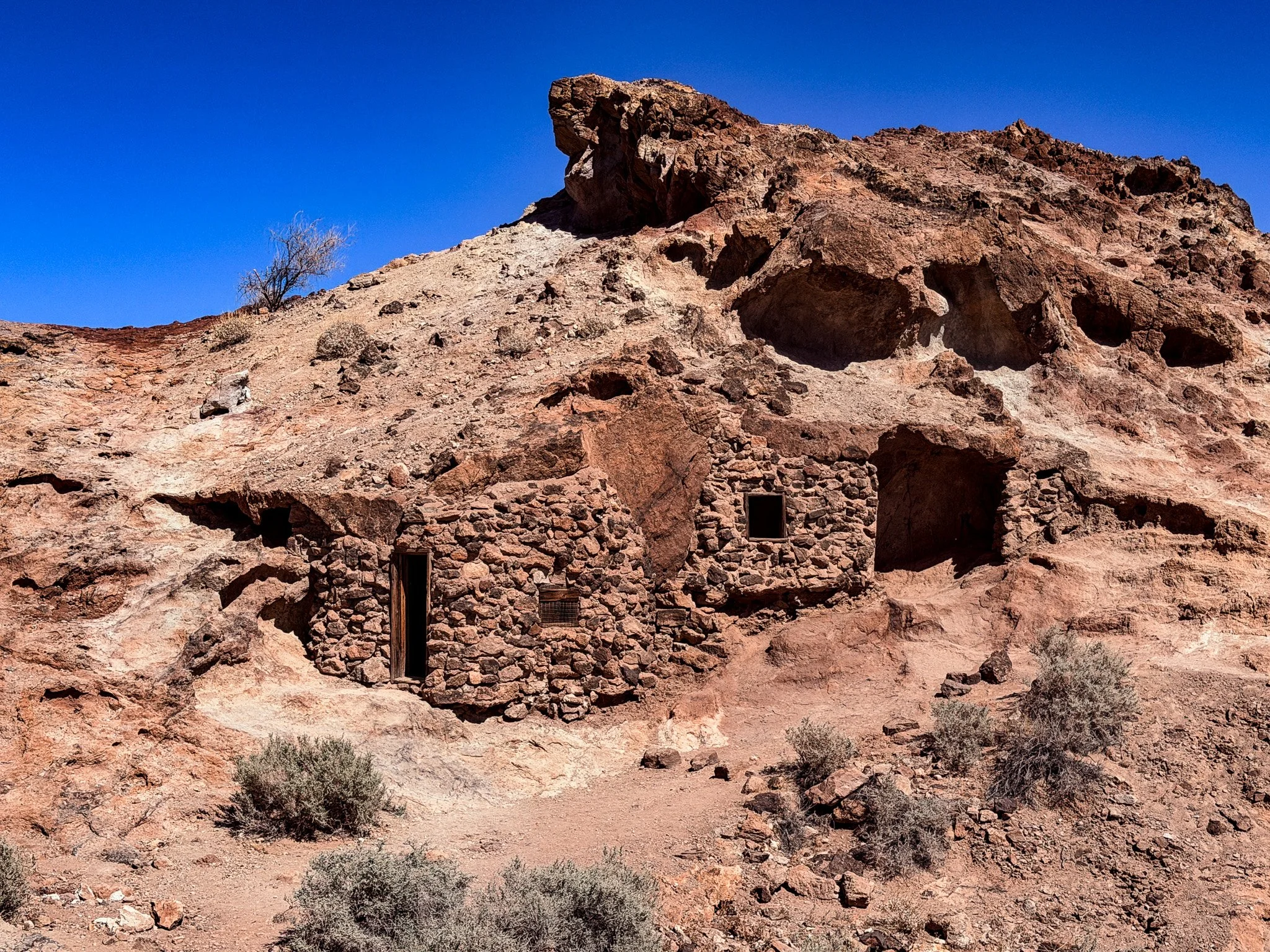
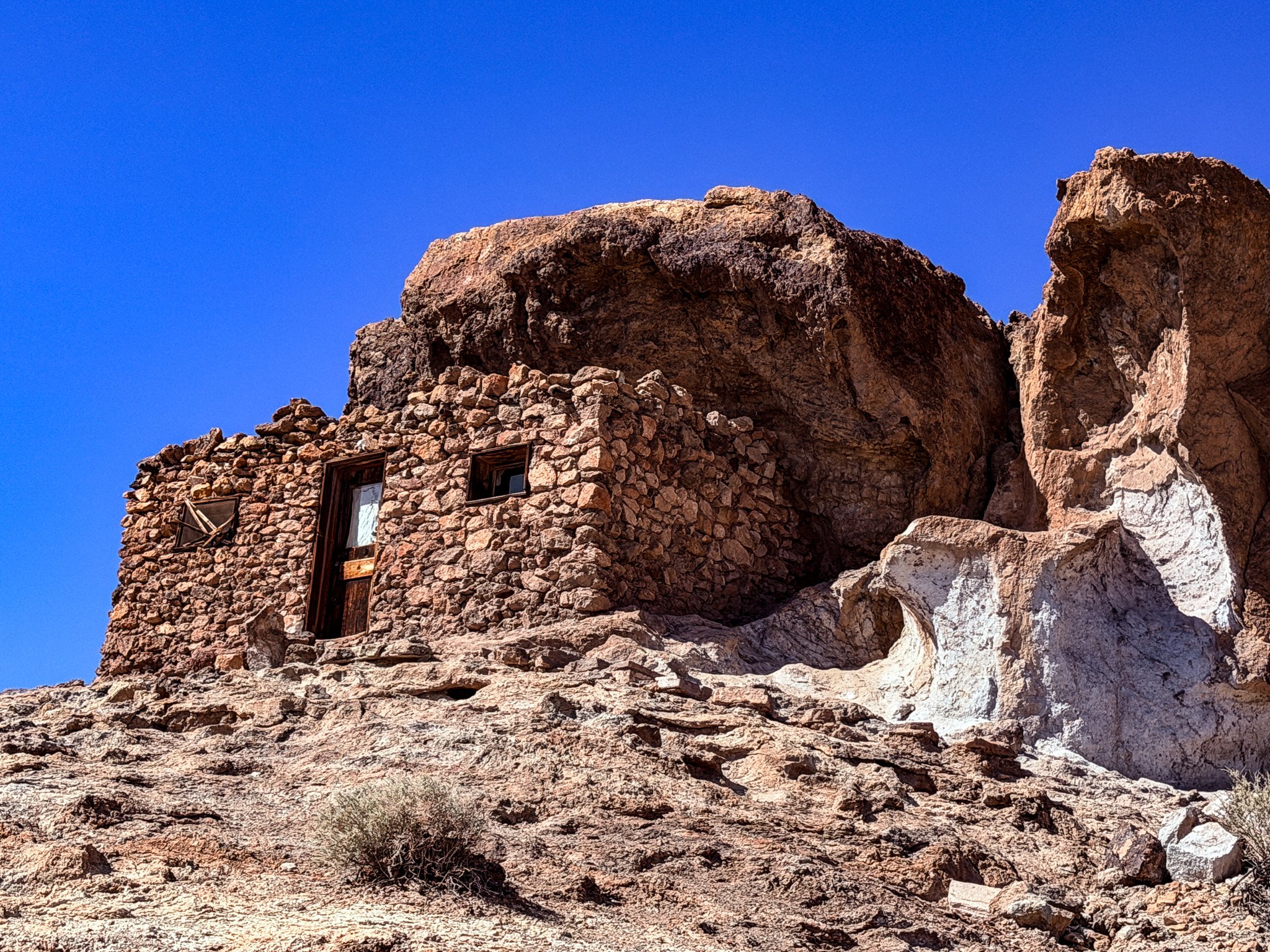
The early arrivals and prospectors - before the arrival of building materials - would make their dwellings from improvised scrap wood attached to overhangs of rock to provide protection.
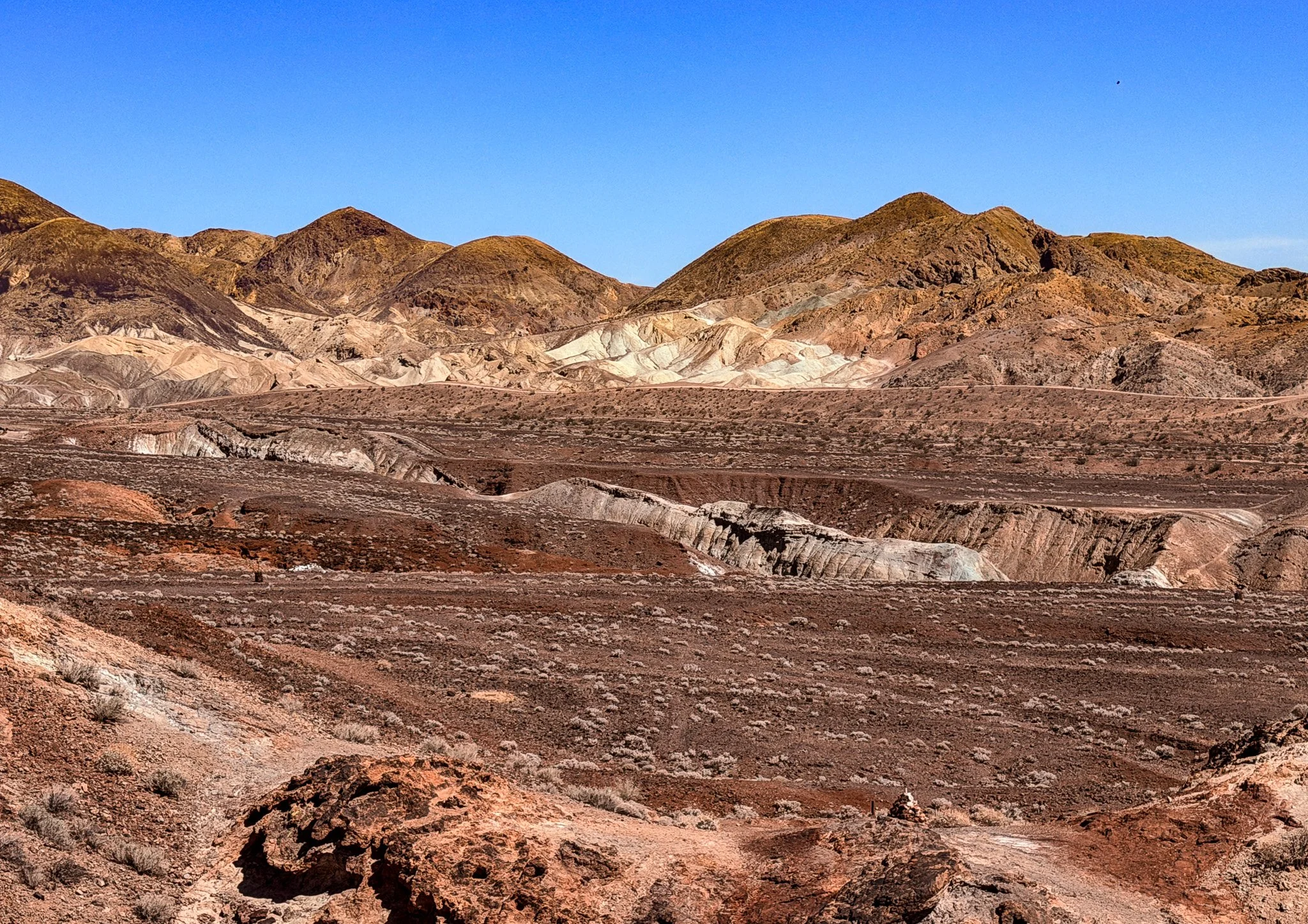
Some formidable territory for sure.
More examples of dwellings, before the arrival of actual building supplies.
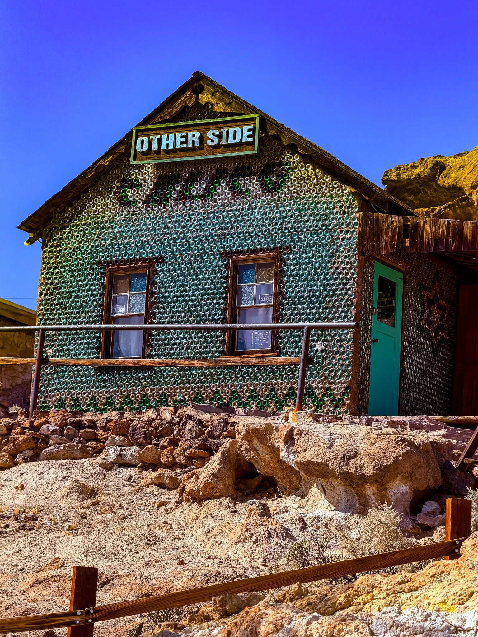
The walls of this building are entirely made up of wine bottles of different colors held in place by mortar. Not sure how period appropriate this is, but interesting nonetheless.
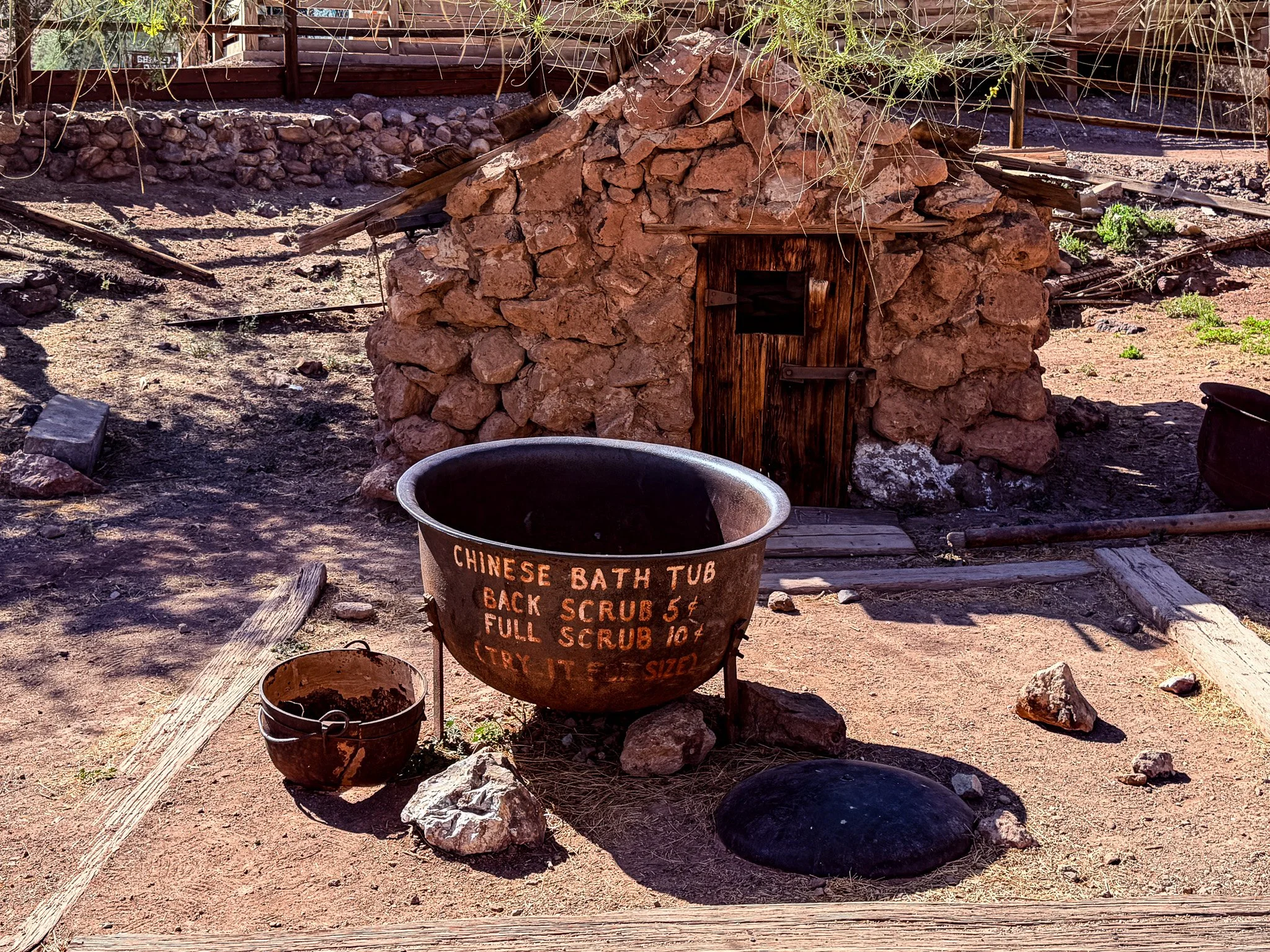
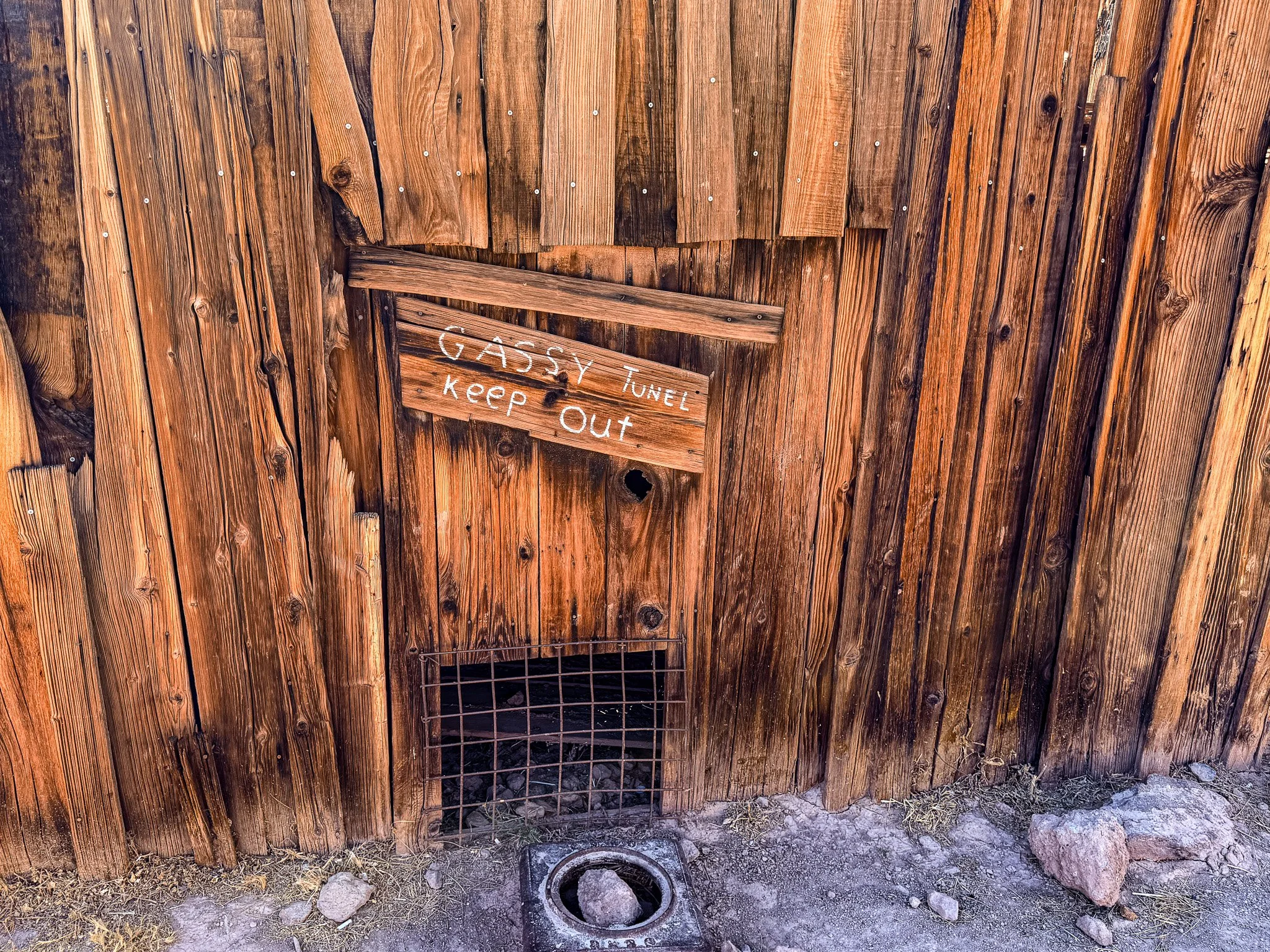
This sign seemed like something straight out of Uranus, MO.
Keep the theme alive.
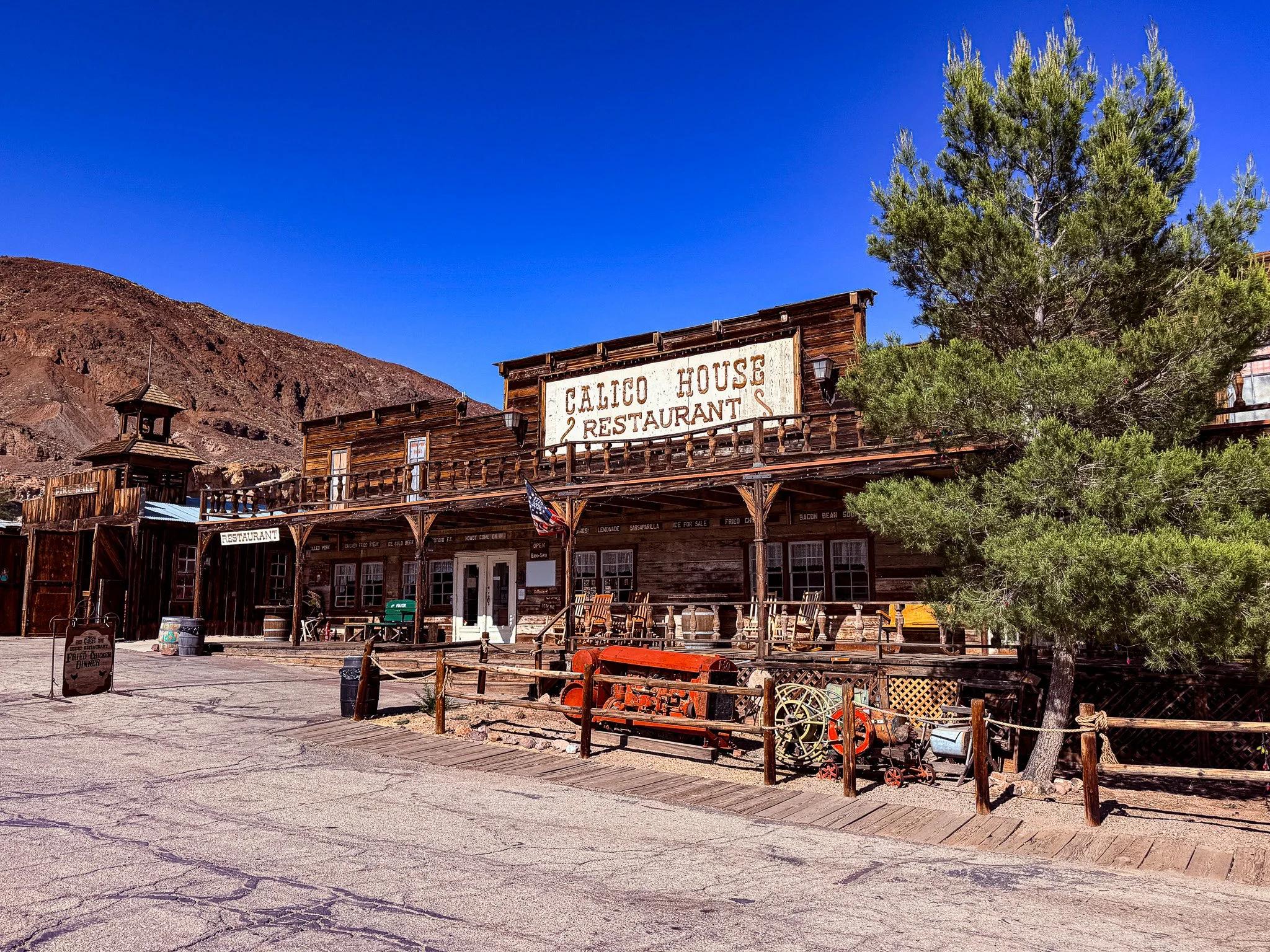
It was commercialized for sure, but interesting all the same for the historical aspects.