Route 66 - Day #15
Saturday, April 25, 2026
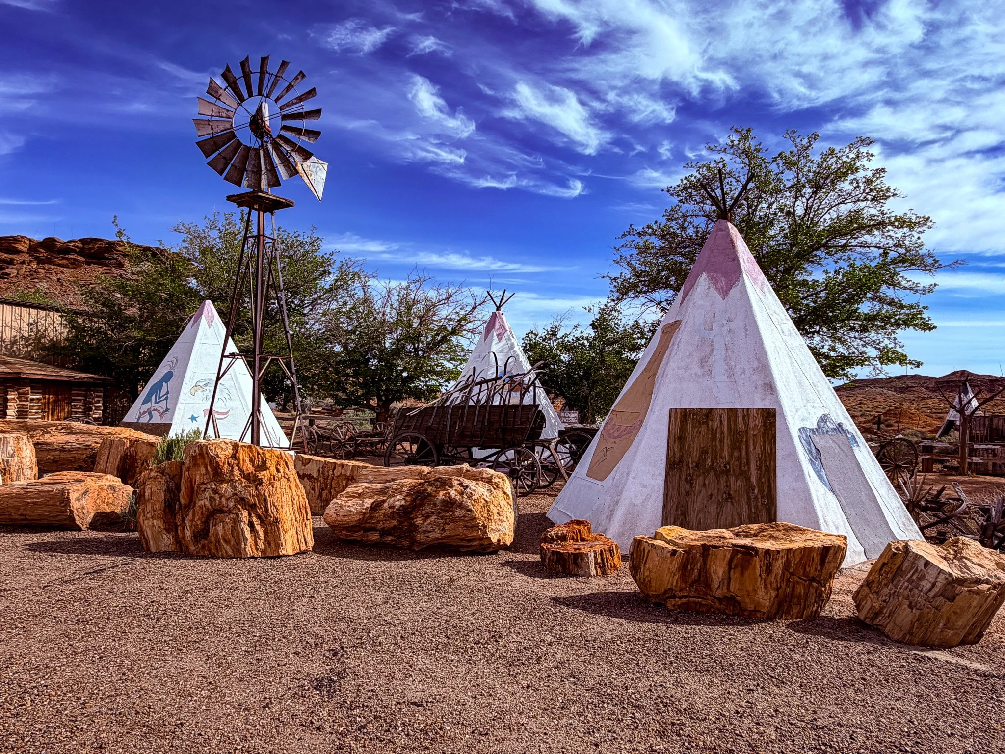
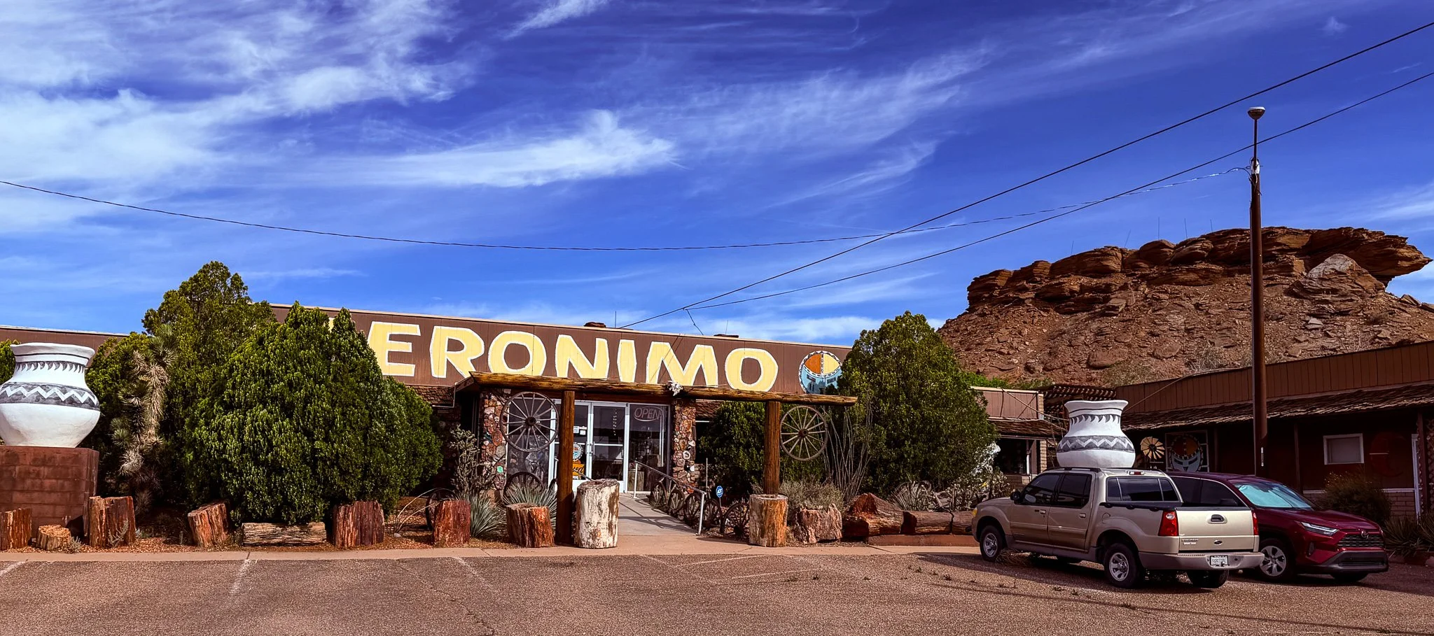
Today’s first stop was at Geronimo Trading Post. They were not open this early, so we just opted for some outside photos of this well recognized stop on the route.
Click on Image for Map.
From ChatGPT:
The Geronimo Trading Post is a classic Route 66 roadside attraction near Joseph City, Arizona, known for souvenirs and its “World’s Largest Petrified Tree.” Opened in 1974, it echoes the highway’s heyday, when quirky stops and bold advertising lured travelers along the Mother Road.
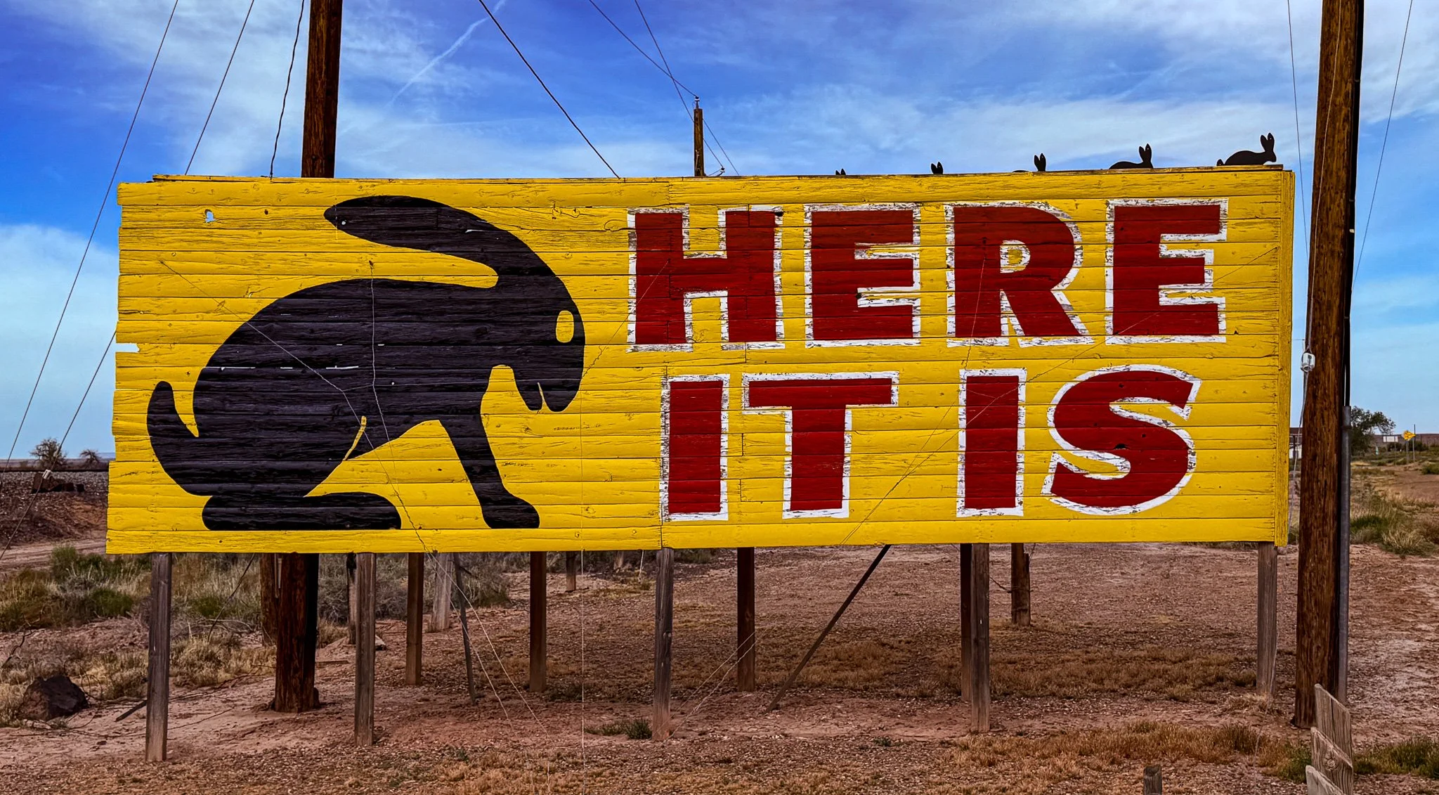
Reminiscent of the advertising campaign by Wall Drug in South Dakota, the Jackrabbit Trading Post has gone all-in on roadside billboards. They are simple black rabbit silhouettes on a yellow background with the number of miles to the location. We saw them all along the route and they are a staple of the experience. Well, the advertising works, because everyone makes a point of stopping at this otherwise unremarkable gift shop in the middle of nowhere, AZ. This is a photo of their truly iconic billboard when you finally arrive - HERE IT IS!
Click on Image for Map.
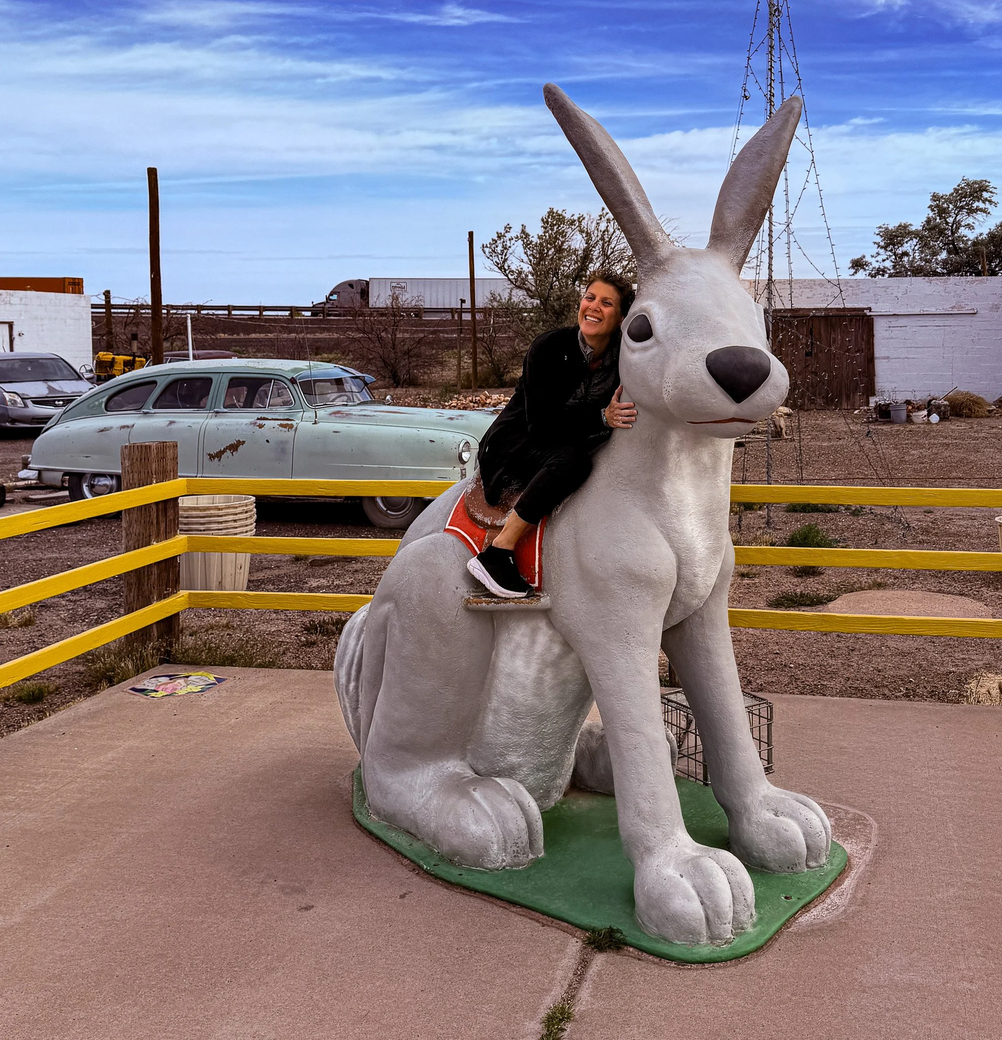
Of course she did!!
From ChatGPT:
The Jack Rabbit Trading Post, opened in 1949 near Joseph City, Arizona, is one of Route 66’s most iconic stops. Famous for its “HERE IT IS” billboard campaign and giant fiberglass jackrabbit, it epitomizes classic roadside Americana and continues drawing travelers seeking nostalgic photo opportunities.
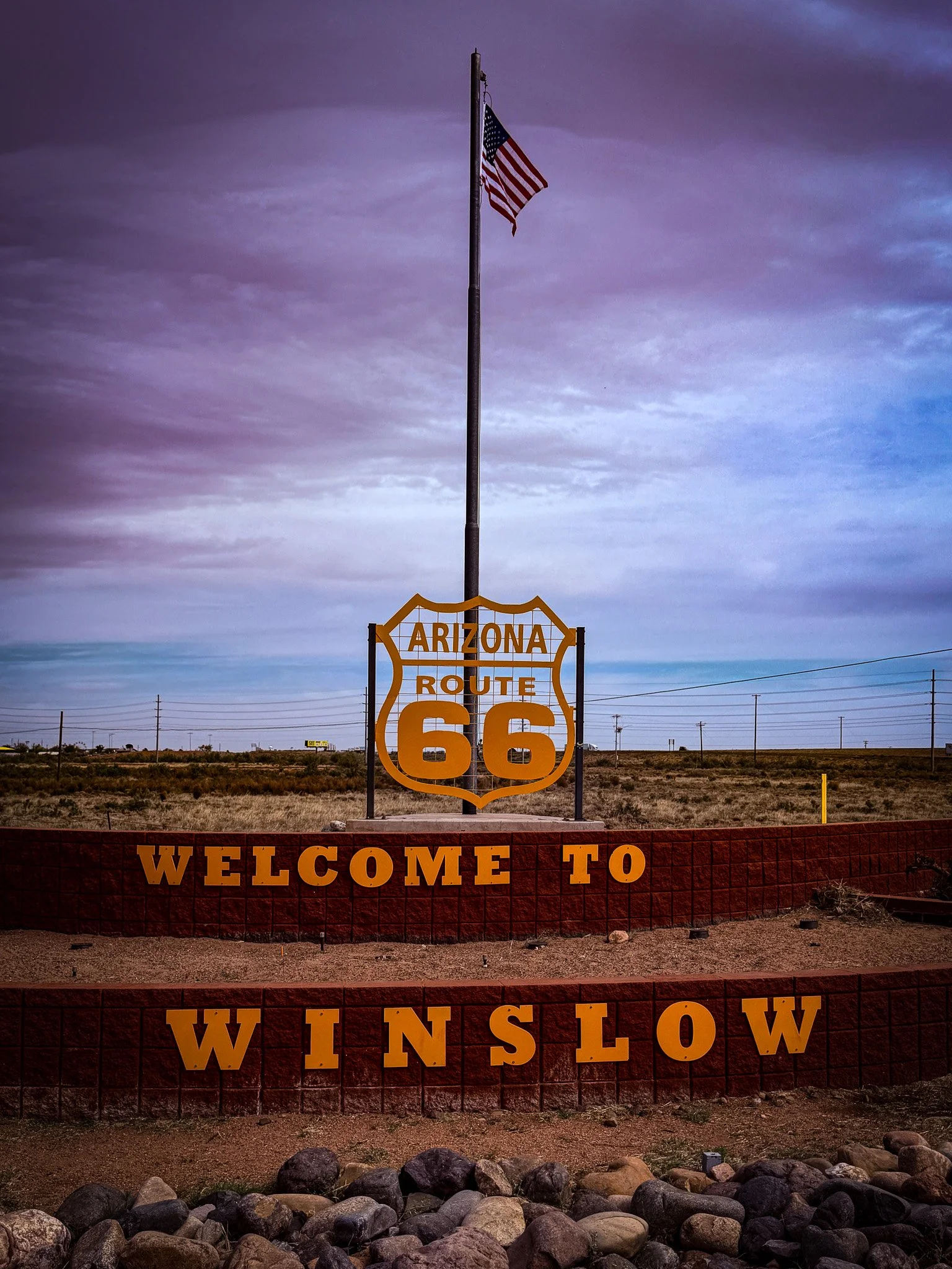
We have reached Winslow, AZ. Soon we will be standing on the corner!
Click on Image for Map.
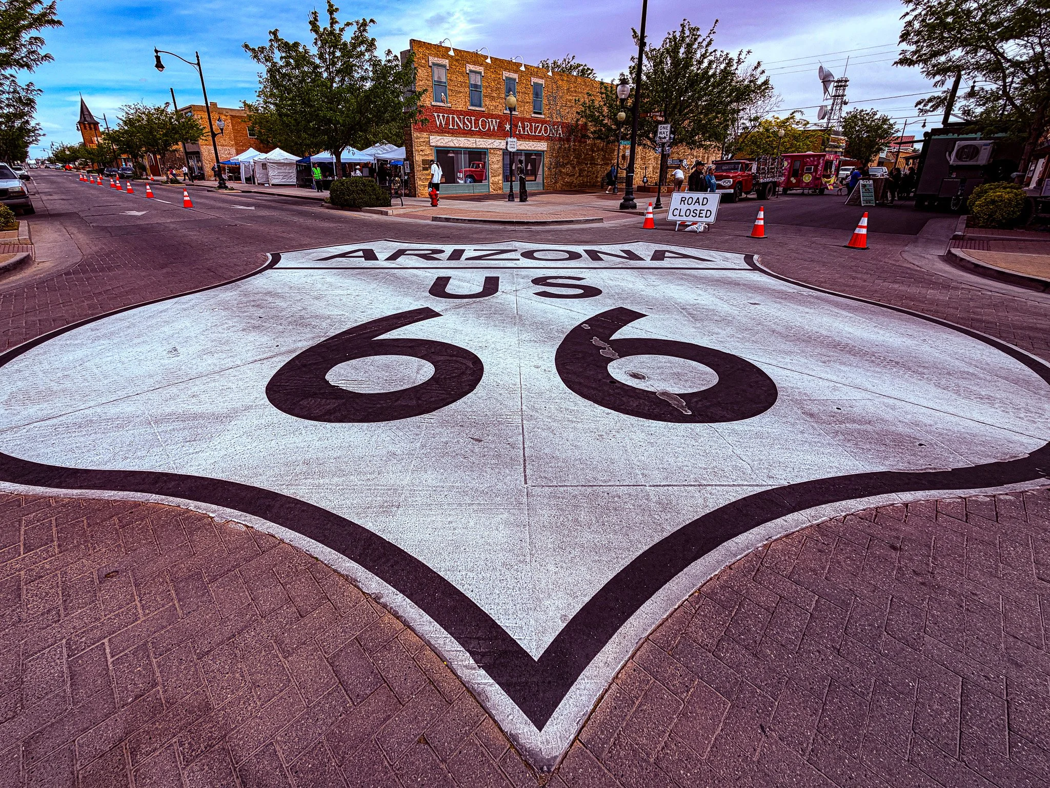
Another of the most photographed locations on the Route - Standing on the Corner Park in Winslow, AZ. This location came to fame due to the classic rock song, “Take it Easy” by The Eagles.
They were having a street festival today so unfortunately we had to have all the traffic cones when photographing the giant shield in the road.
Click on Image for Map.
The art on the corner here in Winslow portray the images from the classic Eagles ballad.
“Well I'm a-standin' on the corner in winslow, arizona
With such a fine sight to see
It's a girl, my lord, in a flatbed ford
Slowin' down to take a look at me.”
Click on Image for Map.
It is often said that these bronze statues are band members such as Glen Frey, Don Henley, or even Jackson Browne. However, in doing my research and with the help of ChatGPT, the truth appears to be that they are NOT replicas of any of the band members, but just the artist’s image of what the person in the song would have looked like.
From ChatGPT:
Over time, because the Eagles made the song famous, many visitors assume the statues depict band members like Glenn Frey or others—but the city and artists designed them as symbolic characters from the song, not literal band portraits.
In addition to the reflection painted in the mural of the woman driving a flatbed Ford, they also have an actual flatbed Ford parked in this location.
First Street Park in Winslow.
Click on Image for Map.
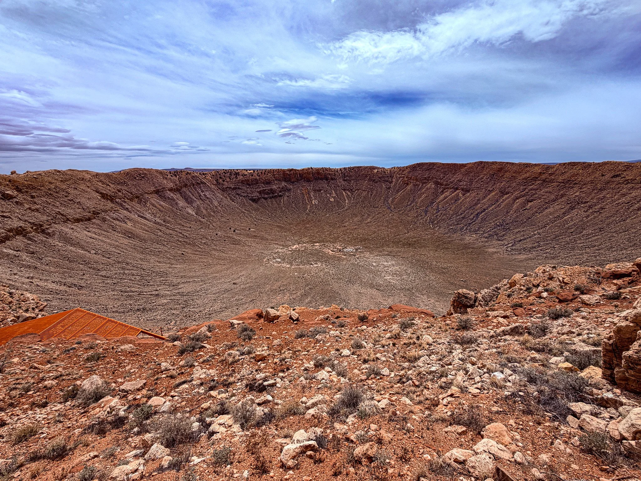
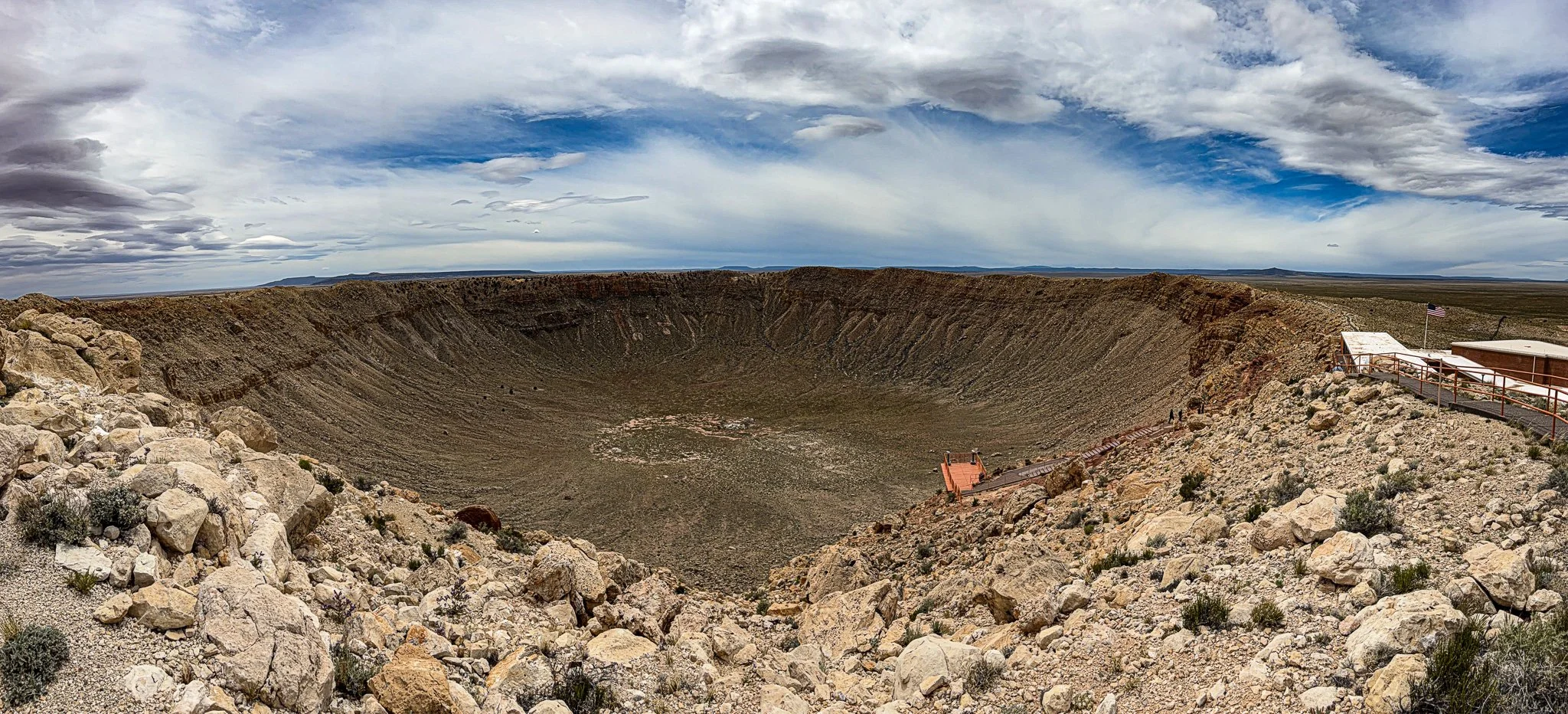
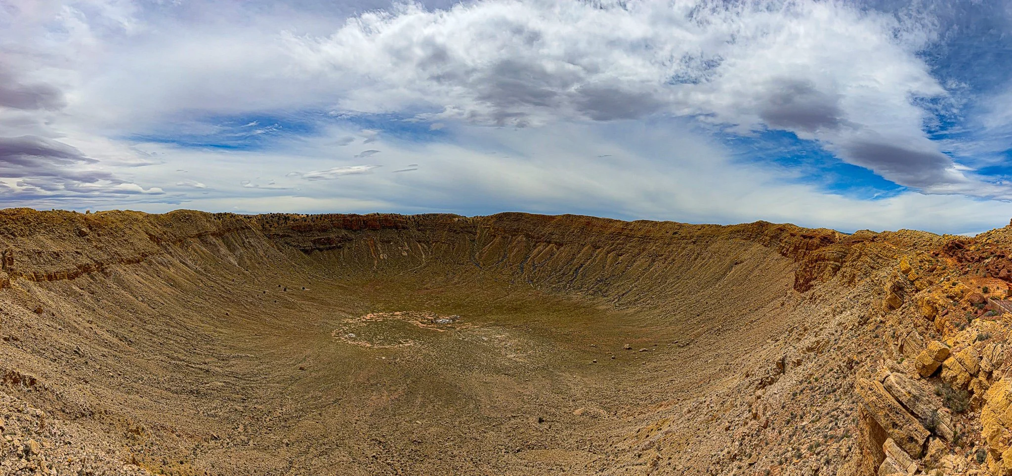
Our next stop was to view the Meteor Crater in the AZ desert.
This is the largest piece of the meteorite ever discovered. You are allowed to touch the meteorite and it feels like a solid block of iron.
Click on Image for Map.
From ChatGPT:
Meteor Crater, also called Barringer Crater, is one of the best-preserved impact sites on Earth. About 50,000 years ago, a nickel-iron meteorite slammed into the desert, creating a bowl nearly a mile wide and over 550 feet deep. Privately owned by the Barringer family, it opened to visitors in the mid-20th century. Today, a visitor center offers exhibits, a theater, and rim trails. Scientists have studied it extensively, including NASA astronauts preparing for lunar missions.
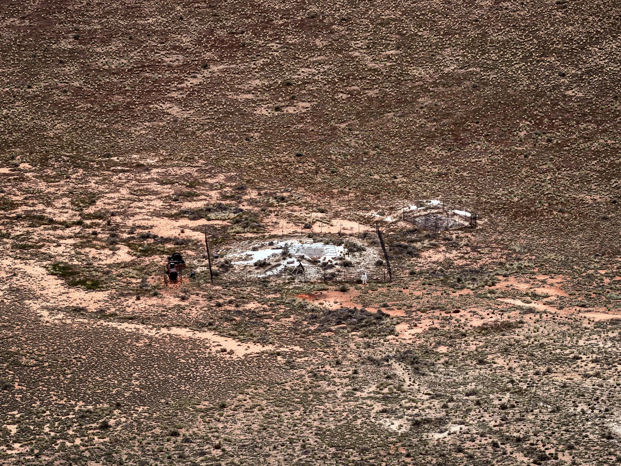
Zooming way in on the bottom of the crater you can see one of the drilling sites where they once drilled in hopes of discovering the meteorite that landed here. However, it has subsequently been determined that the meteorite was blown up upon impact and the largest intact piece ever found was the image above.
For scale, the tiny appearing spaceman positioned in front of the fencing is actually 6 feet tall.
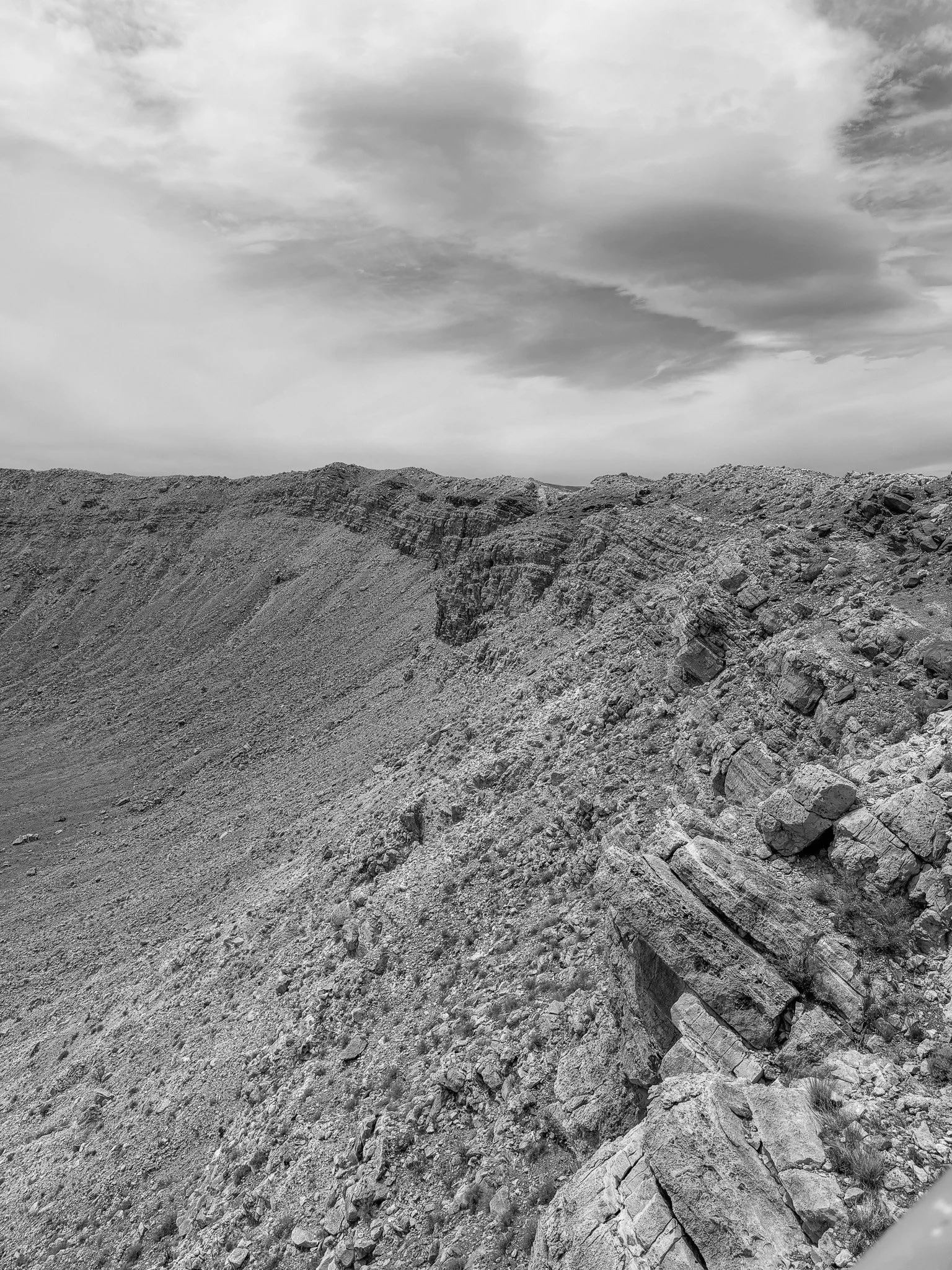
On the right side of this image, you can see how the cleavage lines in the rocks all orient in a slanted upward fashion. This pattern can be seen extending around the crater rim. This is what early scientists used to determine that this was in fact caused by a meteorite impact and not a volcanic eruption. The upward sloped rocks indicate upward blast from an object hitting in the center of the crater.
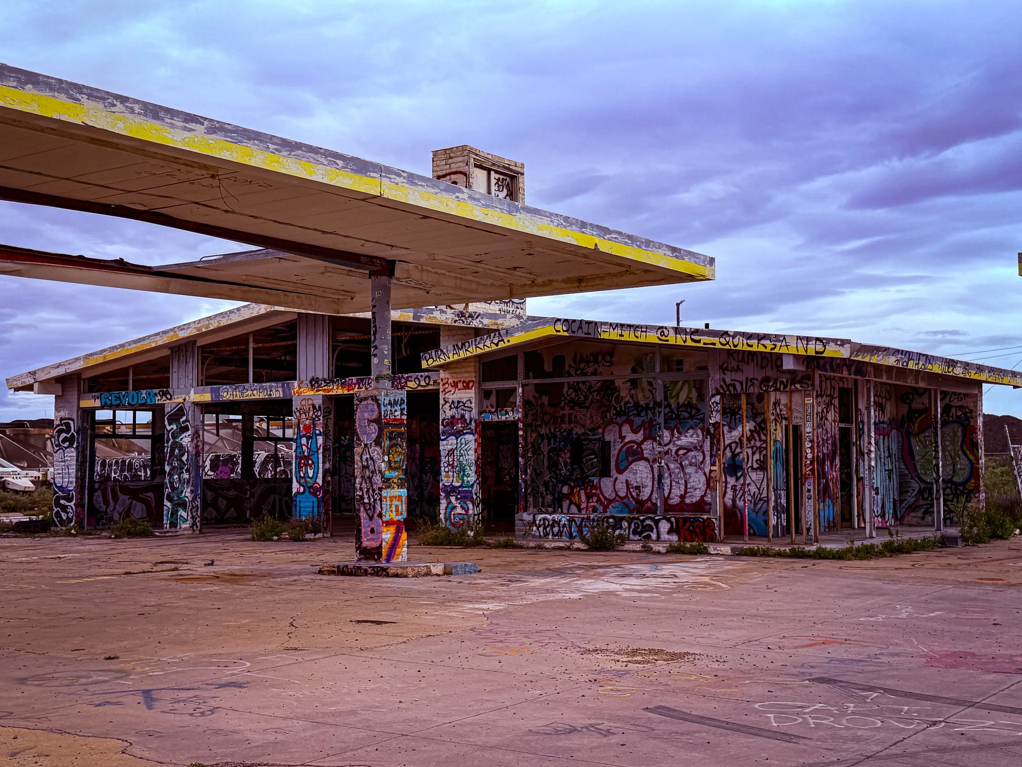
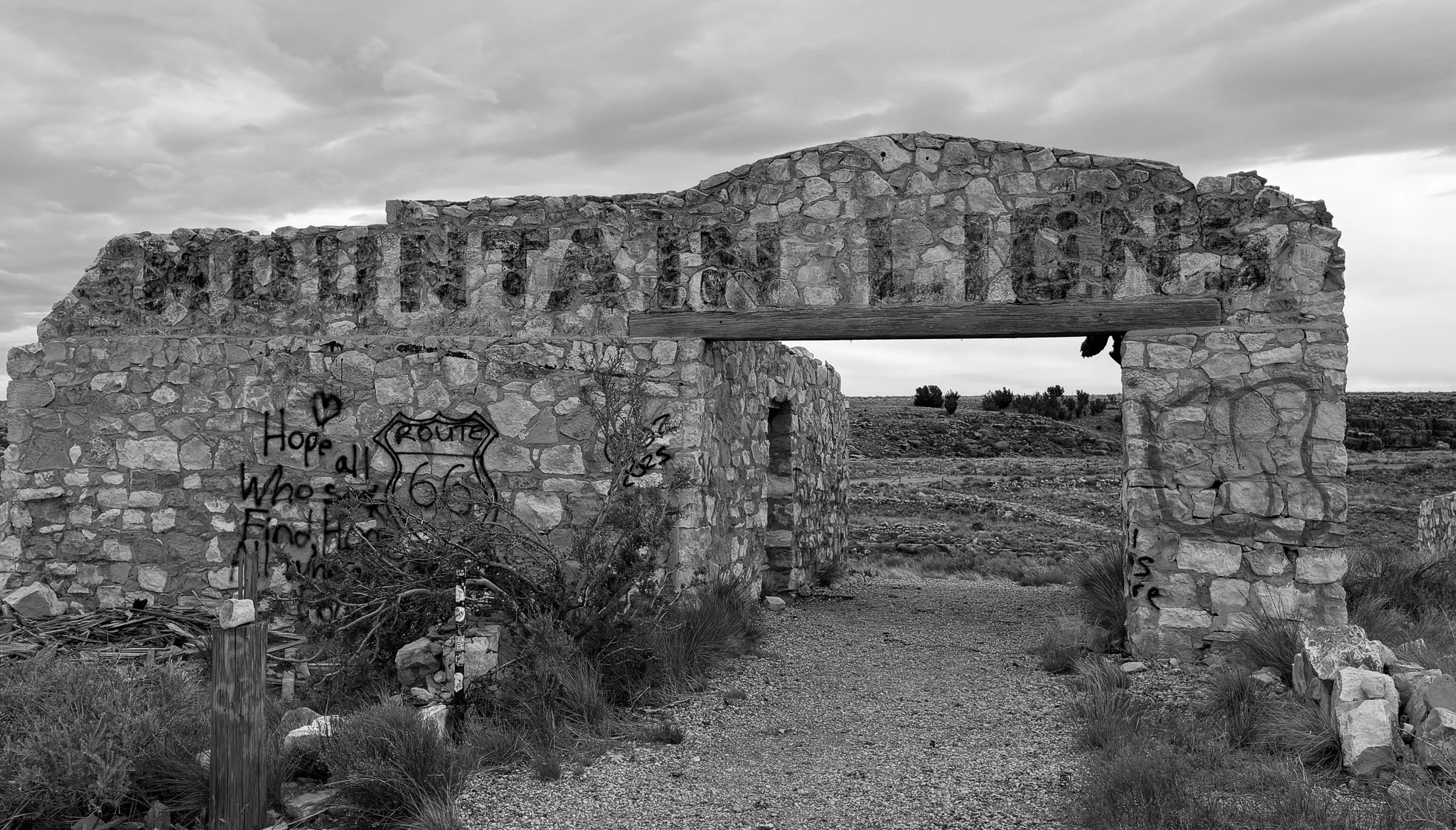
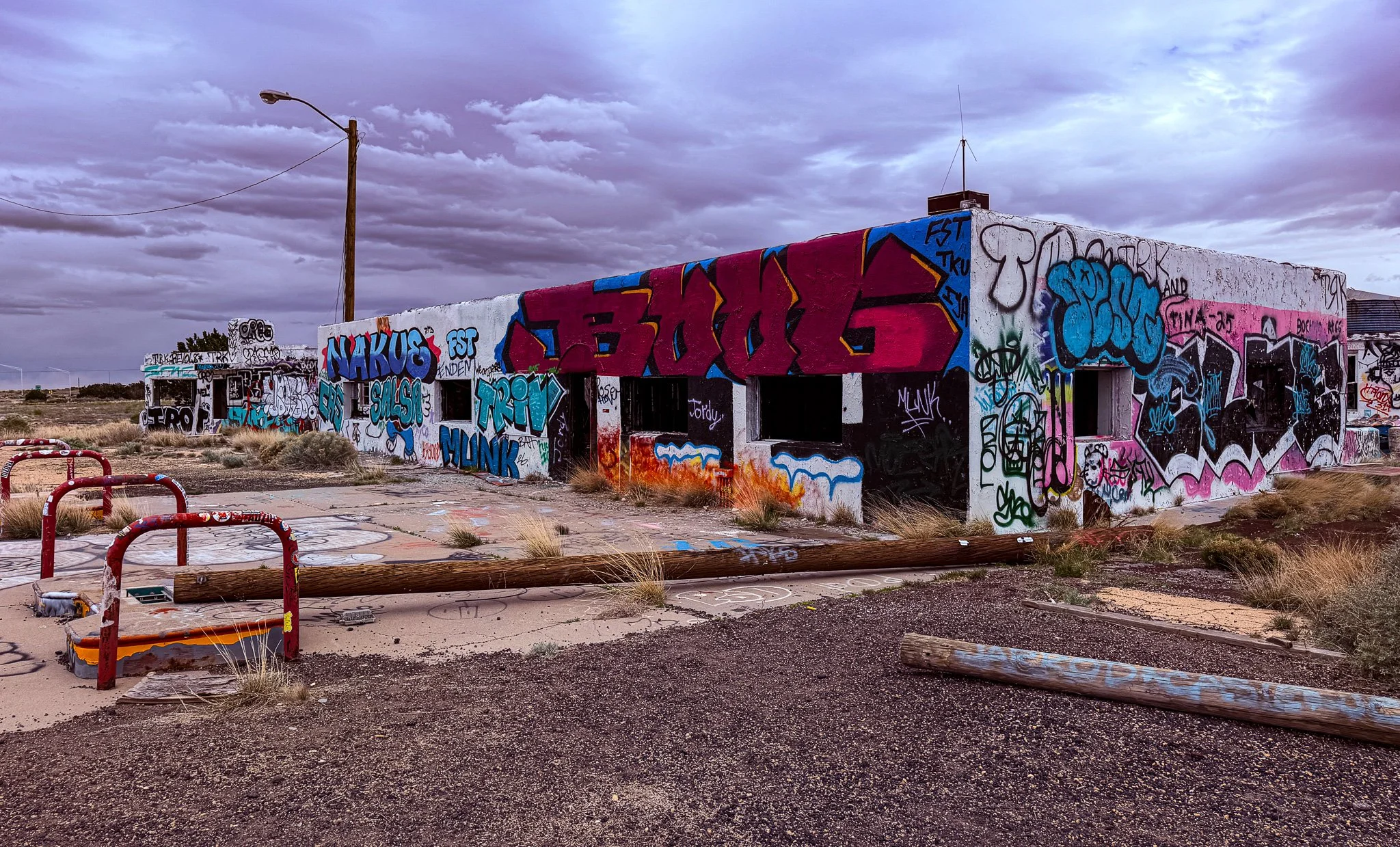
Next, we stopped at the ghost town ruins of Two Guns. This is another favorite ghost town along Route 66 that is popular with graffiti artists, photographers and fans of abandoned buildings. It was fascinating to walk around these old places, but a bit unnerving as well.
Click on Image for Map.
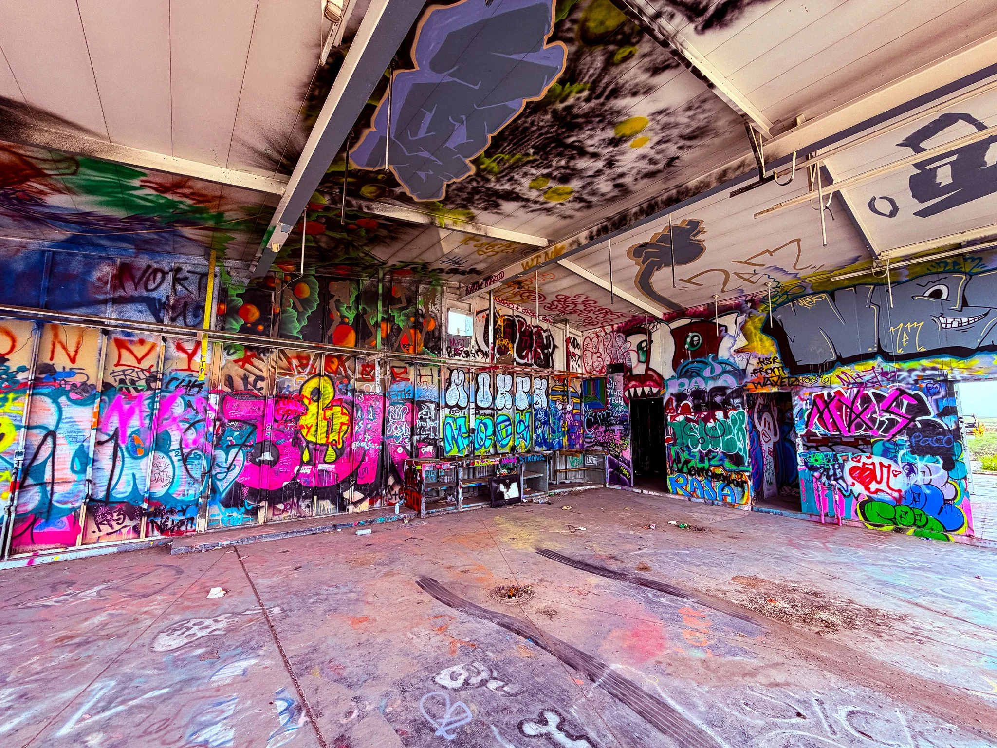
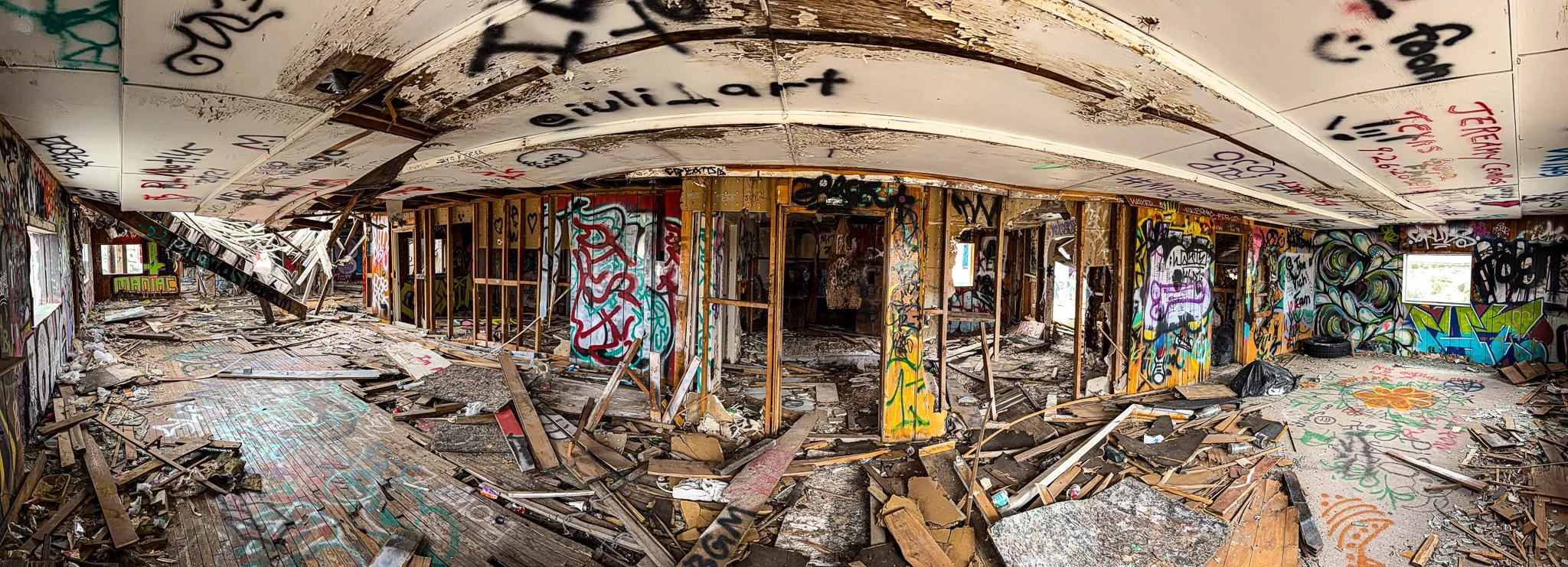
Inside the abandoned station. Fascinating, but also quite creepy.
Just down the road are the ruins of the old tourist attraction zoo that once operated here.
From ChatGPT:
The ruins at Two Guns along U.S. Route 66 are the remains of a once-bustling tourist stop. In the 1920s–30s, it featured a zoo, trading post, and gas station built near Canyon Diablo. The stone enclosures of the ill-fated zoo still stand, tied to the turbulent ventures of promoter Harry E. Miller. Fires, disputes, and declining traffic eventually left the site abandoned, creating the haunting ruins seen today.
Click on Image for Map.
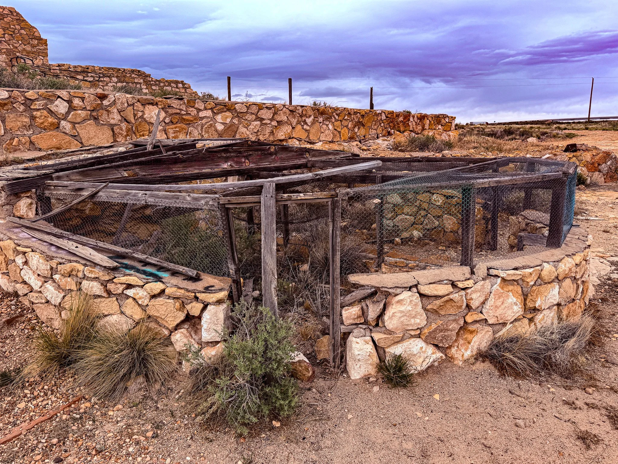
Some of the old animal cages at the zoo.
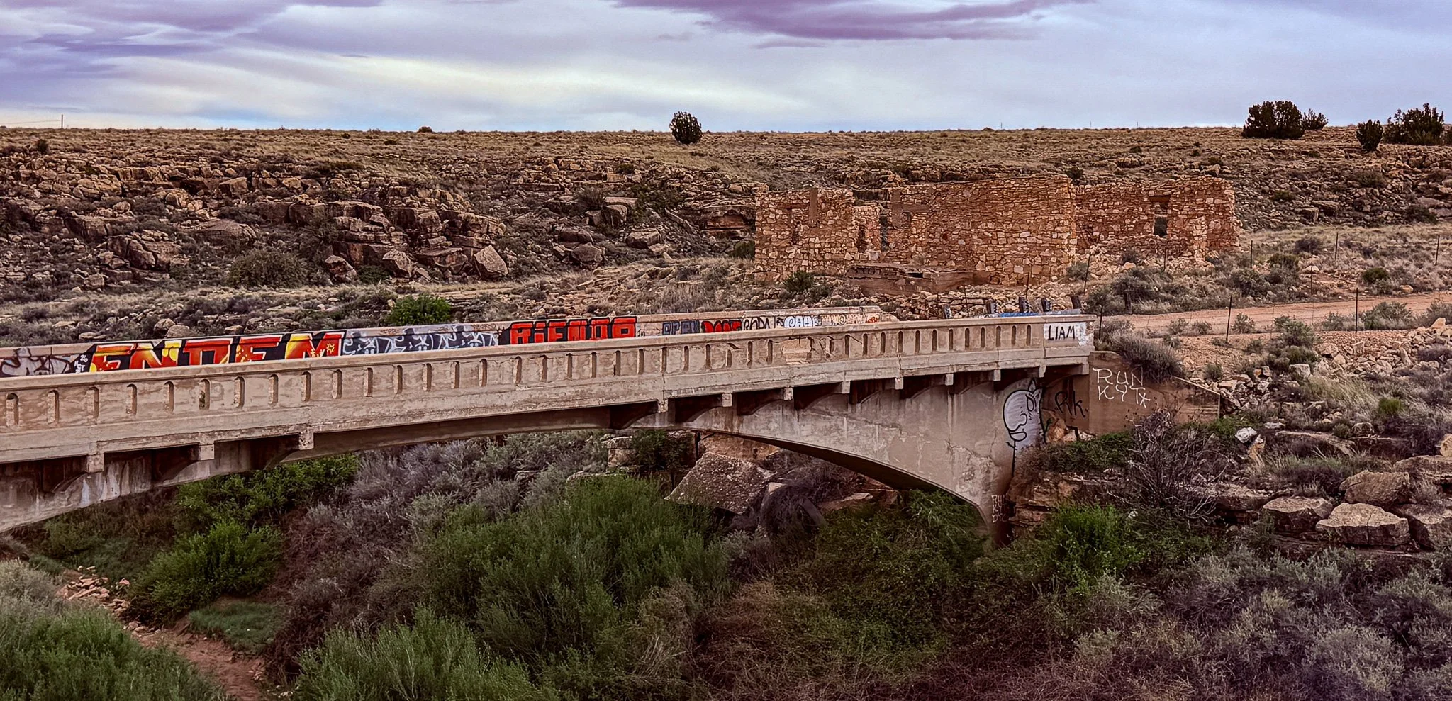
From ChatGPT:
It spans Canyon Diablo and is often referred to as the old Canyon Diablo Bridge. The structure dates to the early 20th century, built to carry traffic across the deep gorge and help connect travelers along what became U.S. Route 66.
The bridge sits just beside the stone cages of the failed zoo, adding to the eerie atmosphere. Though no longer in use, parts of it remain visible, and nearby you can also see remnants of older crossings that predate Route 66. It’s a striking example of early desert infrastructure now left to decay alongside the ghost town.
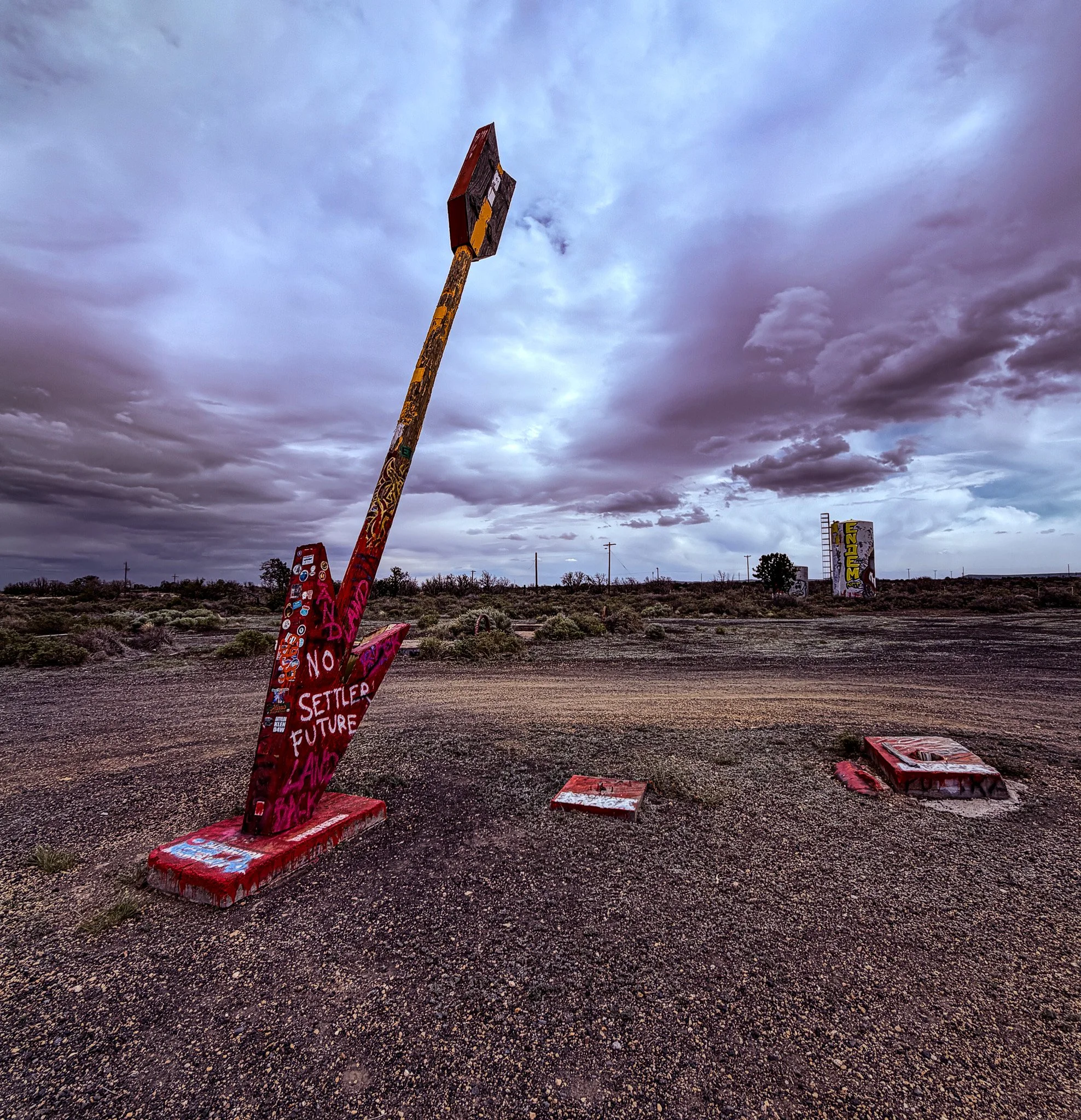
Just a little further west we find more abandoned ruins. This was the Twin Arrows Trading Post. Until just a few years ago there were two arrows here, but you can see that someone tore the other one from the base.
From ChatGPT:
Twin Arrows Trading Post is an iconic roadside relic along U.S. Route 66 east of Flagstaff. Established in the late 1940s, it became famous for its two giant wooden arrows planted upright in the ground, a whimsical photo stop for travelers. The site once included a curio shop, diner, and gas station catering to Route 66 traffic. After Interstate 40 diverted travelers, business declined and the post closed in the 1990s. Today, the weathered arrows still stand, symbolizing the rise and fall of Route 66 culture.
Click on Image for Map.
The building that would have been the diner, curio shop and gas station.
Again, fascinating to look at, but also a bit disconcerting just being there.
Check out the inside of this one!
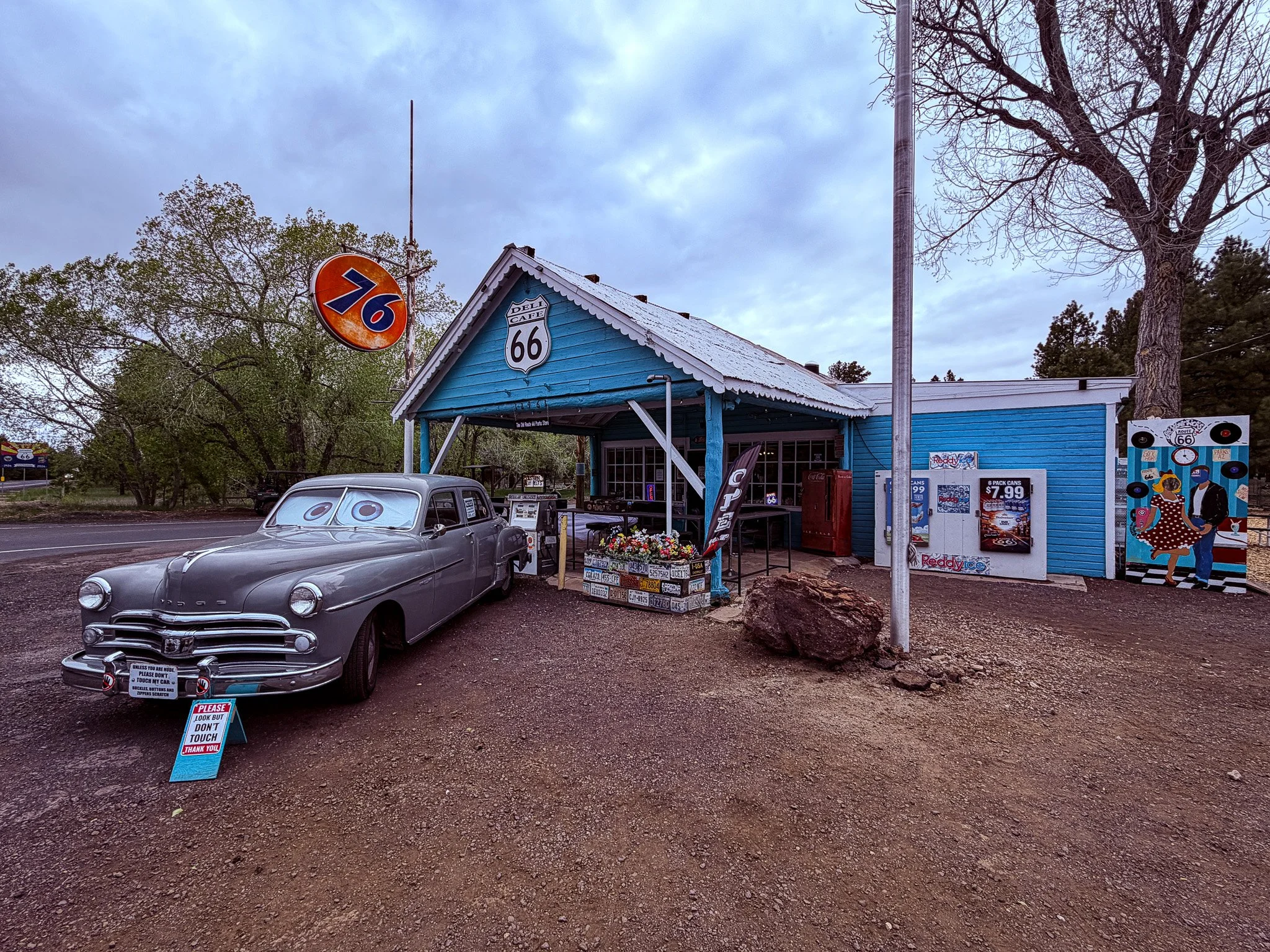
On our way to Williams, AZ we stopped at The Old Route 66 Parks Store. This is a fully operational little town store with all the usual convenience items and a whole lot of Route 66 memorabilia.
Click on Image for Map.
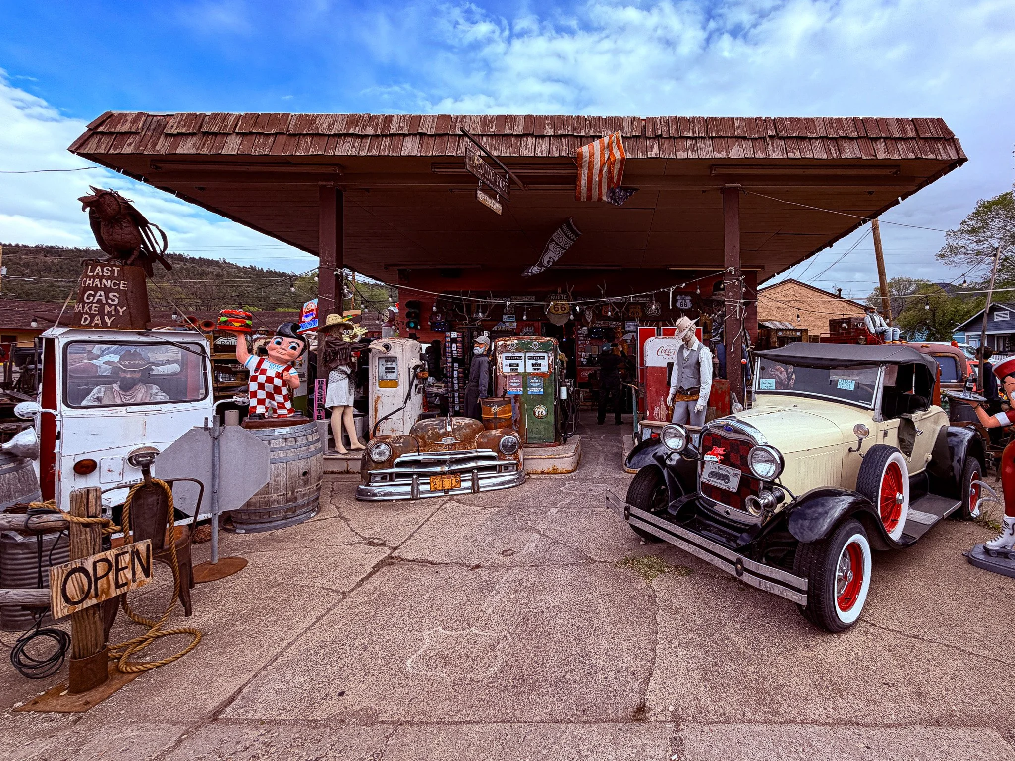
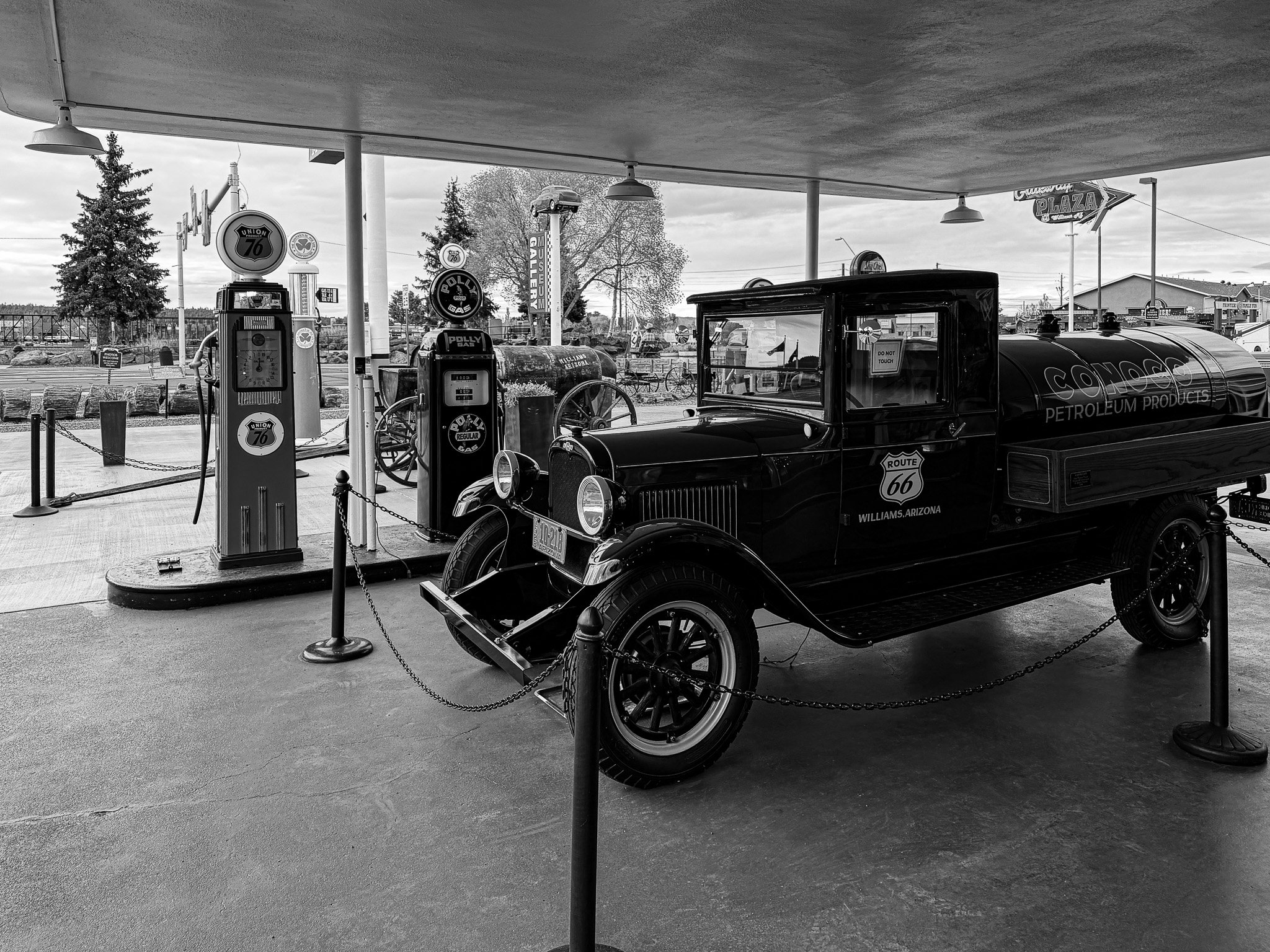
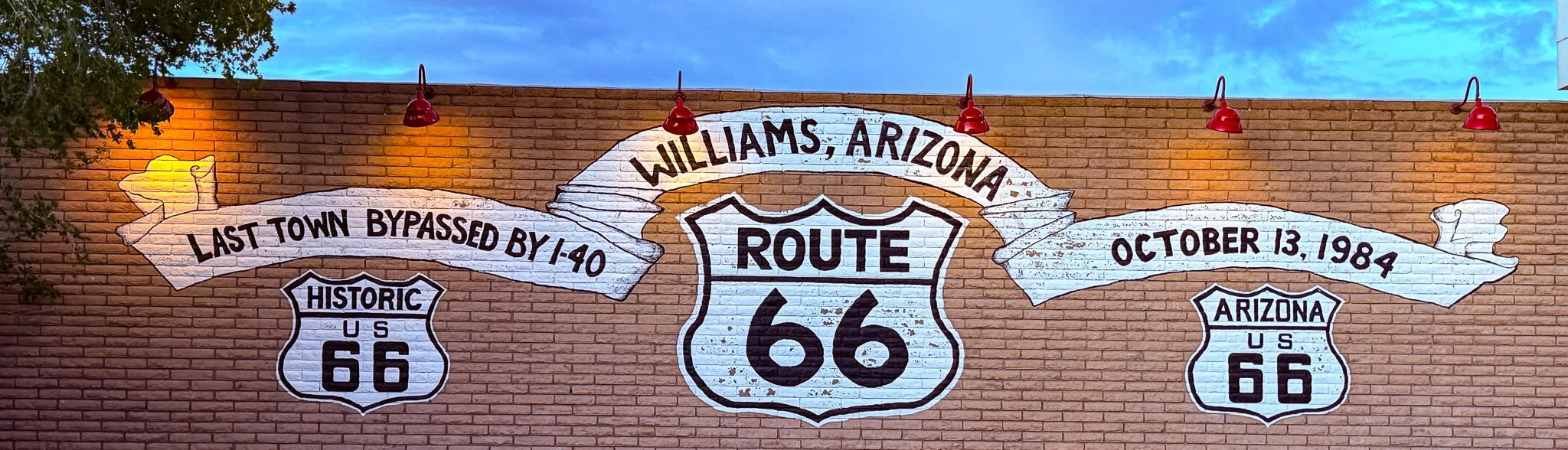
We stayed in Williams for the night. Williams, AZ is called the Gateway to the Grand Canyon. They even have a train that takes tourists from Williams to the Canyon and back. Because of the proximity to the Canyon and Route 66, Williams does a big tourist business and therefore has lots of gift shops, eating establishments and overall quirky things to check out.
Click on Image for Map.