Route 66 - Day #14
Friday, April 24, 2026
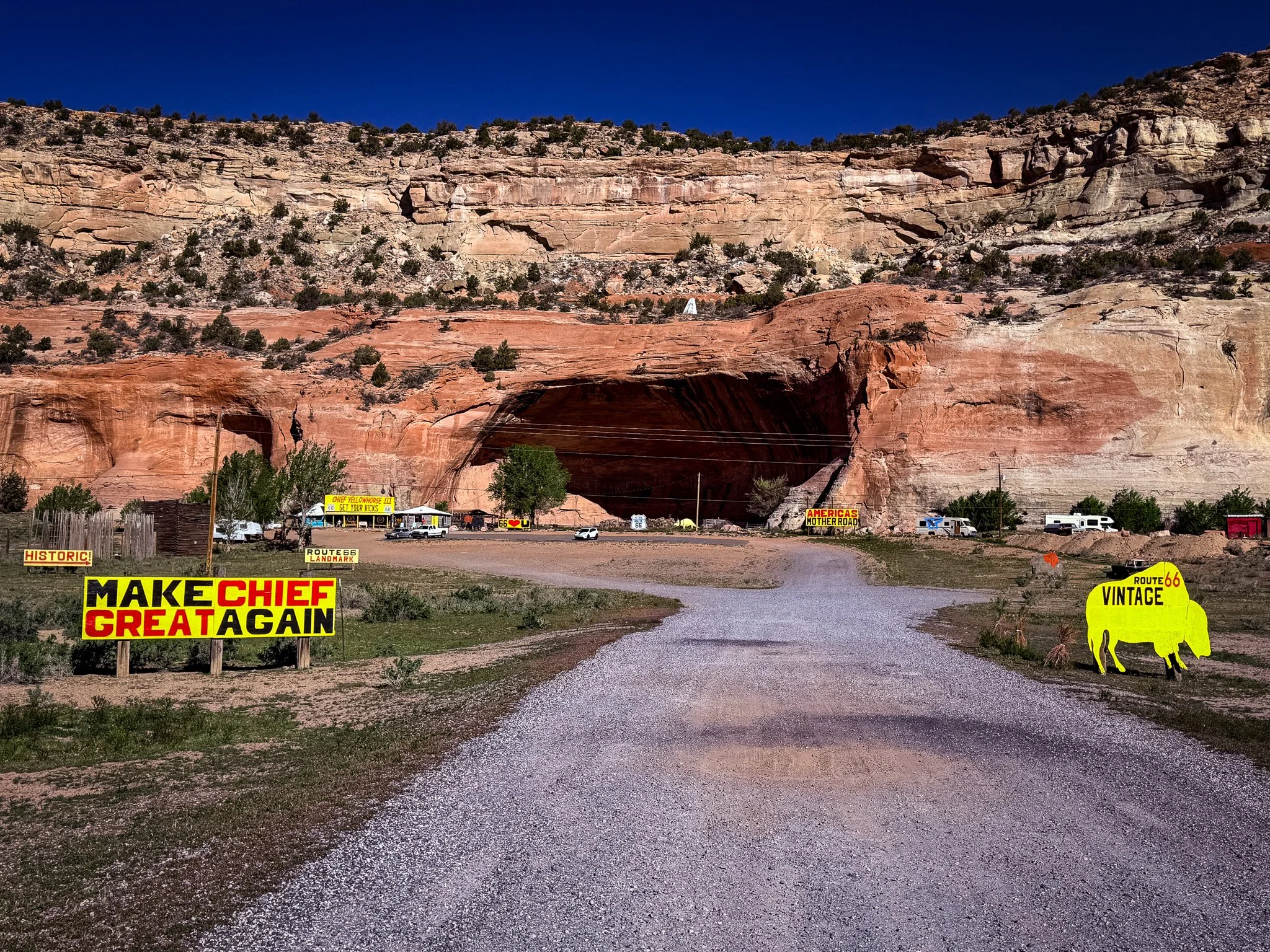
Our first stop was at Chief Yellowhorse Hole-in-the-Wall right at the New Mexico/Arizona boarder. However, he was not open for the day yet, so we could only snap this photo from the gate.
Click on Image for Map.
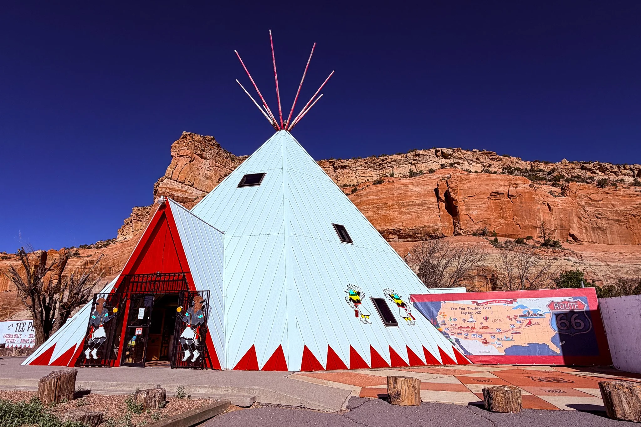
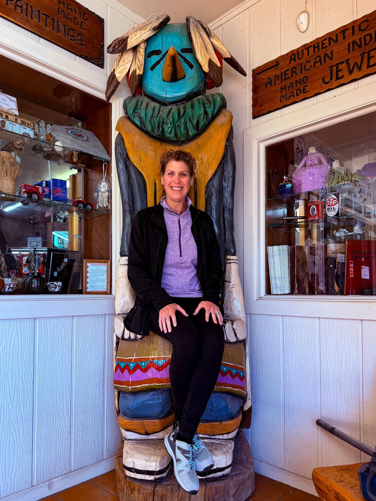
Just next door was the Tee-Pee Trading Post so we made a stop there.
Click on Image for Map.
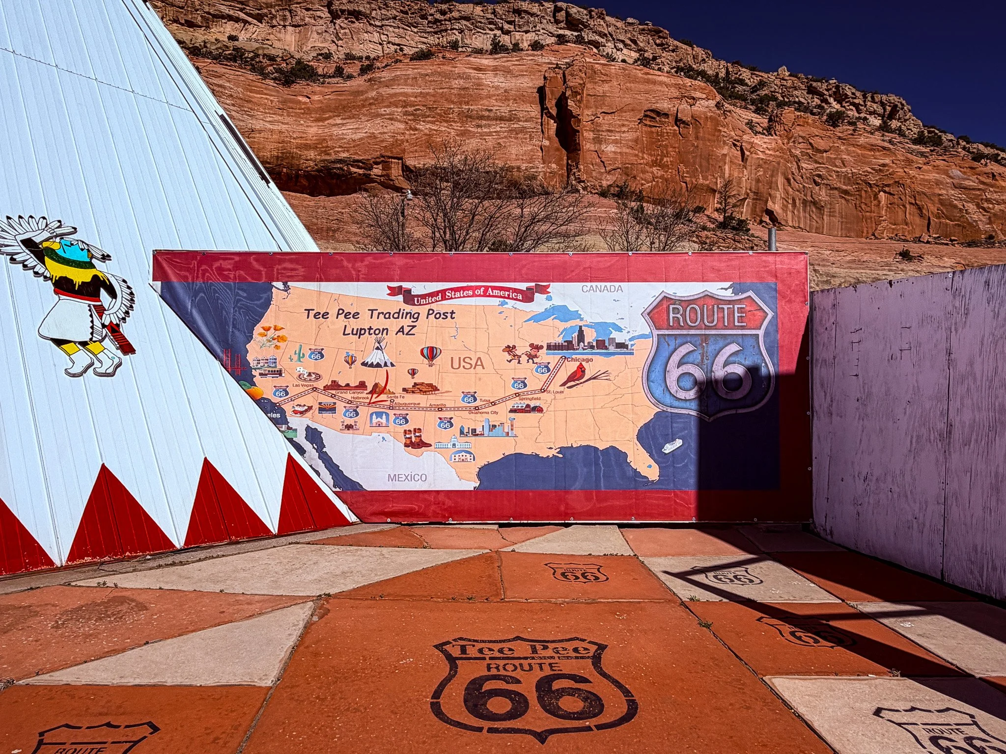
The mural on the wall says we are about 2/3 of the way there.
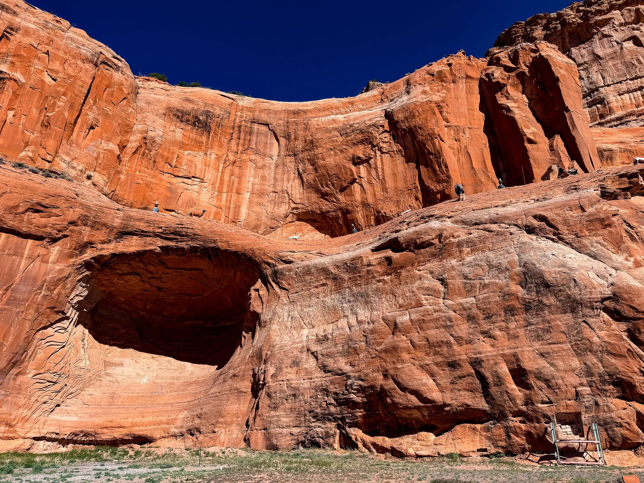
The shear red rock cliffs with these holes in them is such a unique feature in this area. These cliffs run directly beside Route 66 in this part.
Click on Image for Map.
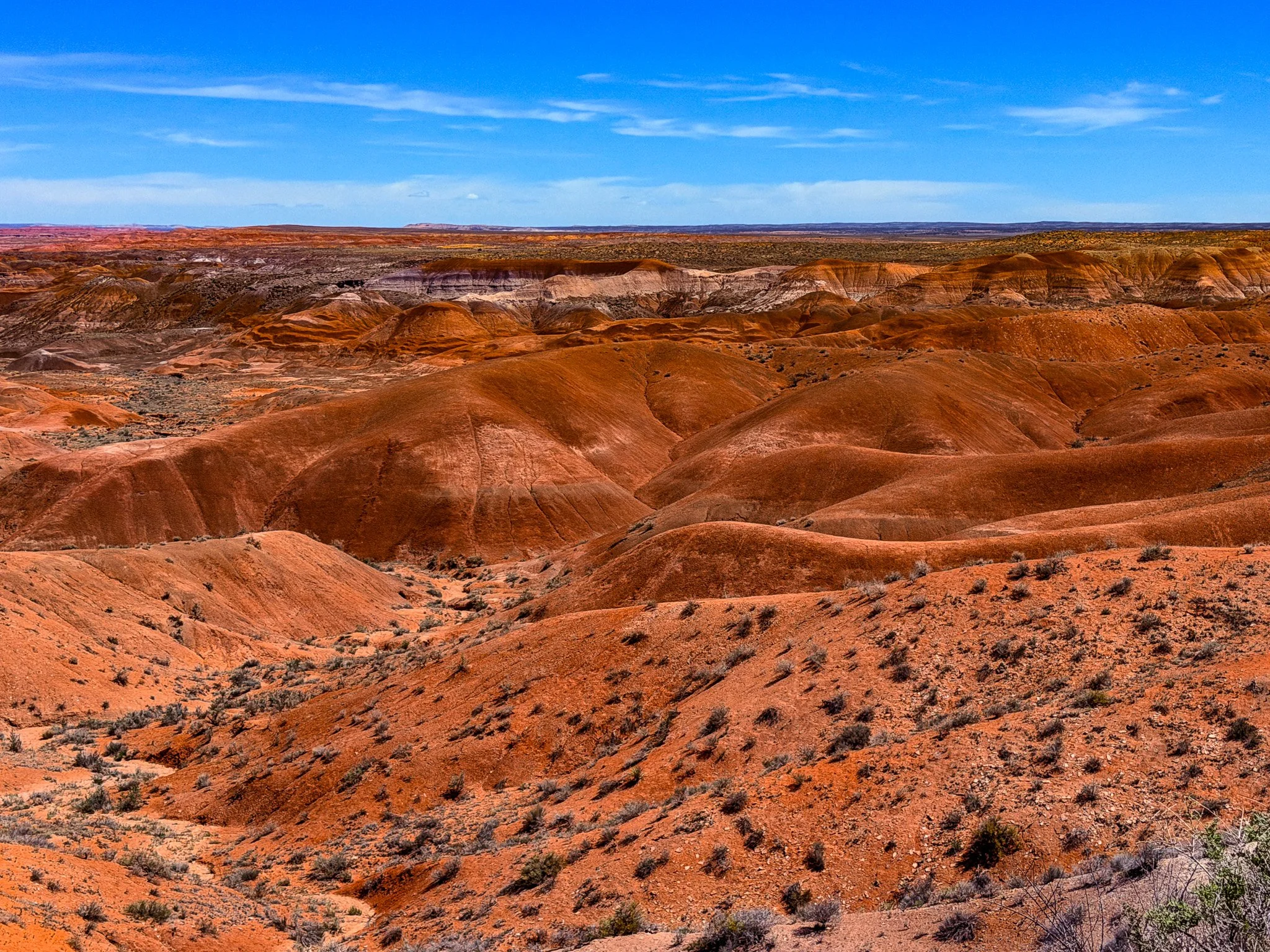
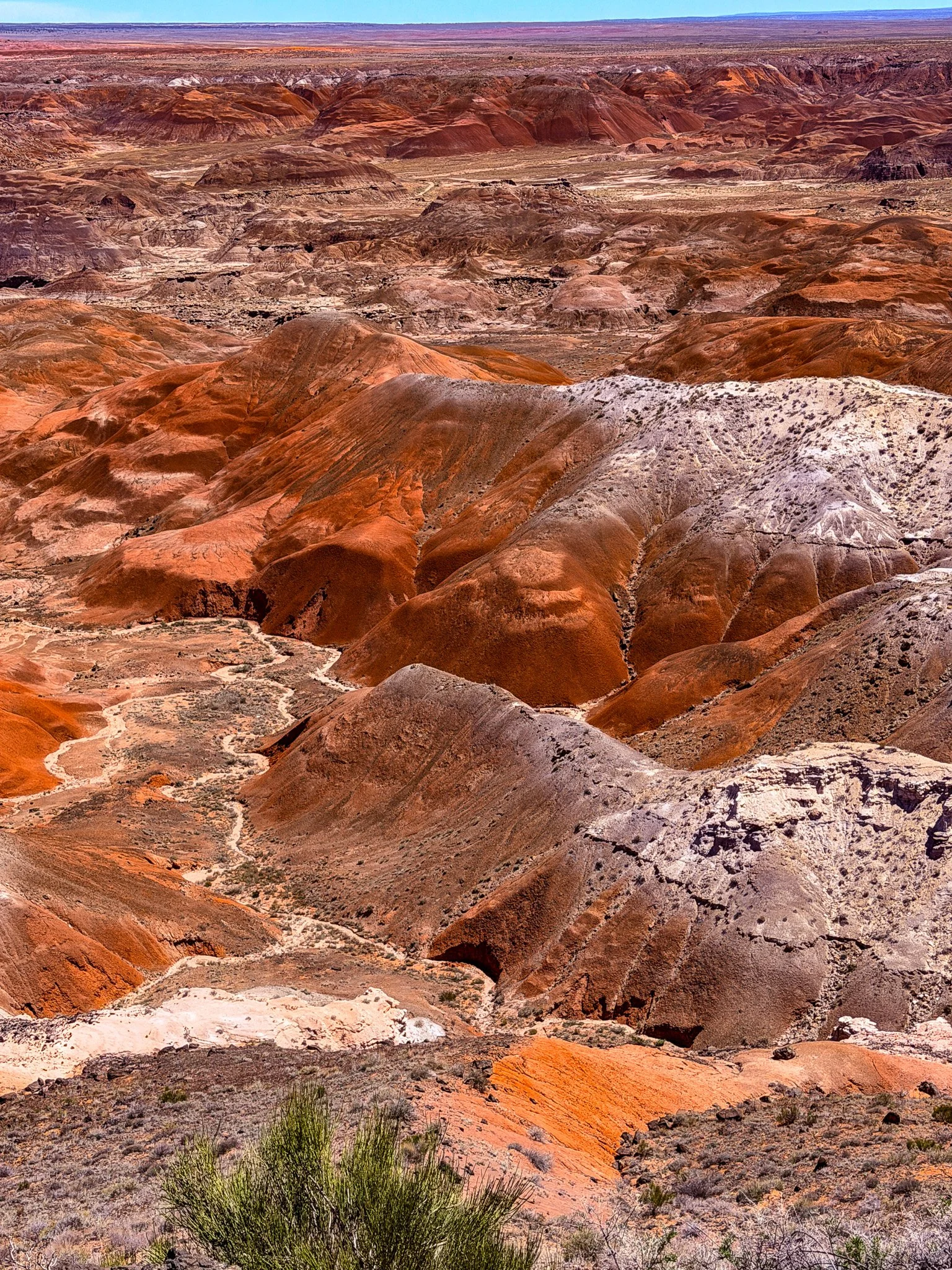
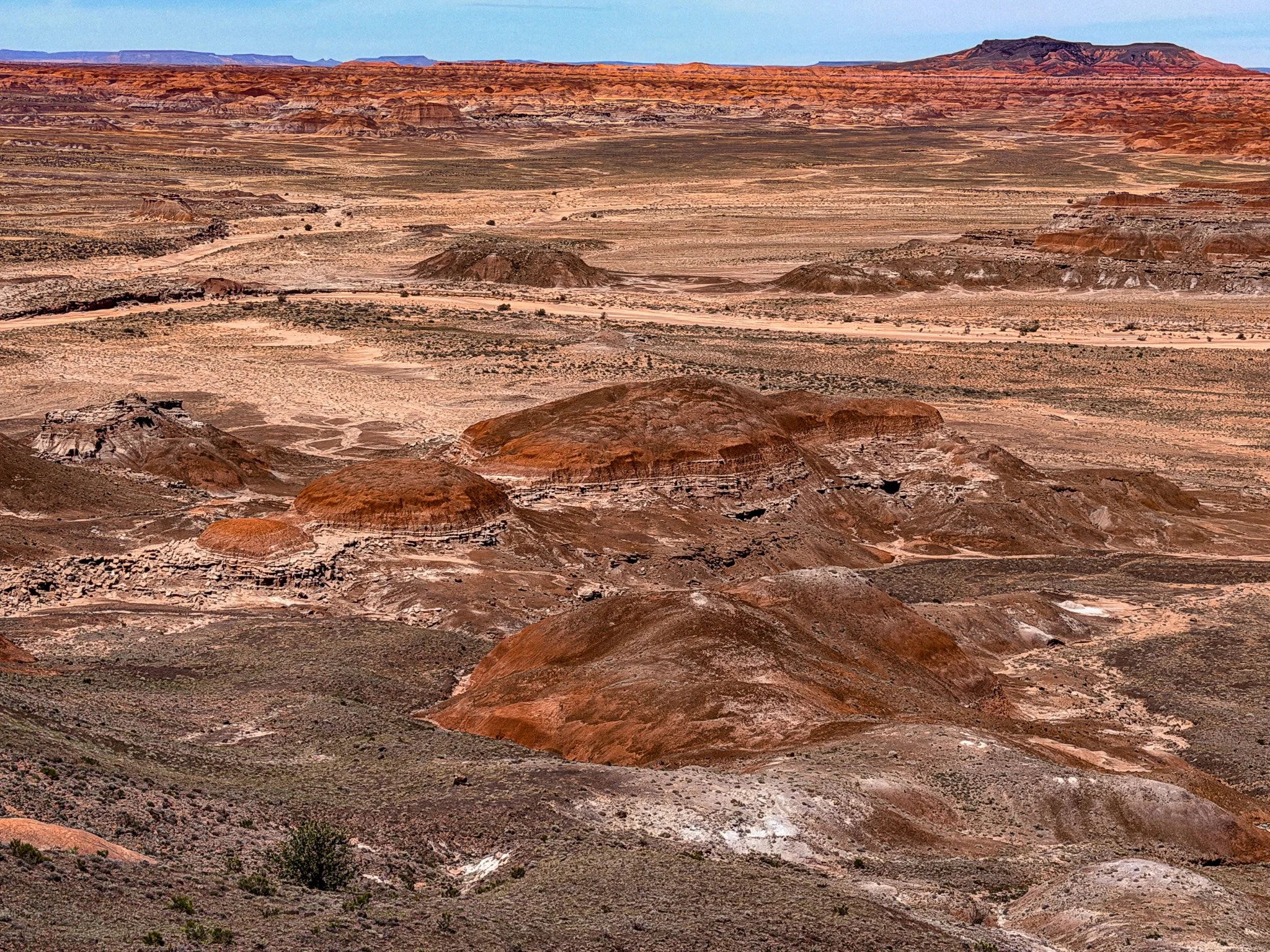
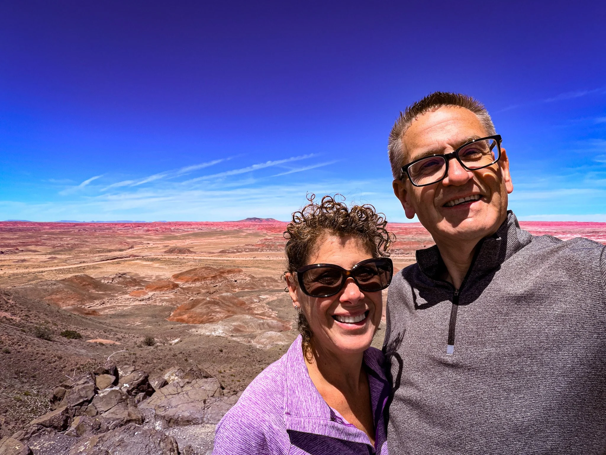
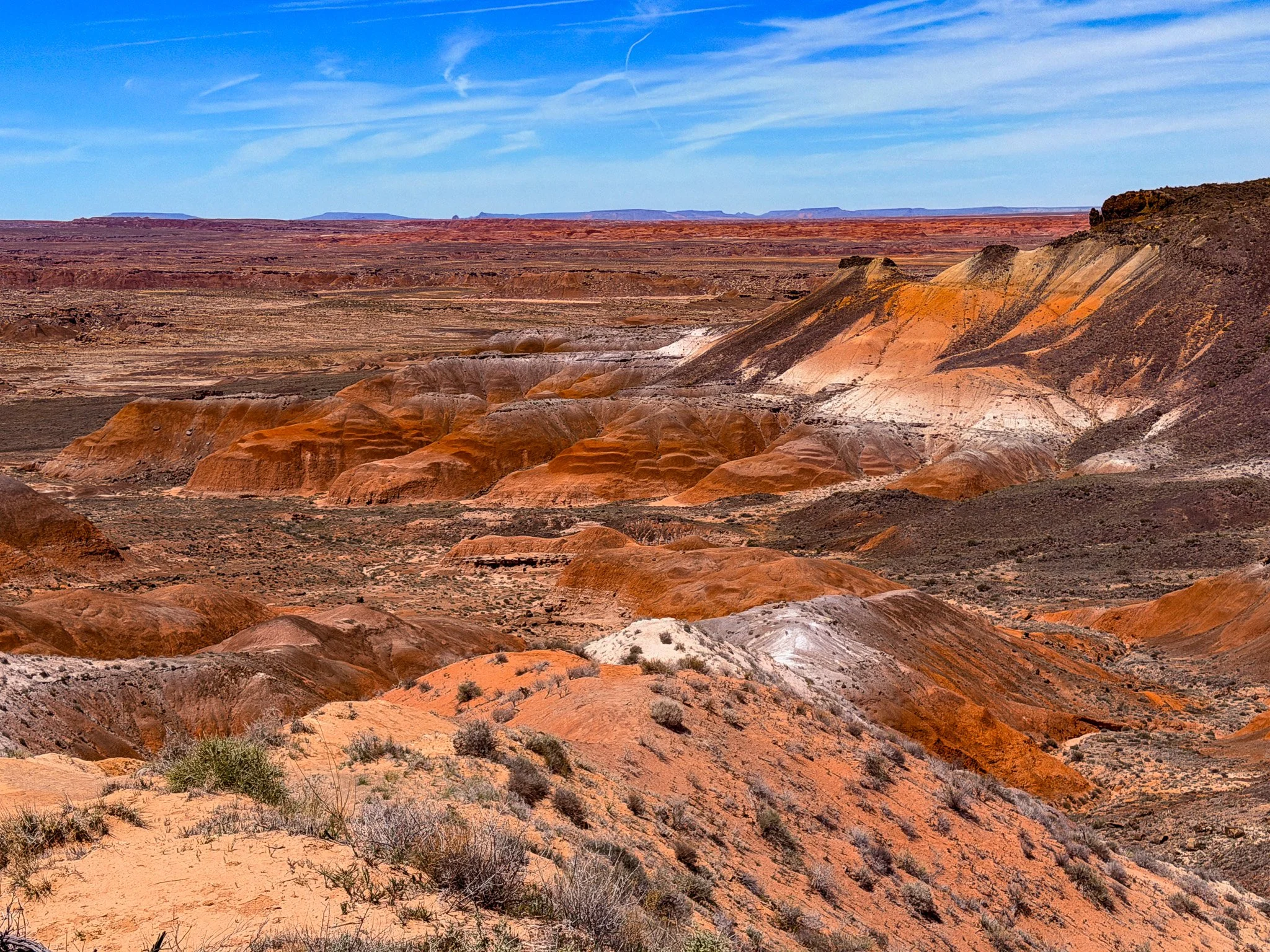
Most of the rest of the day was spent really taking in the Petrified Forest National Park. It consisted of the Painted Desert and Petrified Forest. Such a beautiful place and there were great walking trails.
Click on Image for Map.
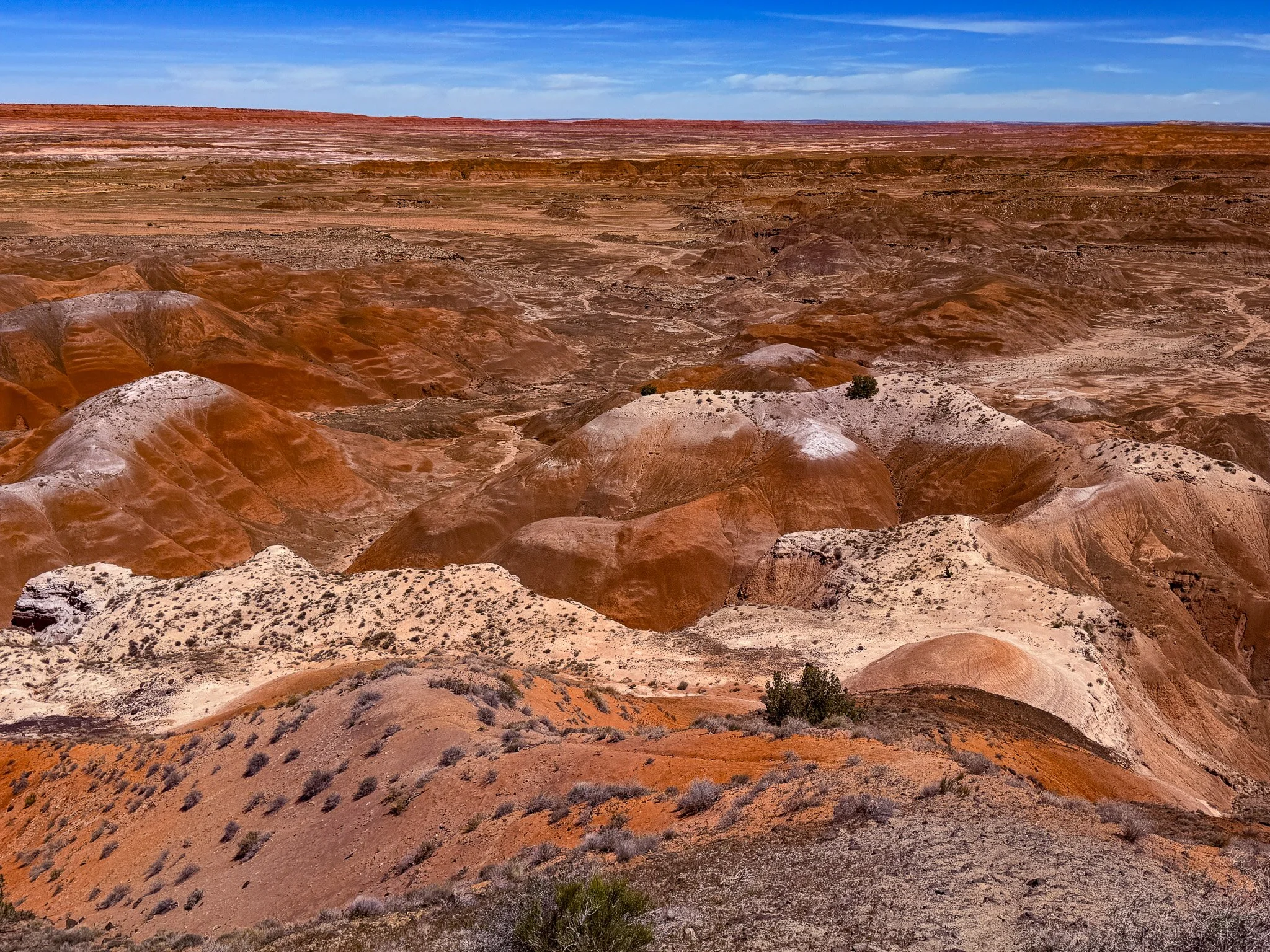
We used the National Park Service App to give us an audio self-guided tour as we traveled through the park. It is so well done. These rock formations were formed hundreds of millions of years ago. That timeframe is simply unfathomable.

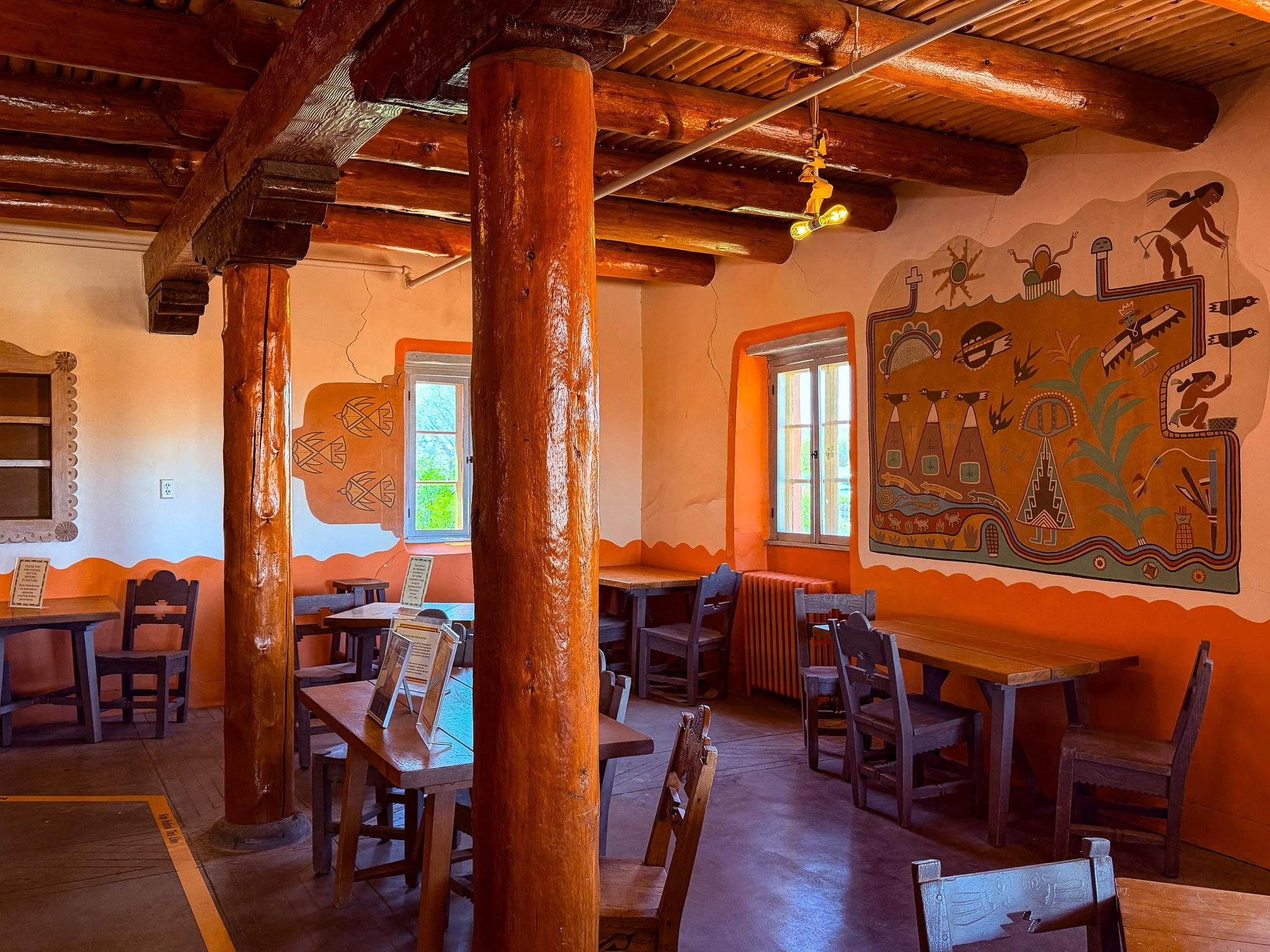
This is the Painted Desert Inn which has been restored as a visitors center.
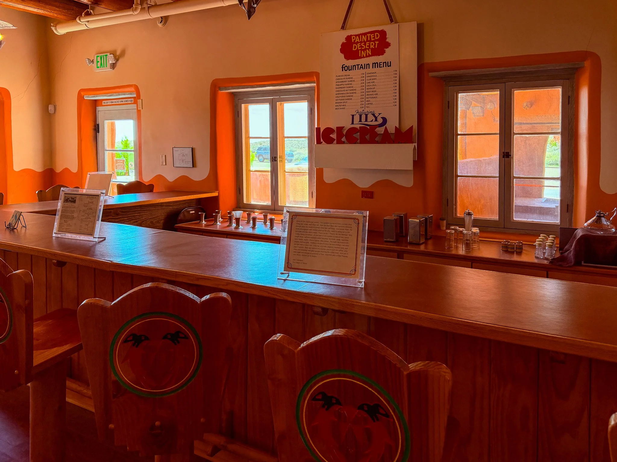
The interior has been restored to keep it period-appropriate from the time when the Inn was functional.
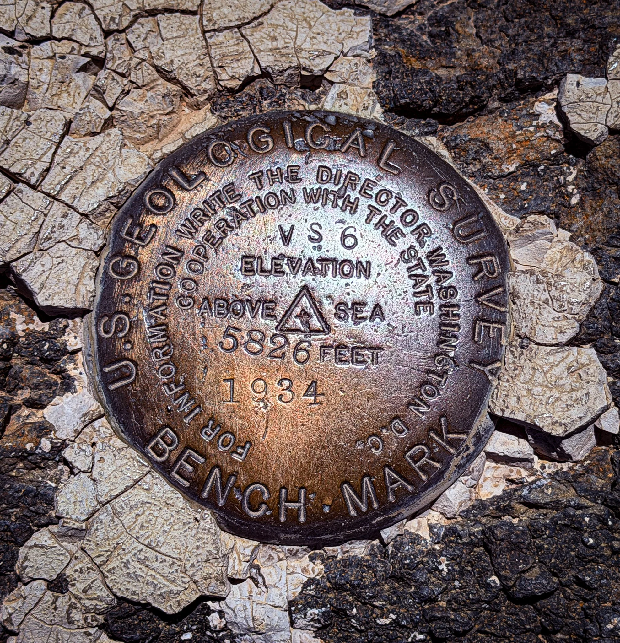
Just an interesting geological survey marker located outside the Inn.
Click on Image for Map.
The park has two sections, one on the north side of Interstate 40 and one on the south side. So far, all these images have been from the north side of the park, which is the painted desert part. The petrified wood is located more on the south side and we will see some of that coming up.
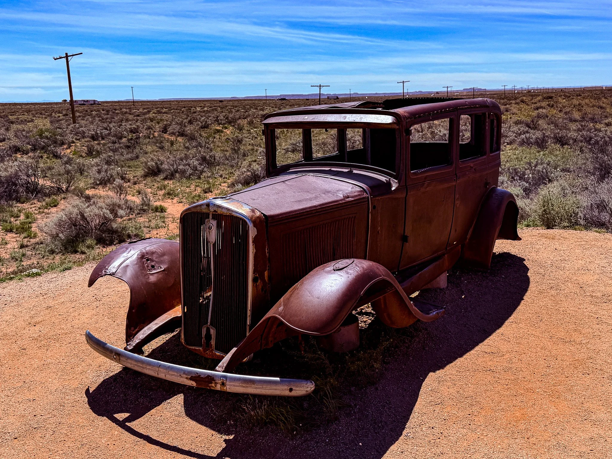
Just before you leave the north side of the park they have a 1932 Studebaker shell as a tribute to Route 66. Part of old Route 66 actually ran directly though the park at this location. The line of telephone poles behind the car mark the route as it would have been in the years a car like this would have driven it.
Click on Image for Map.
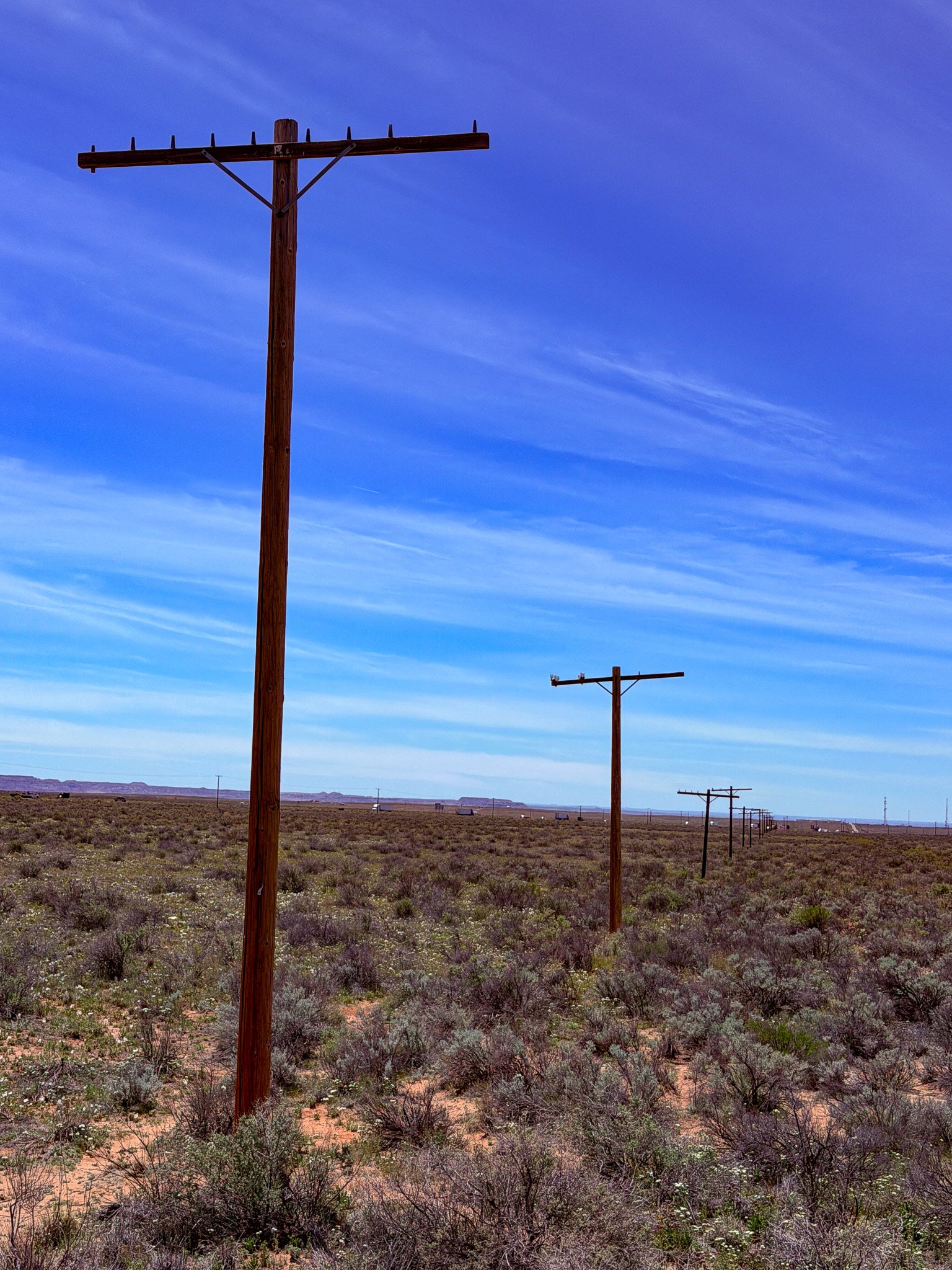
These are the telephone poles that once ran right along old Route 66 through this part of the desert. Although the road surface is long gone, the telephone poles still stand as testament to its long ago existance.
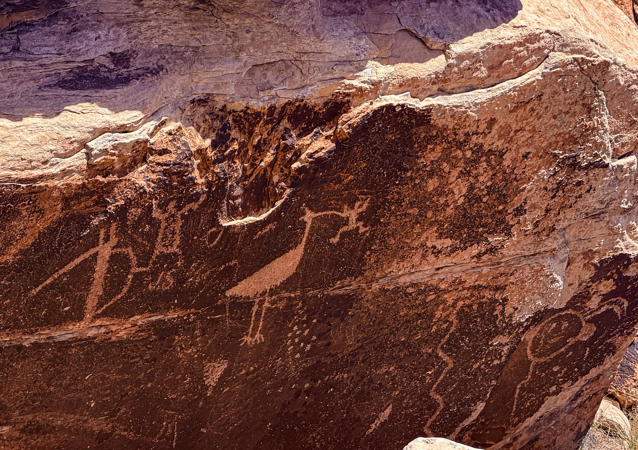
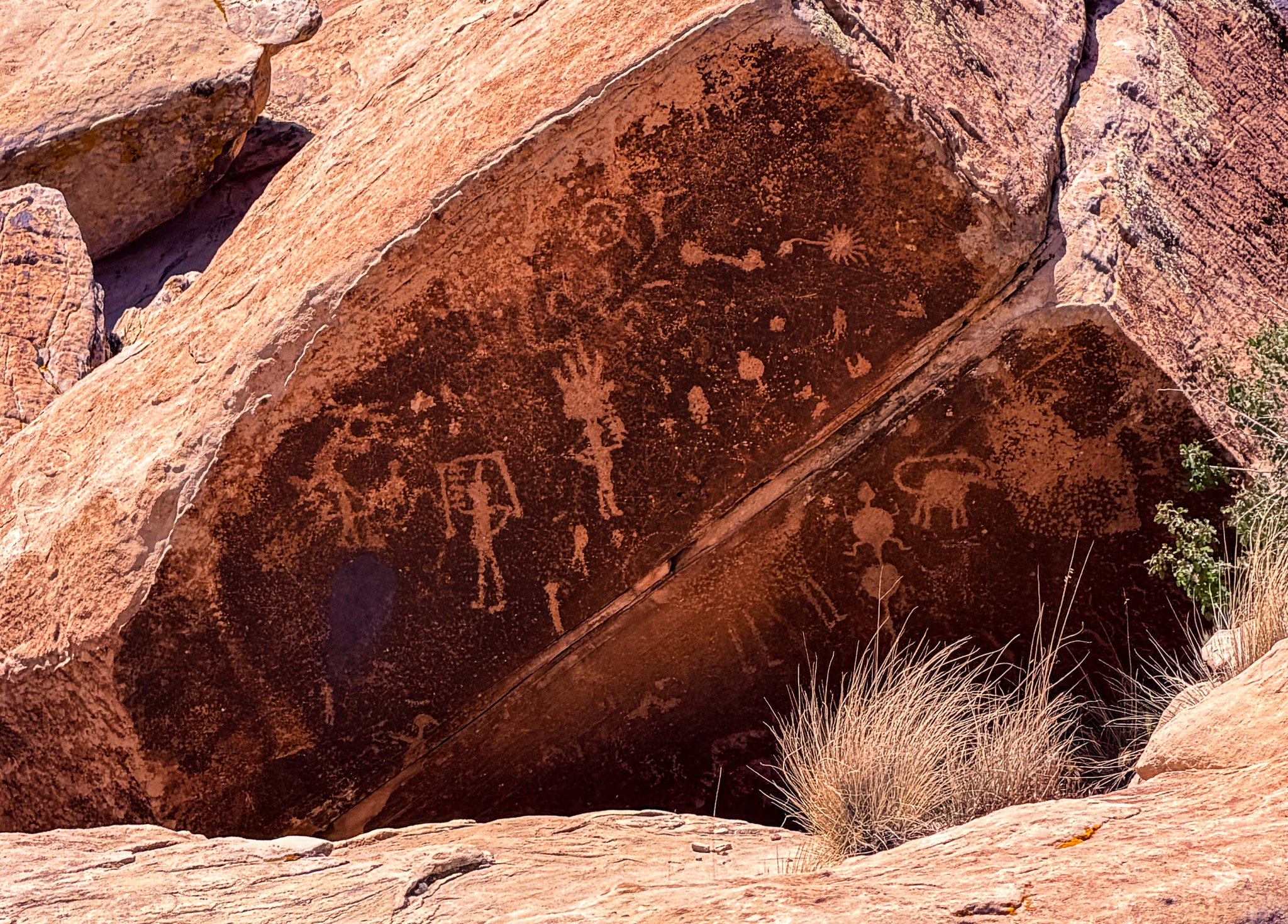
Crossing over to the south side of I-40 we got to see the petroglyphs.
Click on Image for Map.
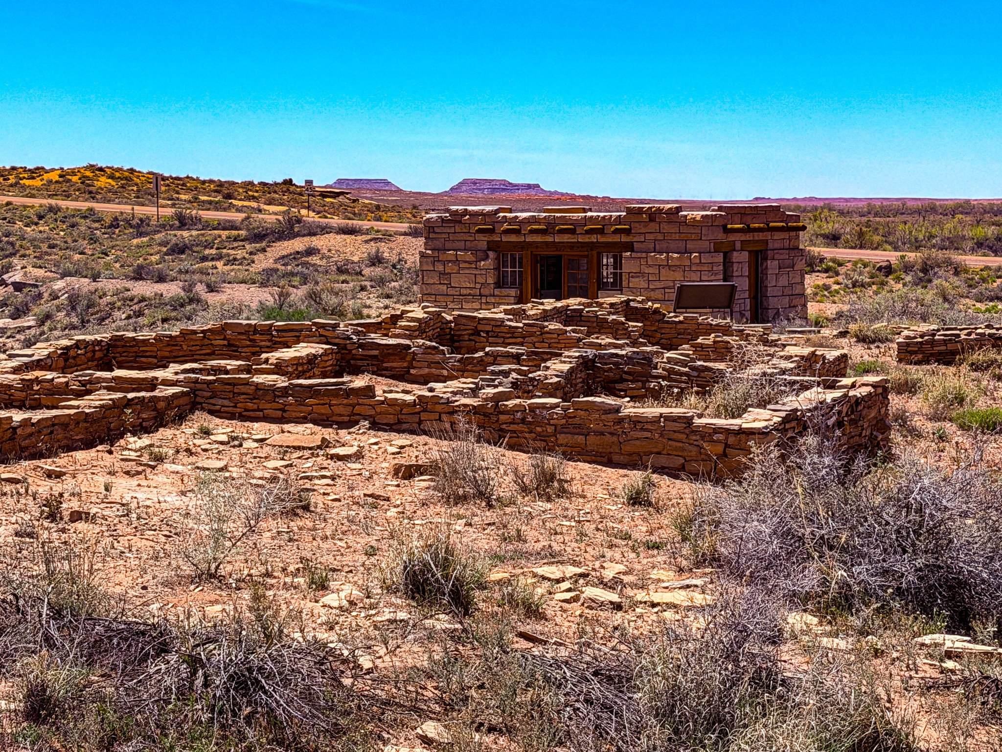
The stone foundations in the foreground are the ruins of Puerco Pueblo.
Click on Image for Map.
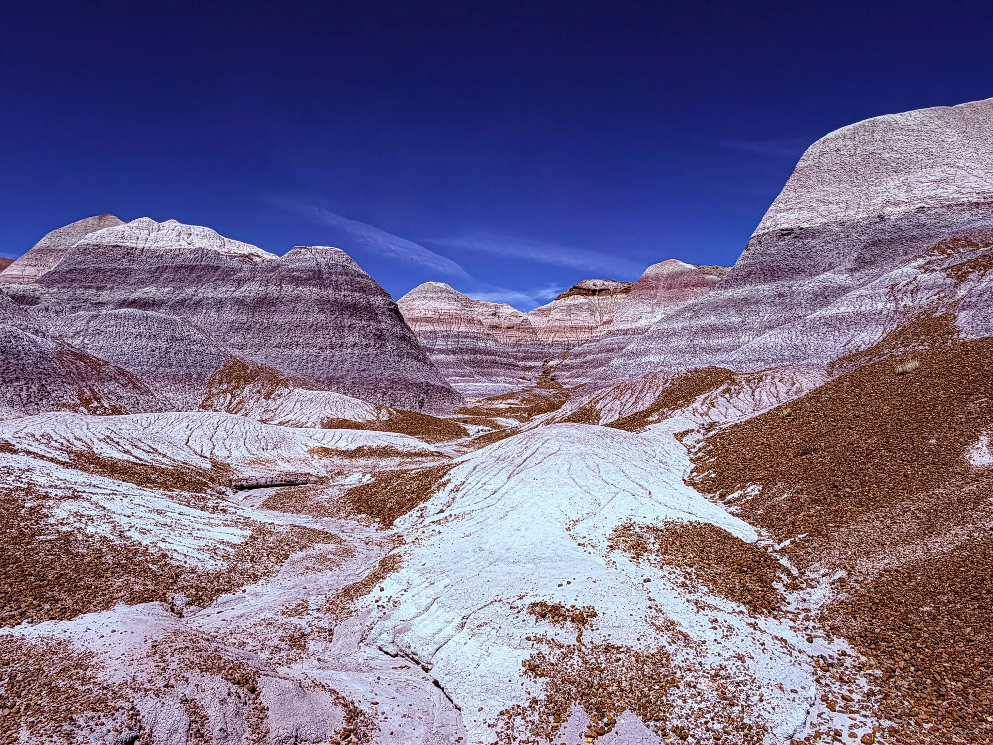
These formations on the Blue Mesa Trail were strikingly similar to those seen in Badlands National Park.
Click on Image for Map.
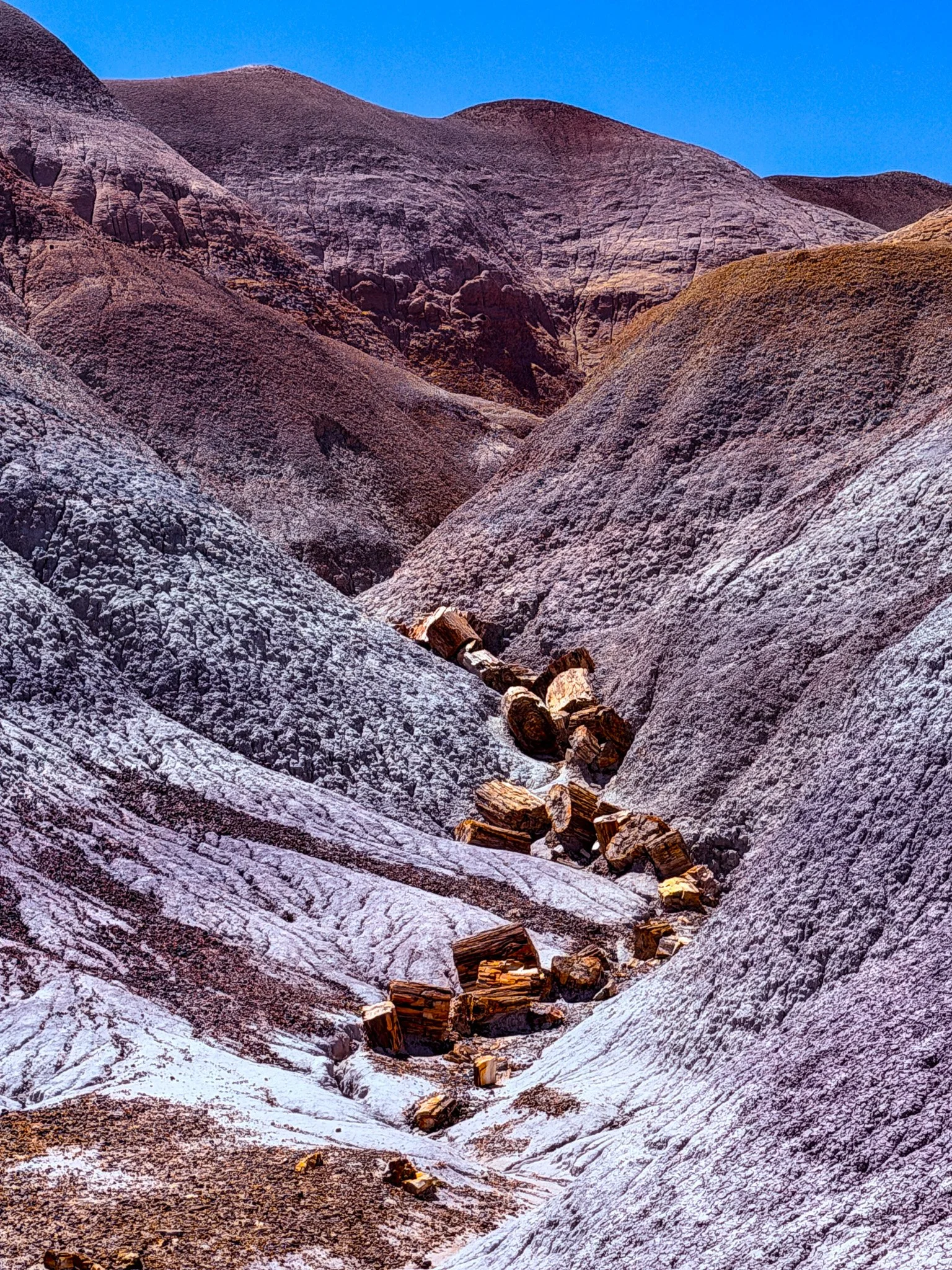
It was here, on the Blue Mesa Trail, that we started to see some petrified wood.
From ChatGPT:
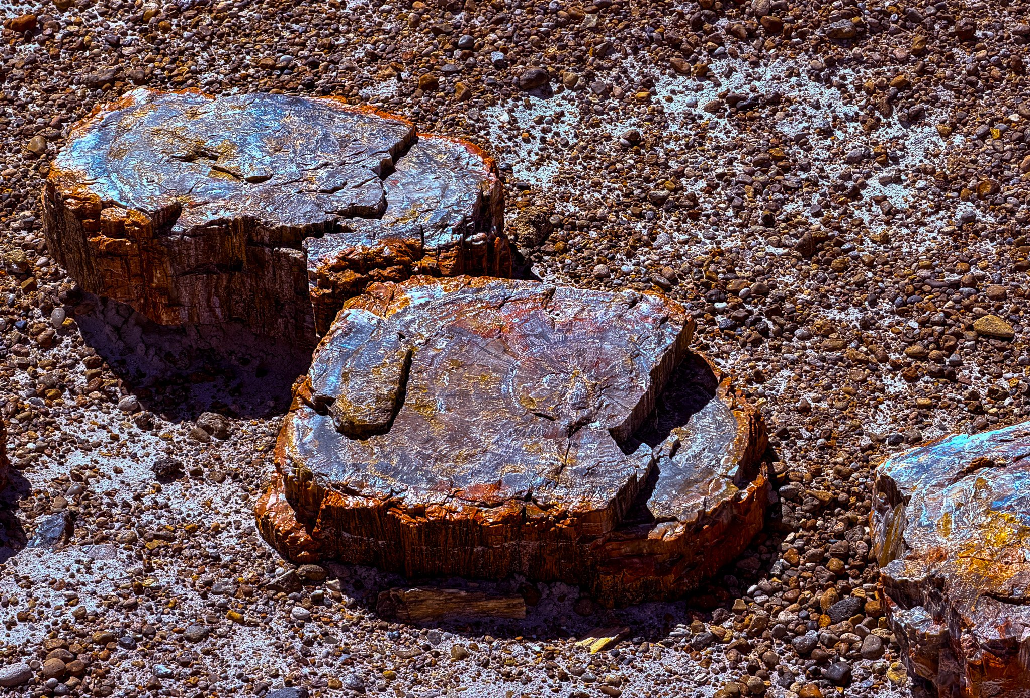
Petrified wood forms when buried trees are preserved through a process called permineralization. After a tree is rapidly covered by sediment—often from volcanic ash—oxygen is limited, slowing decay. Mineral-rich groundwater, especially silica, seeps into the wood’s cells. Over time, minerals replace the organic material while preserving the original structure. The result is a stone fossil that retains growth rings, bark texture, and even microscopic details of the ancient tree.
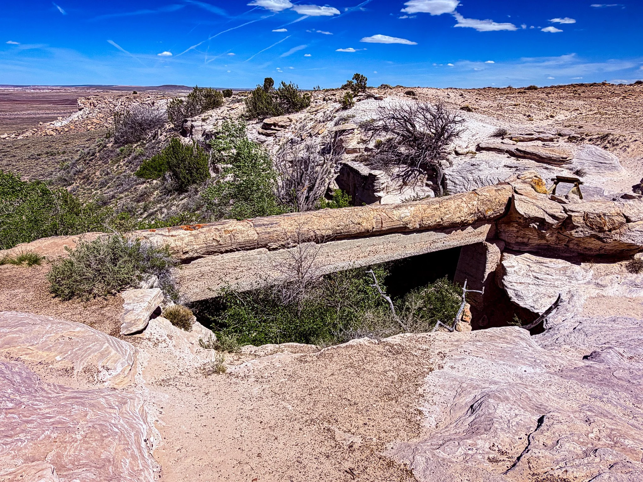
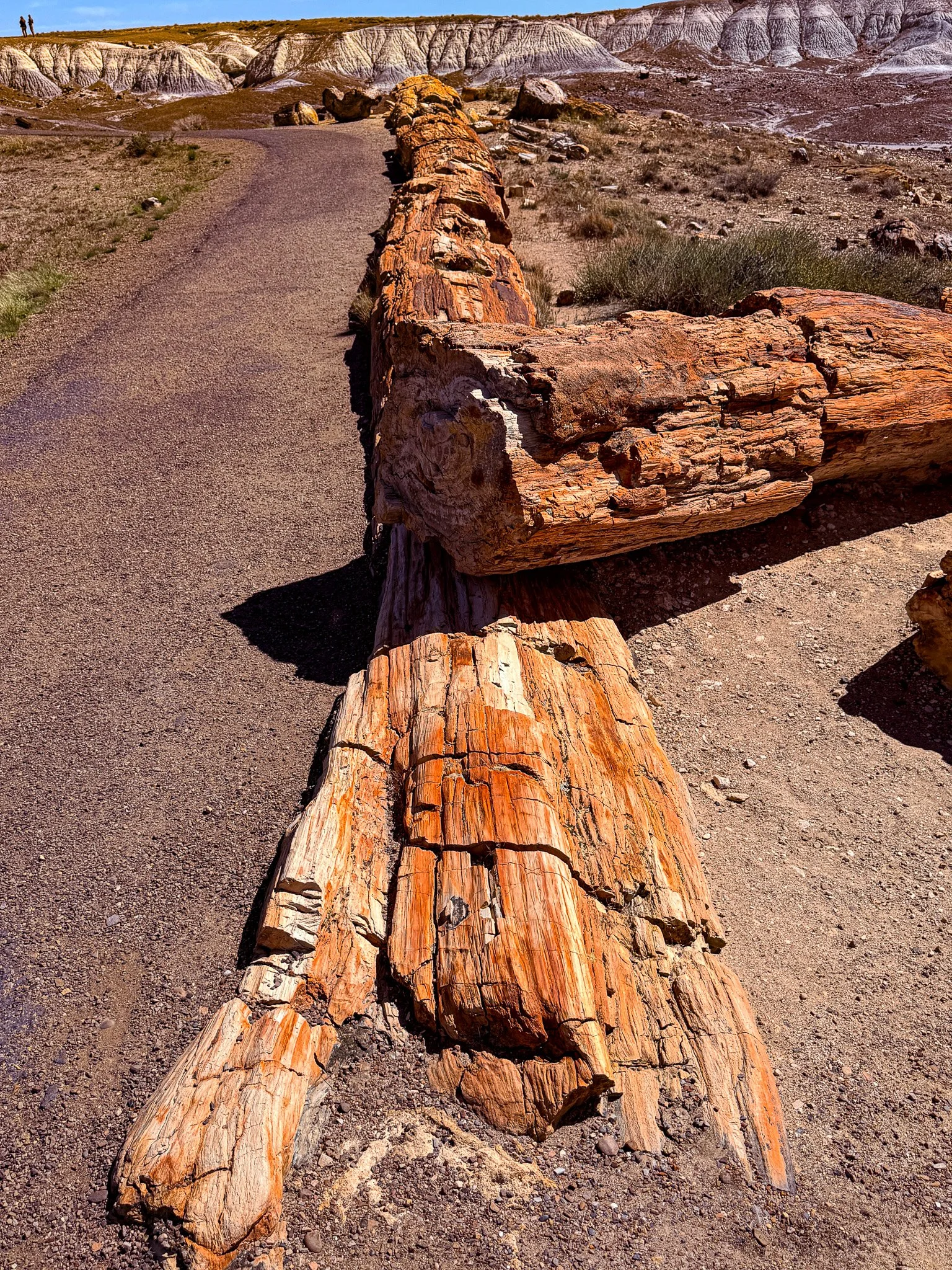
This is known as Agate Bridge; a petrified log that spans a desert wash. The structure below the log is a reinforcing beam that preservationists installed in hopes of preventing the log from one day crumbing into the wash below.
From ChatGPT:
Agate Bridge in Petrified Forest National Park is a remarkable 110-foot petrified log spanning a small gully like a natural bridge. Formed over 200 million years ago, it was exposed by erosion as softer rock washed away beneath it. Early visitors once walked across it, but today it’s protected and supported to preserve this fragile geologic wonder.
Click on Image for Map.
From ChatGPT:
The petrified wood at Petrified Forest National Park is over 200 million years old, dating to the Late Triassic period—about 225 to 207 million years ago.
So when you see those colorful logs today, you’re looking at trees that were alive long before dinosaurs dominated the Earth.
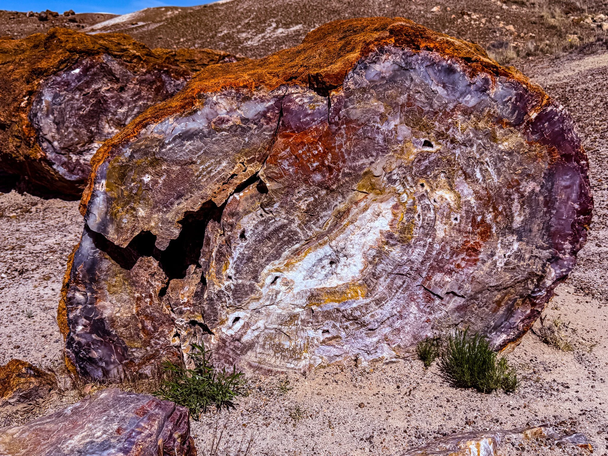
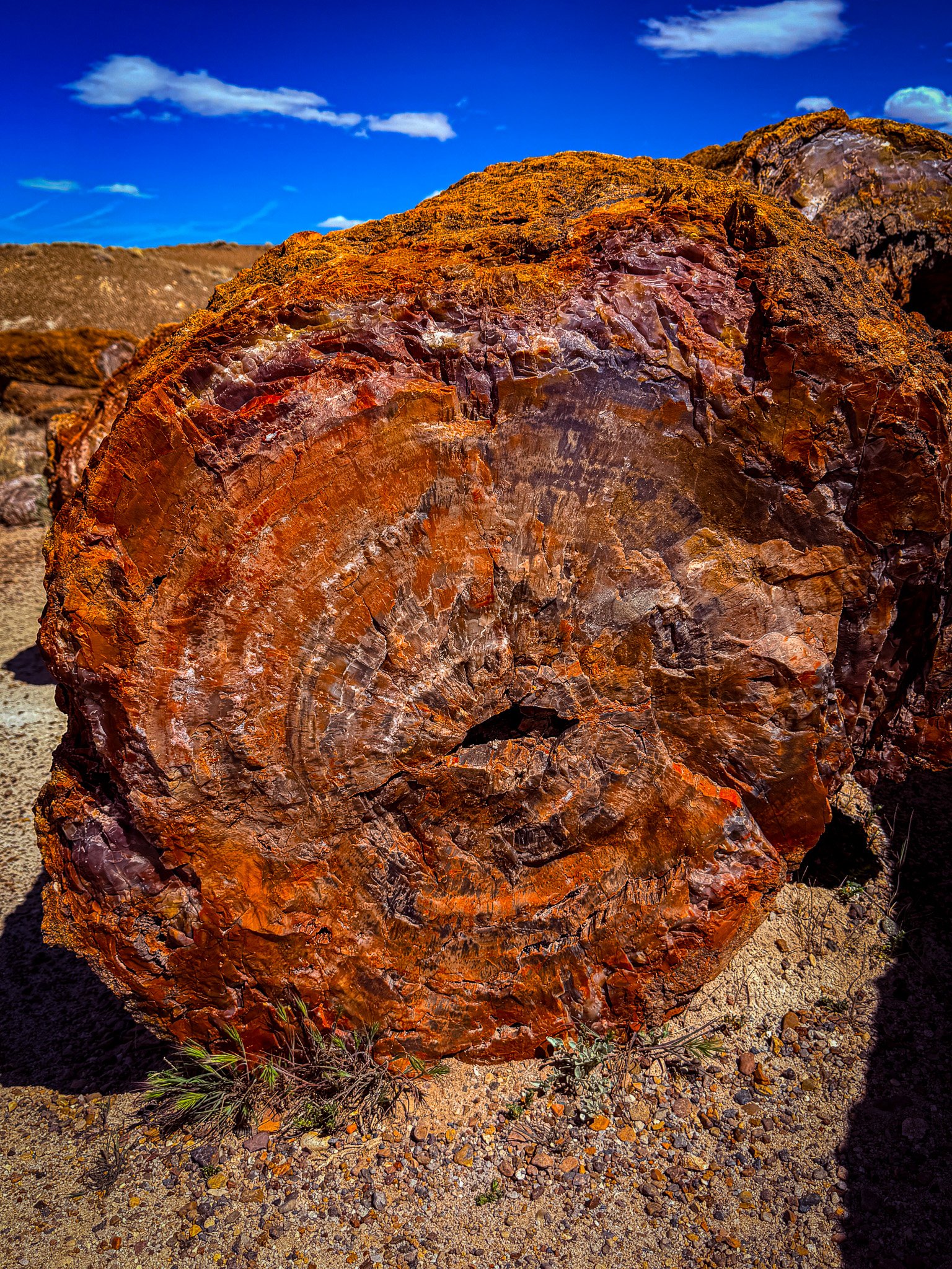
This petrified wood is really amazing to experience. The colors and texture are incredible. It looks like colorful wood, but feels like smooth solid rock.
This particular specimen stretches over 100-feet in length. These were some huge trees that exited back then.
Click on Image for Map.
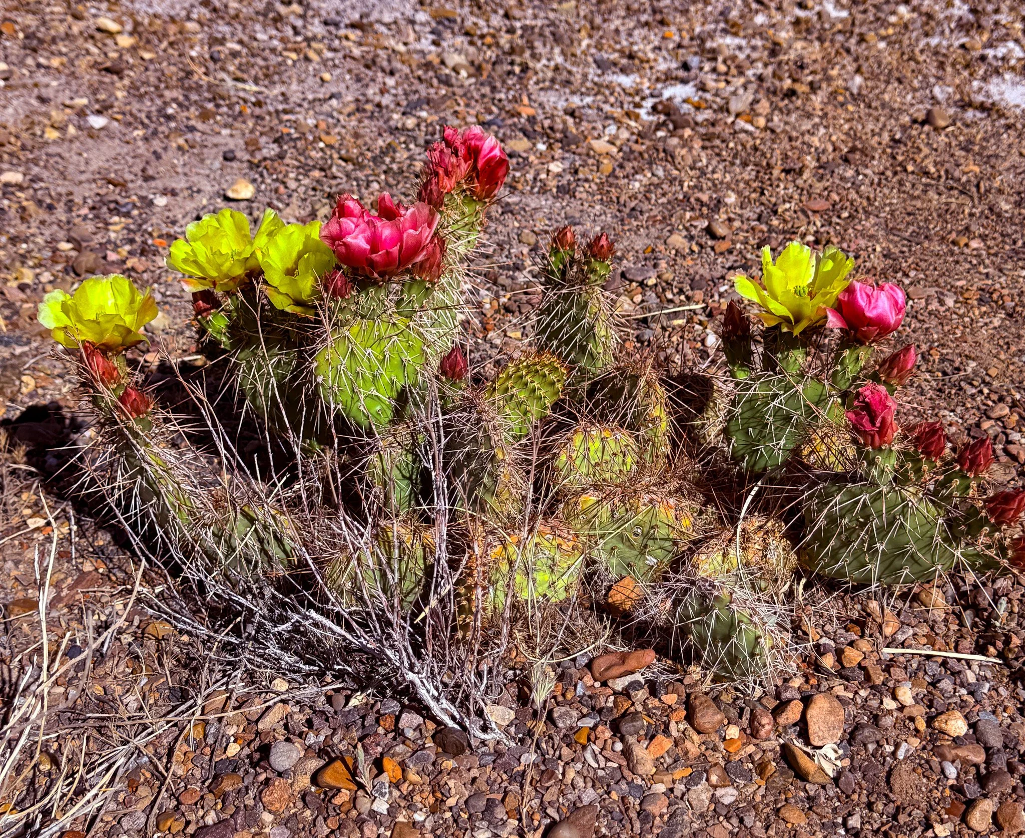
A nice colorful prickly pear cactus.
From ChatGPT:
The prickly pear cactus is a hardy desert plant with flat, paddle-shaped pads and sharp spines. It produces vibrant flowers and edible fruit called tunas. Adapted to arid climates, it stores water efficiently and thrives across the American Southwest.
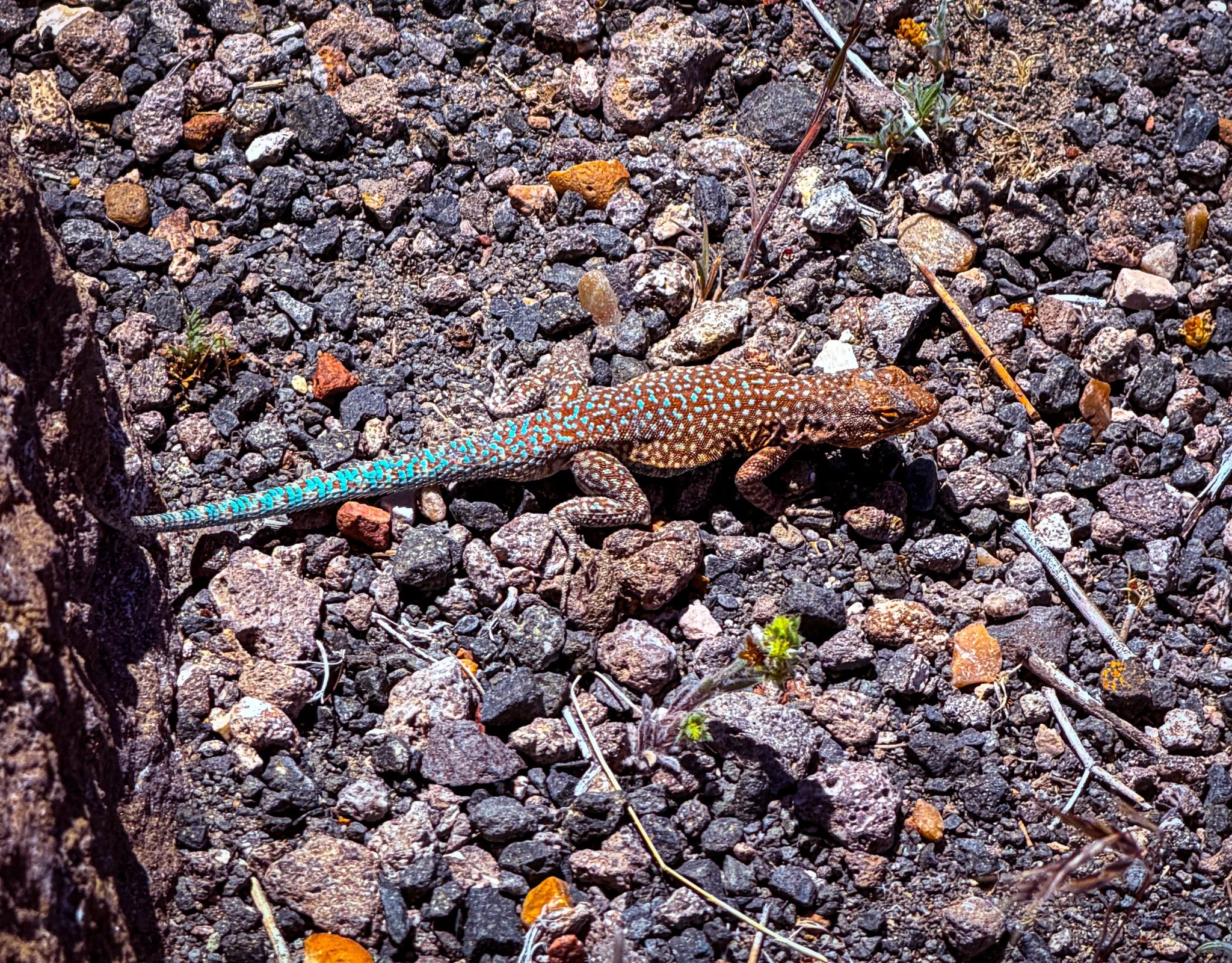
We really have not seen much for wildlife on this trip, but we did get to encounter these guys.
From ChatGPT:
The Side-blotched Lizard is a small, common desert reptile found across Arizona. Named for the dark spot behind its front legs, it adapts well to harsh environments, feeds on insects, and displays varied color patterns.
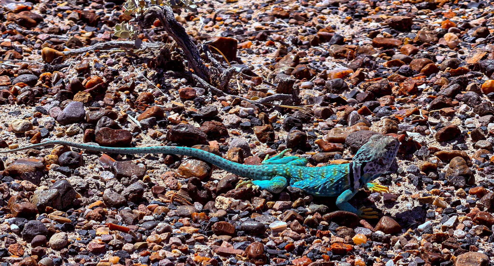
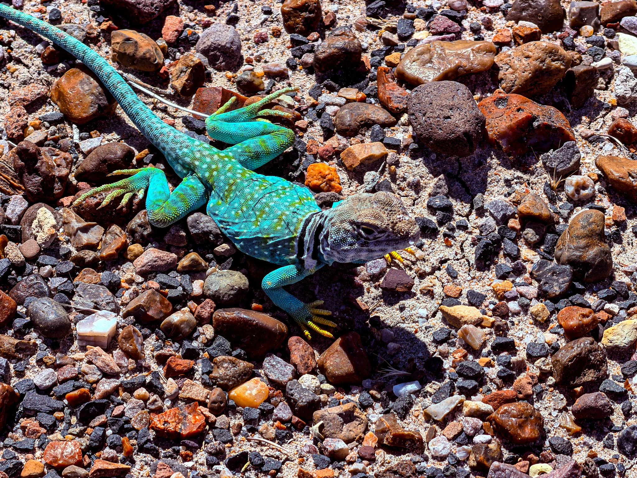
This little guy was colorful enough to warrant a couple of photos. This is a Common Collared Lizard.
From ChatGPT:
The Common Collared Lizard is a colorful desert reptile known for two black “collars” around its neck. Found in rocky areas, it’s fast and agile, often running on hind legs, and feeds on insects and smaller lizards.
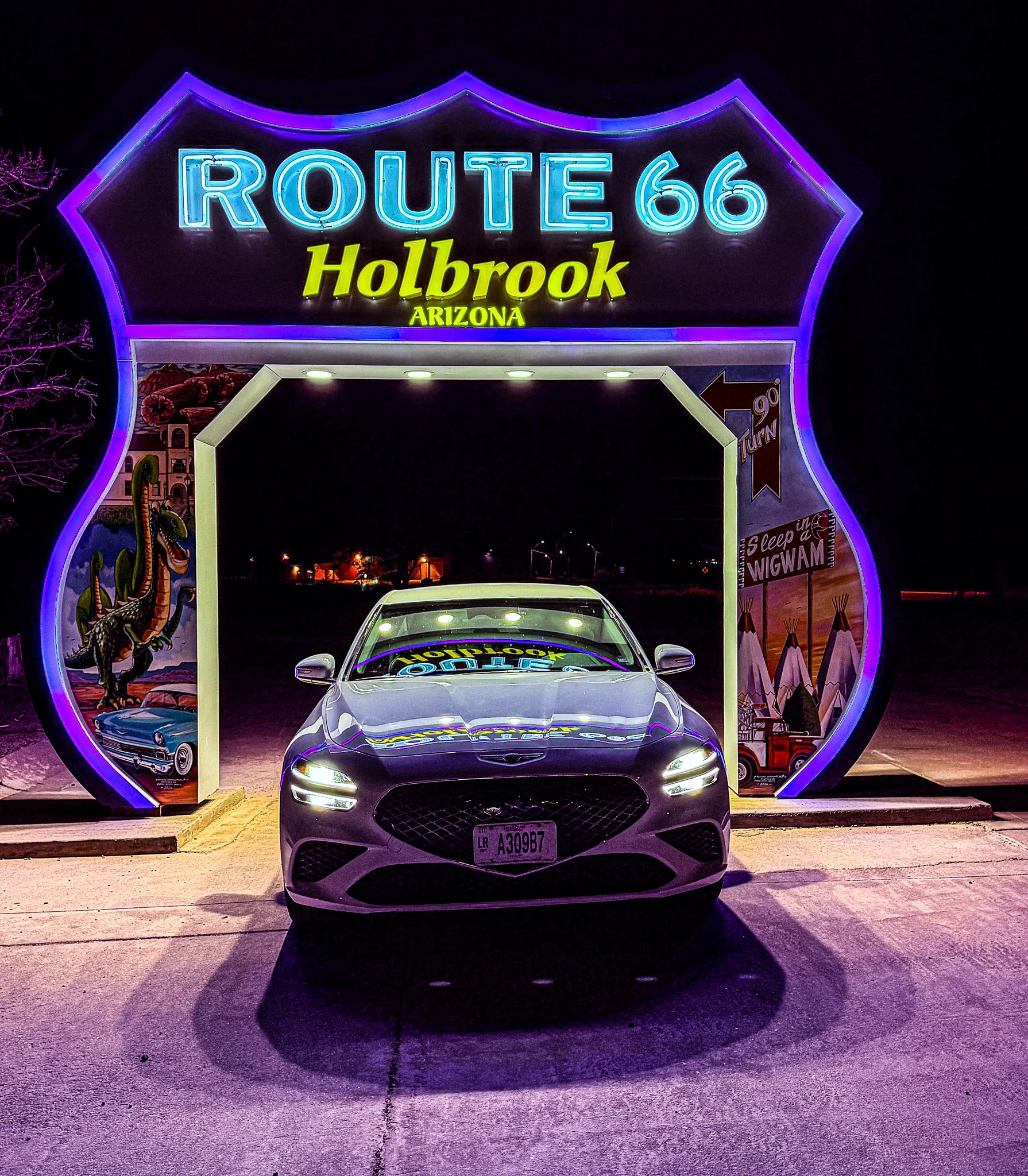
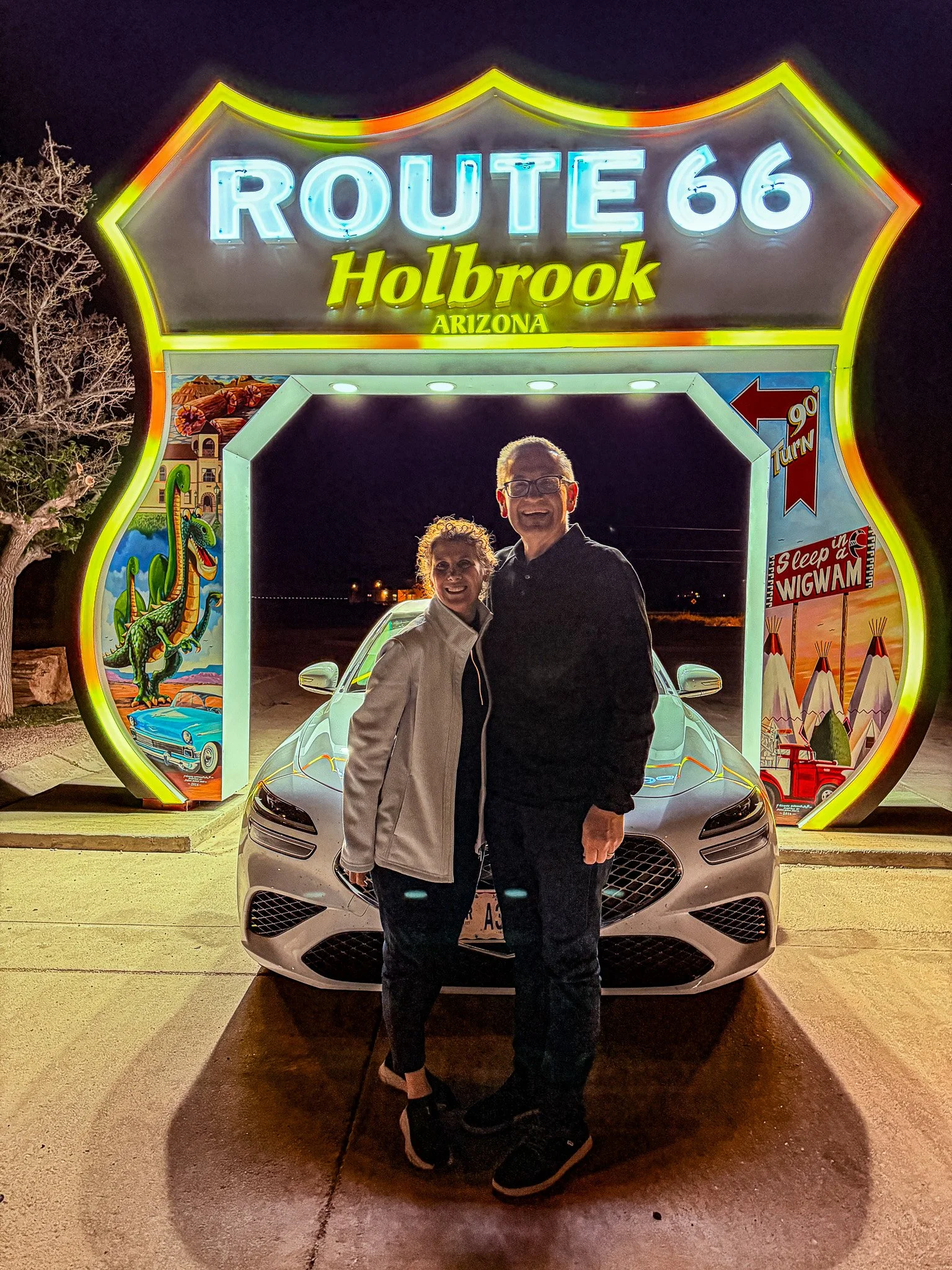
After diner we made our way over to the Holbrook, AZ neon drive-thru Route 66 shield.
Click on Image for Map.
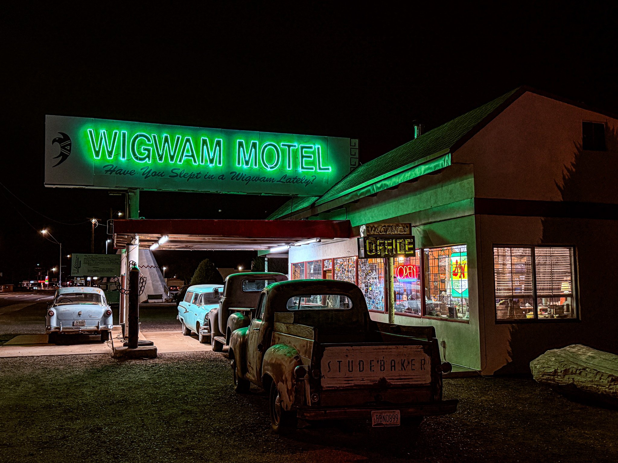
We also stopped to take a few photos of the Wigwam Motel. It is one of two still in existence along Route 66. The other is in California. We did not stay in a wigwam this trip.
Click on Image for Map.
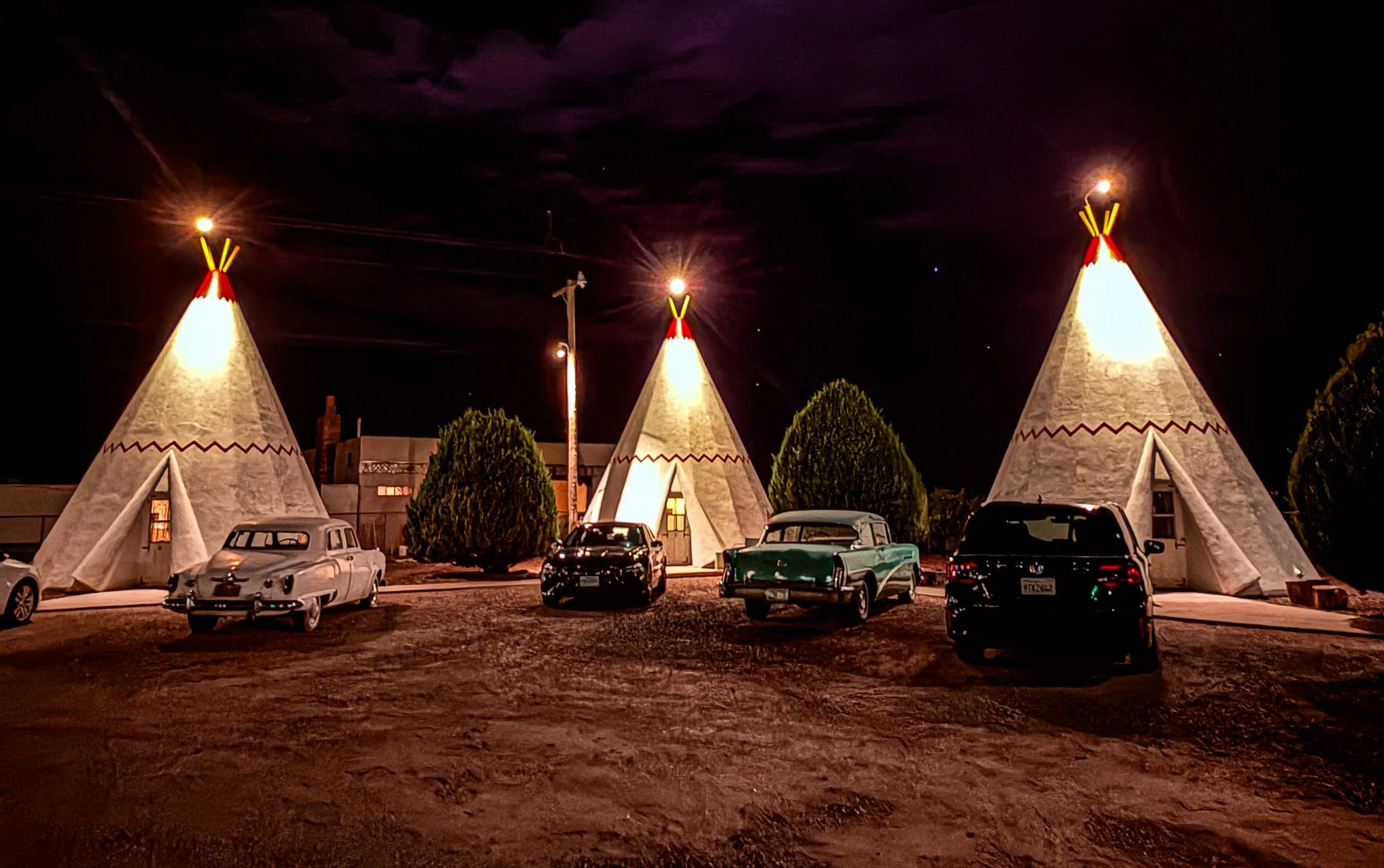
From ChatGPT:
The Wigwam Motel Holbrook is a classic Route 66 landmark built in 1950 by Chester E. Lewis. It features concrete teepee-shaped rooms arranged around a courtyard, each with vintage furnishings and nostalgic roadside charm. Listed on the National Register of Historic Places, it’s one of only a few surviving Wigwam Villages in the U.S. and remains a popular stop near Petrified Forest National Park.