Great River Road Trip, Day #8
Sunday, May 11, 2025

Today’s first stop was a walk along Main Street in New Roads, Louisiana. They appear to have a bustling little combination of business and residential along the Main Street. However, being a Sunday, about the only thing that was open were the churches. This little piece of green space is known as Doris Park.
[Click on Image for Map]

The further we moved south, the more common the magnolia trees. This one, in front of the Pointe Coupee courthouse was just starting to bloom.
New Roads is located on a body of water that looks very much like a river, and at one time it was a part of the Mississippi, but it is now a horseshoe shaped lake. As the river changes course over the years from floods and other natural factors, parts of the river get separated from the main channel and this body of water is now called False River.
[Click on Image for Map]

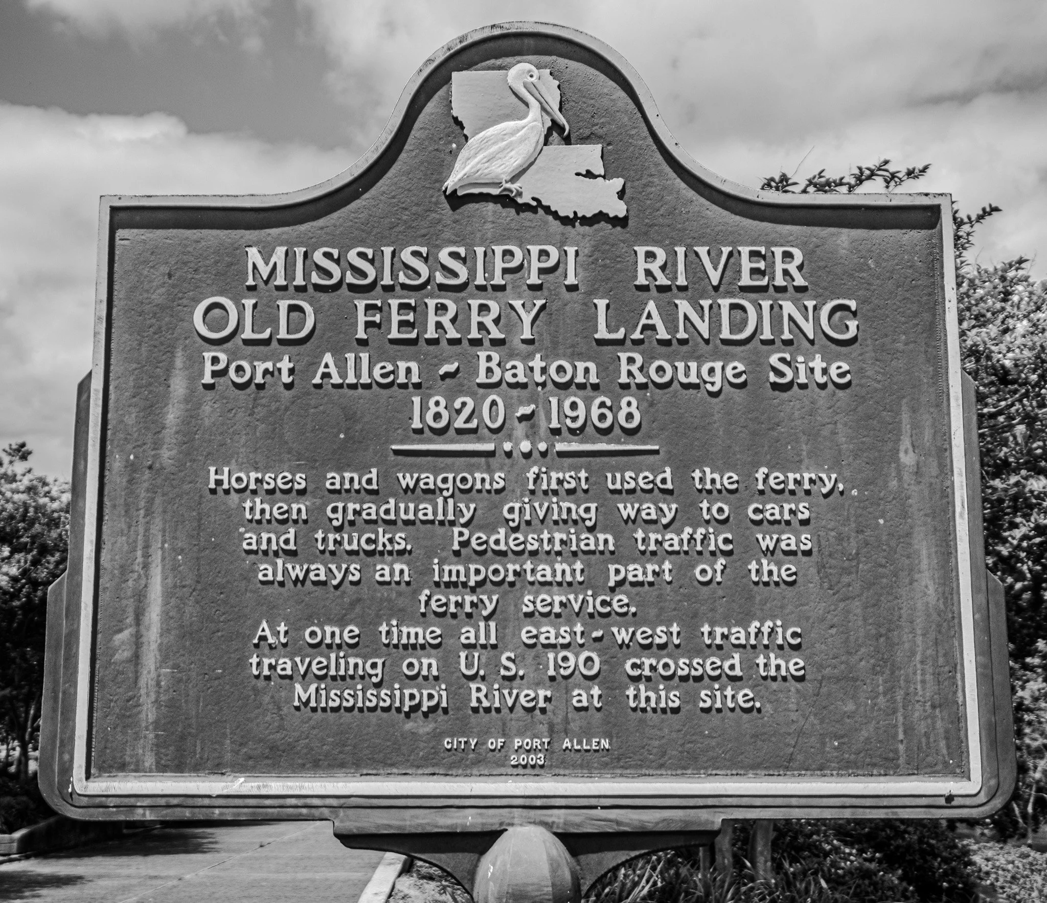
Next, it was on to Port Allen, Louisiana. Port Allen is located directly across the river from Baton Rouge and was once the site of an early ferry crossing. Now, there is a bridge connecting the two sides.
They have a very nice park and walking trail along the river giving good views of the river and city skyline of Baton Rouge.
[Click on Image for Map]

View of the Baton Rouge shoreline from Port Allen. On the far side of the river you can see a tug and barge pushing north.
[Click on Image for Map]
While walking the park Lisa had an emergency bout with her gastrointestinal issues and a very kind Port Allen Police Officer, Detective Alaric Celestaine saved the day by offering to let her into the police office to use their facilities. A huge thank you to Officer Celestaine, his kindness was much appreciated; as every other option was closed due to it being a Sunday.
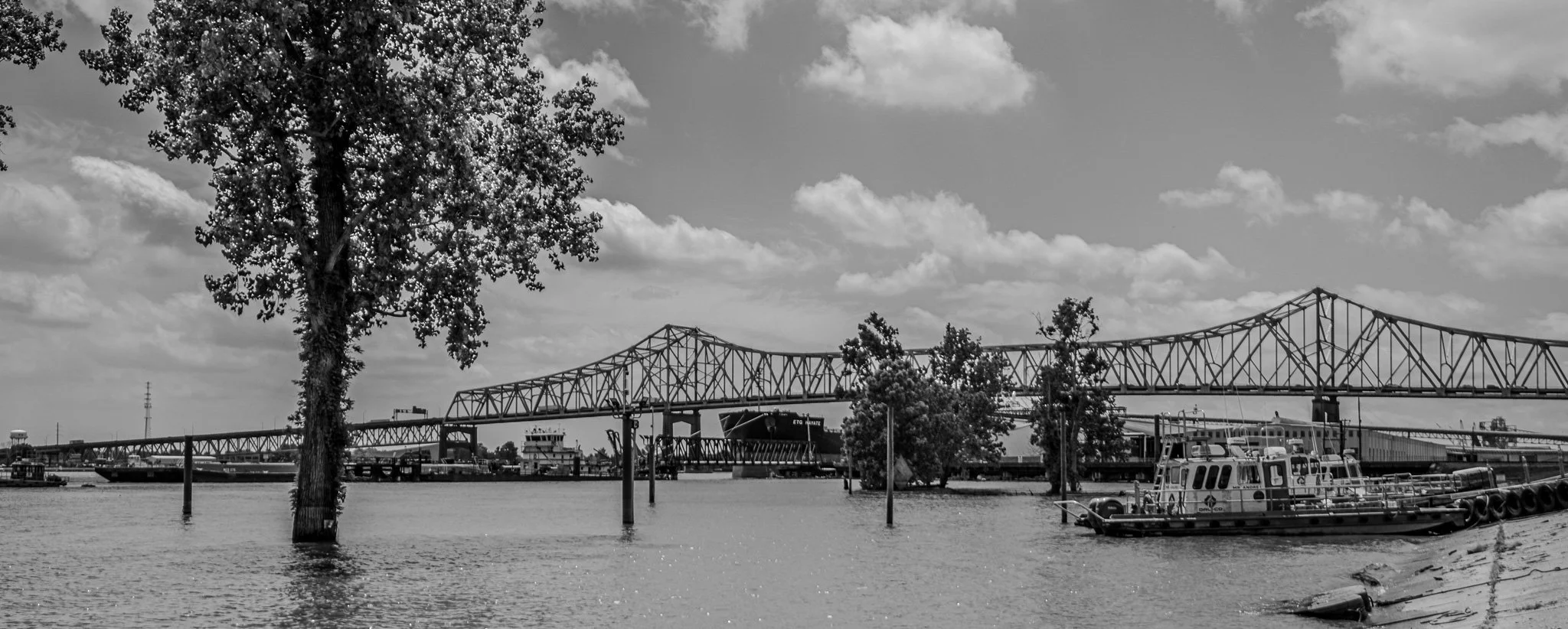
This is the bridge that now connects Port Allen to Baton Rouge. In the center of the image you can just see the bow of a large ship docked for loading/unloading at the port of Baton Rouge. This is the first time we have spotted anything “larger” than a tug and barge on the Mississippi. Doing a little research, I have discovered that from here to the Gulf the U.S. Army Corps of Engineers maintains a navigable channel with a depth of at least 45-feet. This makes it possible for ocean going vessels to come this far up the river. The same search told me that at points around Baton Rouge the river can be over 100-feet deep. This is a far cry from the 10-12 feet in our area.
[Click on Image for Map]

We are now starting to see the above ground cemeteries. The water table here is so high, that just about any digging soon encounters water; as a result, graves cannot be “dug” here and instead they have to locate the caskets in above-ground graves. This was a rather old cemetery and many of the units were sinking into the soft wet ground.
[Click on Image for Map]

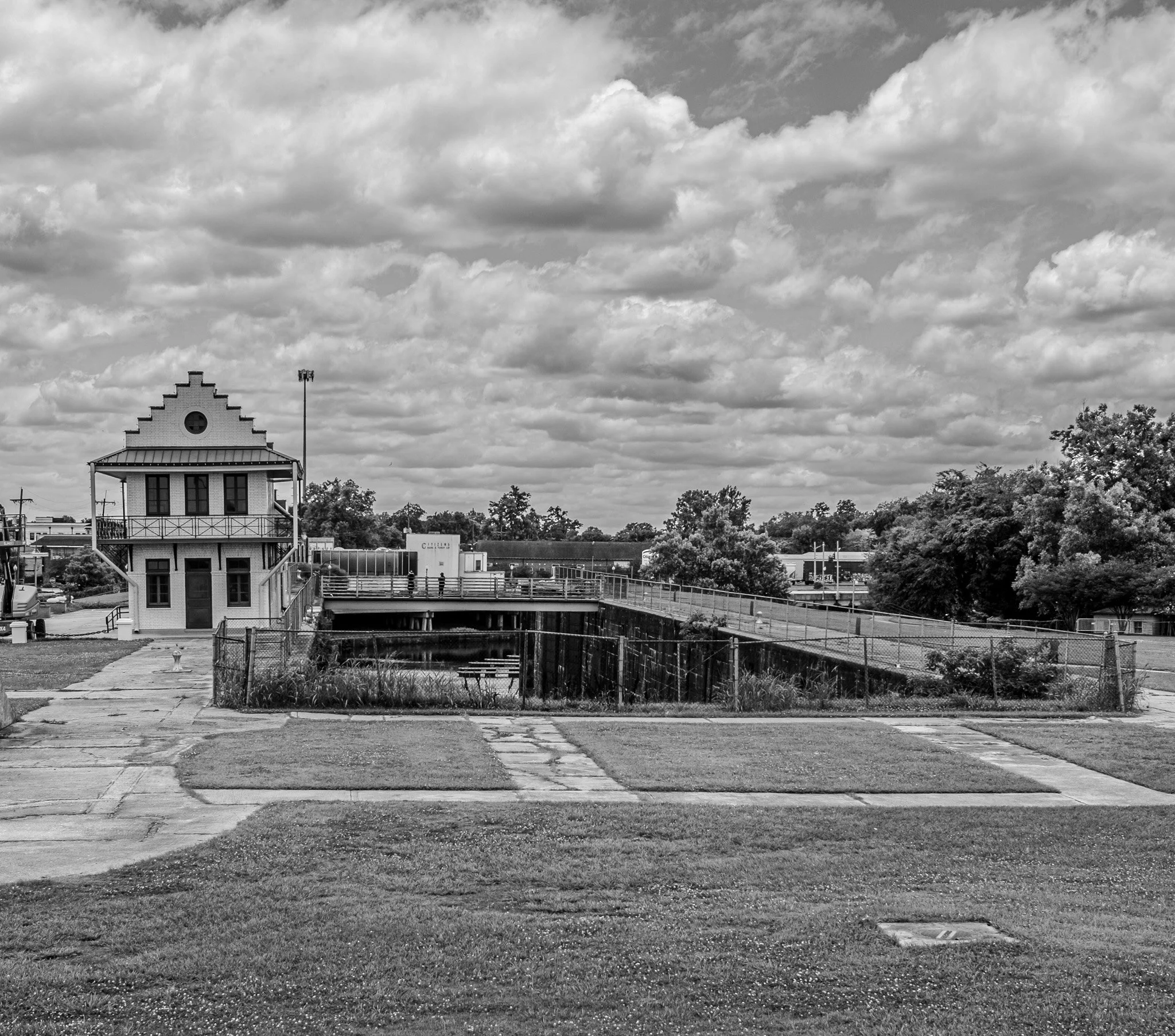
We then visited the town of Plaquemine, Louisiana. This is an old lock chamber that once connected the Bayou Plaquemine to the Mississippi River. This connection no longer exists, so this is just an historical site today.
[Click on Image for Map]

This image showcases the huge swinging gate doors of the old lock.
[Click on Image for Map]

This is the old Lock House, which is now a museum; but it was closed when we were there on a Sunday.
[Click on Image for Map]
Where we stood to take this photo was once the connection of the Bayou Plaquemine to the Mississippi. However, as you can see in the foreground, this has been turned into part of the levee and the Bayou no longer connects to the Mississippi.
[Click on Image for Map]

Walking along the levee walkway looking across the river, there really isn’t much to see here. You can make out a number of barges and tugs on the far side. This part of the river is very industrial and I can’t recall the last time we saw a pleasure craft on the river. This is much different than up in Minnesota where it is common to see sailboats, fishing boats and other pleasure crafts; down here, it’s all business.
[Click on Image for Map]
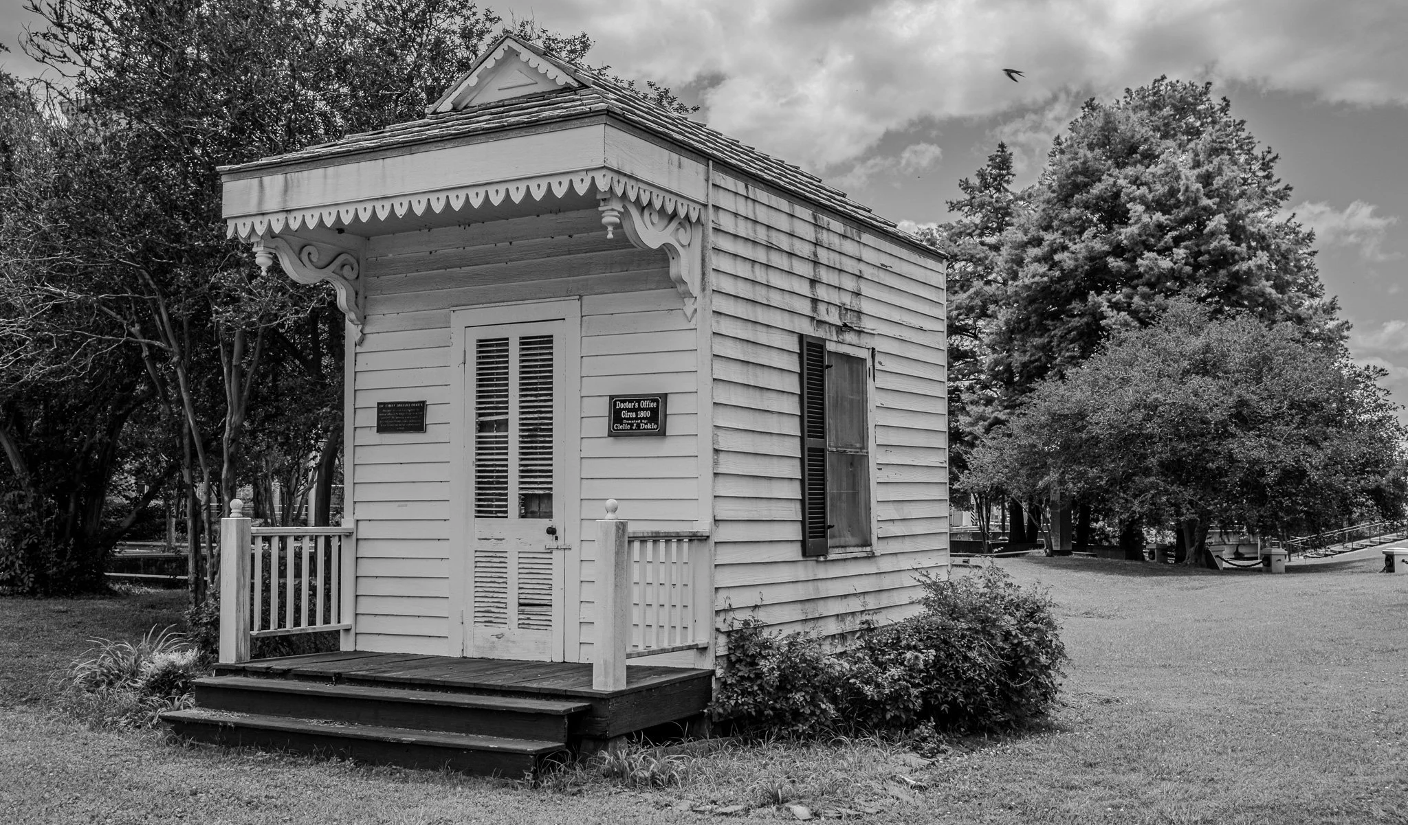
The plaque on this little building read: “Dr. Emile Hiriart Office. This small structure was originally the medical office of Dr. Emile Hiriart from 1885 until 1895. The structure is an example of pure Louisiana French country architecture. It was donated and moved to this location in 1994.”

This area along the Mississippi is reportedly known as “cancer ally.” They claim that huge chemical plants and refineries have polluted the area so bad that cancer rates are much higher for those that live here. I can’t confirm or deny that report, but we can say that huge factories/refineries/chemical plans like this one are all along this stretch of the river.
We stopped briefly to take this photo and a security guard came out of the building in the foreground and said we could not take photos here or he would call the cops. Apparently, they are worried someone will use photos to do reconnaissance and then come bomb the place. We aren’t exactly the typical appearing terrorist, but we hightailed it out of there nonetheless.
[Click on Image for Map]

After roughly 1200 miles, we have arrived in New Orleans, Louisiana! Our plan was to visit the botanical gardens, however, they were scheduled to close only 30 minutes after our arrival. So, instead, we walked around city park some. The park was very busy on this beautiful Mother’s Day Sunday.
[Click on Image for Map]

Only a half a block from our hotel was St. Louis Cathedral.
[Click on Image for Map]
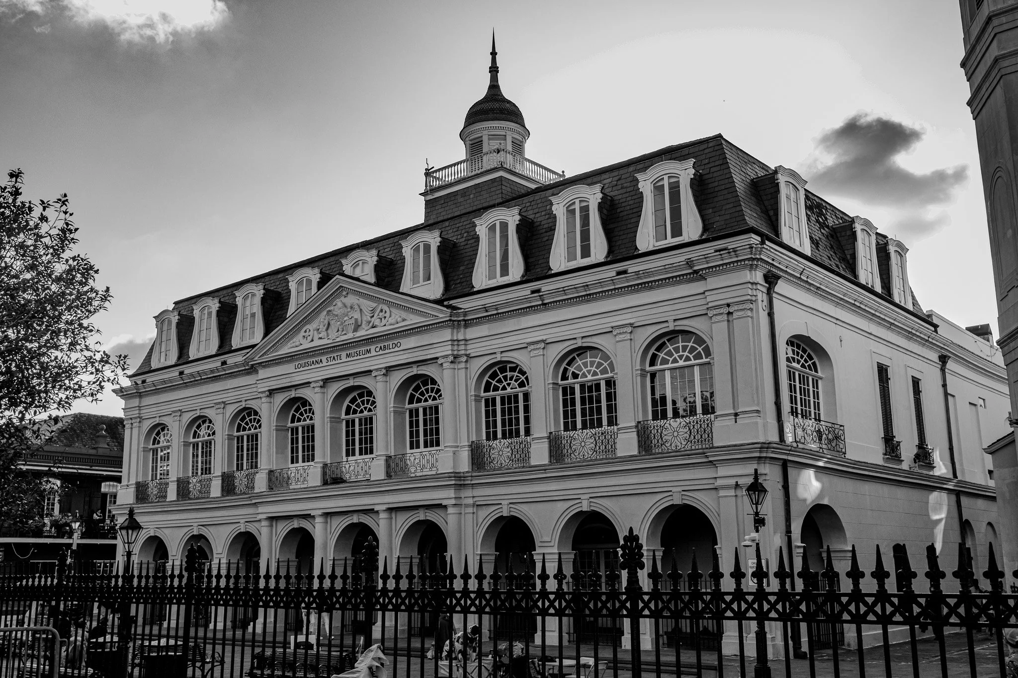
Immediately adjacent to the cathedral is The Cabildo, an 18th century building that now houses the Louisiana State Museum.
[Click on Image for Map]
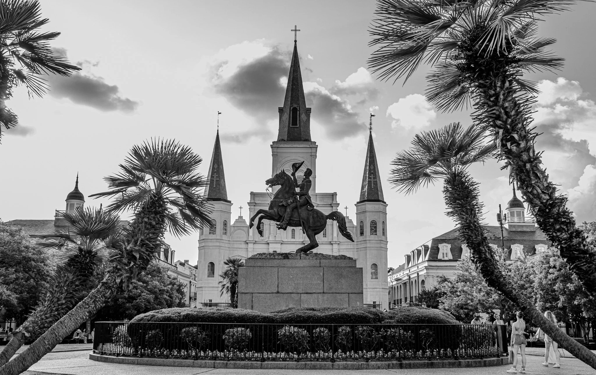
No trip to New Orleans would be complete without a photo of Jackson Square with the iconic cathedral as backdrop.
[Click on Image for Map]
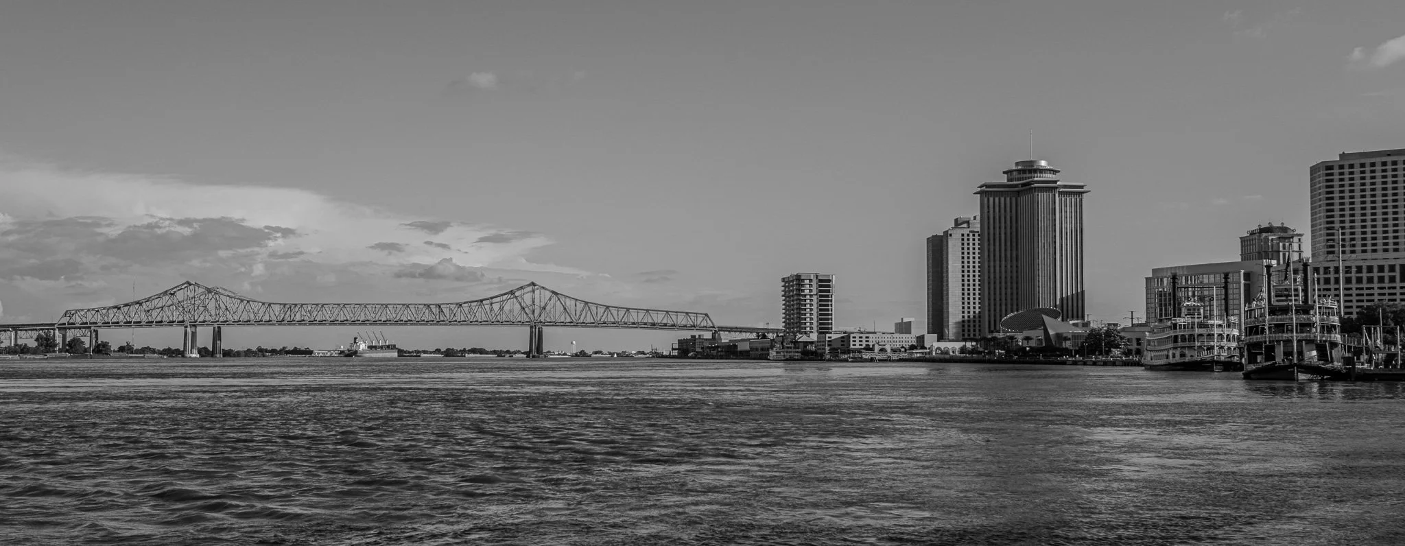
And here it is - the Mighty Mississippi River from the New Orleans waterfront.
The river does not actually end in New Orleans proper; rather, it forms a deep water channel all the way until it empties into the gulf. We had discussed traveling the additional 80 miles to reach the southern most point accessible by car. However, it is a road that is lined by heavy industry and you can’t physically see the river due to the levees. Plus, as we learned on the way in today, Louisiana doesn’t go to great lengths in maintaining their roads. I can only imagine the status of the roads that are traveled almost exclusively by heavy industry as being particularly favorable to our little car. So, with all of that in mind, we have decided that for this trip, New Orleans will serve as the symbolic end of the road for us. Tomorrow we will spend a day touring the city and then on Tuesday, we start the return trip up the eastern bank of the river.
In doing some research, the Mississippi reaches its deepest point just to left of this photograph at the bend in the river across from Algiers Point. We have been told the river reaches to depths in excess of 200-feet in this location.
[Click on Image for Map]

Our first time in New Orleans we went with local fare; I had the Creole sampler (Chicken gumbo, Shrimp creole, Red beans and Jambalaya) and Lisa had blackened redfish.
[Click on Image for Map]