Great River Road Trip, Day #3
Tuesday, May 6, 2025
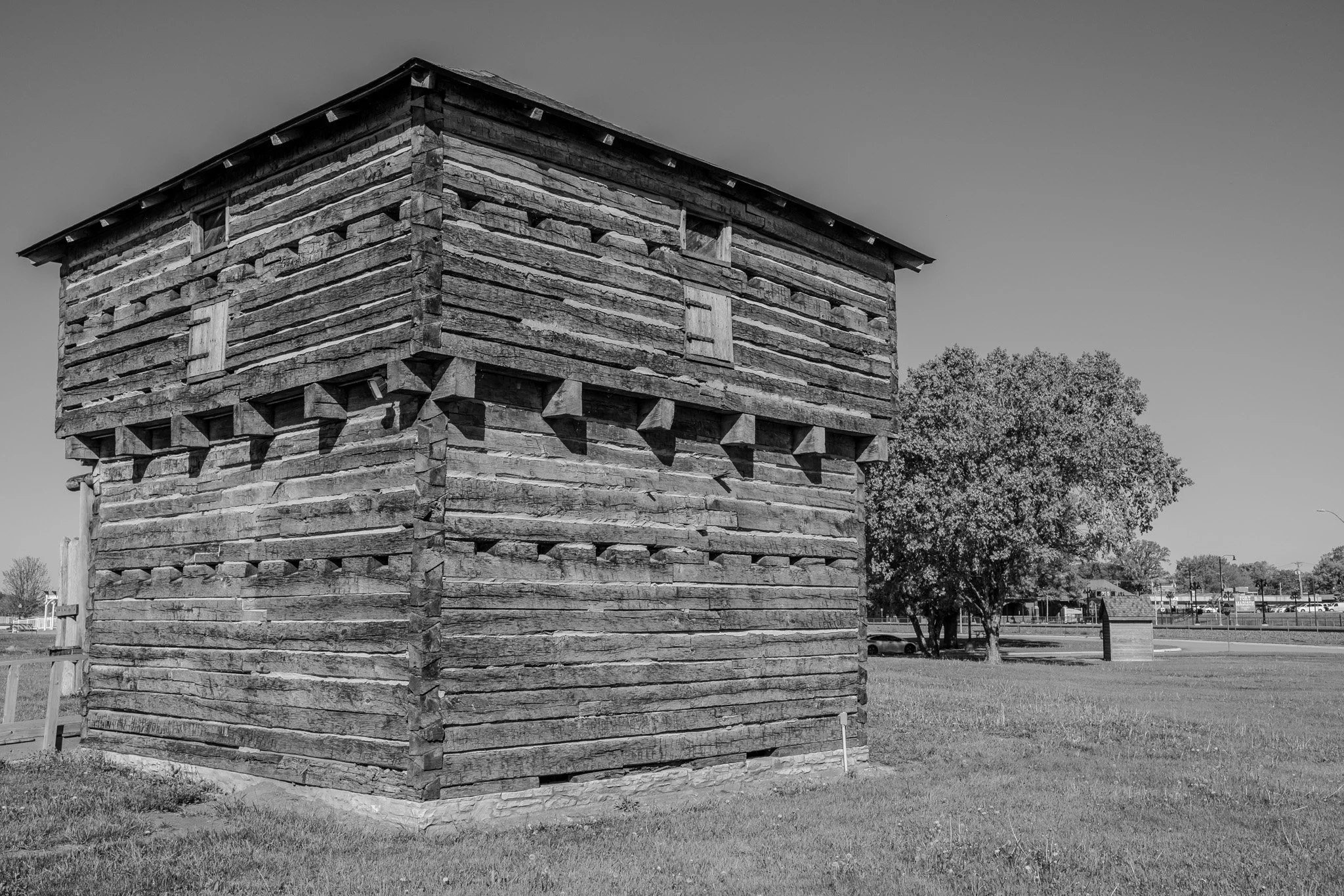
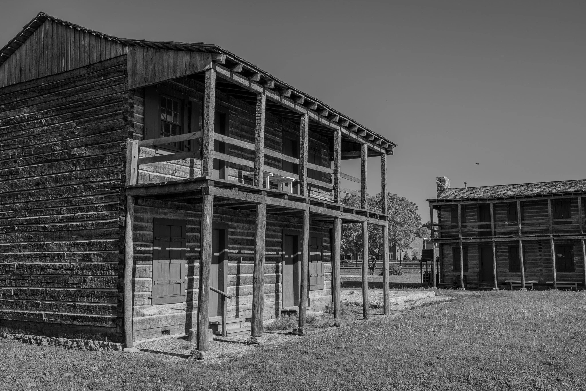
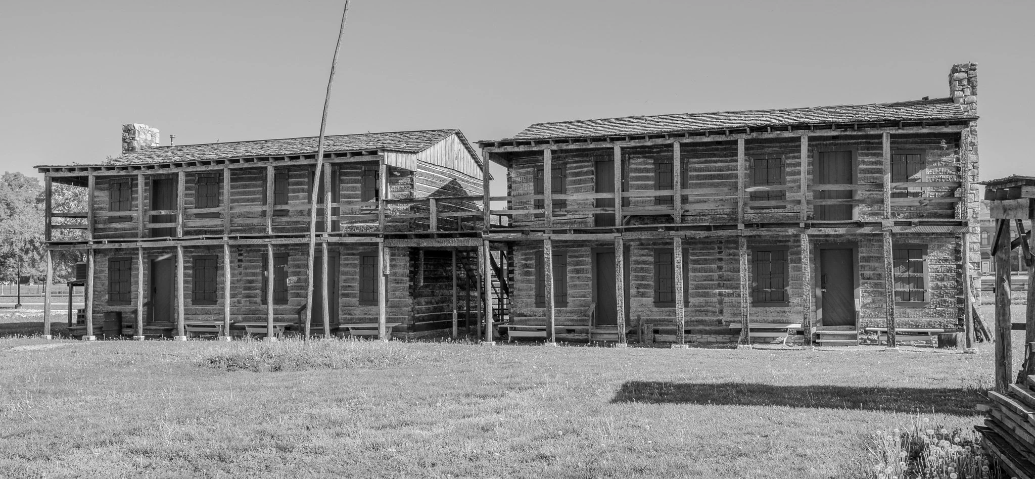
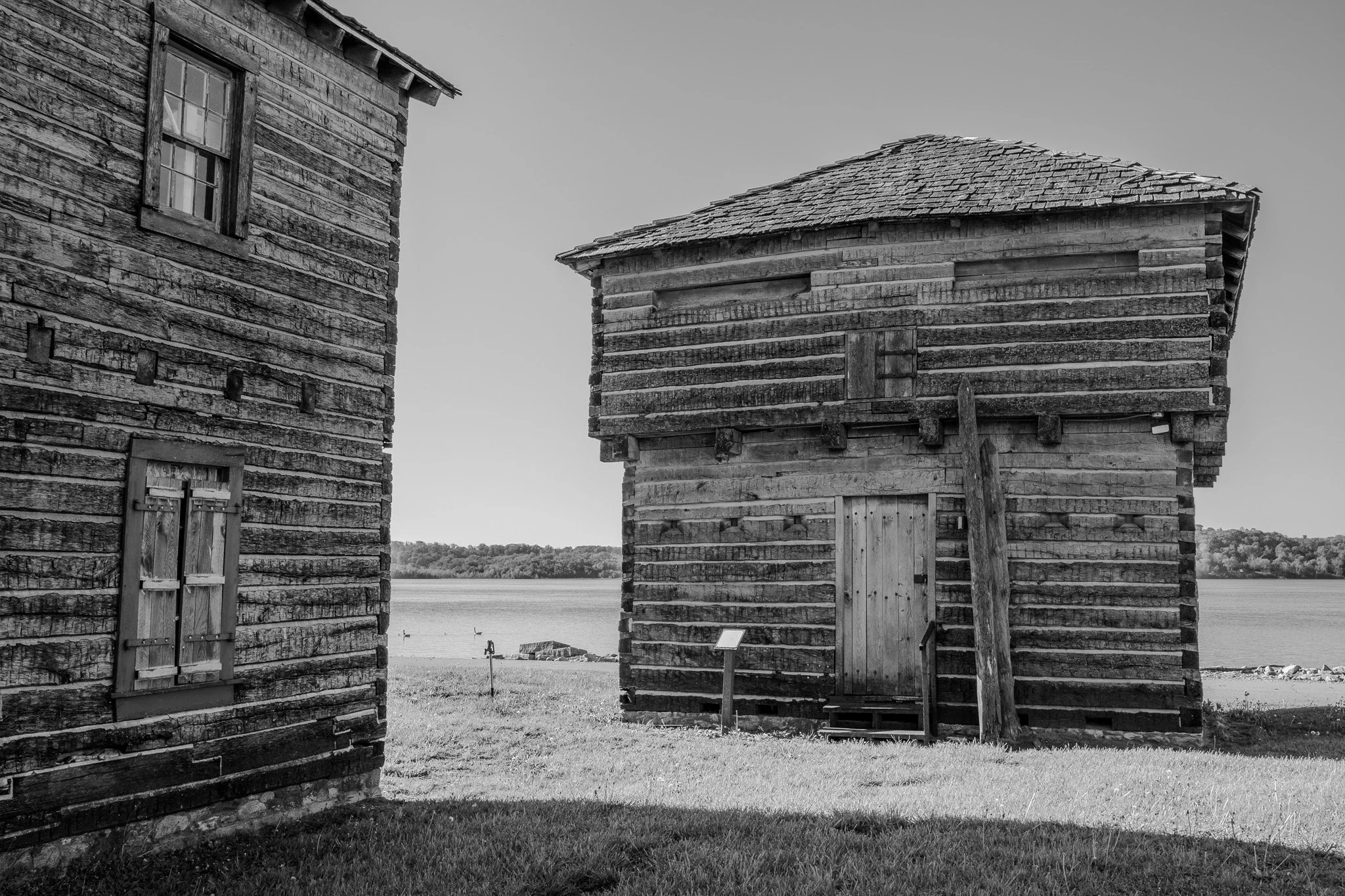
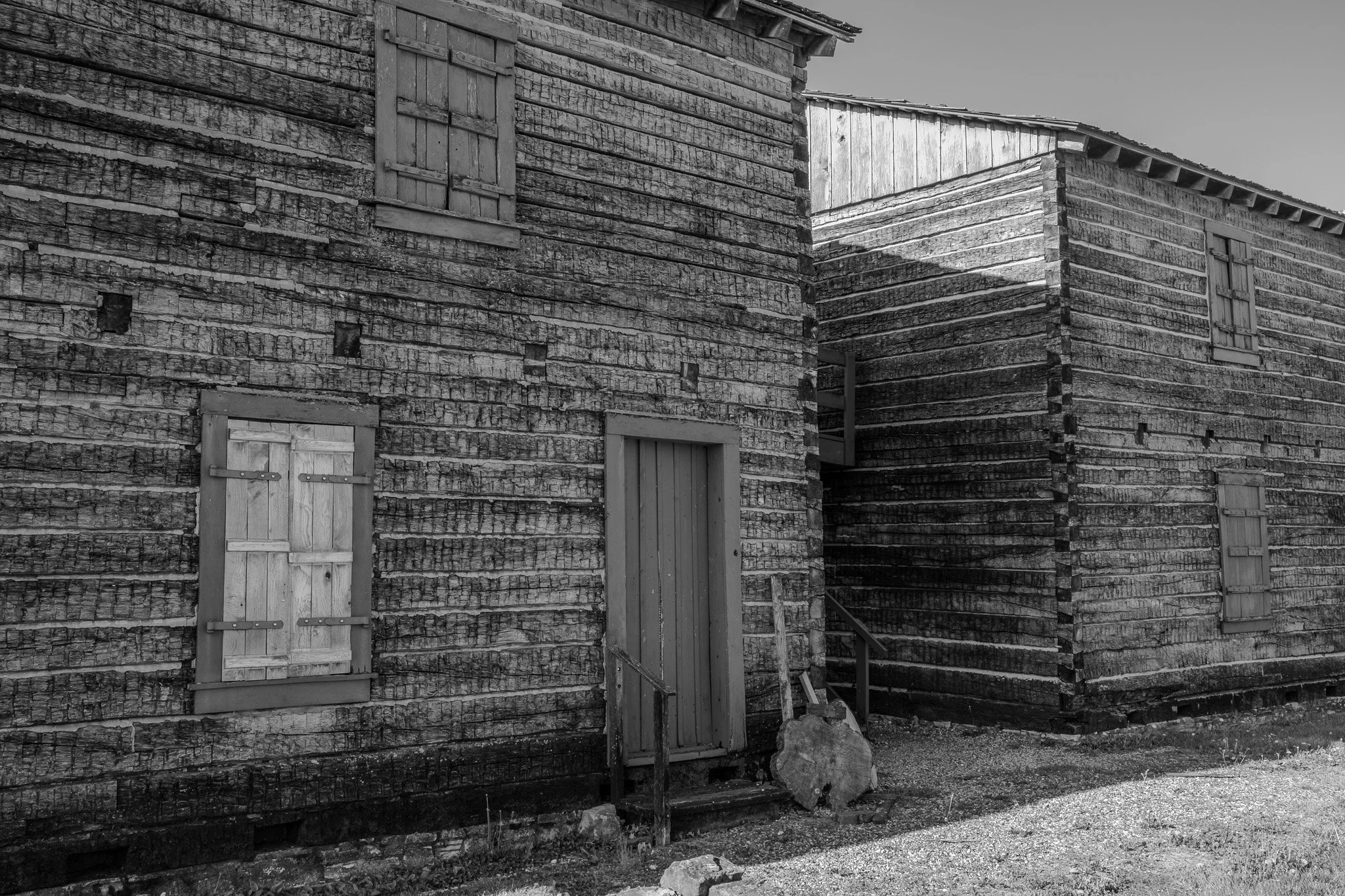
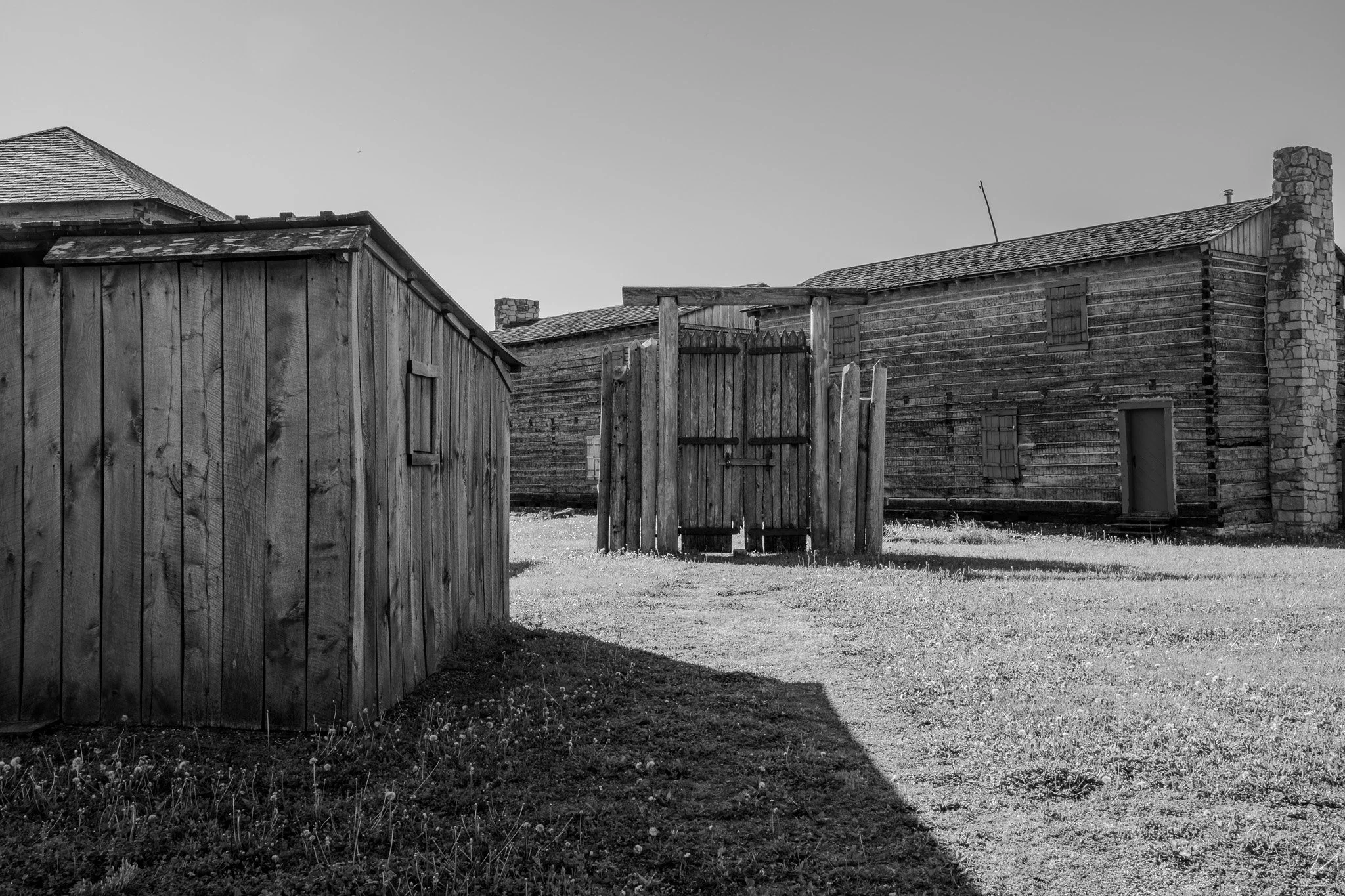
Our first stop today was in Fort Madison, Iowa. This series of images are of the Old Fort Madison buildings.
“Old Fort Madison is a historically reconstructed U.S. military fort located on the banks of the Mississippi River in Fort Madison, Iowa. It’s notable as the site of the first U.S. military fort in the Upper Mississippi region and played a role in the War of 1812.” - From Chat GPT.
[Click on Image for Map]
[Click on Image for Map]
[Click on Image for Map]
[Click on Image for Map]
[Click on Image for Map]
[Click on Image for Map]
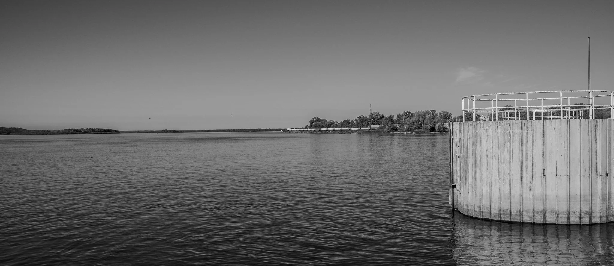
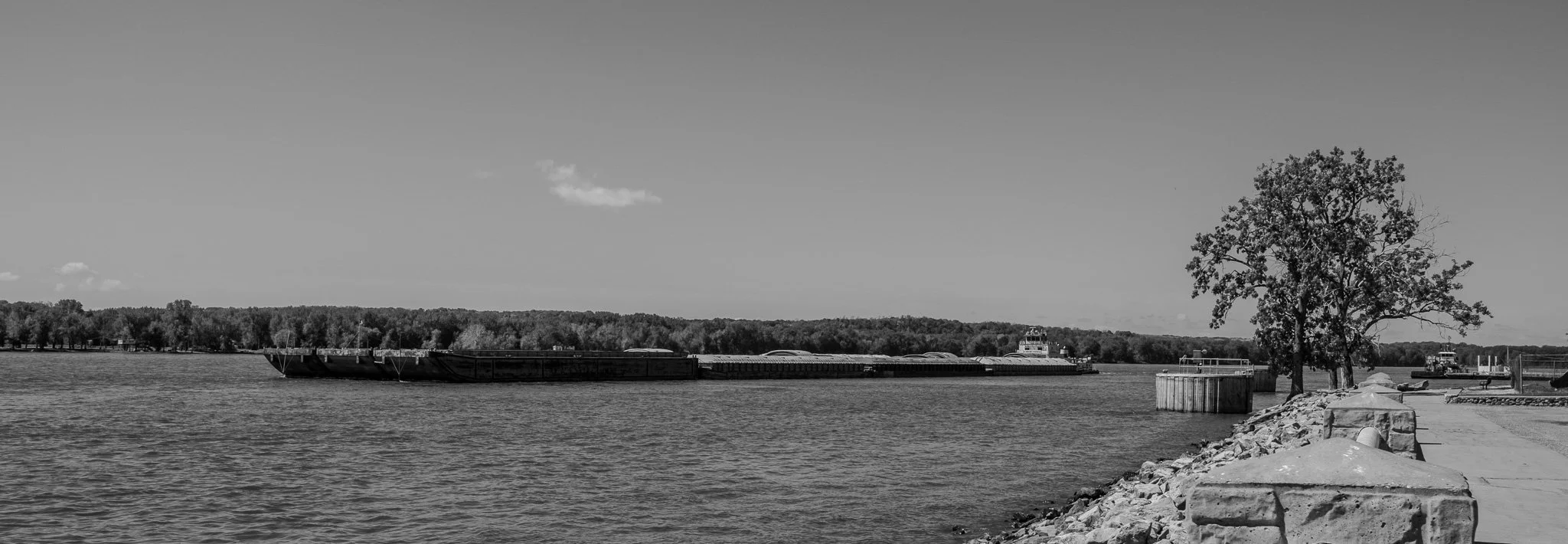
Looking down river from the pier at Fort Madison. The river is quite wide here and there was a great deal of barge traffic in both directions.
[Click on Image for Map]
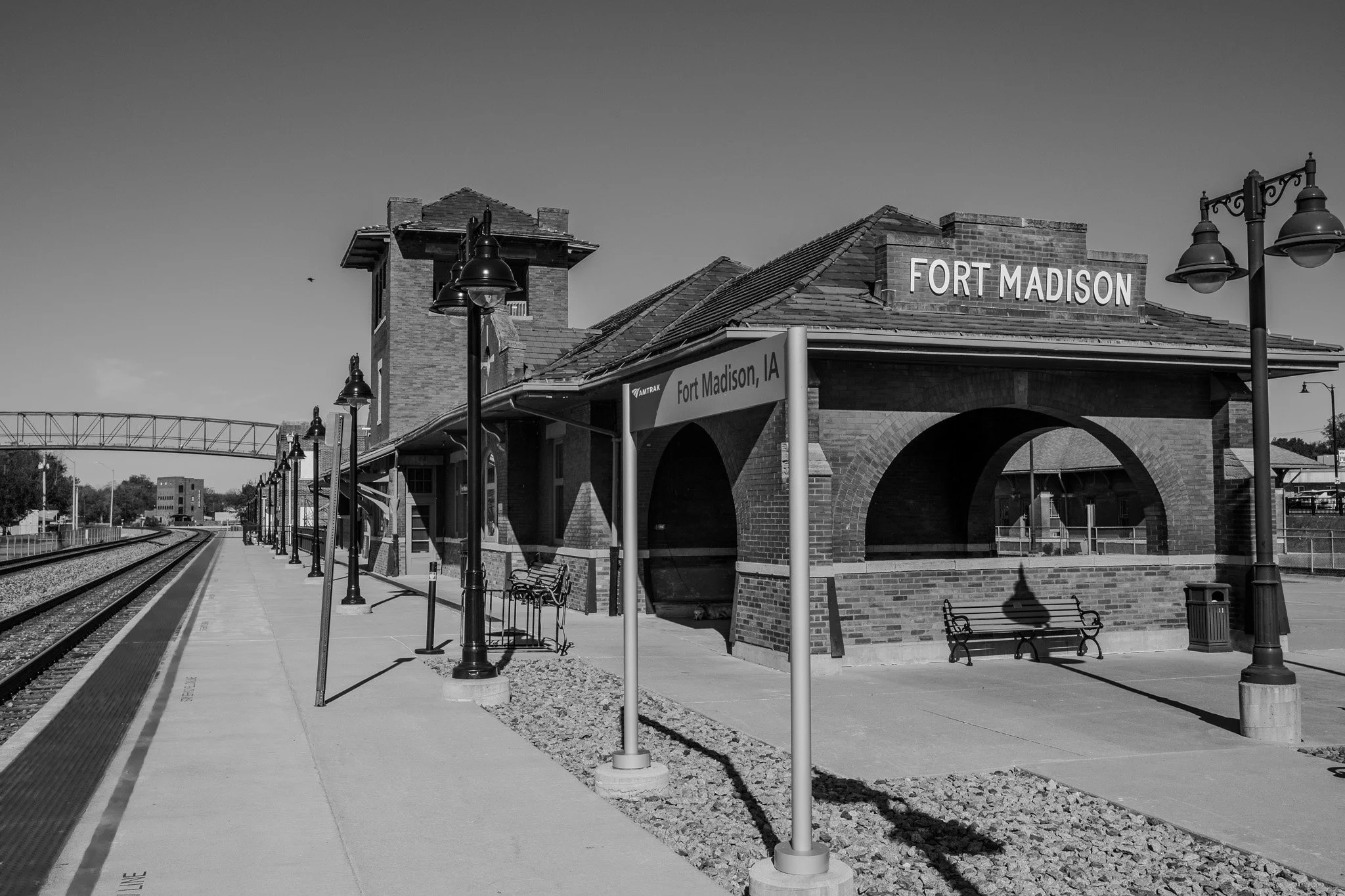
Fort Madison train depot.
[Click on Image for Map]
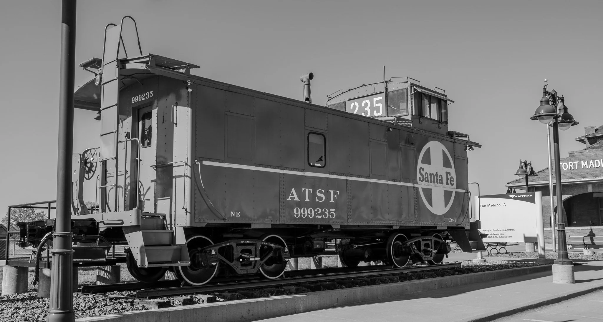
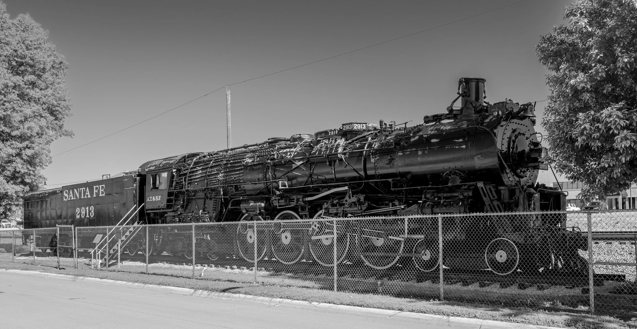
There are a few Santa Fe railroad cars on site to explore.
[Click on Image for Map]
[Click on Image for Map]
Like so many small towns in America today, Fort Madison’s downtown has quite a number of empty storefronts. One has to imagine the likes of WalMart & Amazon has had a negative effect on downtowns like these.
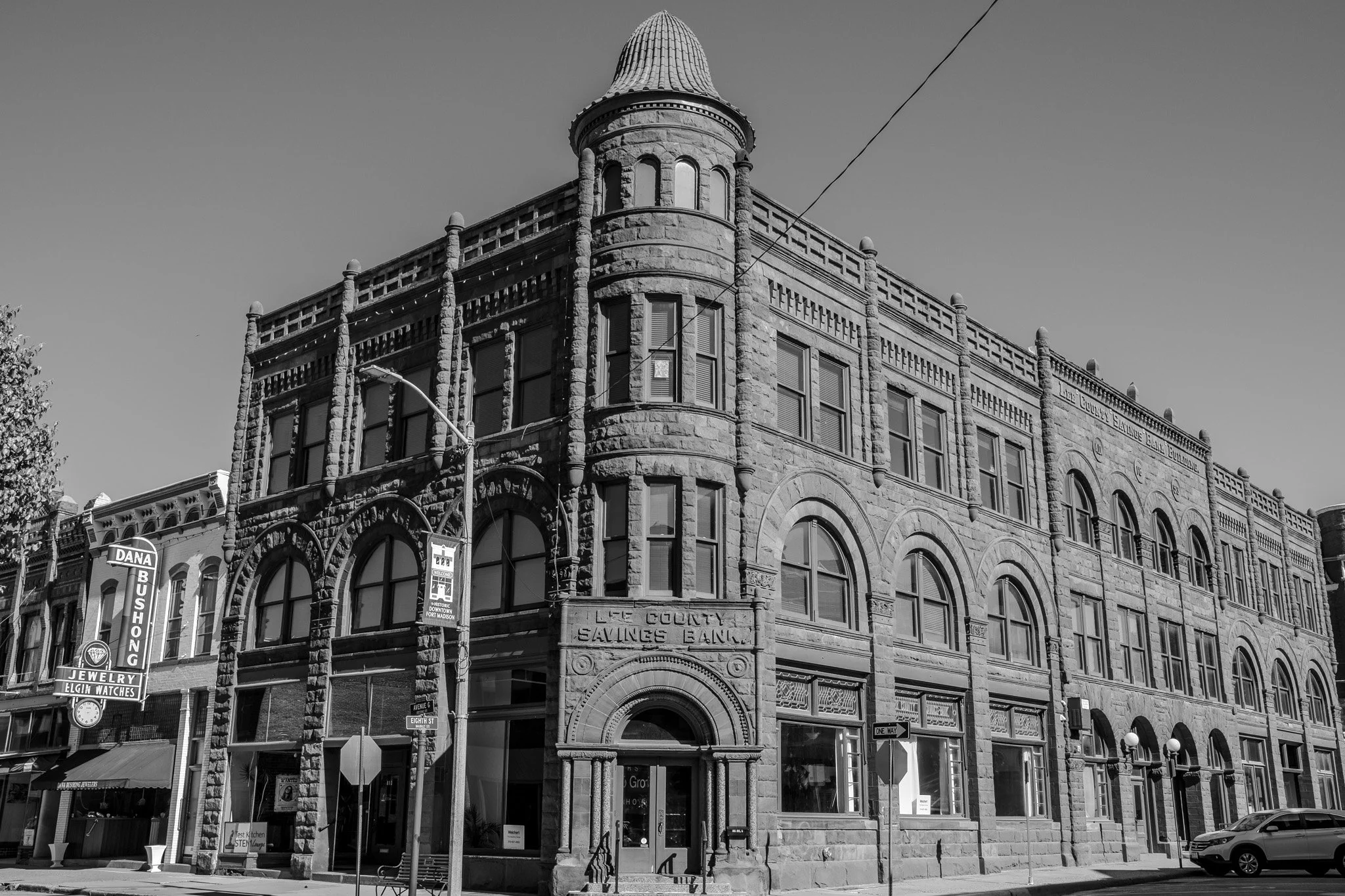
This old bank building is quite impressive. They don’t make structures like this anymore.
[Click on Image for Map]
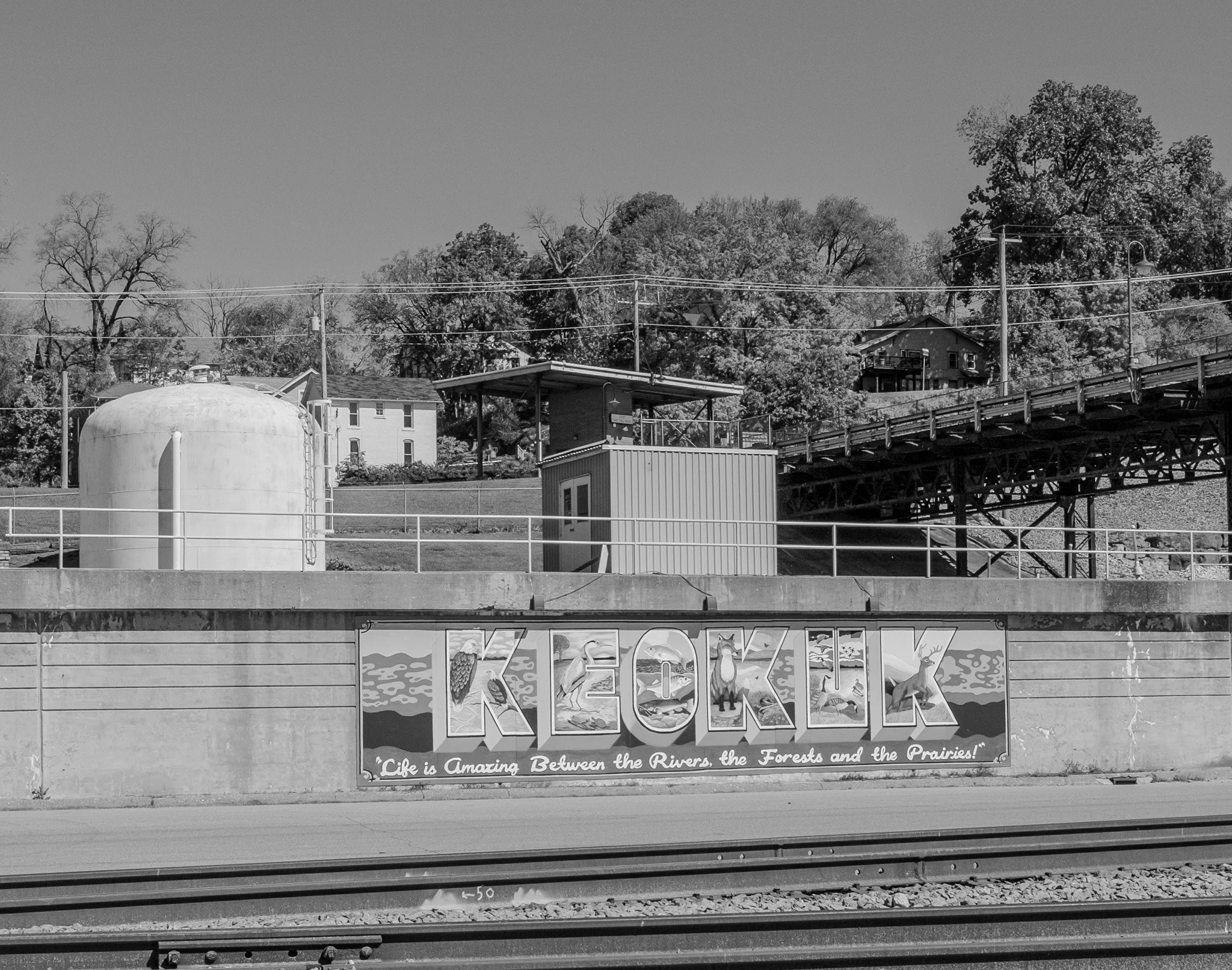
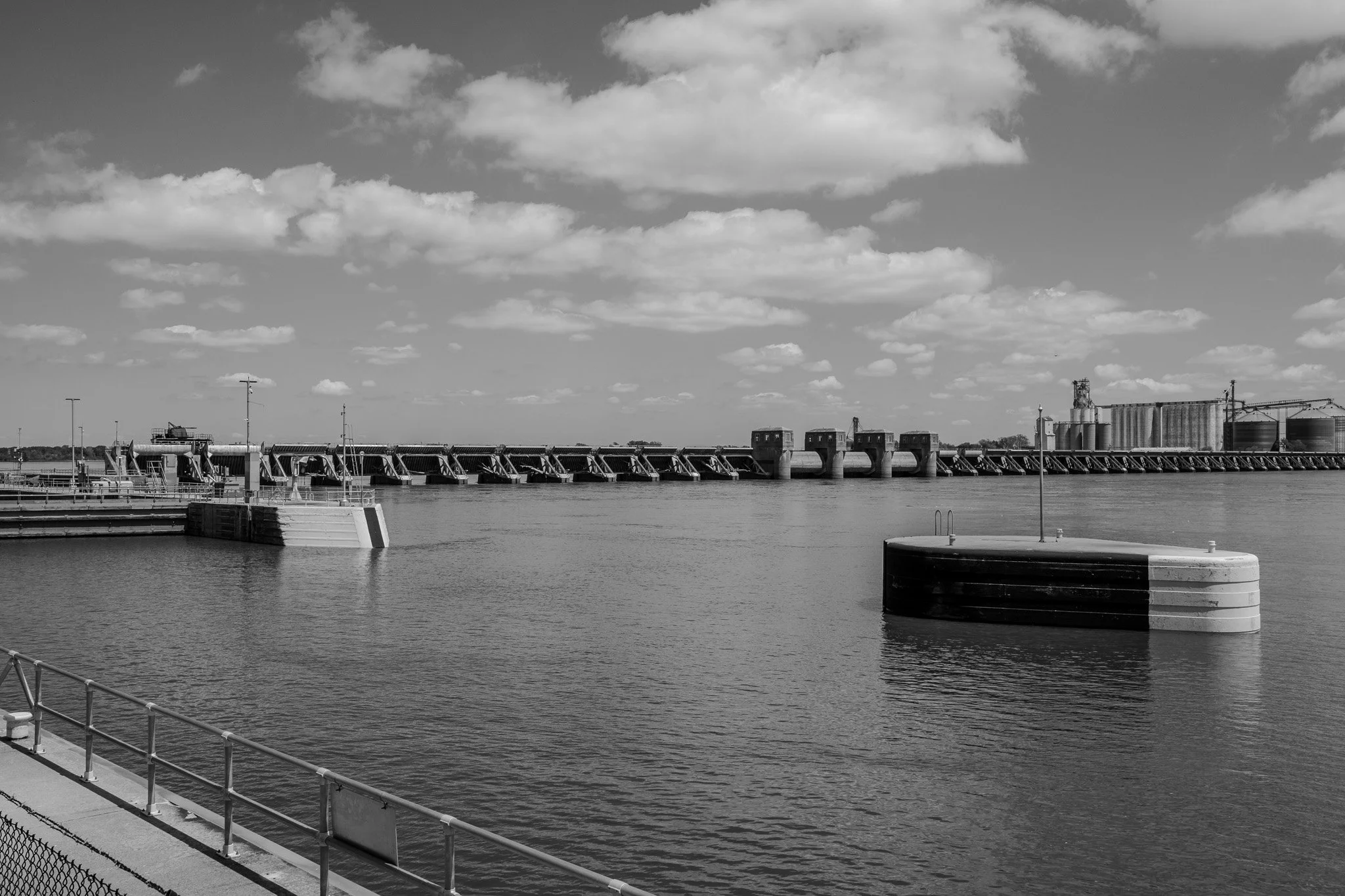
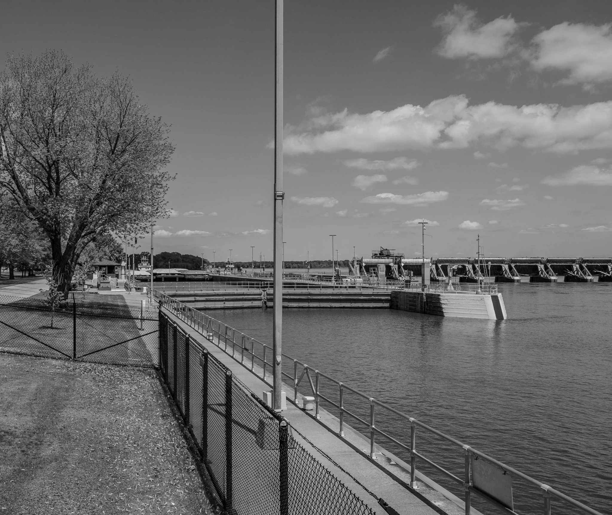
Our next stop was in Keokuk, Iowa. This was supposed to be a quick stop to check out the riverfront. We ended up spending a few hours here taking in Lock & Dam #19. More on that to come….
[Click on Image for Map]
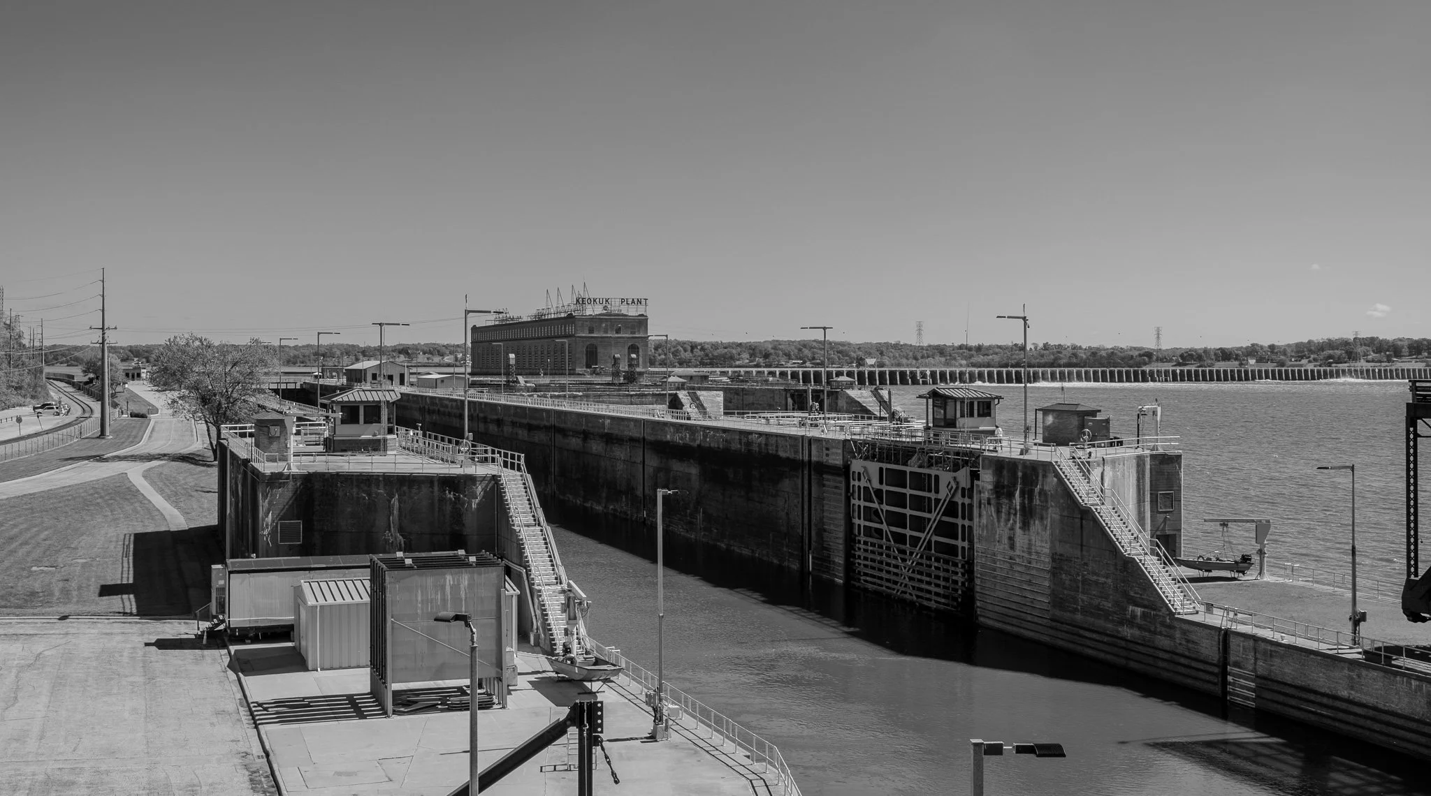
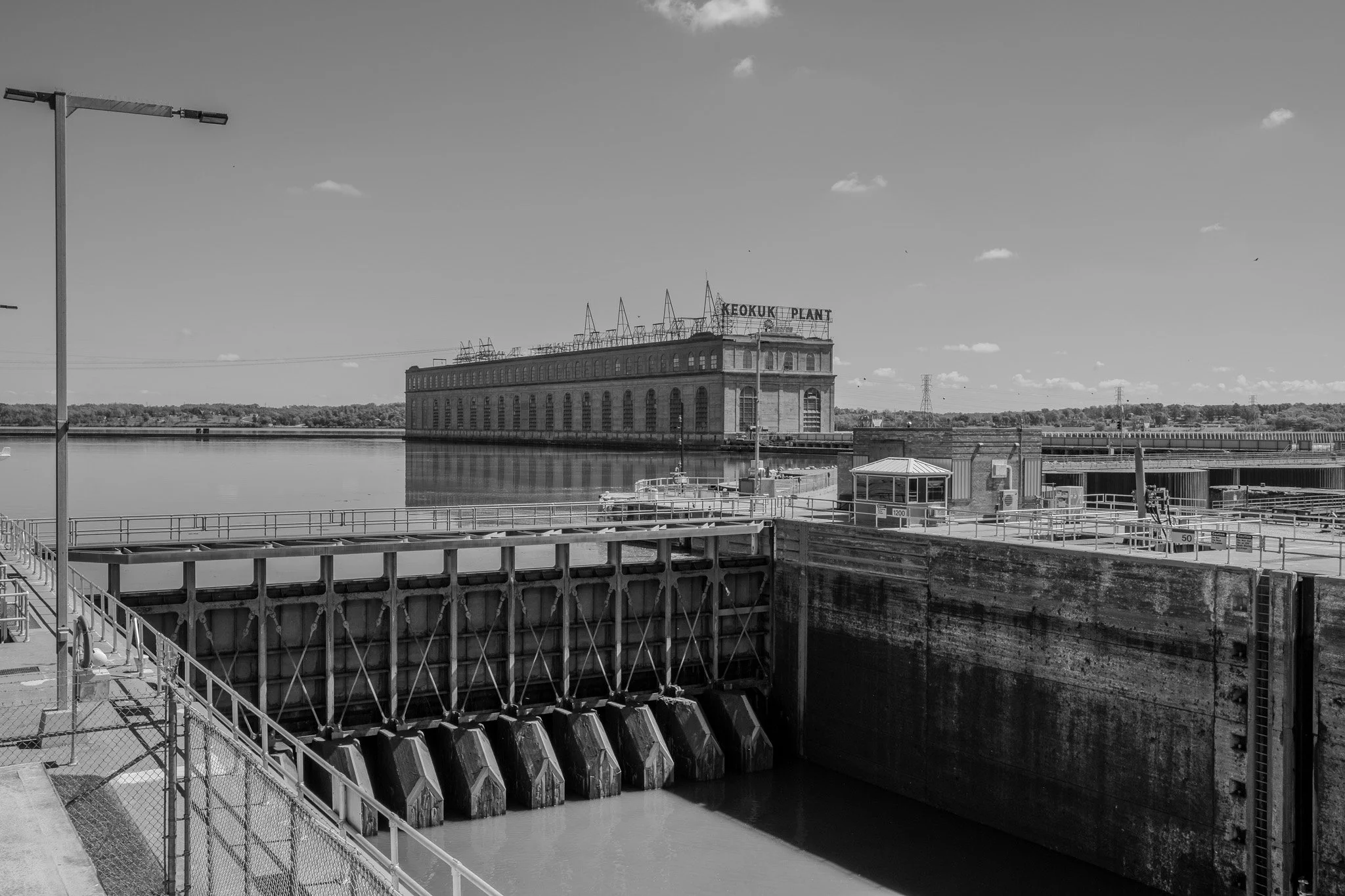
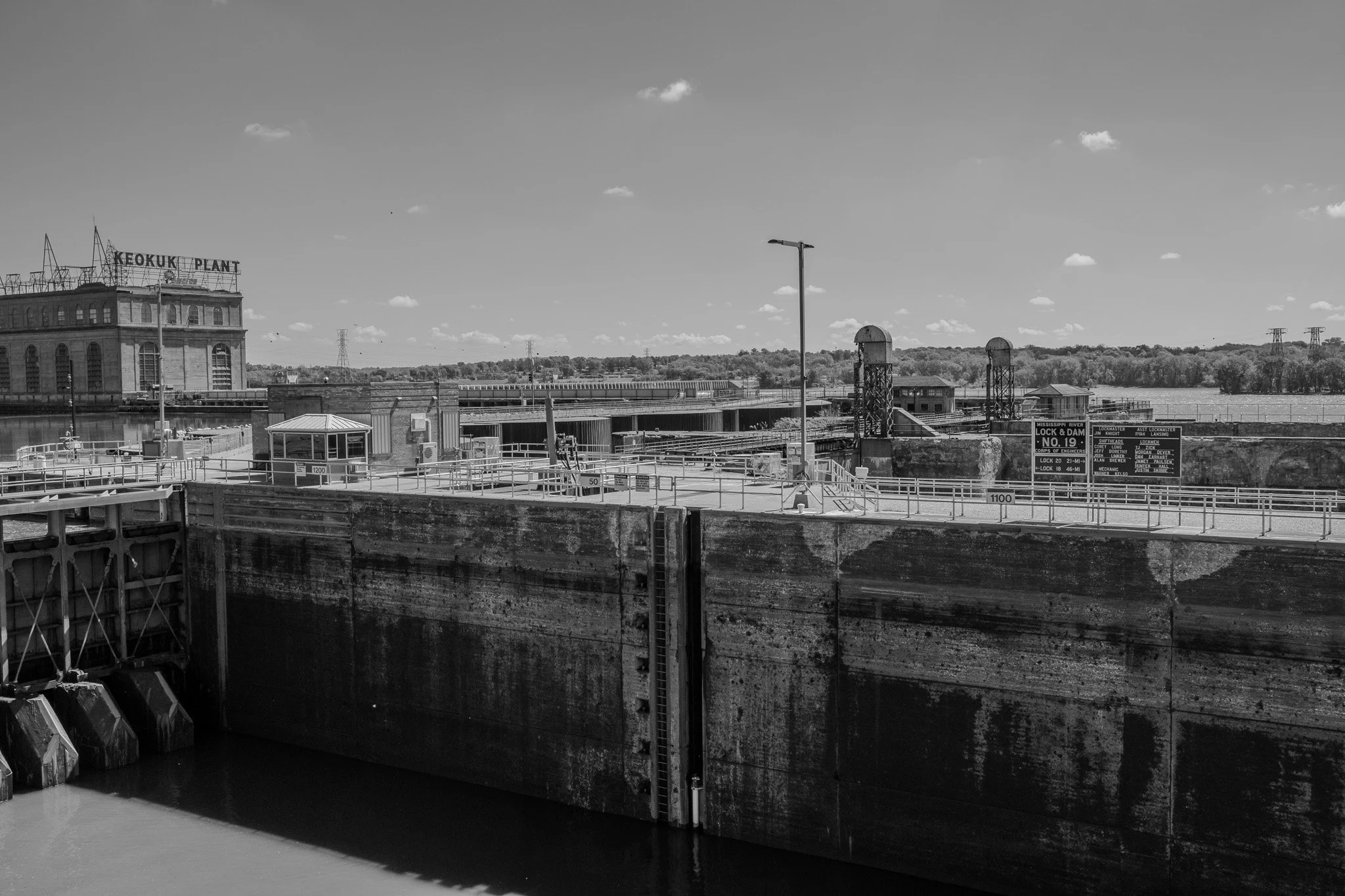
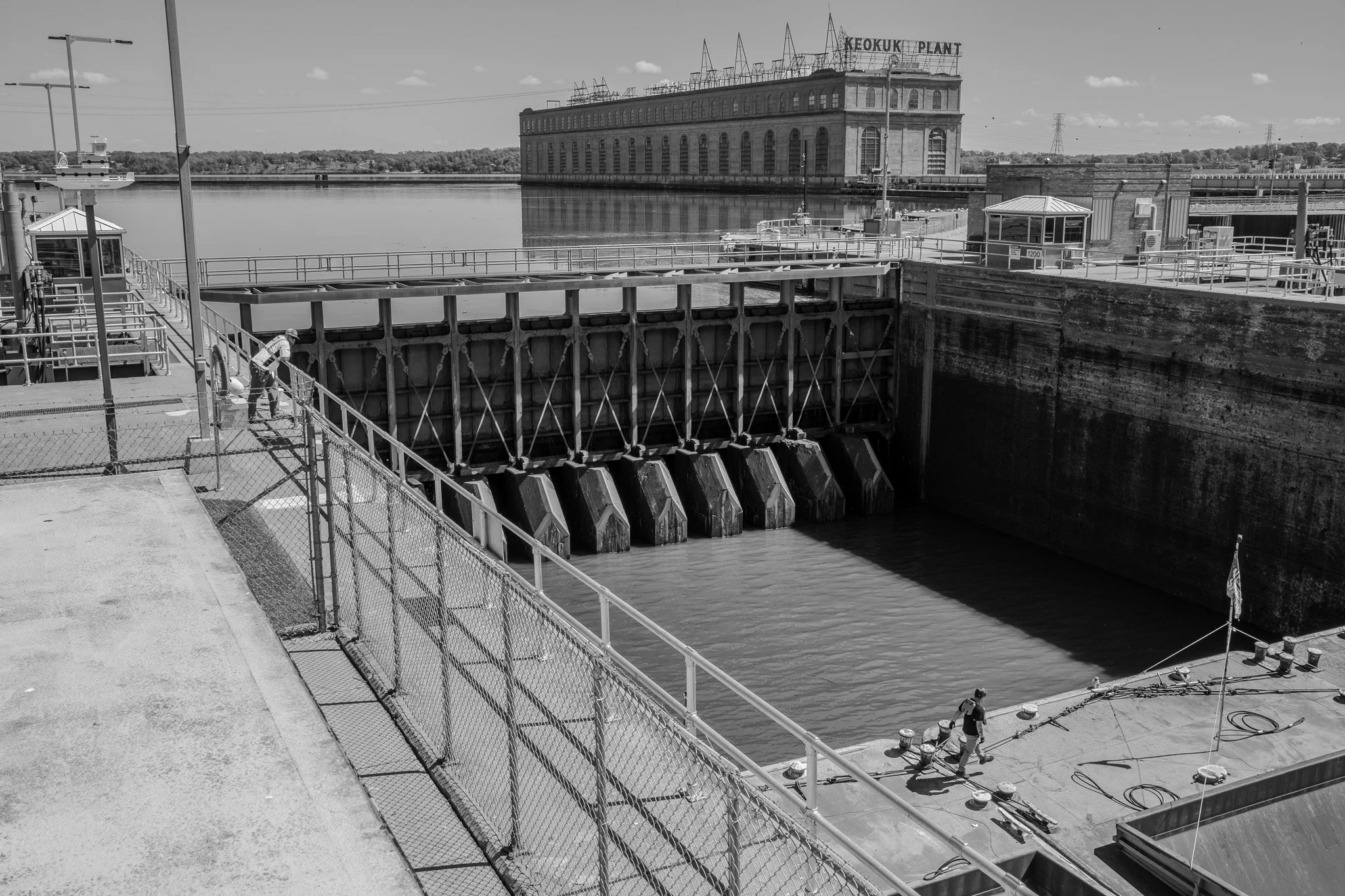
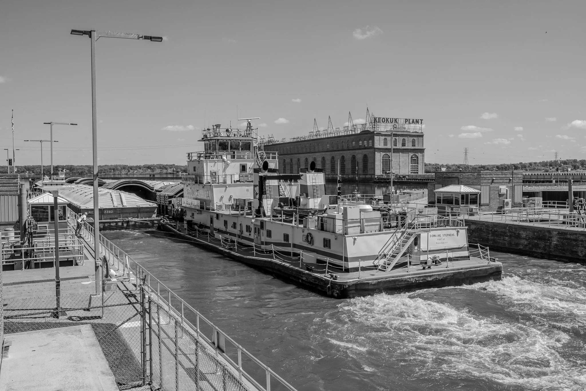
Keokuk has a pedestrian Bridge Observation Deck which allows you a nice elevated view into the locking chamber of Lock & Dam #19. The Keokuk hydroelectric plan is seen in the distance. The flow through this dam is quite impressive.
[Click on Image for Map]
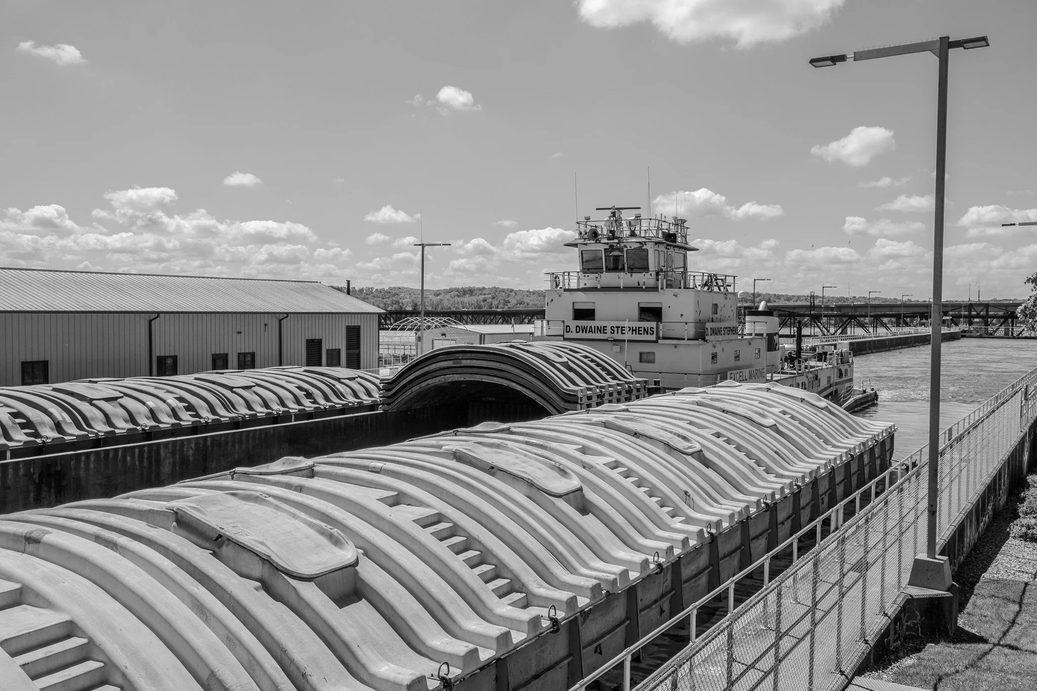
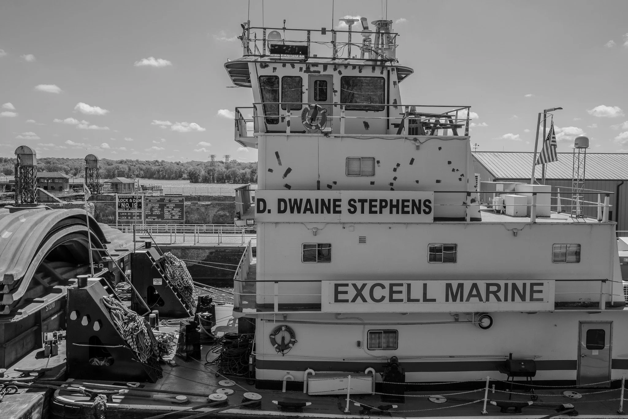
While walking the riverfront we noticed the D. Dwaine Stephens pushing north with twelve barges. Little did we know at the time, we would be seeing a great deal more of this tug.
[Click on Image for Map]
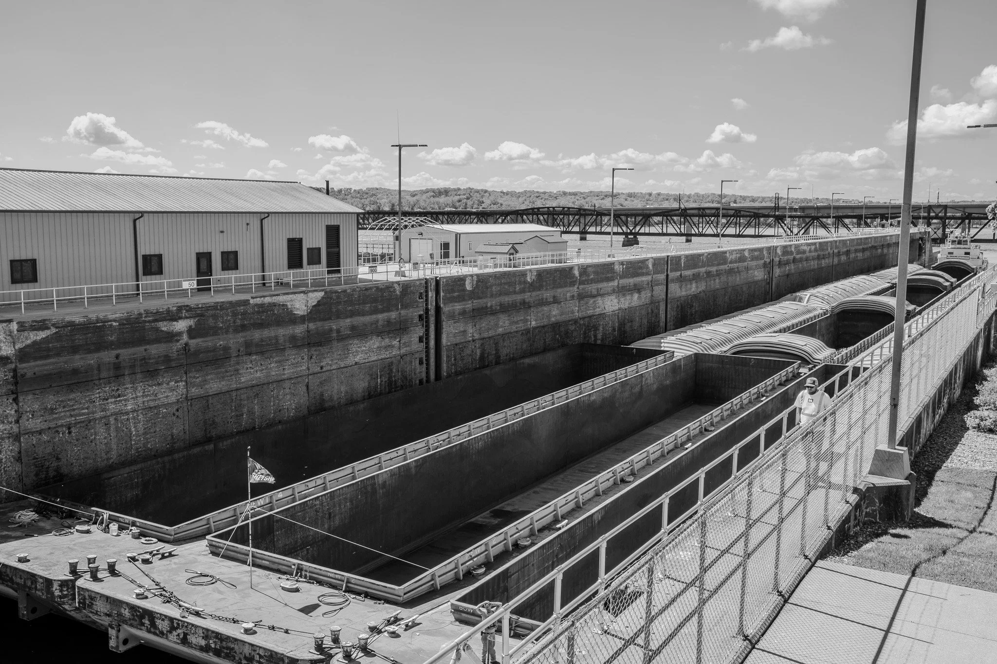
We made our way to the observation deck for Lock & Dam #19. What an impressive site! We are used to the locking chamber at locks 2 thru 9 where the vertical lift is probably 8-10 feet. This chamber was providing a lift of 35 feet today!! This is the largest vertical lift on the entire Mississippi River. This image gives a good perspective on what a 35 foot lift looks like from above. The closed north side gate actually drops vertically under water to allow the boats to enter/exit when the water in the chamber is raised.
[Click on Image for Map]
You can’t really appreciate it in this image, but the flow under the dam in the distance is amazingly powerful and turbulent. What a feat of engineering to build such a structure.
[Click on Image for Map]
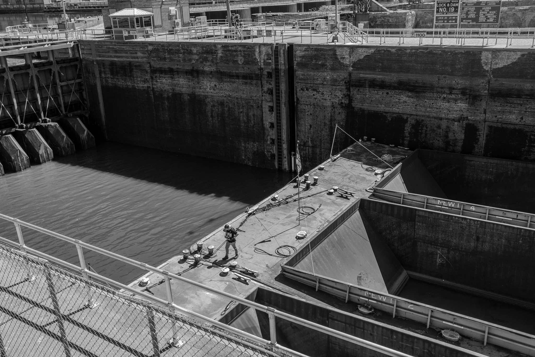
By this time the D. Dwaine Stephens was pushing into the locking chamber. Most of the barges were empty heading north. We can only speculate that they may be headed up river to pick up some of the grain harvested in our region.
Each barge is 200 feet long and the tug itself is just a little under that length. This chamber can accommodate a tug and a 3 X 5 barge configuration. This is much larger than the chambers up where we live; where this load would have to be broken into two sections in order to lock.
[Click on Image for Map]
The guys working on the barge prepare the lines to attach the barges to the locks.
[Click on Image for Map]
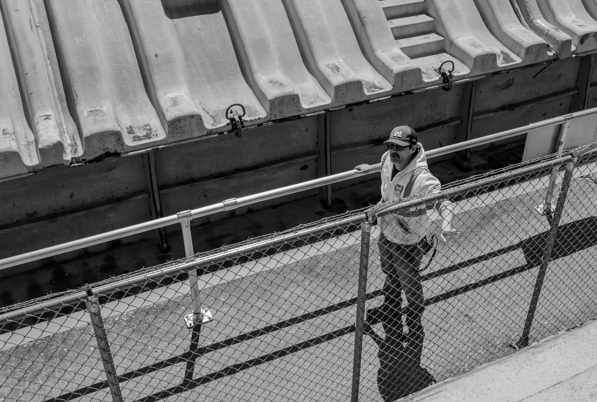
This is Lockman TJ Zick. These U.S. Army Corps of Engineer guys are generally great folks who love what they do and enjoy talking to visitors. But Lisa and I want to give a special shout-out to TJ for the time he took to tell us about Lock #19 and the surrounding area. What a fantastic guy and what a wealth of information he provided to us; thank you TJ!! Let us know when you make Lockmaster.
[Click on Image for Map]
Water level is up, north gates are open and pushing on….
[Click on Image for Map]
Passing directly in front of our observation deck.
[Click on Image for Map]
Exiting the locking chamber and headed north.
[Click on Image for Map]
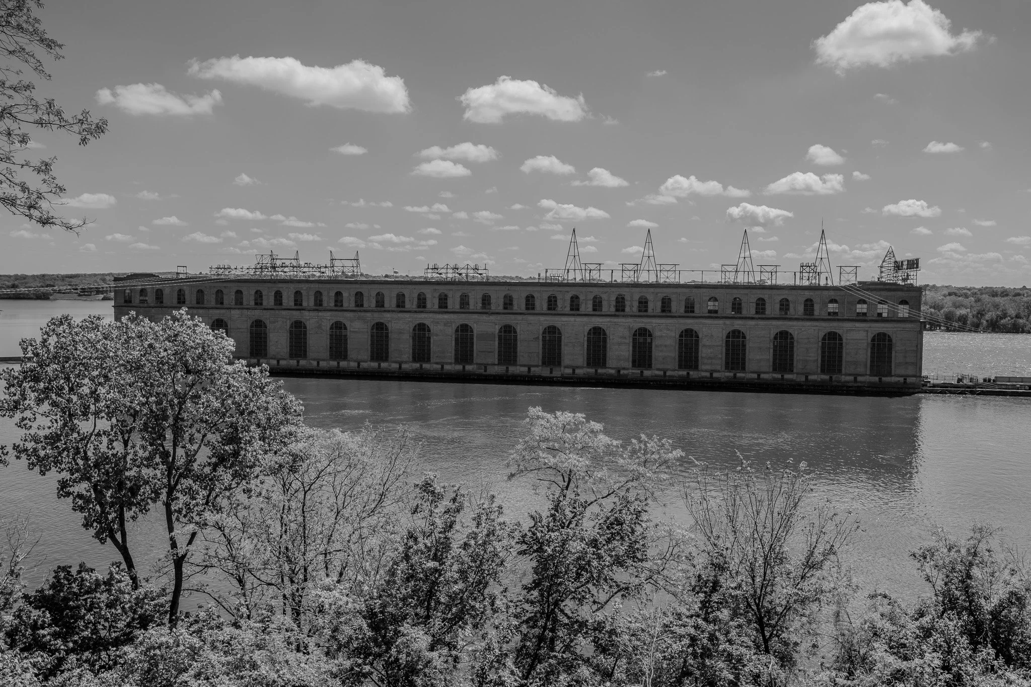
TJ Zick told us about this vantage point looking down upon the Keokuk power plant. He also told us a story of something that happened about a week before we were here. He says they were having a fishing tournament and a bunch of the fishermen’s boats were in this part of the water above the lock. A barge came up river and the fishing boats wouldn’t move out of his way - they had no radios to communicate with the Lockmaster. As a result, the tug captain had to try to maneuver around them and his barge and tug got caught in the current from the water going through the dam and it pulled the entire thing into the power plant building seen here. They had to use a helper tug to extricate him and get him back in the channel. TJ says the current by the shore here is minimal, but the closer you get to the power plant building it gets very powerful and in this case the barge and tug were forced to get too close. Fascinating stuff really!
[Click on Image for Map]
This is Lock & Dam #20 in Canton, Missouri. The grain elevator on the far side of the river is the westernmost point of Illinois.
As we were leaving Iowa and passing into Missouri on Highway 136 we noticed that immediately after passing into Missouri there were a series of tobacco/smoke shops right in a row on the Missouri side of the state line. Knowing absolutely nothing about smoking or tobacco we can only speculate that there must be some kind of favorable pricing/taxing of tobacco in Missouri compared to Iowa. At least three of the cars ahead of us and behind us leaving Iowa pulled into the tobacco shops. We elected to keep moving.
[Click on Image for Map]
You can just make out a barge and tug about to lock through #20 heading south. With the water running high in these parts, the vertical travel at this lock seems almost negligible.
For anyone growing weary of my fascination with the lock & dams, we plan to stop at #24 tomorrow and then it is on to St. Louis; you will be happy to know that there are no further locks south of St. Louis.
[Click on Image for Map]
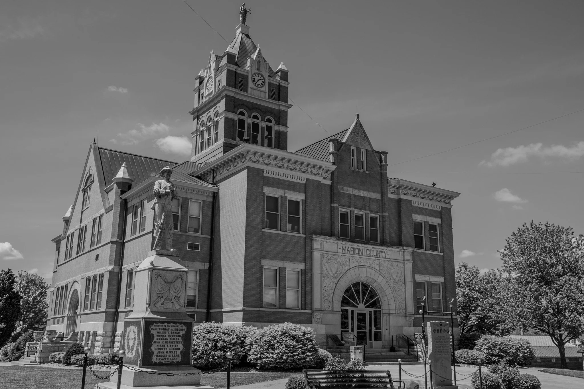
The Marion County building in Palmyra, Missouri. So many of the small towns in the midwest have these wonderful historic county buildings.
We grabbed a Subway sandwich from across the street and had a picnic lunch on a park bench here on the grounds of the beautiful Marion County building. It was in the upper 60’s, sunny sky and a slight breeze; making it just a wonderful day for a picnic lunch.
[Click on Image for Map]
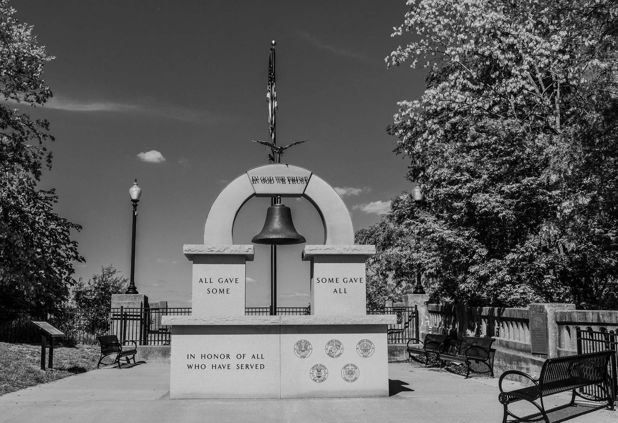
Our final stop for the day was Hannibal, Missouri for all things Mark Twain. This Veterans Memorial also has some fascinating information about the original bridge that connected Hannibal to East Hannibal on the Illinois side. It tells that the bridge was closed from about June to September of 1993 because the flood waters kept it covered. Additionally, it says that the Mayfly hatch was a problem for the old bridge with the Mayflies getting up to 2-inches thick on the bridge, making it very slippery and they used snowplows to remove them. Lisa was happy to miss that - she isn’t a fan of BUGS!!
[Click on Image for Map]
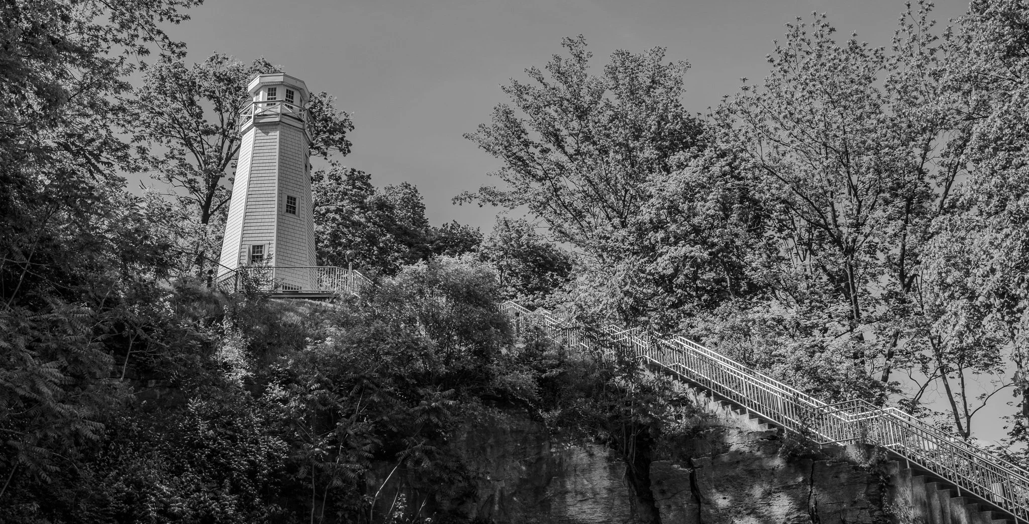
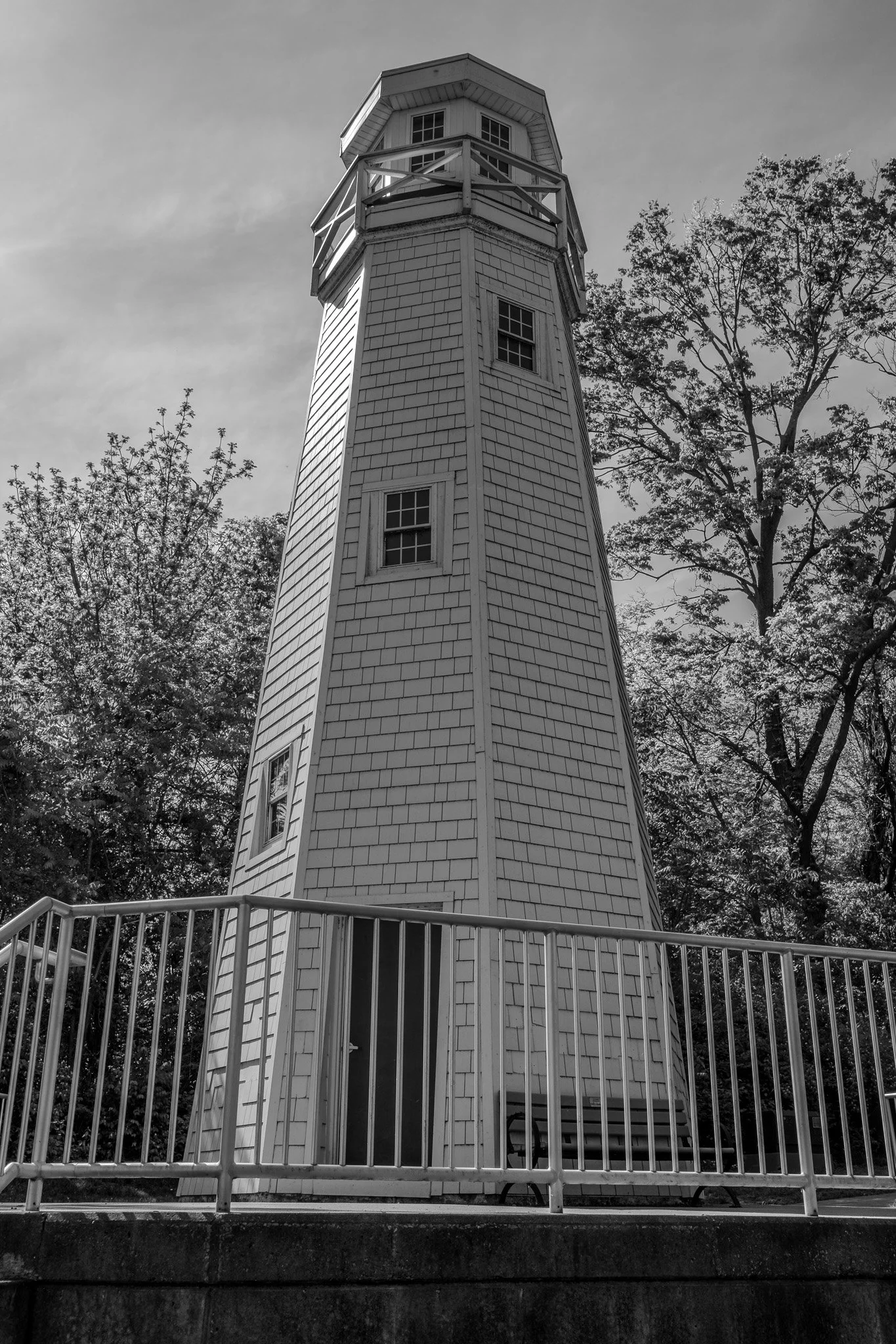
Mark Twain Memorial Lighthouse.
[Click on Image for Map]
[Click on Image for Map]
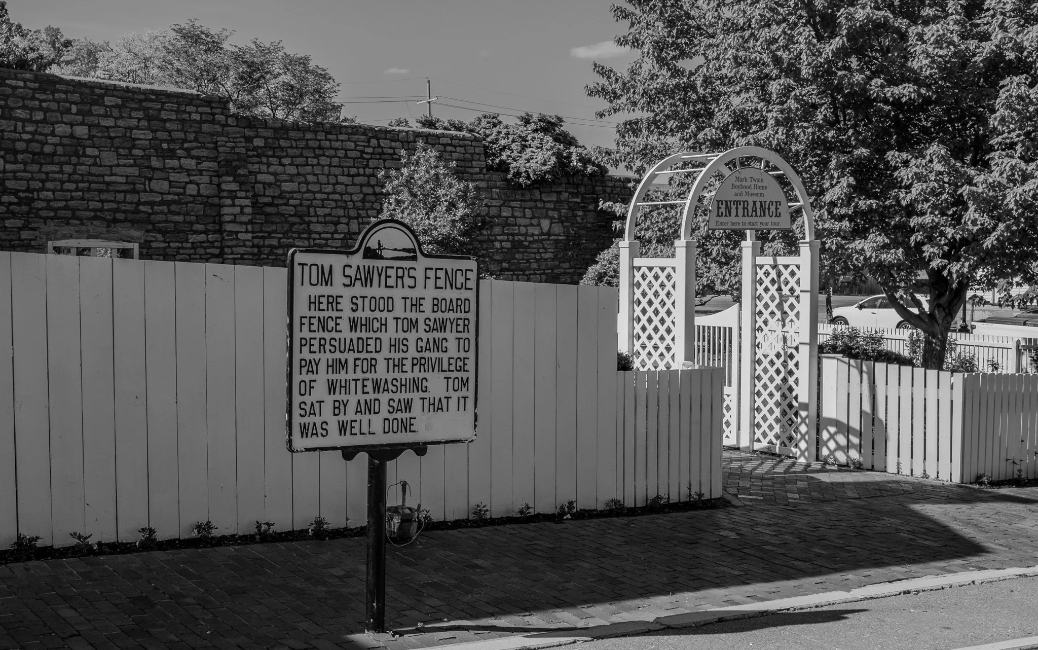
This pedestrian only street is entirely dedicated to Mark Twain (aka: Samuel Langhorne Clemens) and his classic novels “The Adventures of Tom Sawyer” (1876) and “Adventures of Huckleberry Finn” (1885).
[Click on Image for Map]
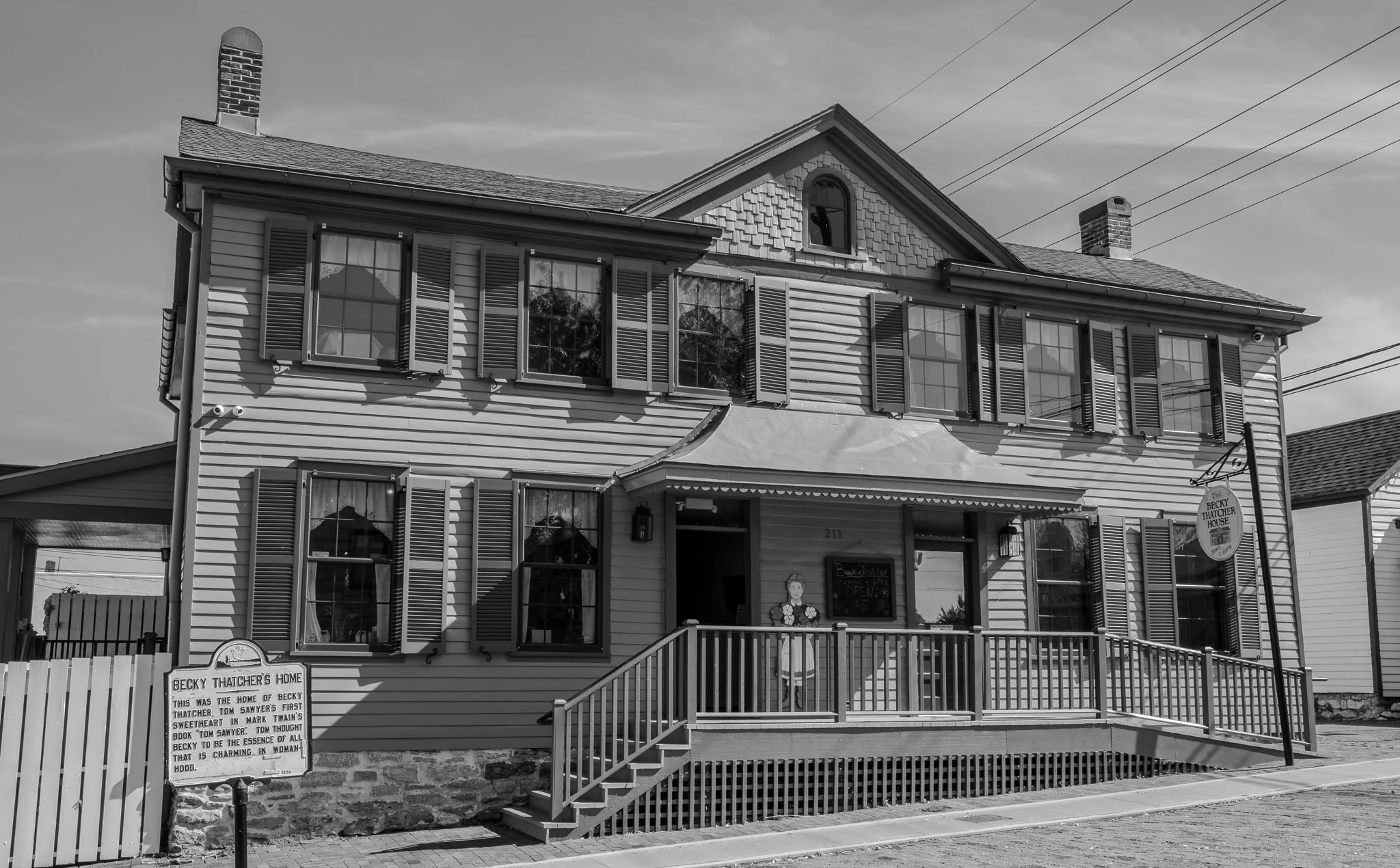
“Becky Thatcher House
The childhood home of Laura Hawkins, the real-life inspiration for Becky Thatcher in Mark Twain’s The Adventures of Tom Sawyer.
Built circa 1839.”
The Plaque reads: “Becky Thatcher’s Home. This was the home of Becky Thatcher, Tom Sawyer’s first sweetheart in Mark Twain’s book ‘Tom Sawyer’. Tom thought Becky to be the essence of all that is charming in womanhood.”
[Click on Image for Map]
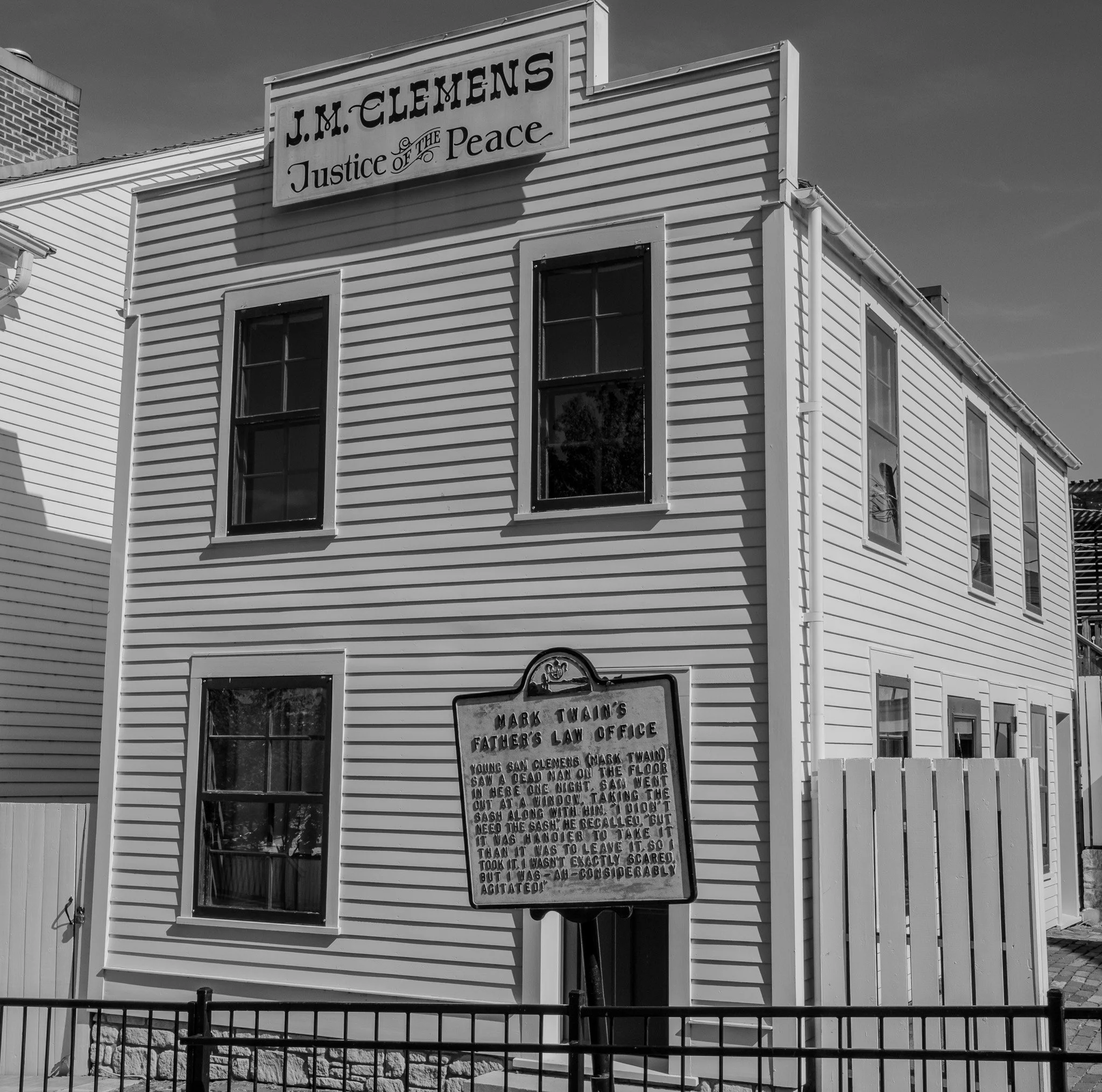
Mark Twain’s Father’s Law Office.
[Click on Image for Map]
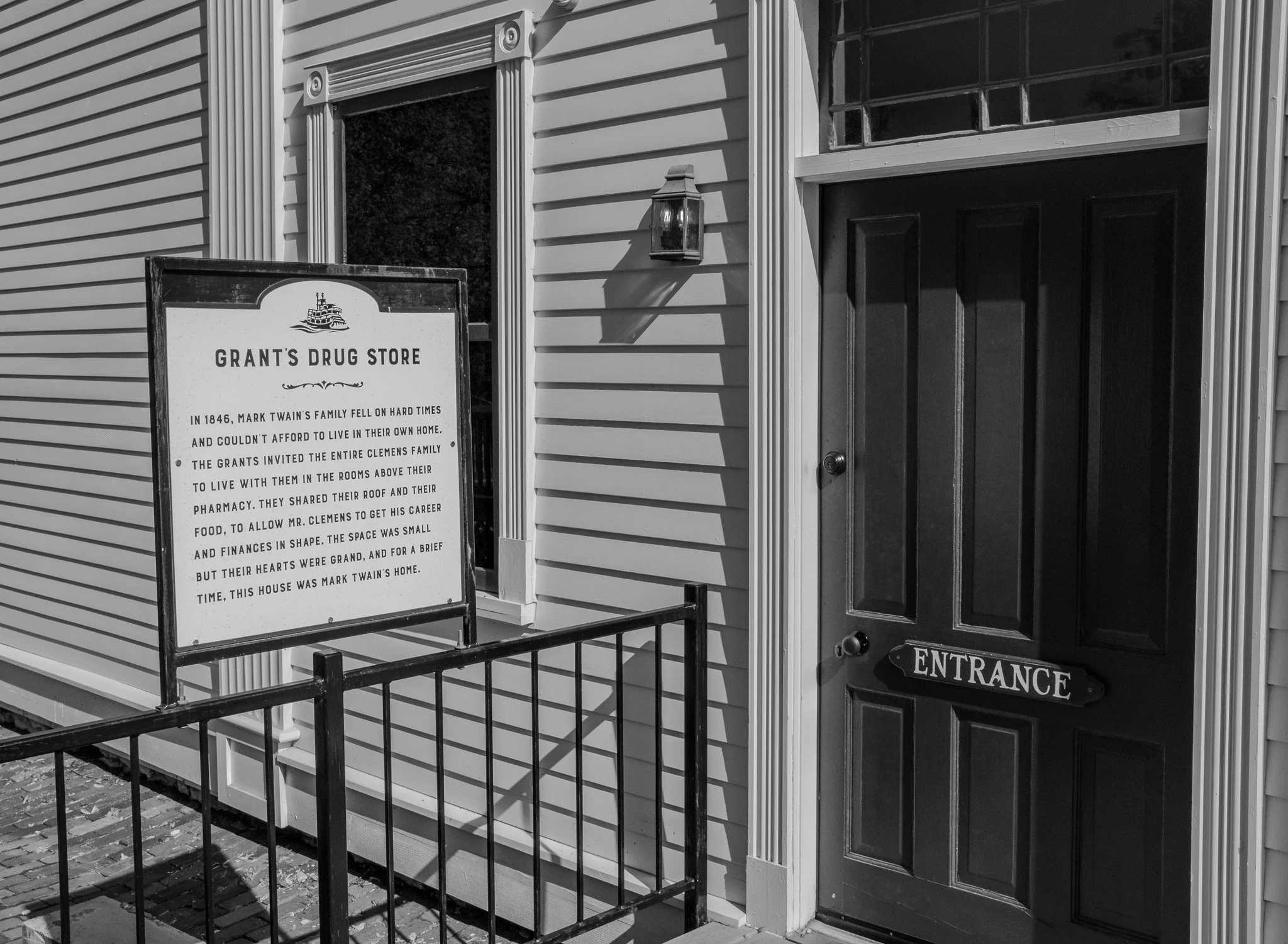
Grant’s Drug Store.
The plaque reads: “Grant’s Drug Store. In 1846, Mark Twain’s family fell on hard times and couldn’t afford to live in their own home. The Grants invited the entire Clemens family to live with them in the rooms above their pharmacy. They shared their roof and their food, to allow Mr. Clemens to get his career and finances in shape. The space was small but their hearts were grand, and for a brief time, this house was Mark Twain’s home.”
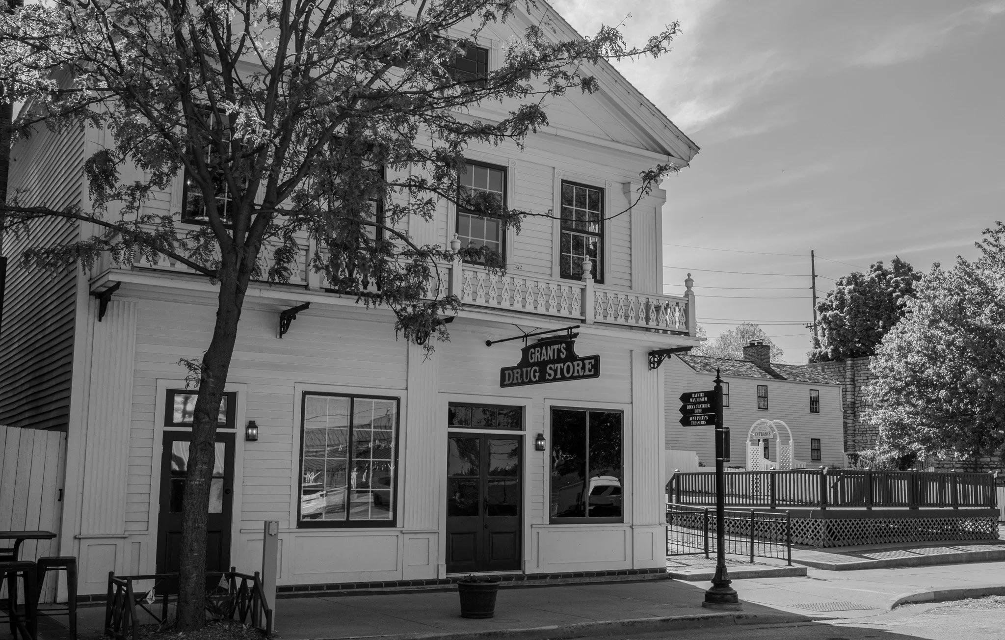
The front of Grant’s Drug Store from Main Street.
[Click on Image for Map]
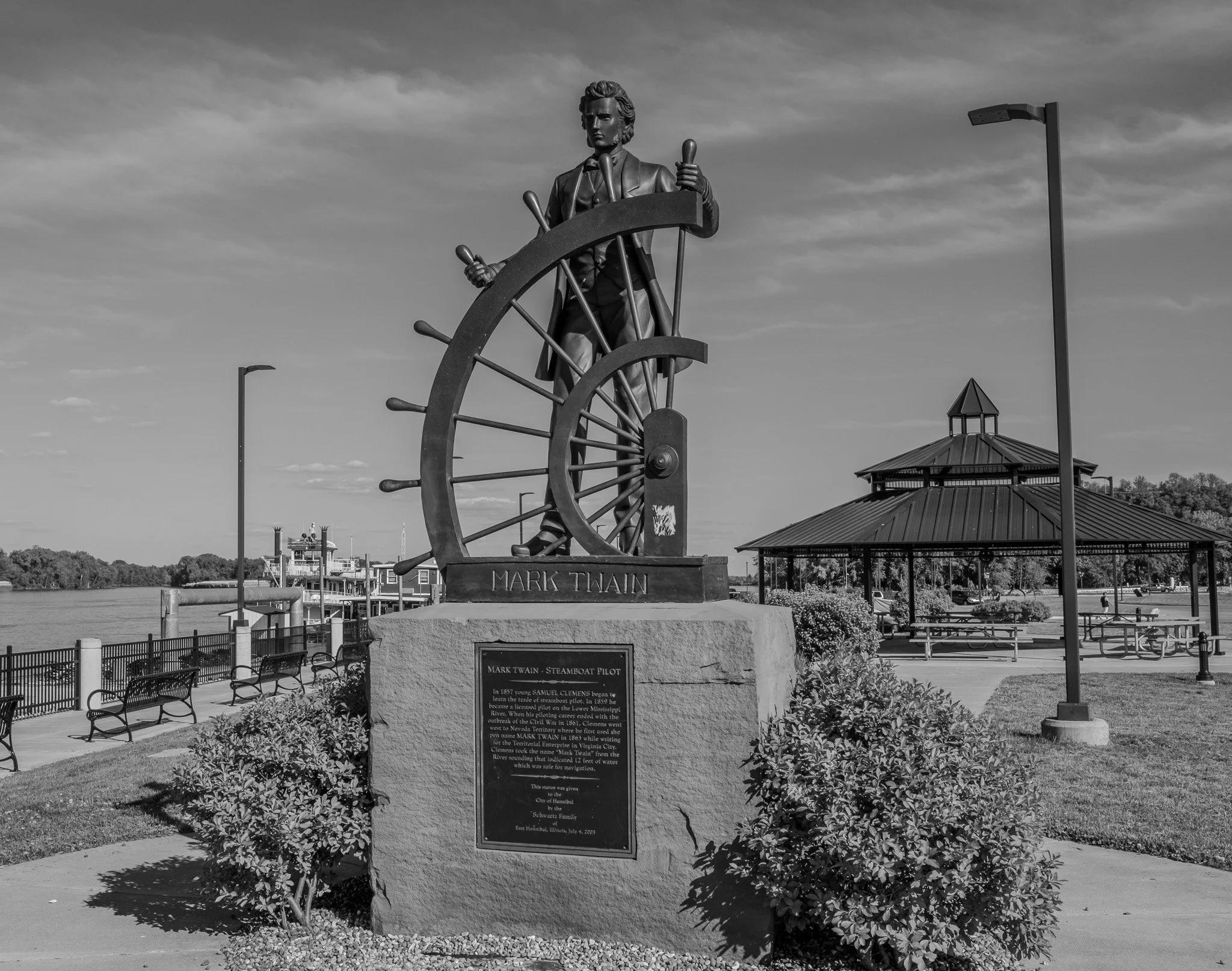
Twain worked as a steamboat pilot on the Mississippi River before the Civil War, which deeply influenced his writing.
The steamboat Mark Twain is seen in the background.
[Click on Image for Map]