Great River Road Trip, Day #14
Saturday, May 17, 2025
Today started with a visit to Columbus-Belmont State Park in Columbus, Kentucky.
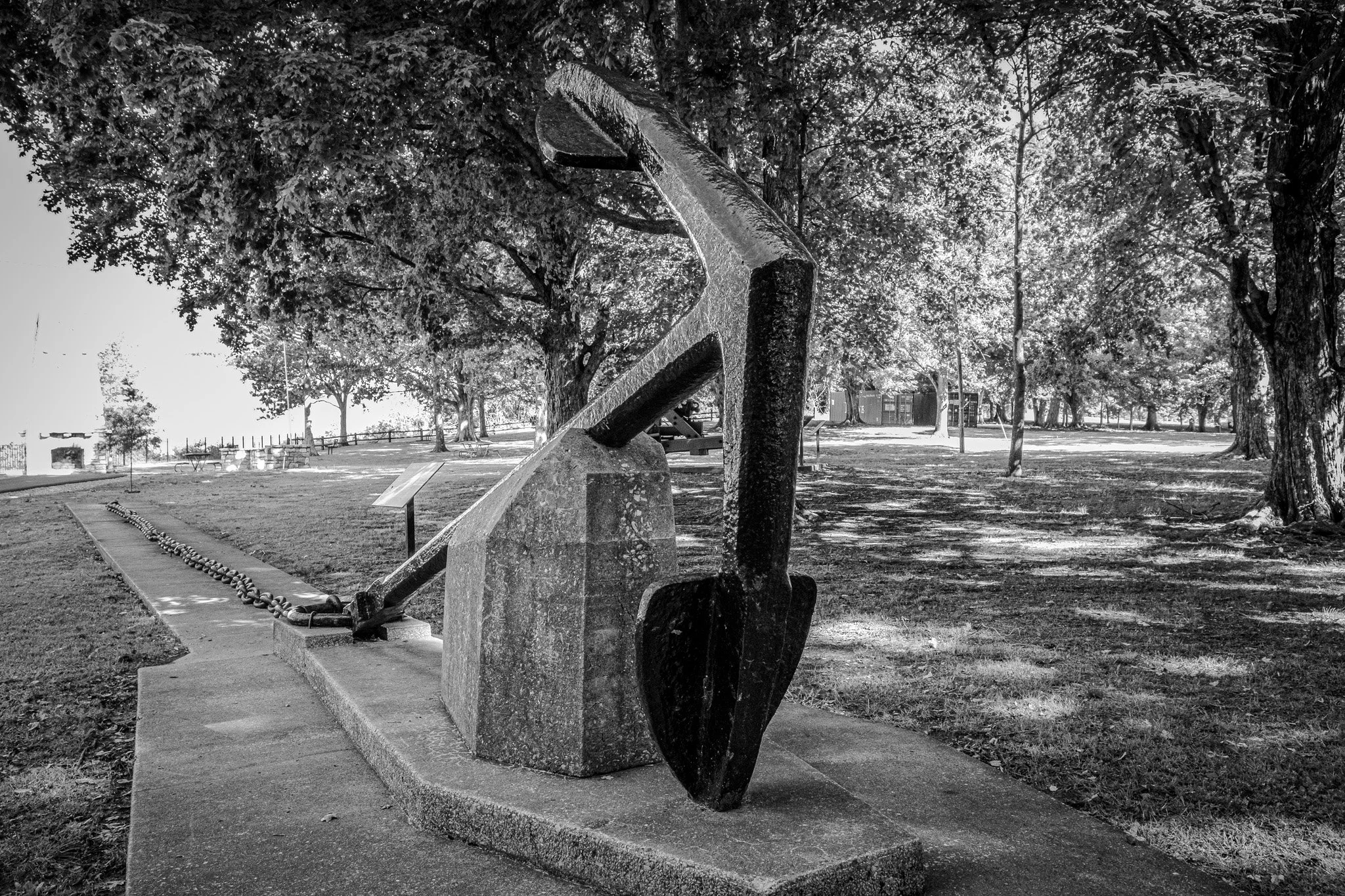
Confederate General Leonidas Polk stretched this mile-long chain across the Mississippi River from Fort DeRussy, on the Iron Banks Bluff north of Columbus, to a capstan on the Belmont, Missouri shore. Polk hoped that any Union ships coming down the river would be stopped by the chain long enough for cannon fire to sink them. When the Union captured the fort in Columbus in March 1862 they removed the chain. The chain was lost to history until 1925 when a landslide exposed a part of the chain. Following the chain they discovered the anchor you see here buried 11 feet deep and held in place by large timber logs. The anchor measures 15 feet 9 ½ inches long and the flukes are 9 feet from tip-to-tip. It is thought to weigh between 2-6 tons.
[Click on Image for Map]

Each link of this chain weighs 20 pounds 5 ounces.
[Click on Image for Map]

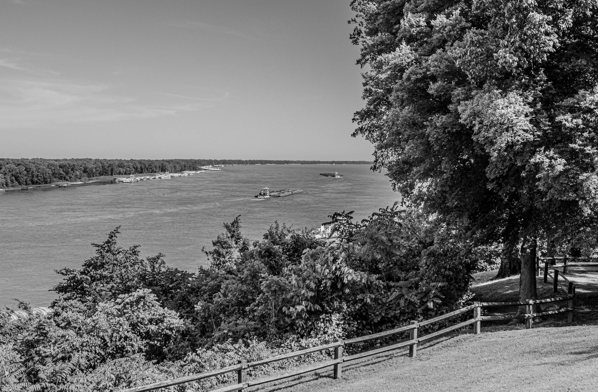
This is the view looking down river from the park. This tug is pushing north with a load of barges 4 X 5 for a total of 20 barges. These are numbers just not heard of up in Minnesota.
[Click on Image for Map]

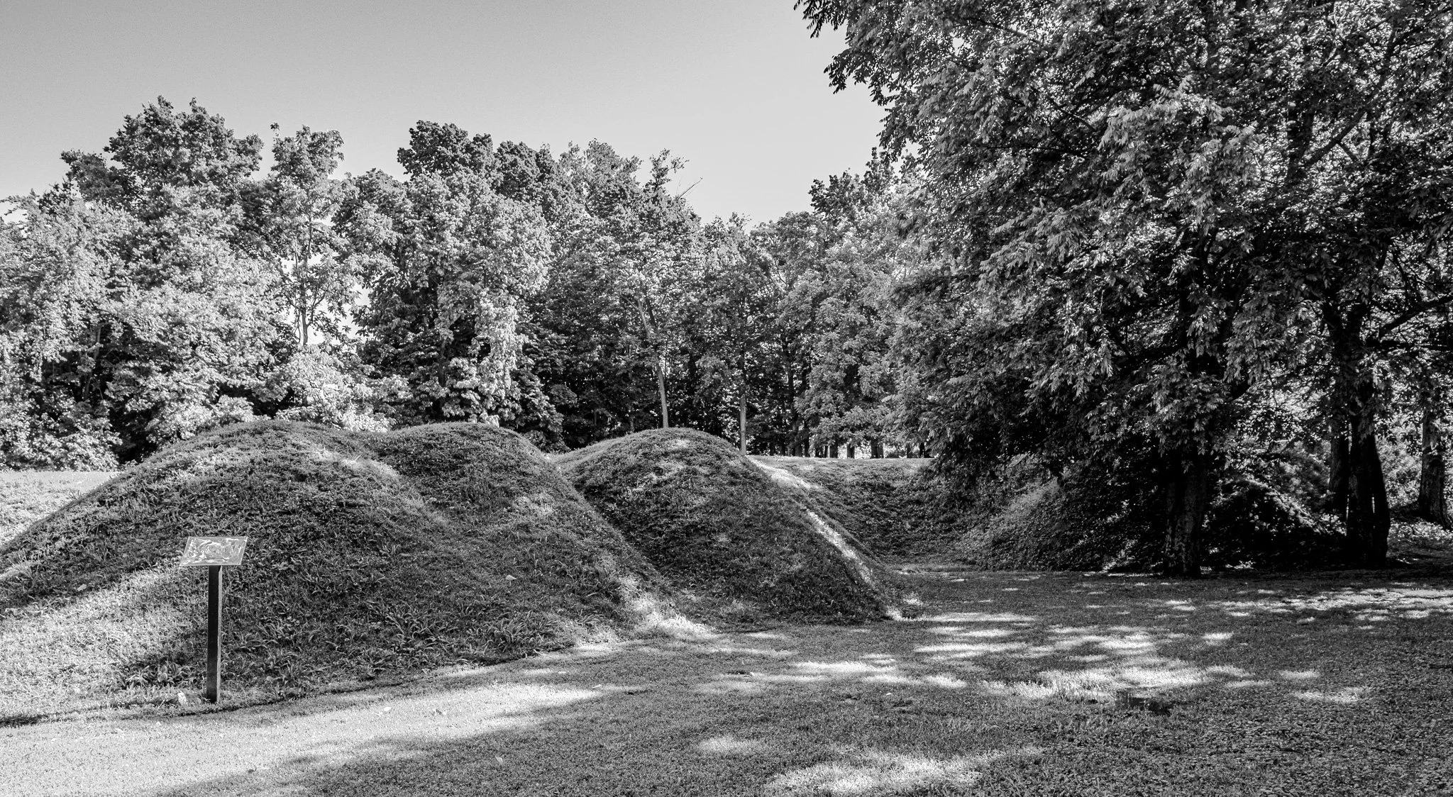
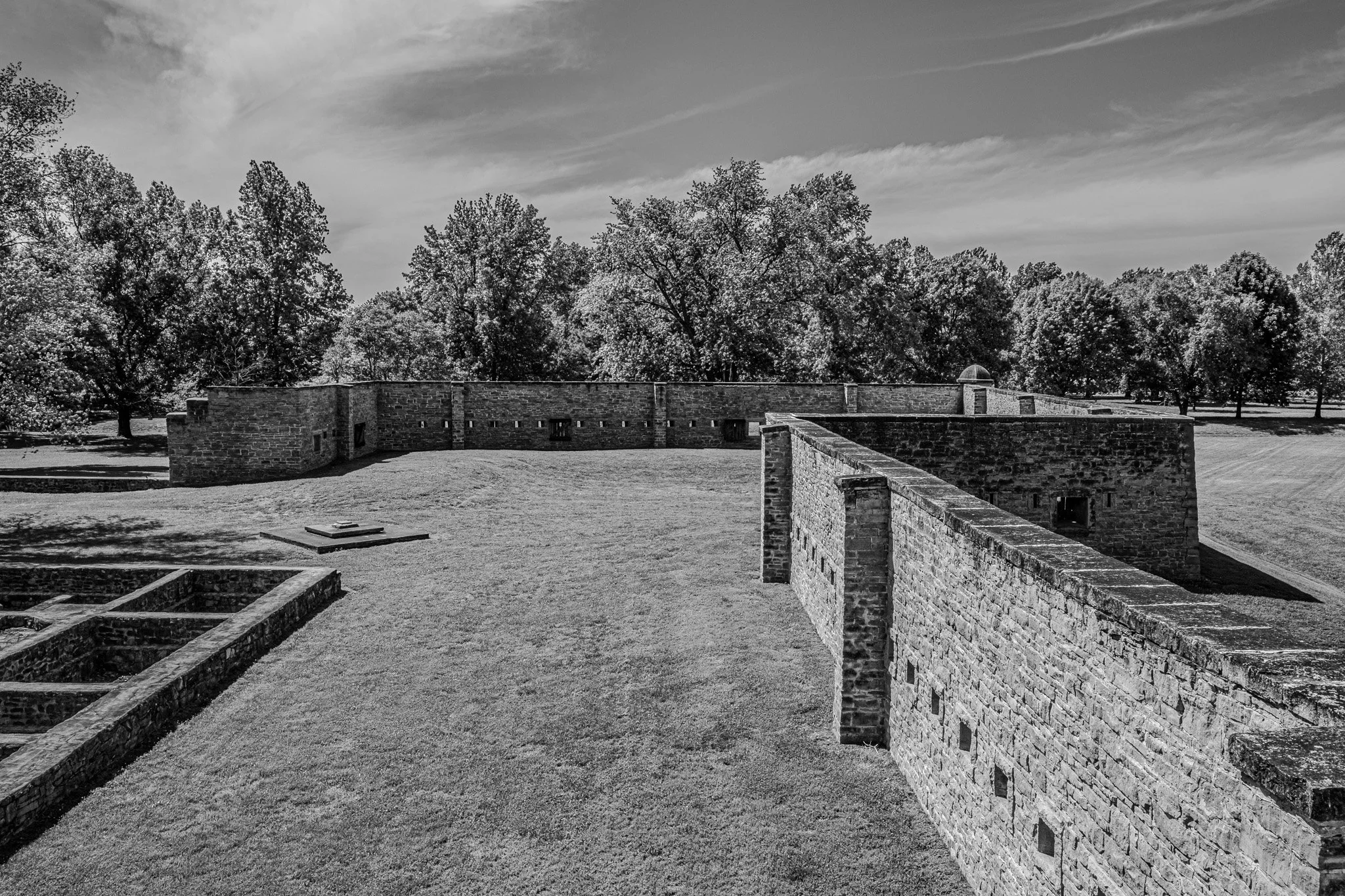
These earthworks were made during the Civil War. It really is amazing to stand here among them and imagine what went on here in this very spot. The next few images are other vantage points of these historic earthworks.
[Click on Image for Map]
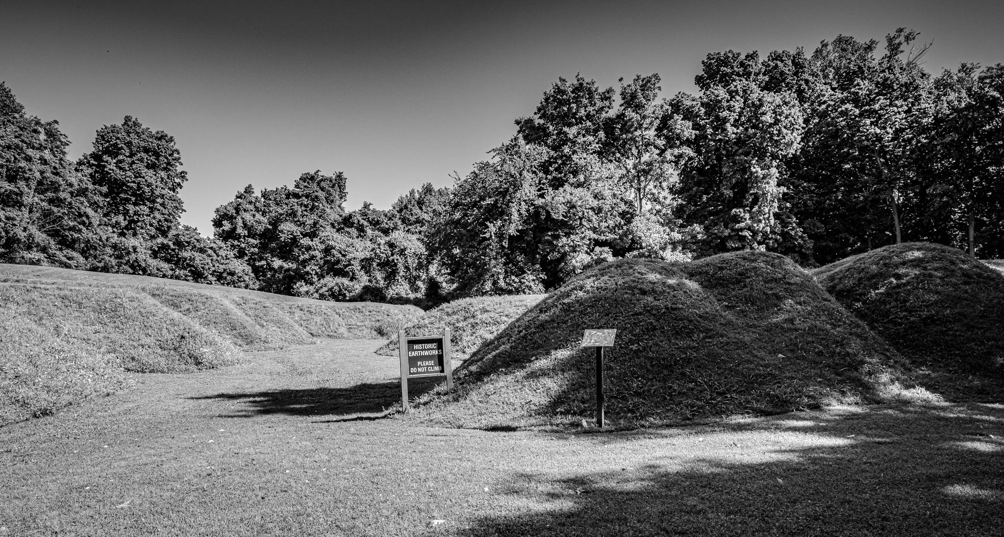
Standing at this level you can picture how soldiers would position behind these earthen walls and fire over the top.
[Click on Image for Map]

This is #209, a Model 1829 32-pounder. It weighs almost 4 tons and can launch a 32-pound cannon ball up to 1 ½ miles. It is not known if #209 actually served in this location, but it was installed at Columbus-Belmont park by the Civilian Conservation Corps in the 1930’s. However, in 1943 a large landslide swallowed this cannon and it remained buried until is was finally found and brought back to this position 55 years later.
[Click on Image for Map]
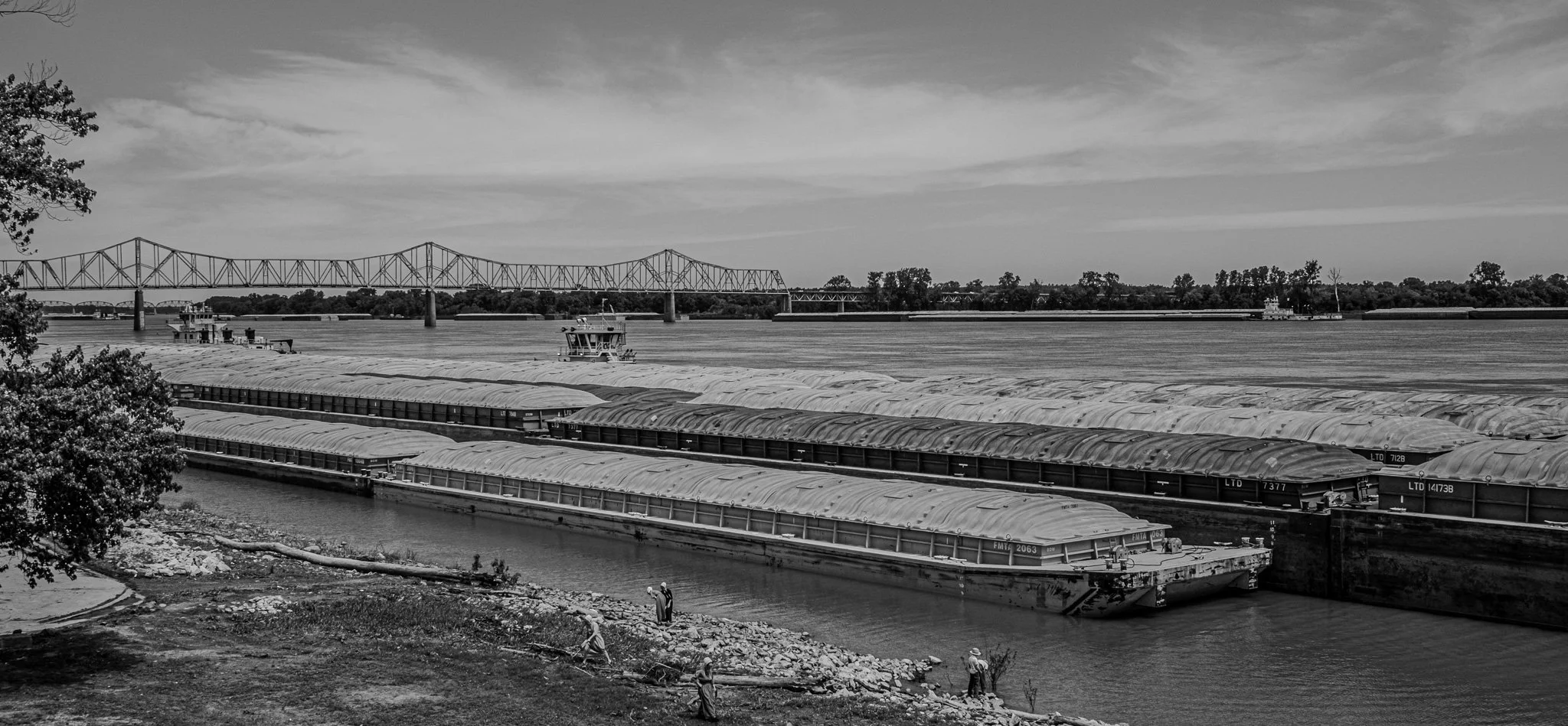
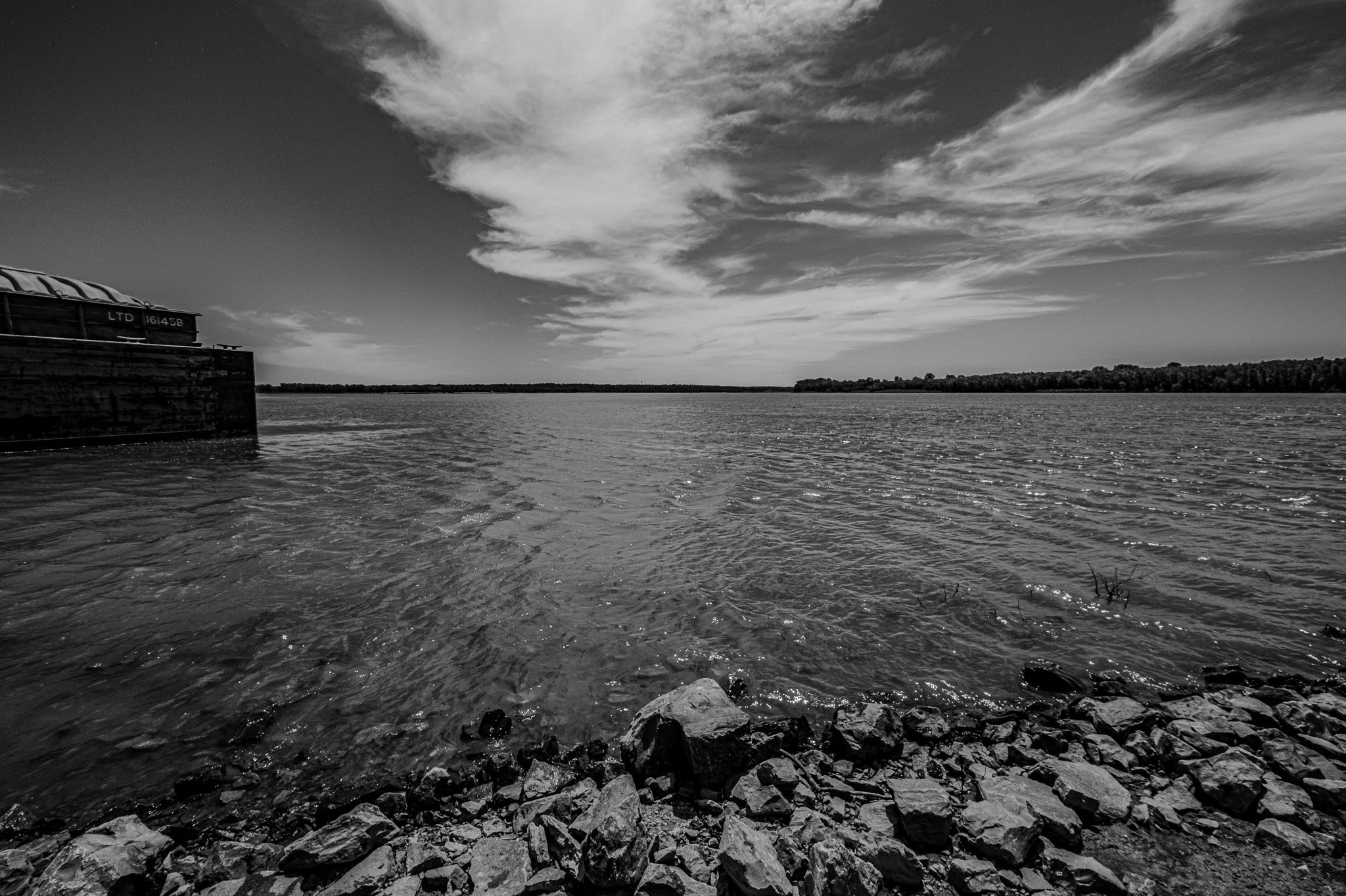
Looking up river from Columbus-Belmont State Park. Heavy commercial traffic and not a single pleasure craft in sight. The Mississippi is still all business here below St. Louis.
[Click on Image for Map]

Next was a stop at Fort Jefferson Park and to see the Memorial Cross in Wickliffe, Kentucky. The Cross stands at 95-feet tall.
[Click on Image for Map]
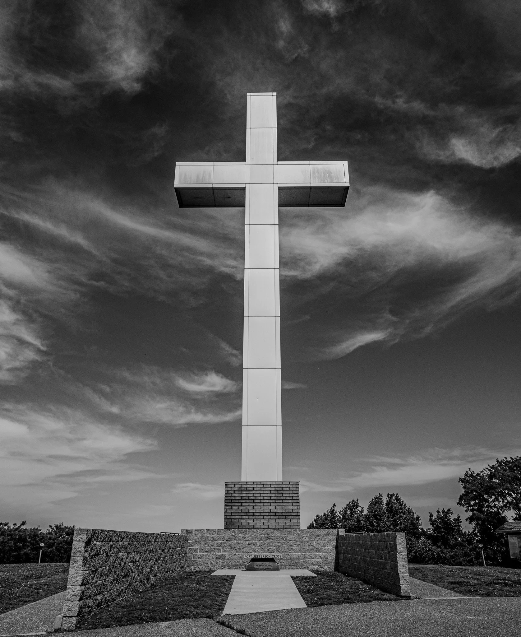
It was completed in 2000.
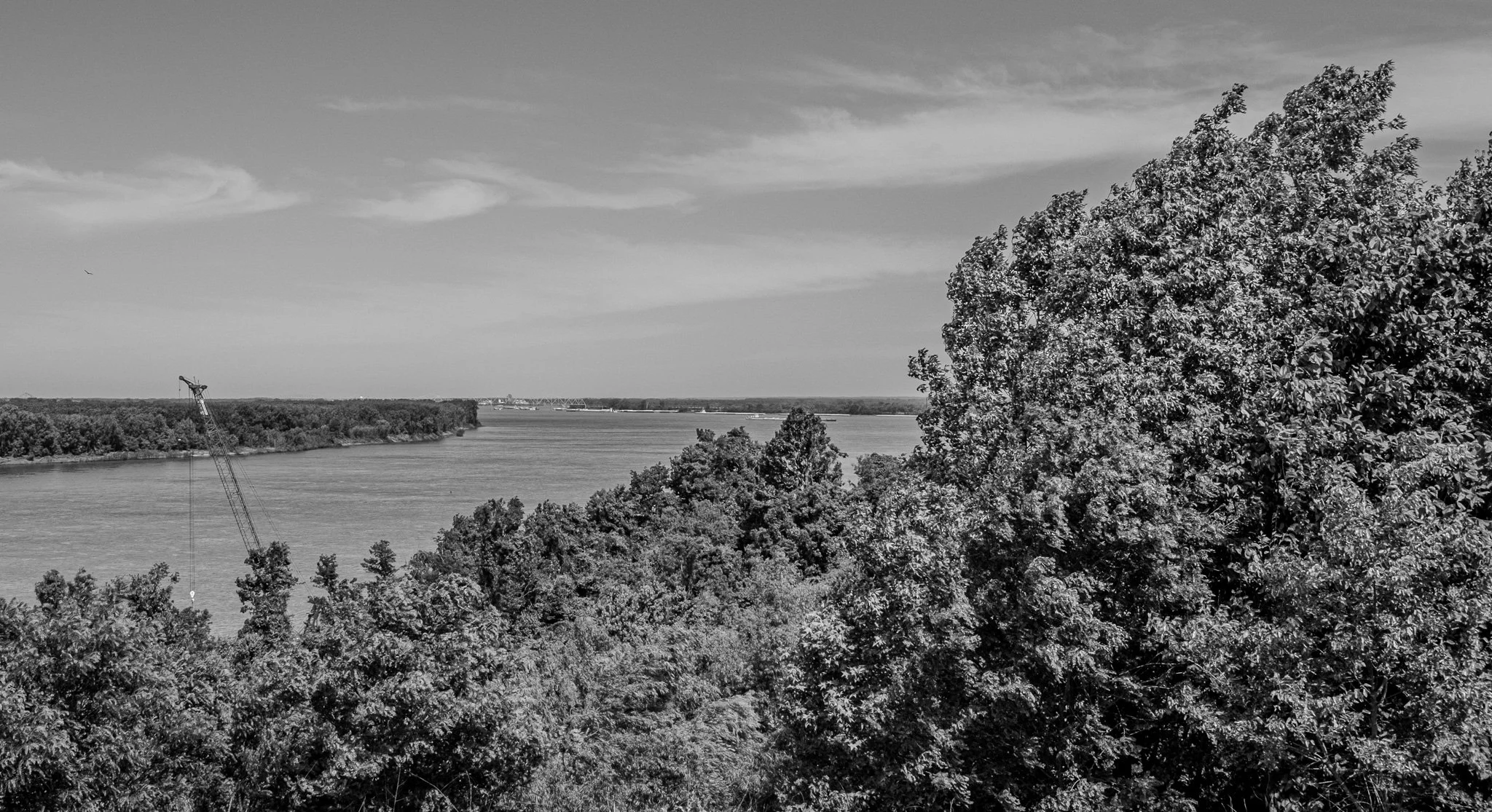
The view looking up river from Fort Jefferson Park. It is too difficult to make out in this image, but just as the river fades out of view to the left is the confluence of the Ohio and Mississippi rivers. That will be our next stop for the day.
[Click on Image for Map]

This is the view of the very tip of land which marks the confluence of two of this nation’s greatest rivers - on the left is the Ohio River and on the right is the Mississippi River. This is from the raised platform at Fort Defiance State Park in Cairo, Illinois.
[Click on Image for Map]
This is looking up river on the Ohio River side.
[Click on Image for Map]
And this is the view up river on the Mississippi River side.
[Click on Image for Map]
And this shot is from the very tip of the peninsula of land that juts out between the two rivers. Below this point these two great rivers become one Mississippi River.
[Click on Image for Map]
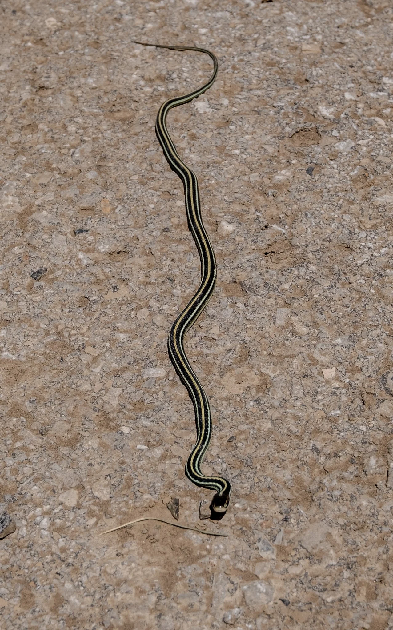
Walking back to the car we came across this little guy. Unlike the armadillo or the turtle, this time Lisa didn’t wish to bring him home as a pet.
[Click on Image for Map]
Next we visited Fort Kaskaskia State Historic Site.
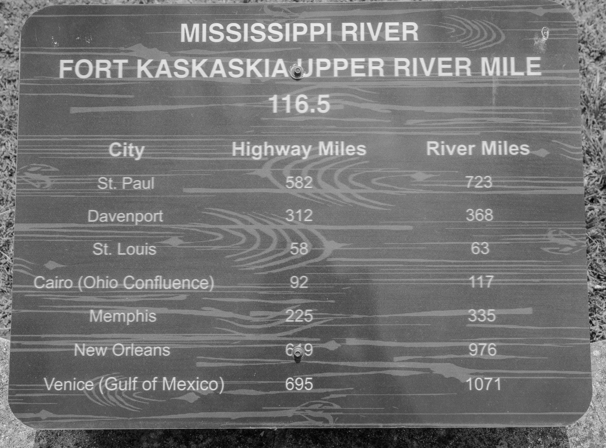
This interesting plaque at the park gives us some idea of the travel we have done over the past two weeks. Our return trip shows 649 miles since leaving New Orleans with a little less than 582 to get back to Rochester.
[Click on Image for Map]

The Fort Kaskaskia State Historic Site has some interesting things. In addition to being the site of Fort Kaskaskia with earth works similar to those we saw earlier in Columbus; it also has this very interesting cemetery. This cemetery is unique because many of the people buried here actually didn’t start out here. In 1881 a flood caused the Mississippi to change course. As a result the town of Kaskaskia began to become eroded as the river ate further into the land. The townspeople saw the writing was on the wall and knew that soon the entire town would be underwater. So, they exhumed their loved ones and moved them to higher grounds. History would show that they made the correct decision, because by 1901 the old town of Kaskaskia had disappeared underwater.
[Click on Image for Map]

Looking up river from Kaskaskia Park. The river takes a 90-degree turn here, as you can see the tug and barges perpendicular to the river in front of us. The old town of Kaskaskia appears to have been located in roughly the bend of the river.
[Click on Image for Map]
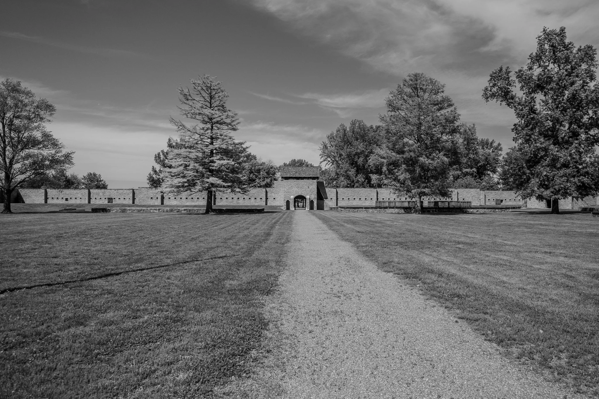
Our final stop for the day was at Fort de Chartres State Historic Site in Du Rocher, Illinois.
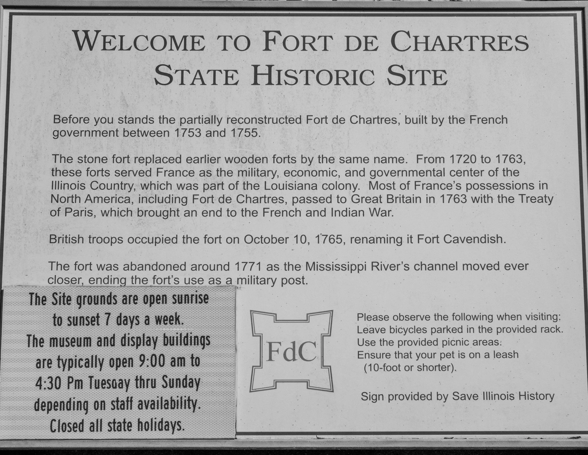
This plaque explains some of the history of the fort.
This fort was once strategically located on the Mississippi River. However, as the river has moved over the years, this site is no longer all that close to the river.
This is one time I would strongly suggest clicking on the image for the map. You can see the river is a fair distance from the fort. However, that was not always the case. Previously, the river came right up to the fort. If you look at the satellite view on Google Maps you can see how the earth still shows remnants of how the Mississippi River once flowed right past the fort, but now has moved some distance away. A fascinating geology lesson.
[Click on Image for Map]
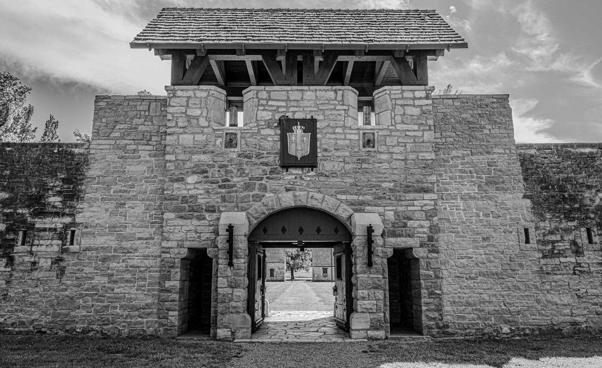
The front entrance to the fort.
[Click on Image for Map]
Once inside the fort you could climb up into the lookout towers. This is the tower at the front entrance looking down into the fort.
Looking to each side from this vantage point gives some idea of the scale of this fort. This is not a small structure.
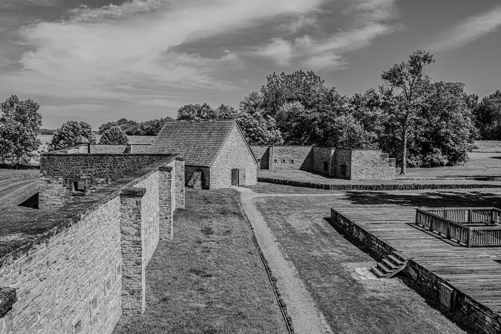
The building in the far corner was the powder magazine. This would have been safely located in what was then the back of the fort. The original front of the fort would have been facing the river on the other side. So, the entrance seen earlier would really have been the “back” entrance to the fort.

Inside the powder magazine.

Each corner had a raised lookout point with small vertical openings for viewing and for firing from while remaining safely behind the stone walls.
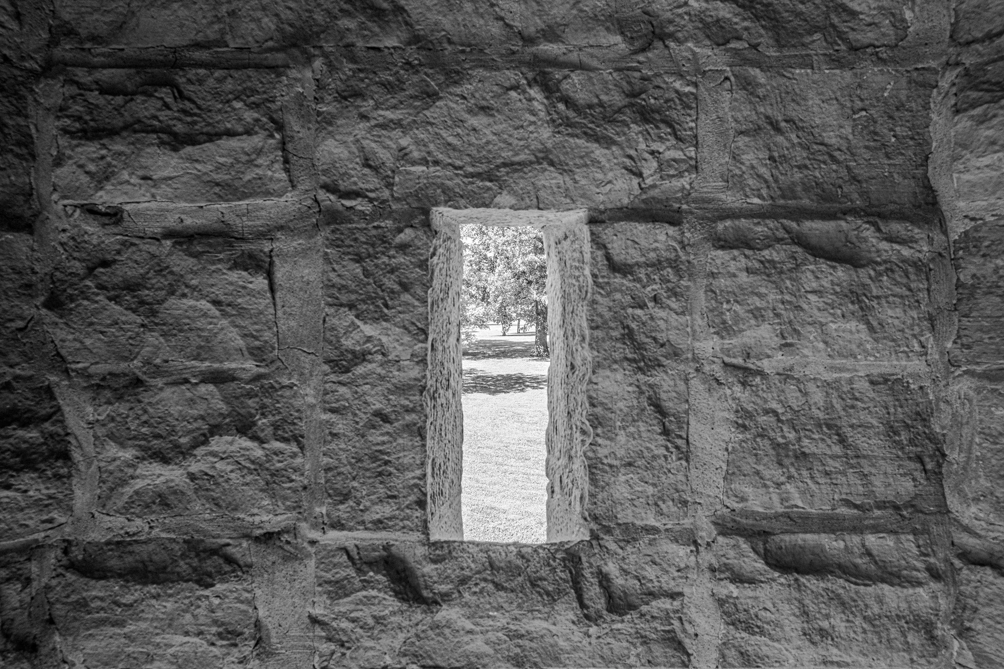
Climbing up into the corner lookout you can see the small “window”/gun turret.
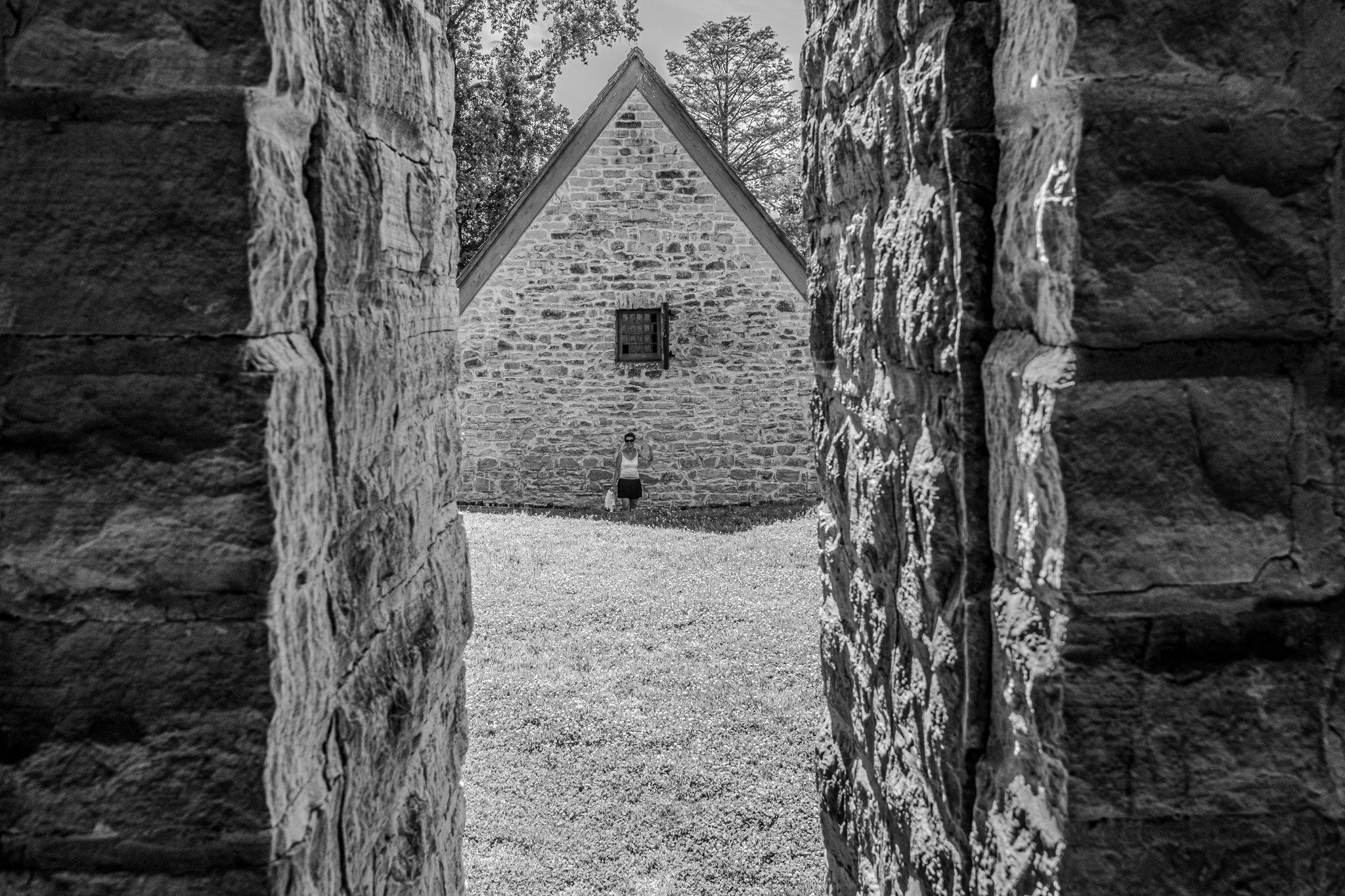
The view back into the fort from the corner lookout. Clearly I failed in my duties as lookout, because it appears someone has made it inside the gates!

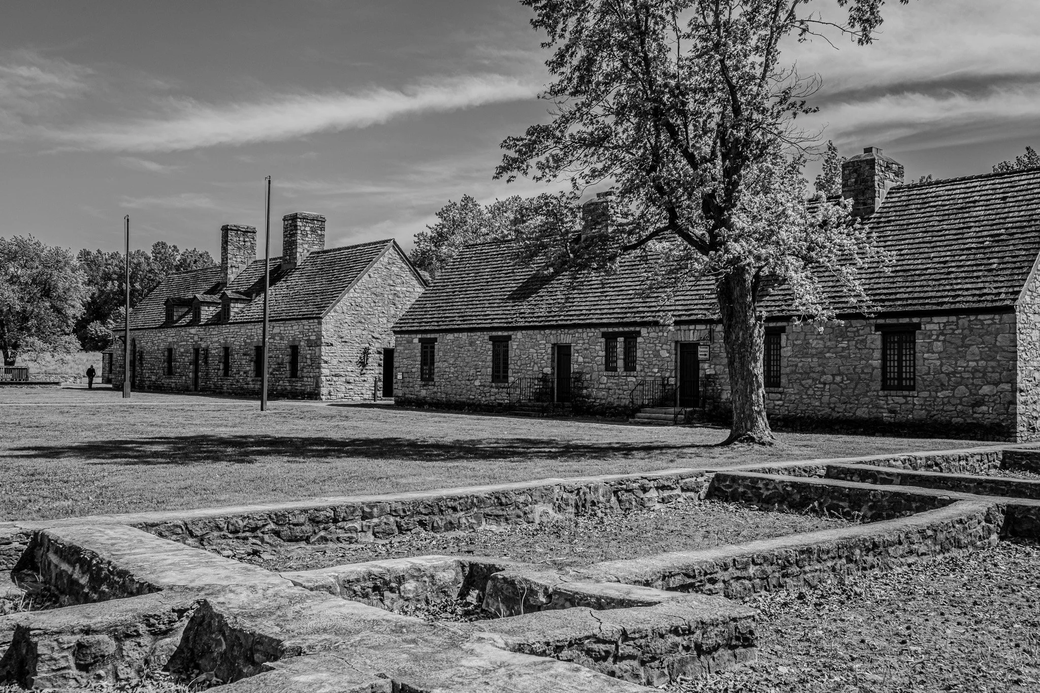
These buildings included a chapel, mess hall, some workshops and storage.
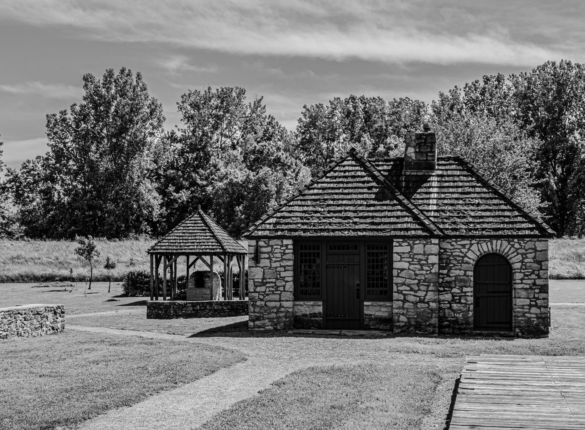
This appears to have been the bake house with the stone oven on the left.

Same building from another vantage point.

Chapel.
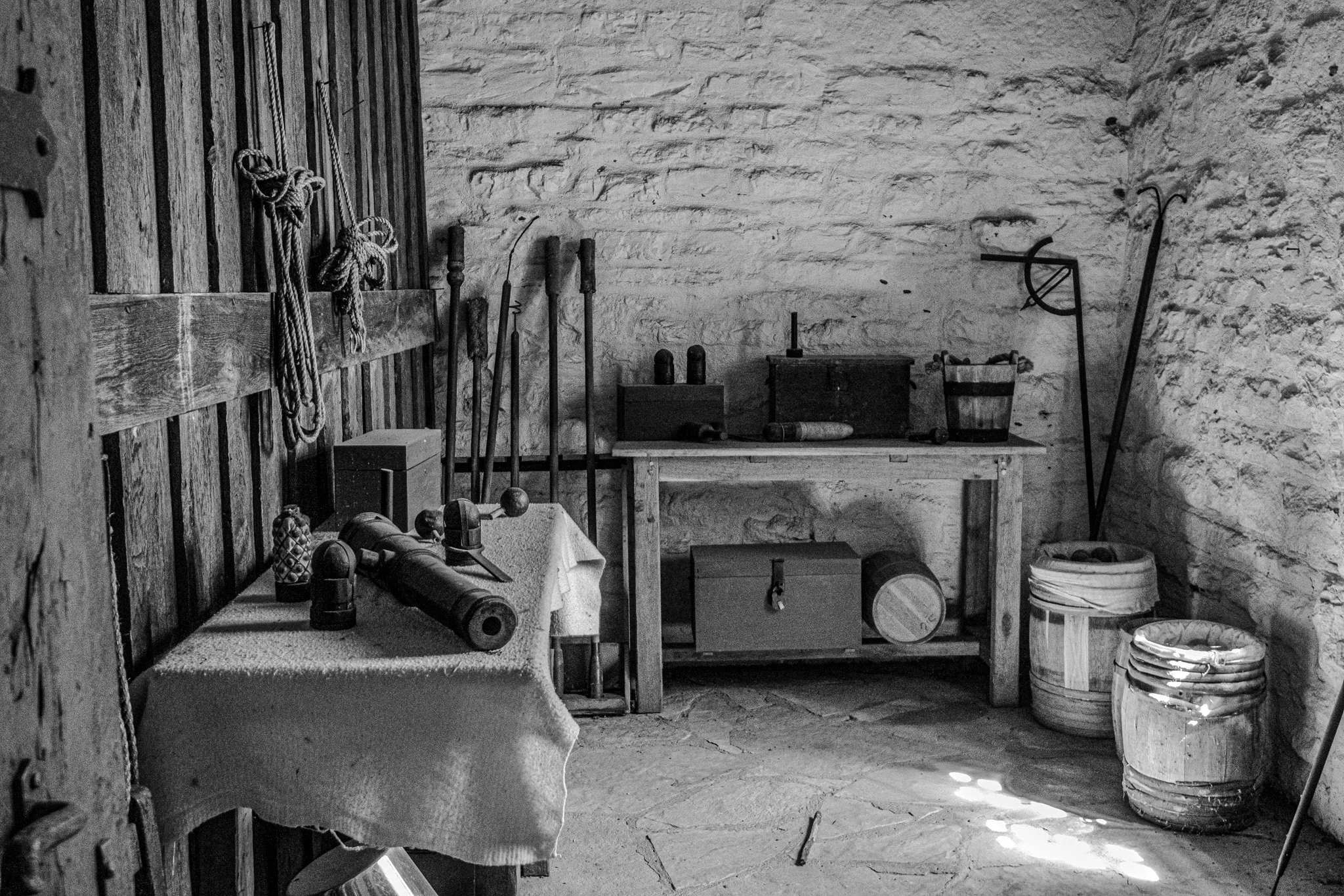
Mechanical/blacksmiths work area.

Upstairs in the large buildings.
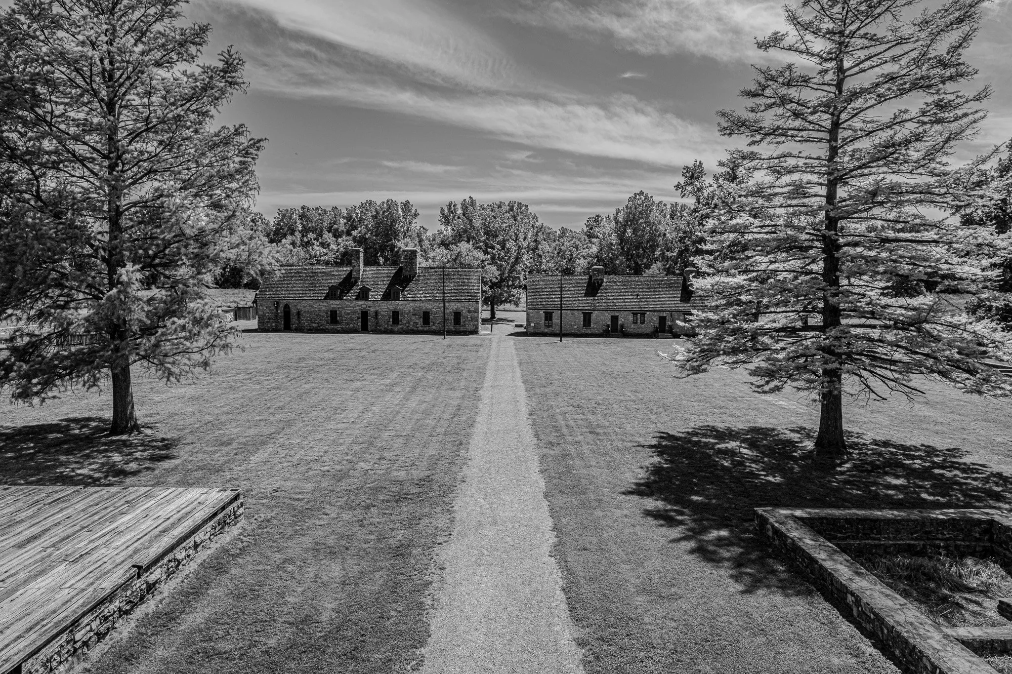
A view across the central parade grounds inside the fort, back toward the main entrance gate.
Looking back toward the main buildings, the foundations in the foreground suggest other buildings which have been lost to history.
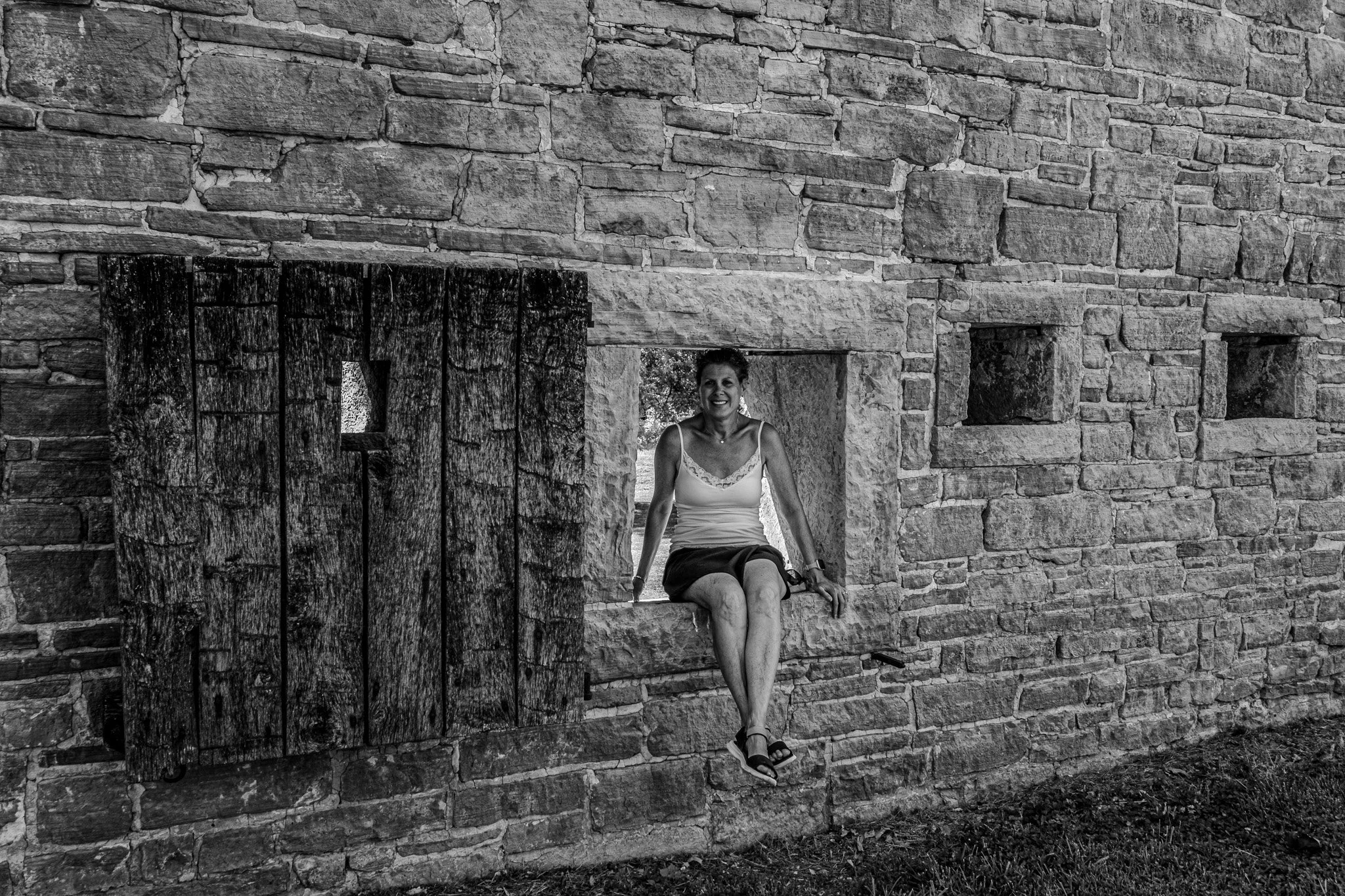
This larger turret likely once contained a smoking hot cannon. Today, it only contains my smoking hot wife. ;-)
Just checking to see if anyone is still paying attention after 14 days.

Looking back into the fort from the other corner lookout position. I climbed every possible structure, just like any typical 12 year old boy would!!

The impressive main entrance with thick wooden doors.
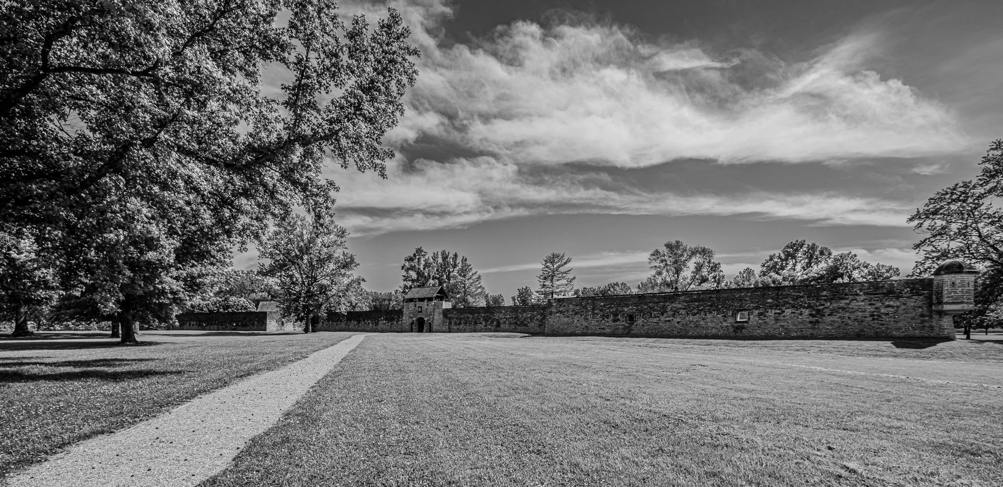
Even with a 10 mm lens, getting the entire fort in one photo required some distance and thus you really can’t see much here. But, it was meant to showcase the size of this structure. This was quite an impressive find on our trip.