Route 66 - Day #5
Wednesday, April 15, 2026
First stop was at the Route 66 State Park Visitors Center just west of St. Louis. This was the original Route 66 bridge and plaques at the site say the plan is to reopen it someday as a pedestrian walkway.
Click on Image for Map.
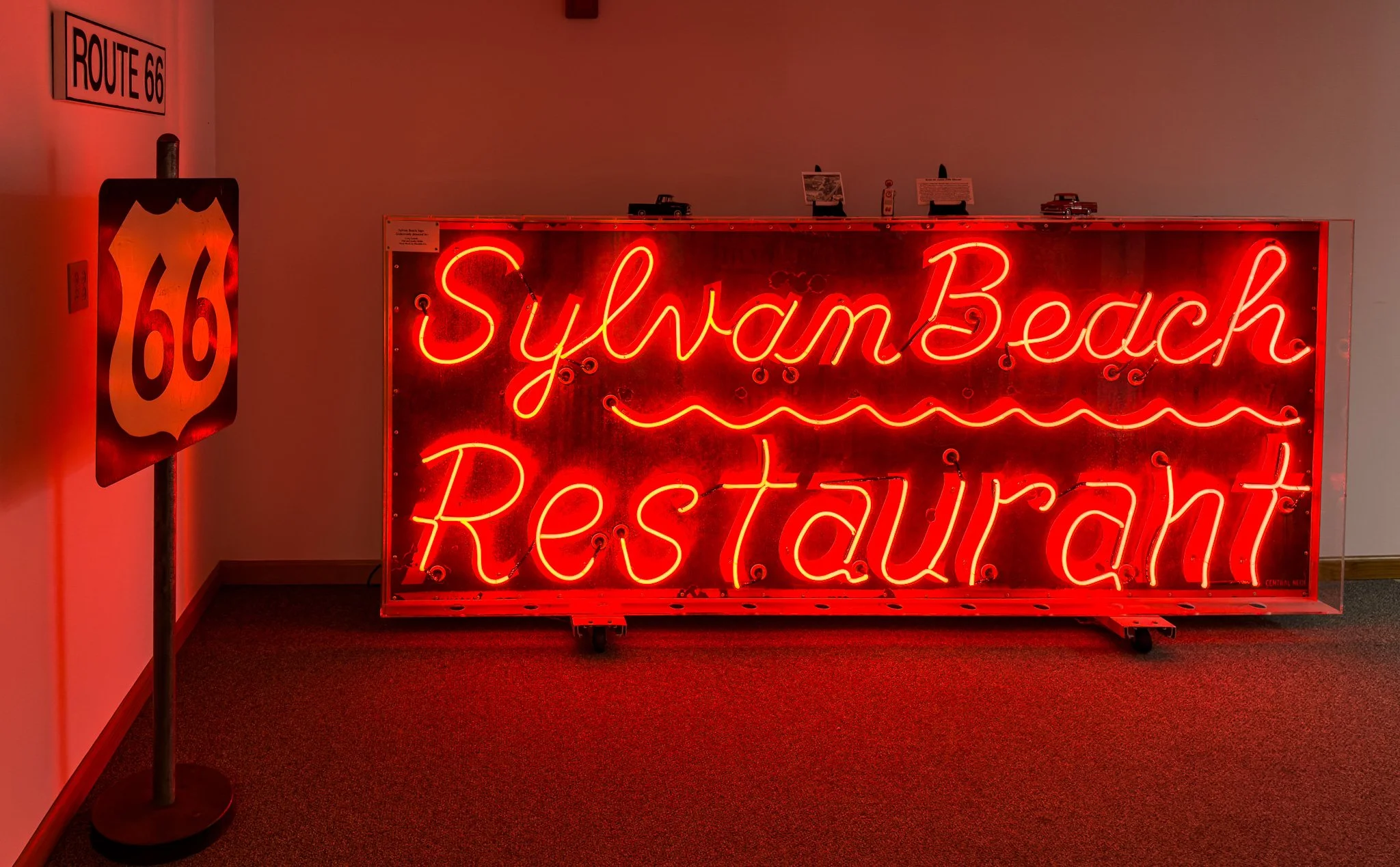
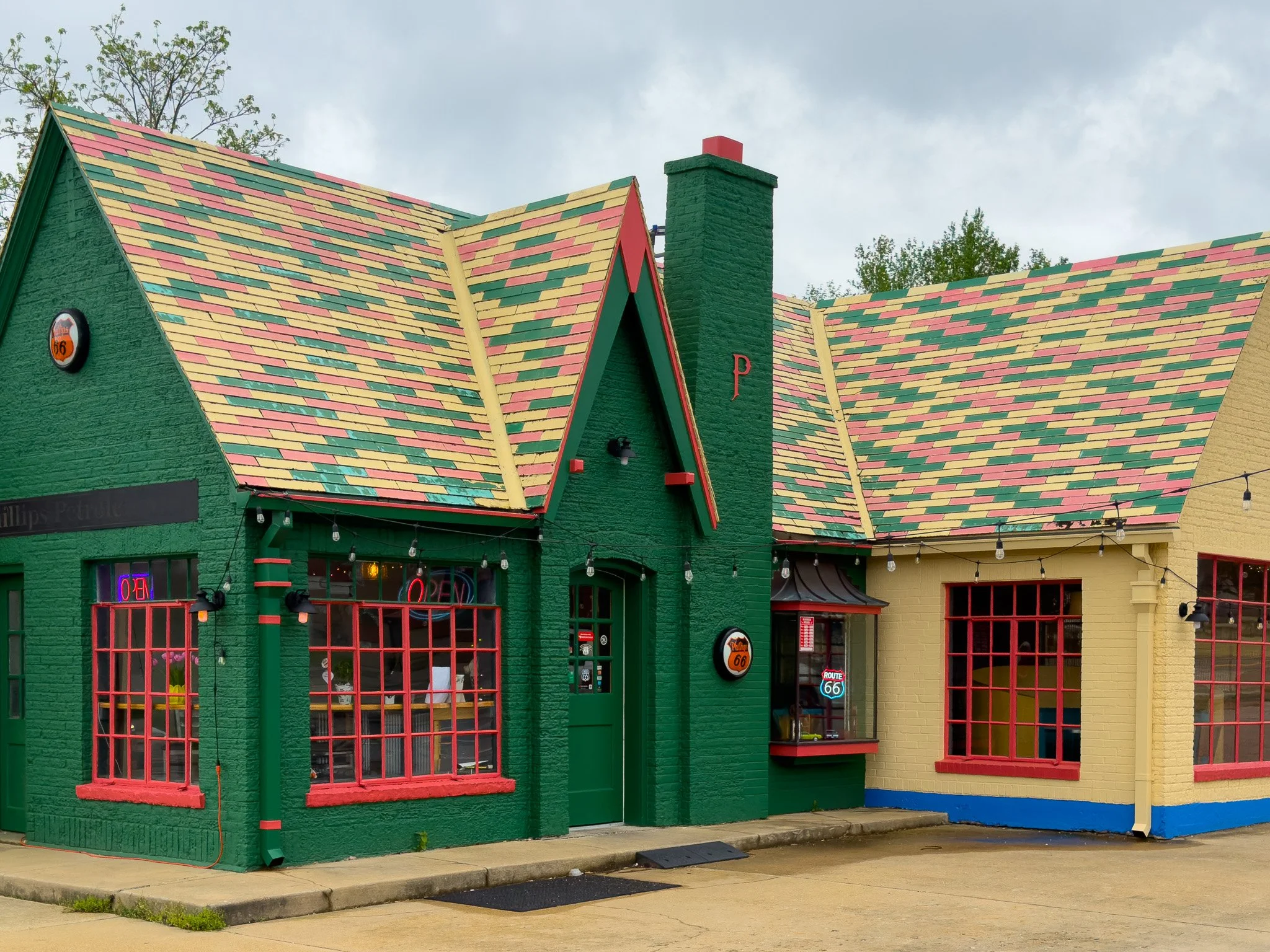
This was the first museum we have visited that was almost fully focused on Route 66. These are some of the artifacts and history from the old route - including this old neon.
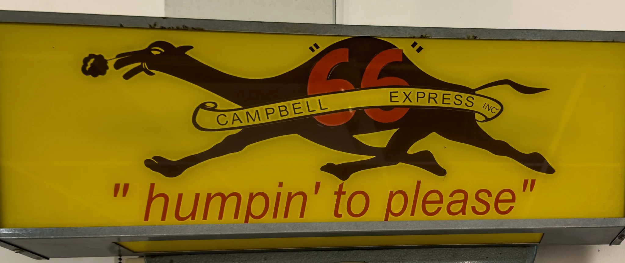
If you saw yesterday’s photos from Henry’s Rabbit Ranch, there was a tractor trailer with an image like this painted on the side with the slogan, “humpin’ to please.” Well, we discovered this was actually a real slogan for a trucking company that worked on Route 66 until about 1986. The images on their trucks were of this camel and the slogan. It appears someone altered the ones at Henry’s to appear to a rabbit instead of a camel.
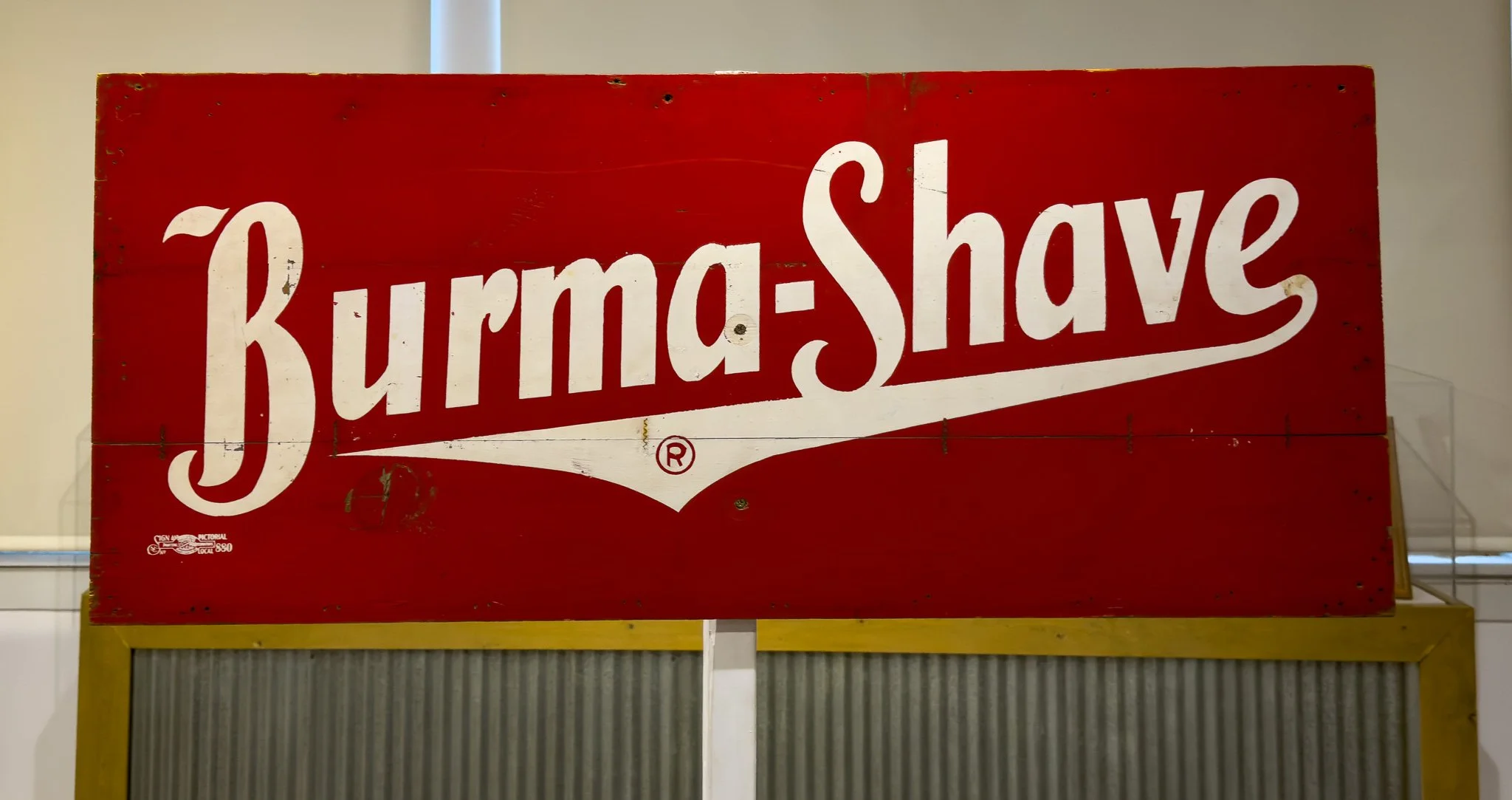
Old Burma-Shave signs can be seen frequently along the route. We have seen several sets already in the first two states.
From ChatGPT:
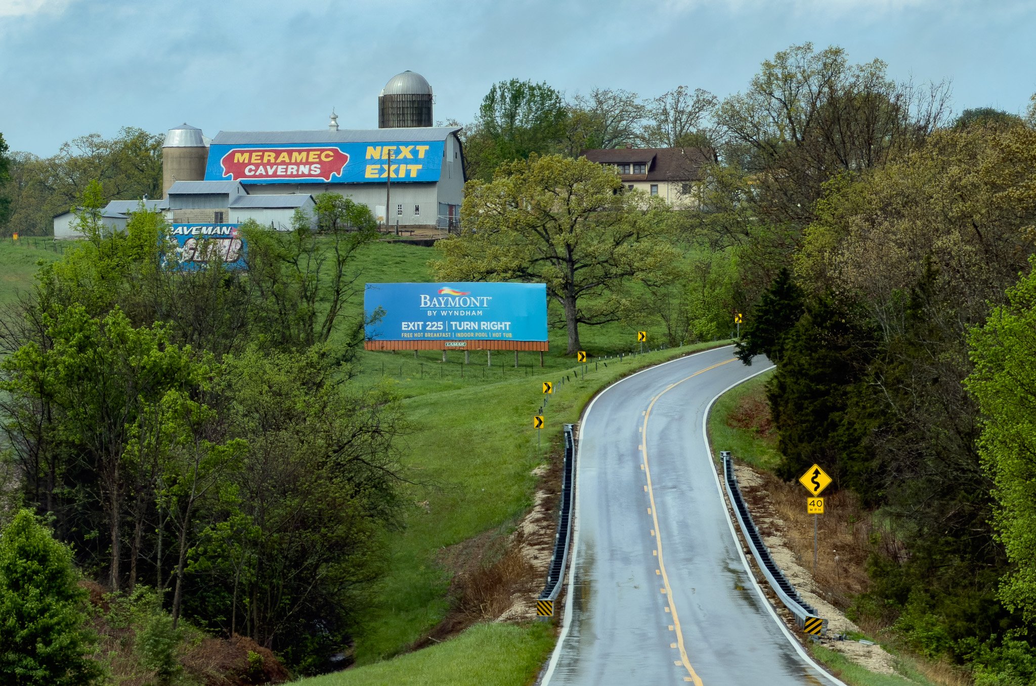
In the 1930s, Lester B. Dill, owner of Meramec Caverns, devised a clever advertising scheme to attract motorists on U.S. Route 66. He paid farmers to paint “See Meramec Caverns” on their barn roofs, ensuring visibility from the road, turning rural landscapes into one of America’s earliest and most iconic roadside marketing campaigns.
Some accounts of this story say he didn’t pay the farmers, but instead offered to paint their barns for free in exchange for them letting him advertise on the roof.
Click on Image for Map.
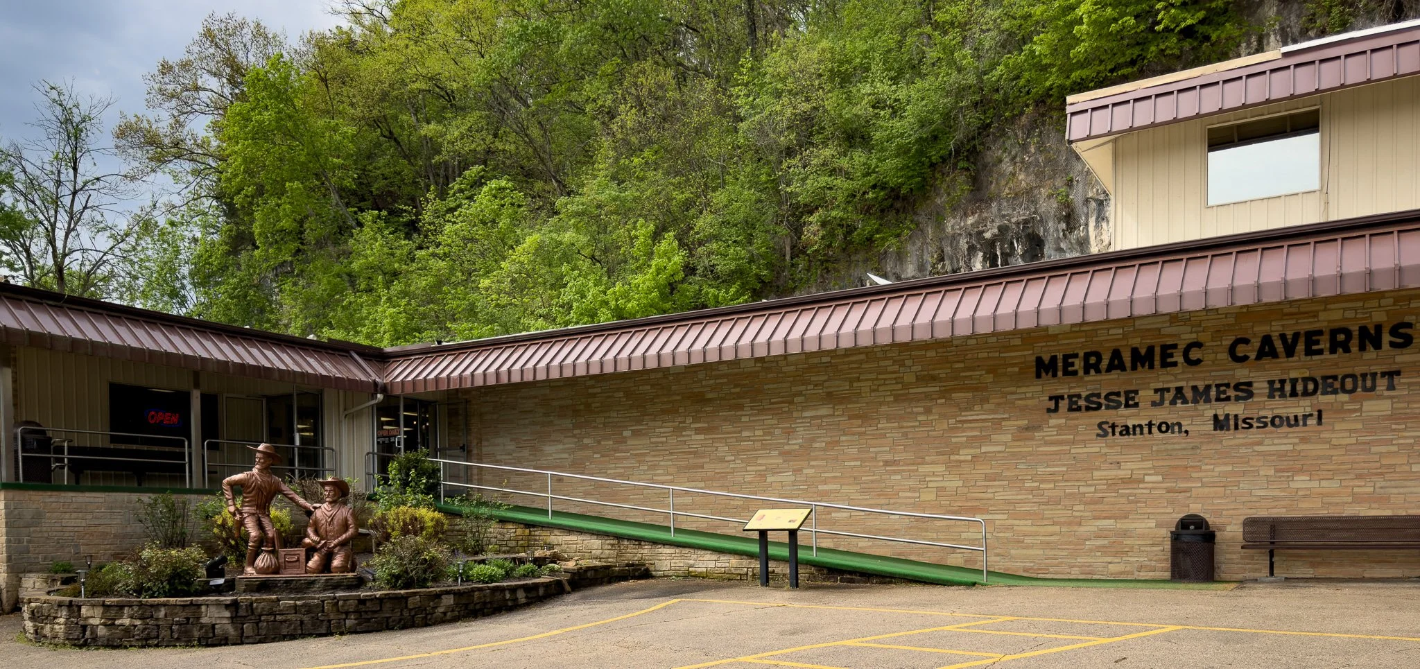
Our next stop was Meramec Caverns.
It was interesting, but if we are going to be honest, the win goes to Luray Caverns in Virginia - which we visited on our Blue Ridge Parkway trip.
Click on Image for Map.
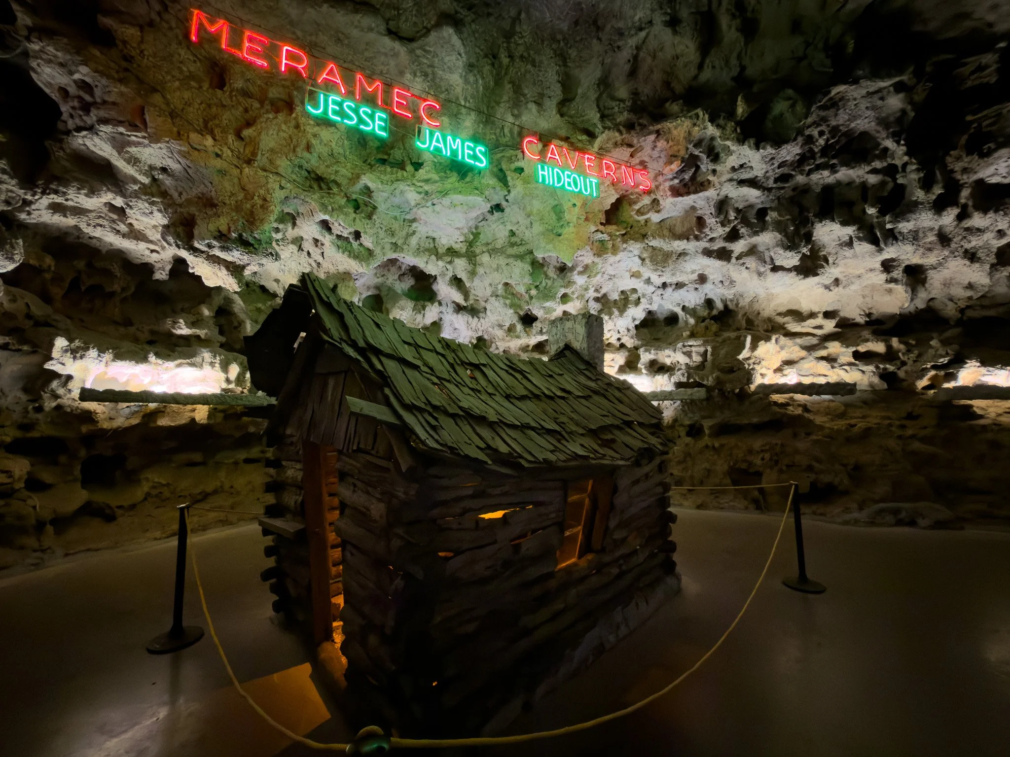
Meramec Caverns really likes to tout an association with Jesse James, but that association may be apocryphal.
From ChatGPT:
It’s not completely impossible that Jesse James passed through or briefly used the caves—but there’s no solid contemporary evidence proving it. The “Jesse James hideout” label is best understood as a mix of local legend and very effective Route 66-era marketing.
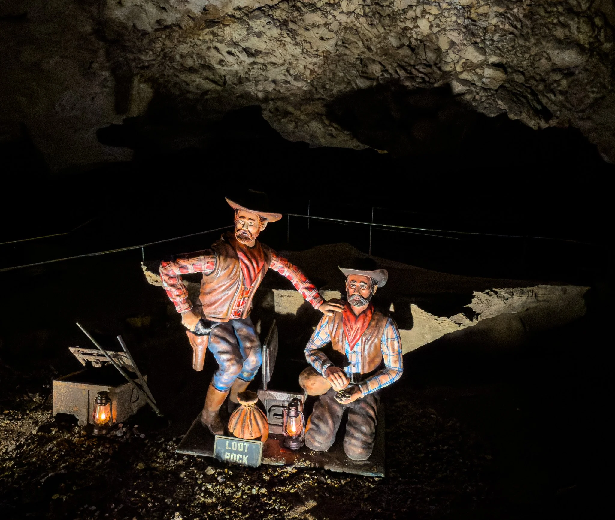
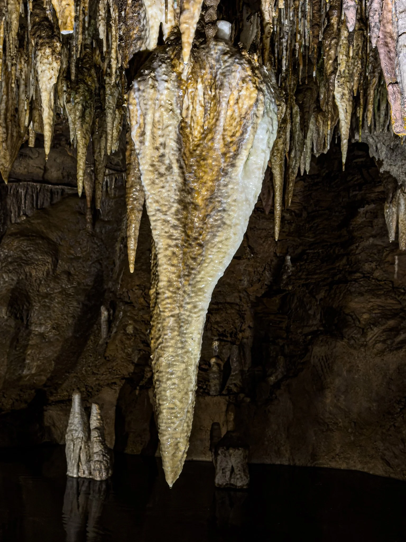
James and his brother were believed to hide out in the caverns and use this rock (“Loot Rock”) to spread out their spoils and count their money.
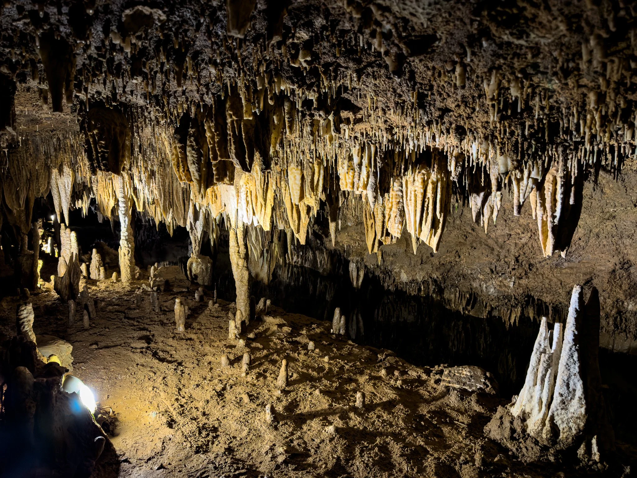
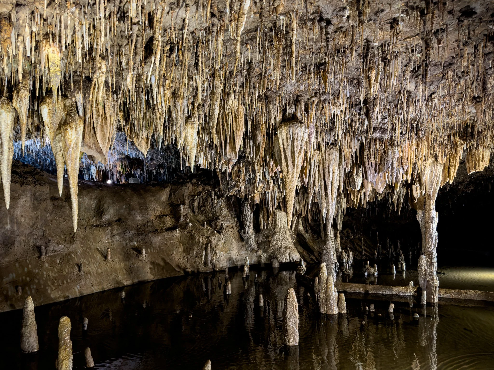
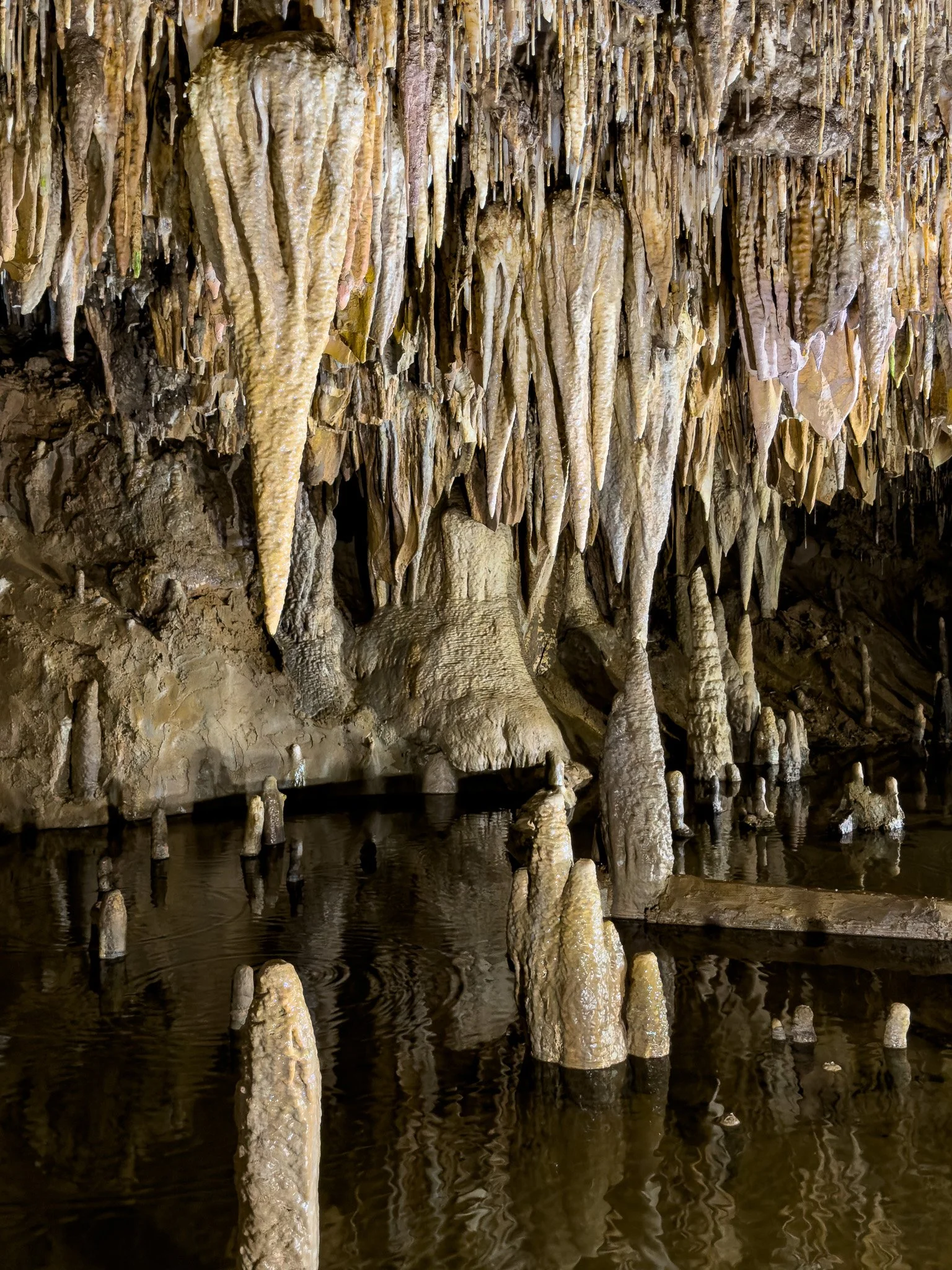
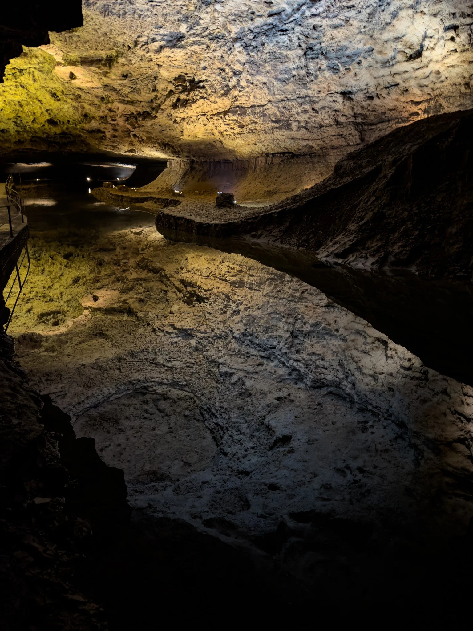
What appears to be a 100-foot drop in this image is actually a mirror image of the upper chamber reflected in the perfectly clear and still water which is only about 18-inches deep.
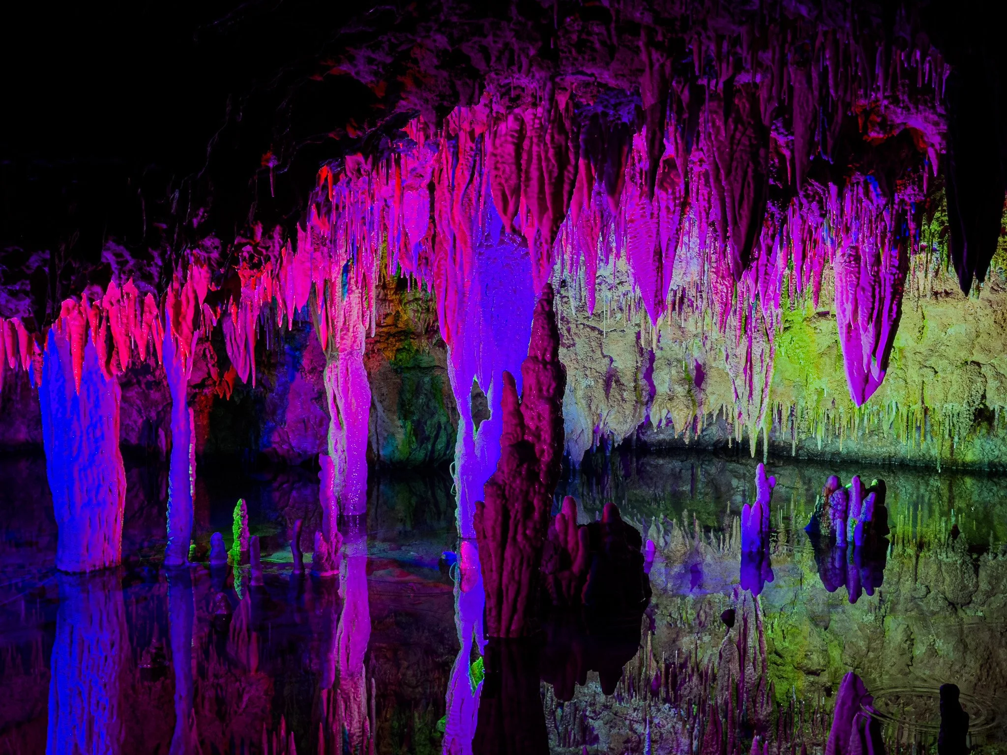
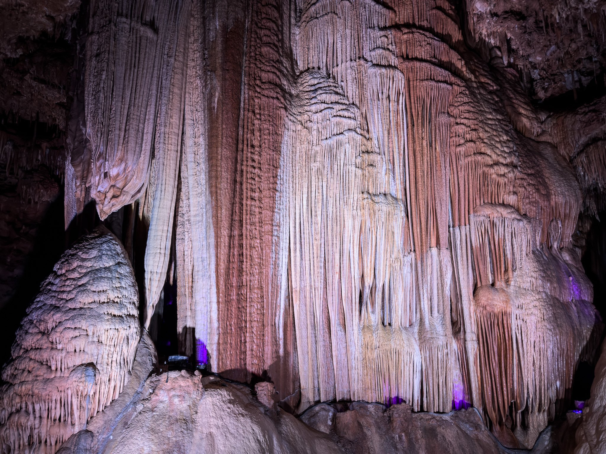
They switch on some “black lights” that give the different mineral deposits some fascinating colors.

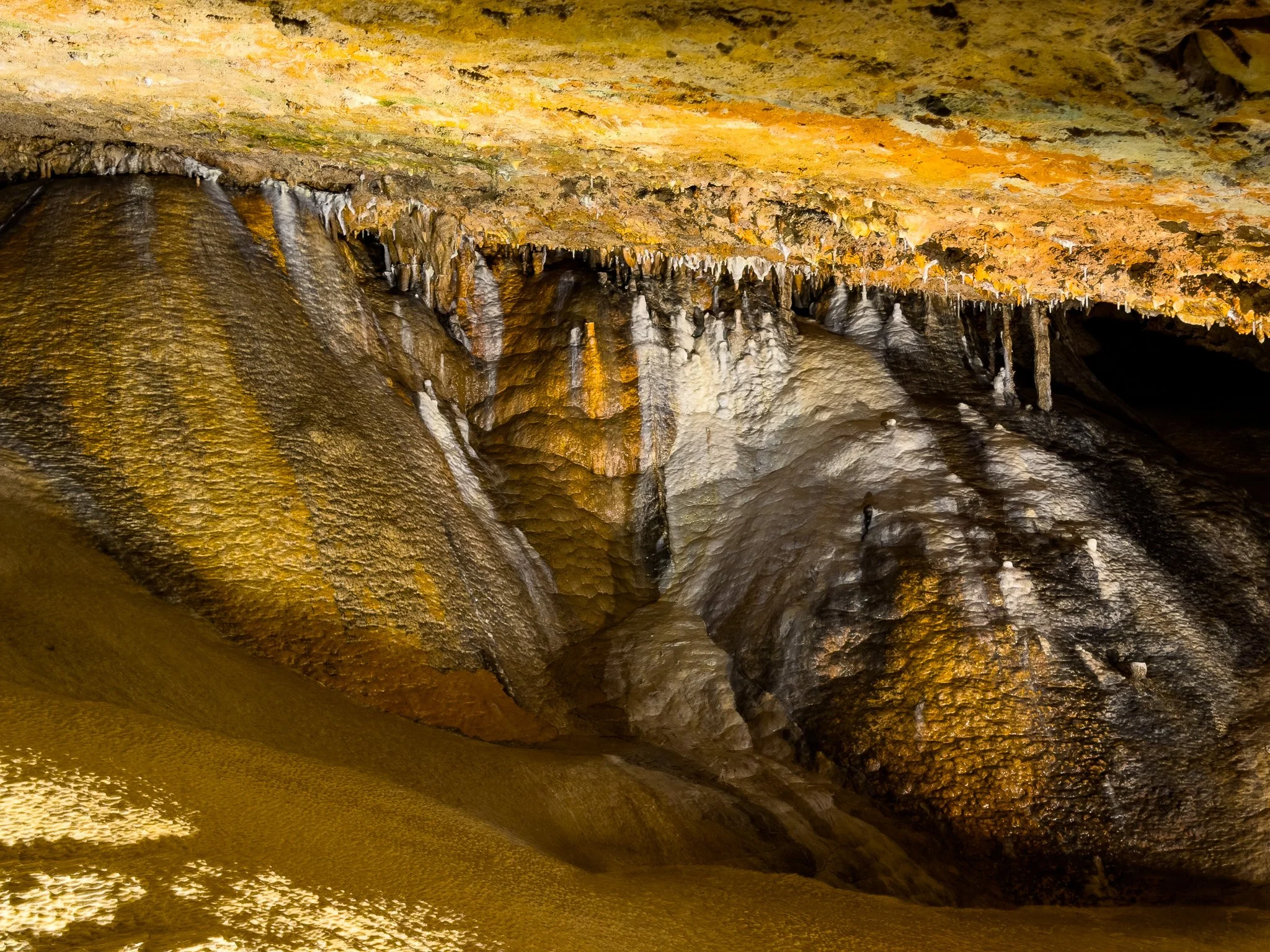
These grape-like mineral deposits are ones which were formed under water; as opposed to the stalactites and stalagmites which form when water dripping from/over them evaporates and leaves the minerals behind.
At the end of the tour, they use this large wall-size mineral formation as a “screen” to project a short film.
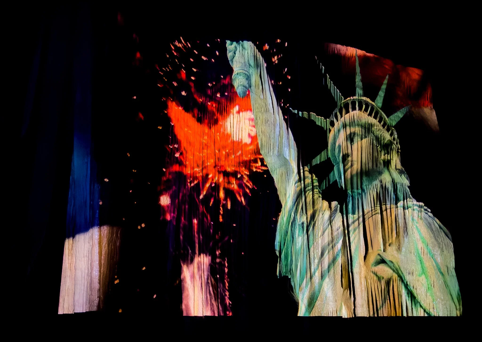
An image from the film projected on the “screen.”
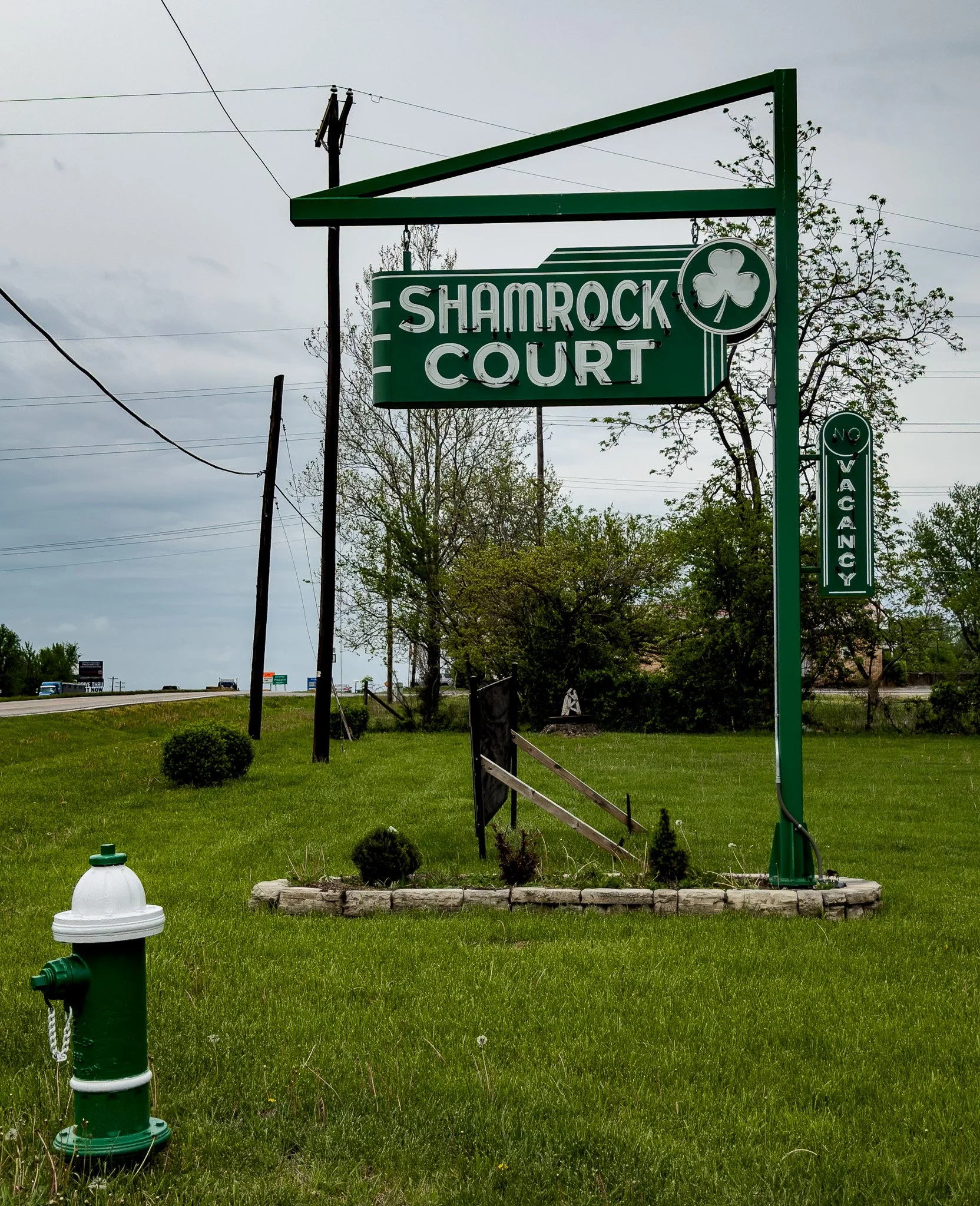
The old Shamrock Court is a classic Route 66 motel. It is currently undergoing a complete renovation and it appears the plan is to keep the quaint exterior and have it completely modernized inside. This is likely going to be a very big hit with future Route 66 fans.
Click on Image for Map.
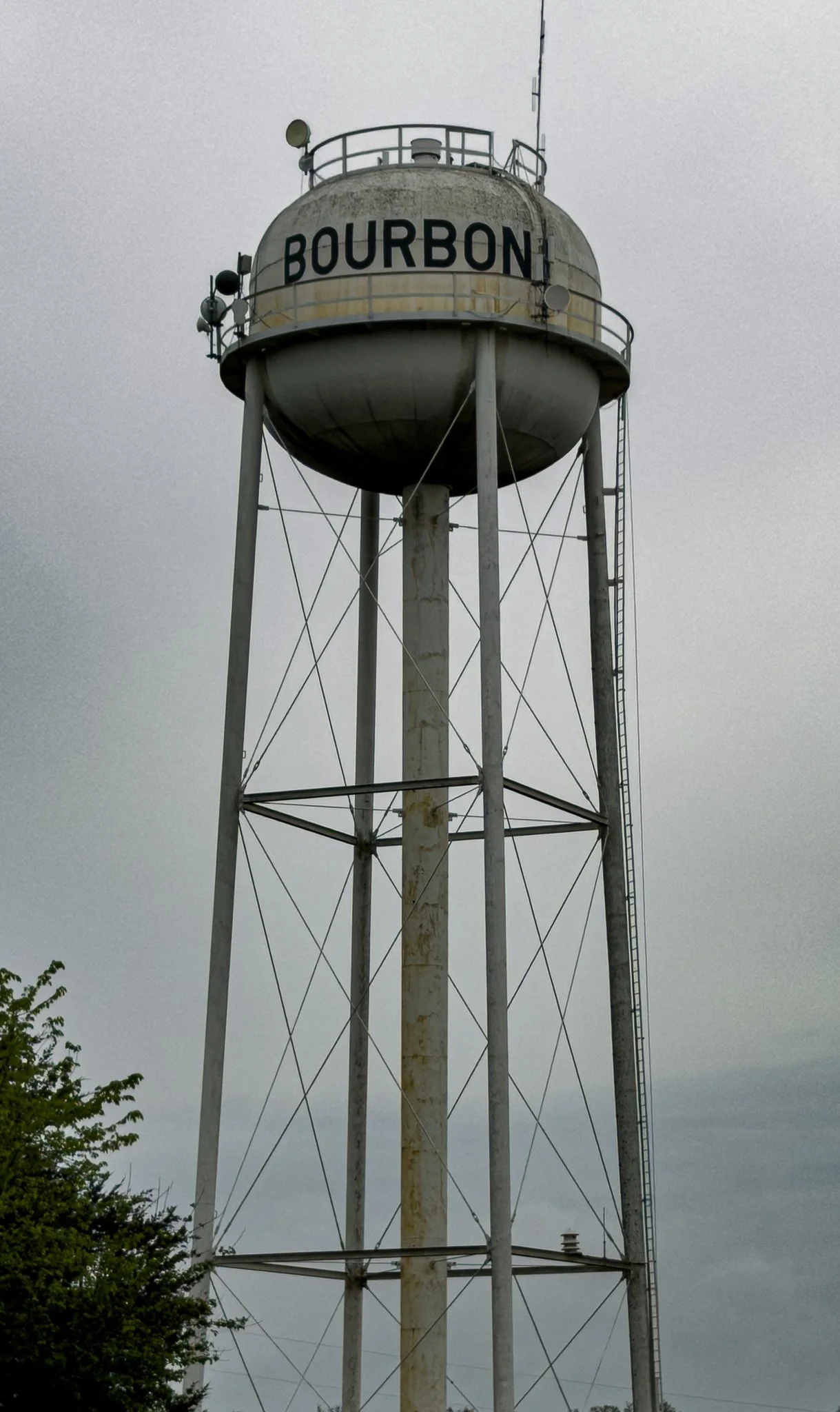
A water tower labeled as Bourbon….
Click on Image for Map.
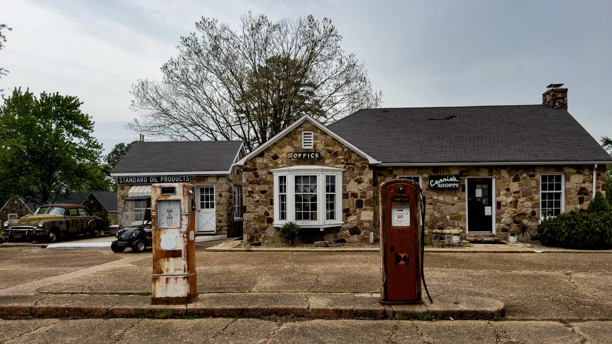
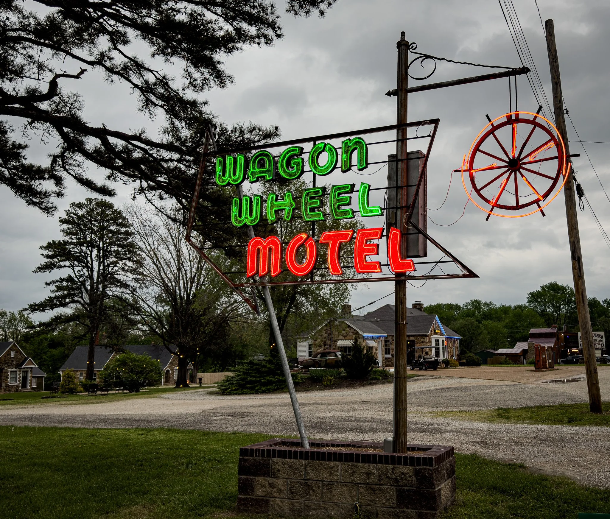
The Wagon Wheel Motel is another absolute classic on the route. We were told it just changed hands within the past week. The people who own and are renovating the Shamrock Court have just purchased the Wagon Wheel. It looks like these two iconic lodging spots along this section of Route 66 have a bright future.
Click on Image for Map.
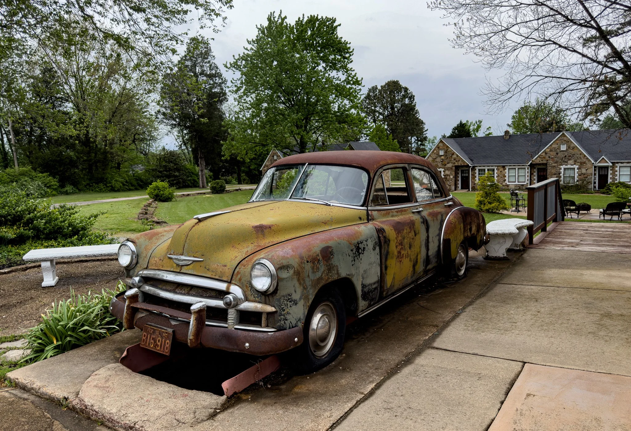
An old car parked next to the Wagon Wheel. Below the car is a mechanics “pit” where they could walk under the car and work on it from below. There was an old service station back in my home town that I recall had one of these “pits.” I would imagine that garage back home and this pit are probably very much from the same era.
From ChatGPT:
The Wagon Wheel Motel in Cuba, Missouri, is one of the most iconic stops on Route 66. Built in 1934 as a “tourist court,” it began as a combination of cabins, café, and gas station serving early highway travelers.
Often called the oldest continuously operating motel on Route 66, it features distinctive Ozark stone cottages and a classic neon sign.
Carefully restored, the motel still welcomes guests today, blending modern comforts with the nostalgic charm of America’s “Mother Road.”
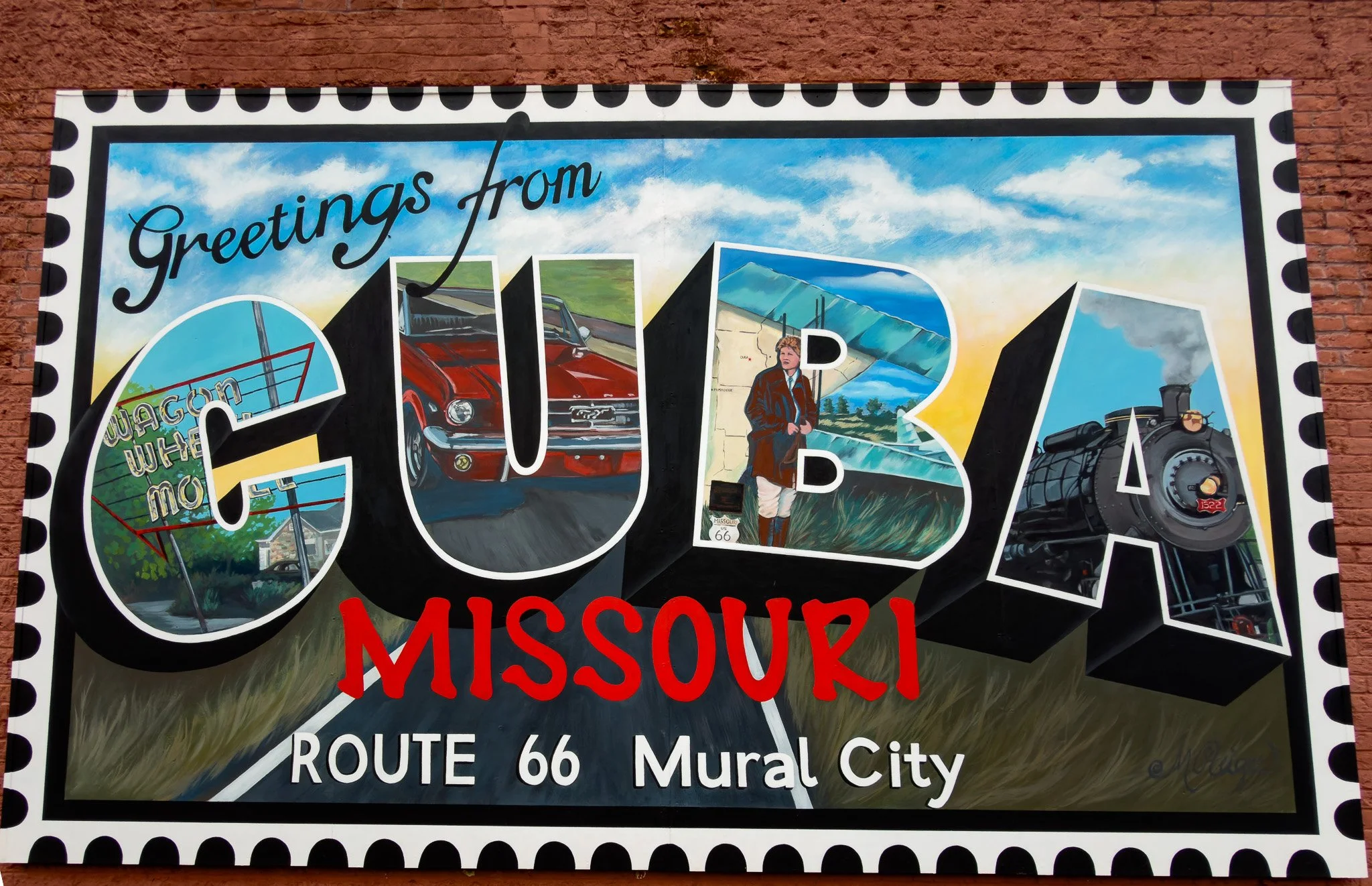
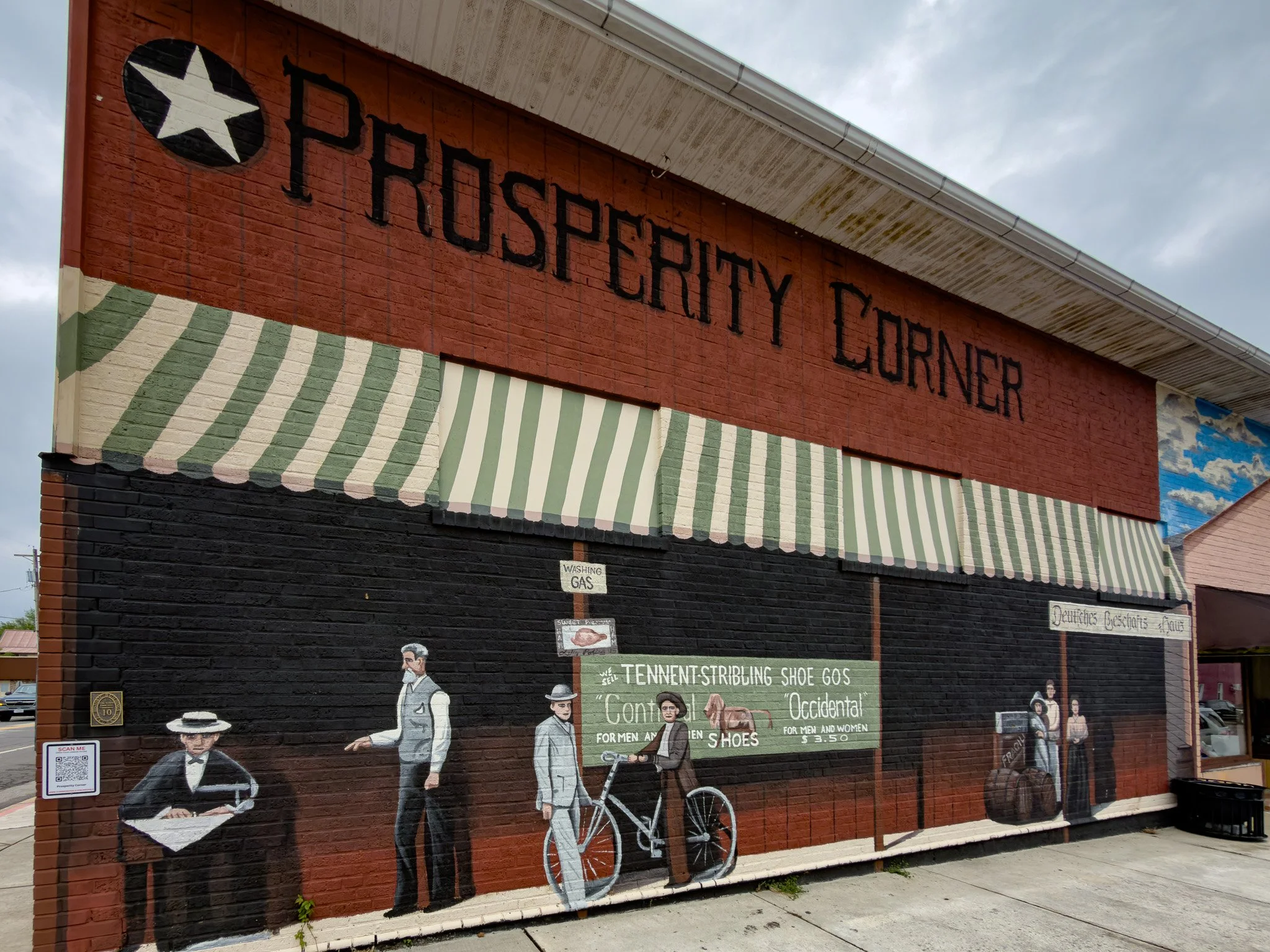
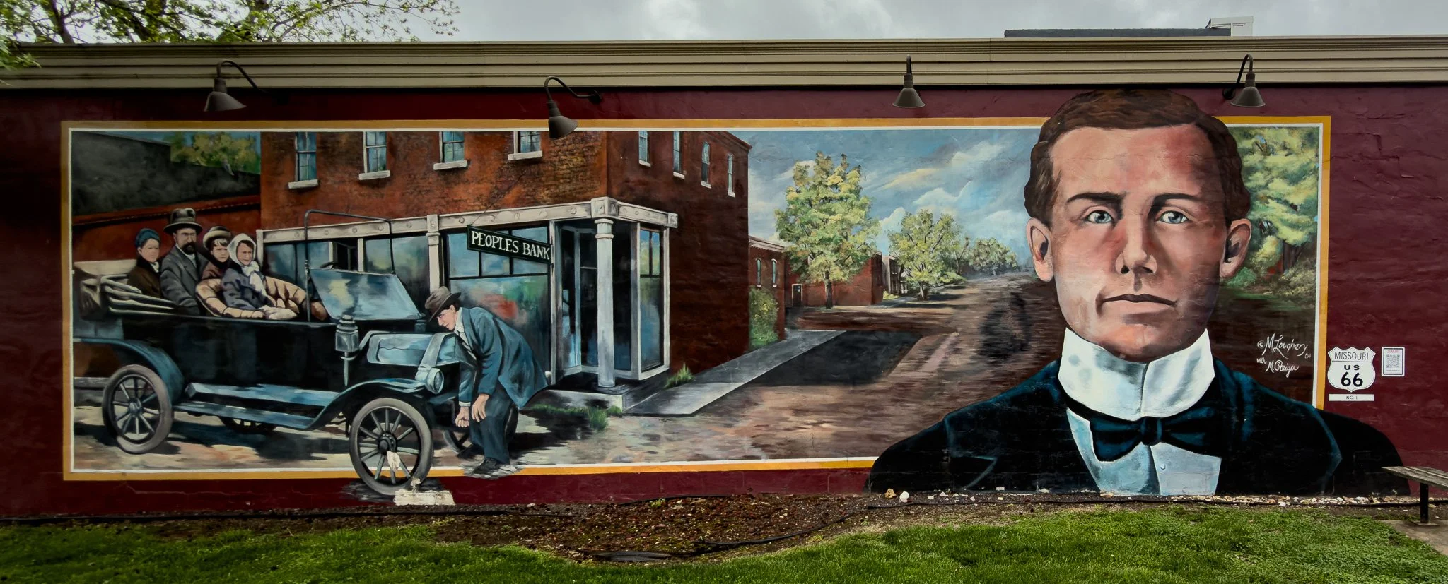
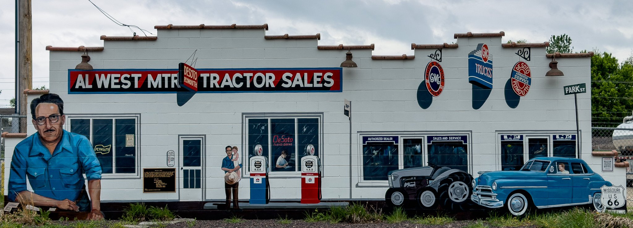
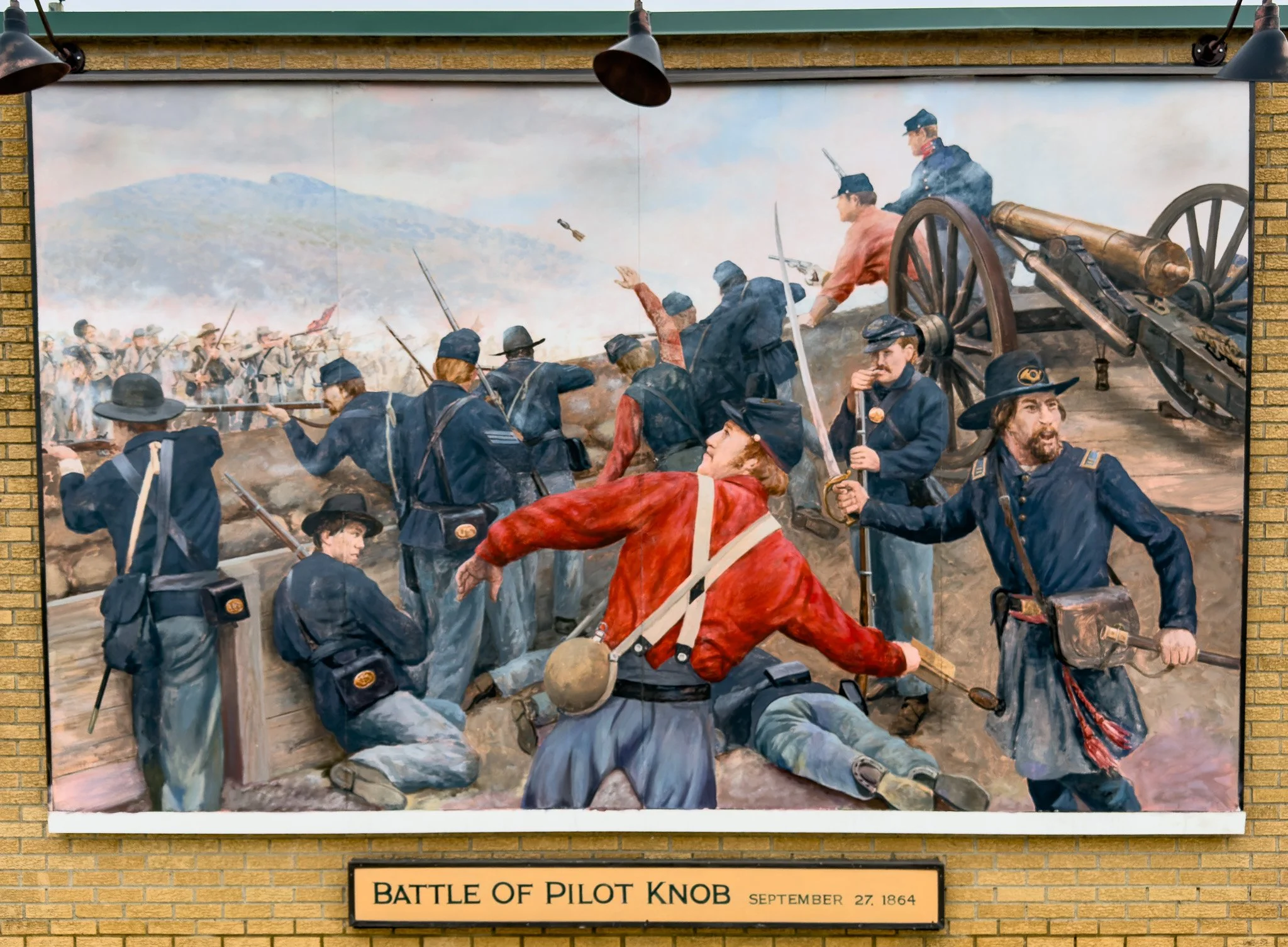
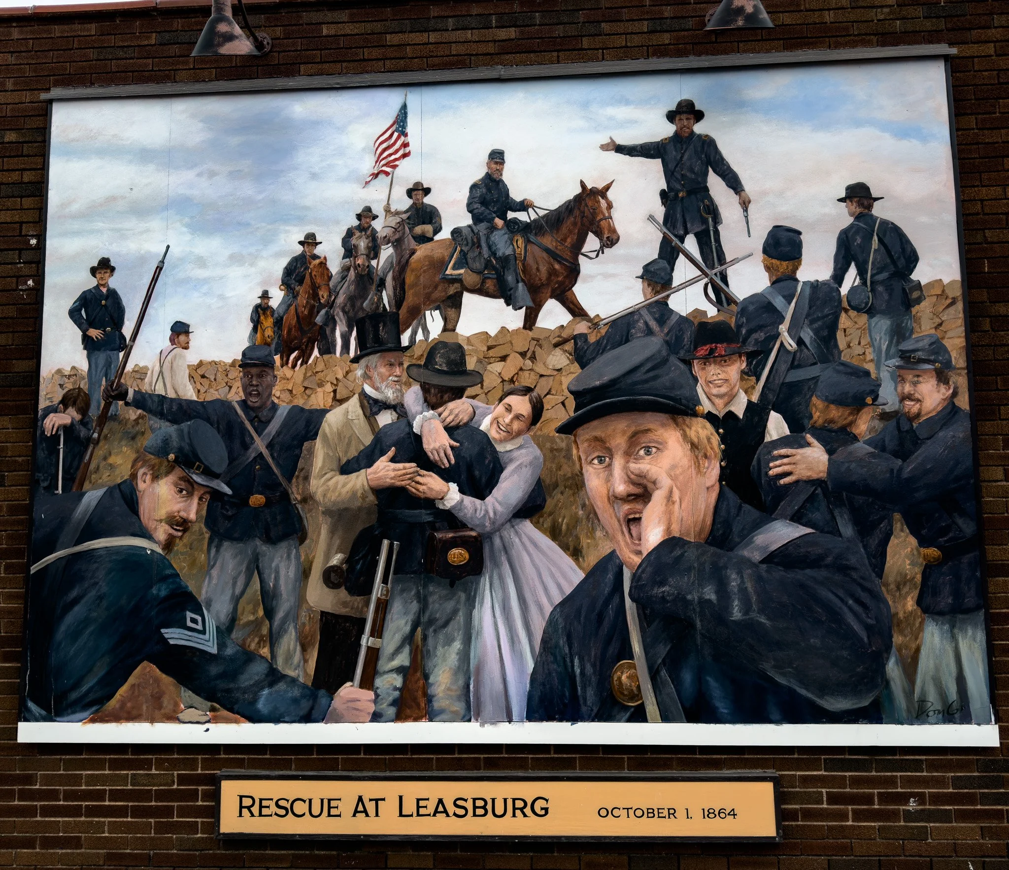
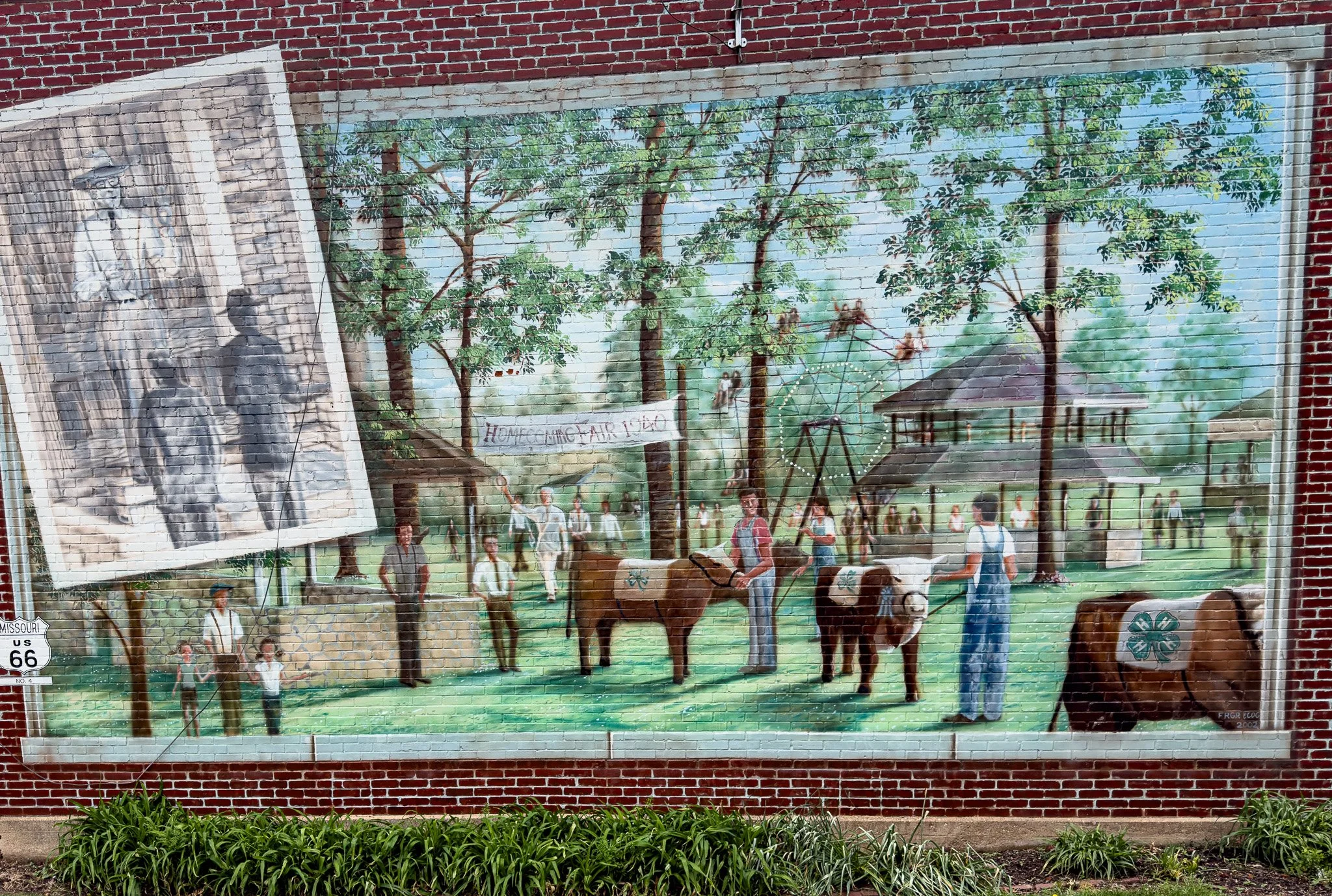
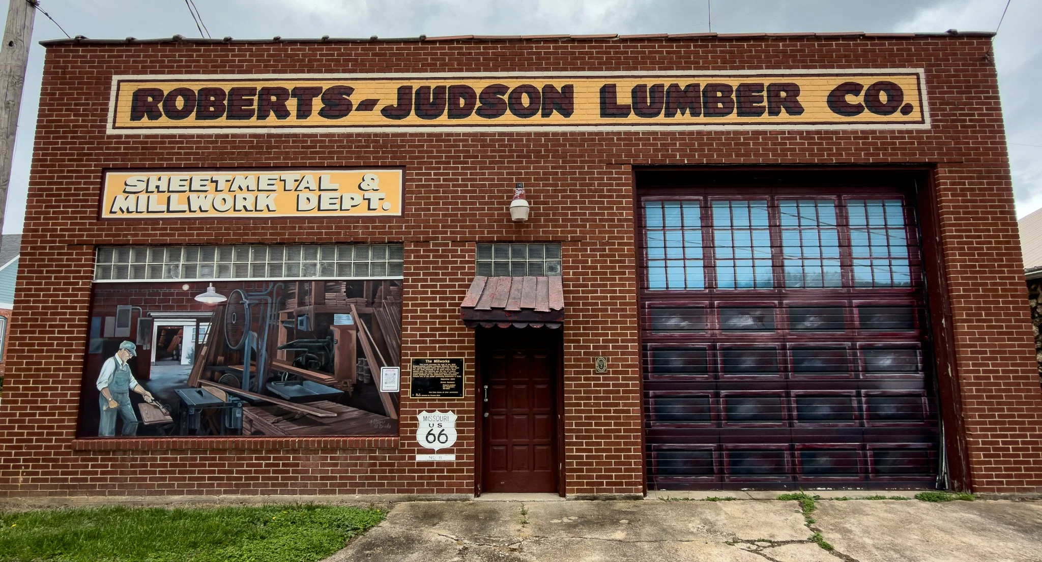
Cuba, MO is another town along the route that takes great pride in their many rather elaborate murals.
Despite all our research, I don’t think we ever expected to see the number of murals we have seen on this trip. Here are a few from Cuba.
Click on Image for Map.
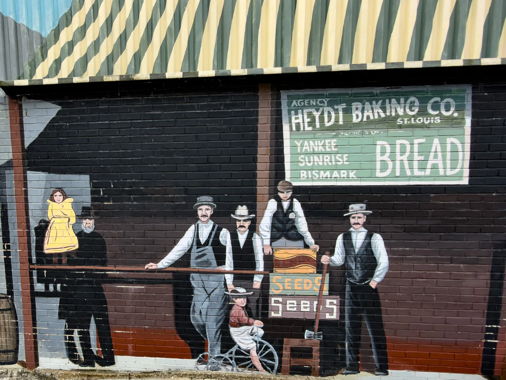
This is entirely painted on a wall which has no building behind it. It may once have been the front of an actual building, but now it is just the facade and everything you see is just painted on a flat wall. Behind this wall is just an empty lot.
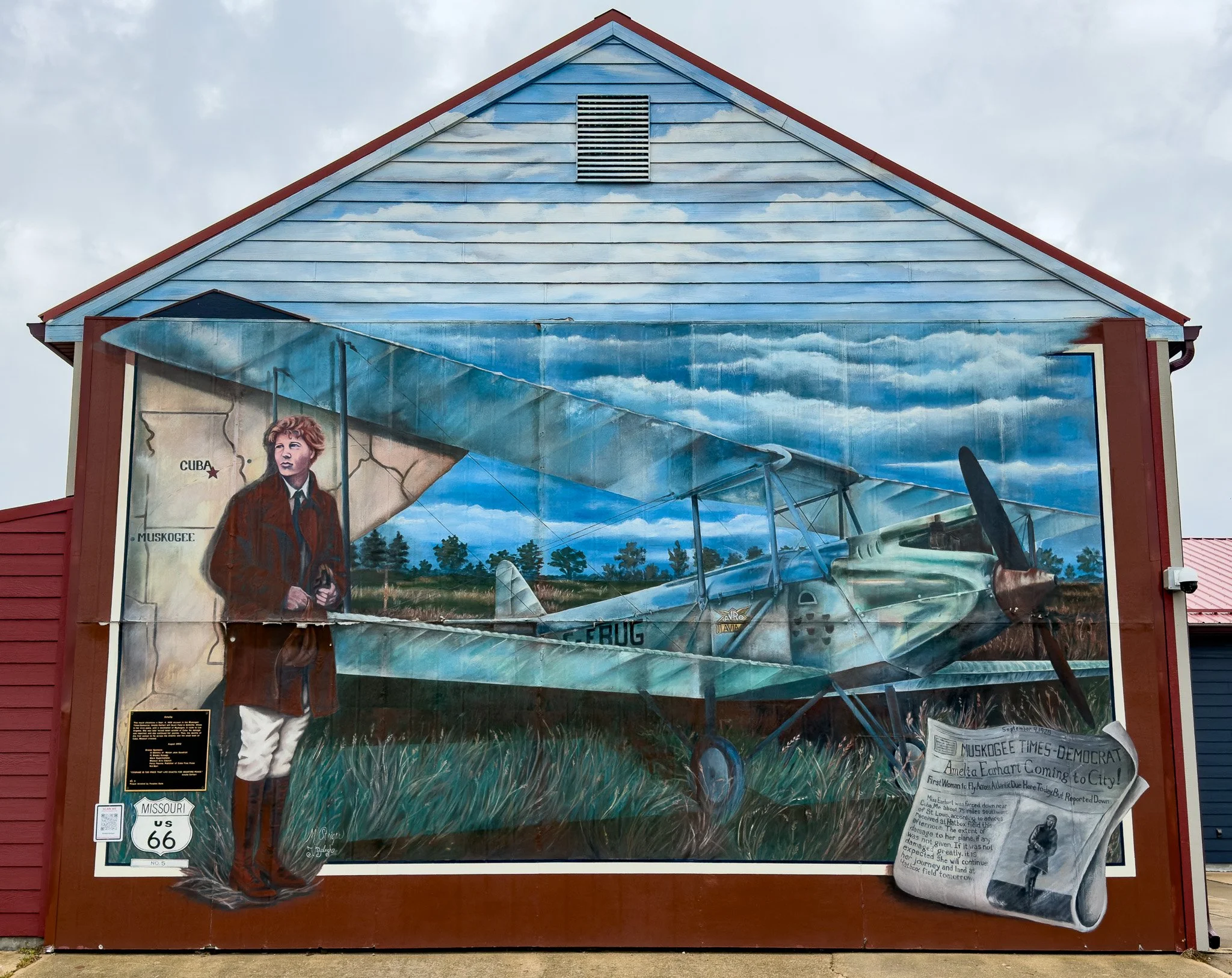
From ChatGPT:
Amelia Earhart’s brief connection to Cuba, Missouri, dates to September 4, 1928, when she made a forced landing in a field just outside town during a flight west from Illinois. Finding no serious damage to her Avro plane, she soon continued on her journey. Today, the stop is commemorated by one of Cuba’s famous Route 66 murals.
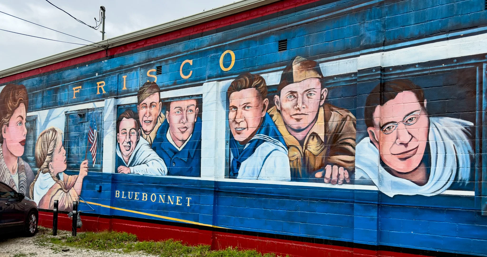
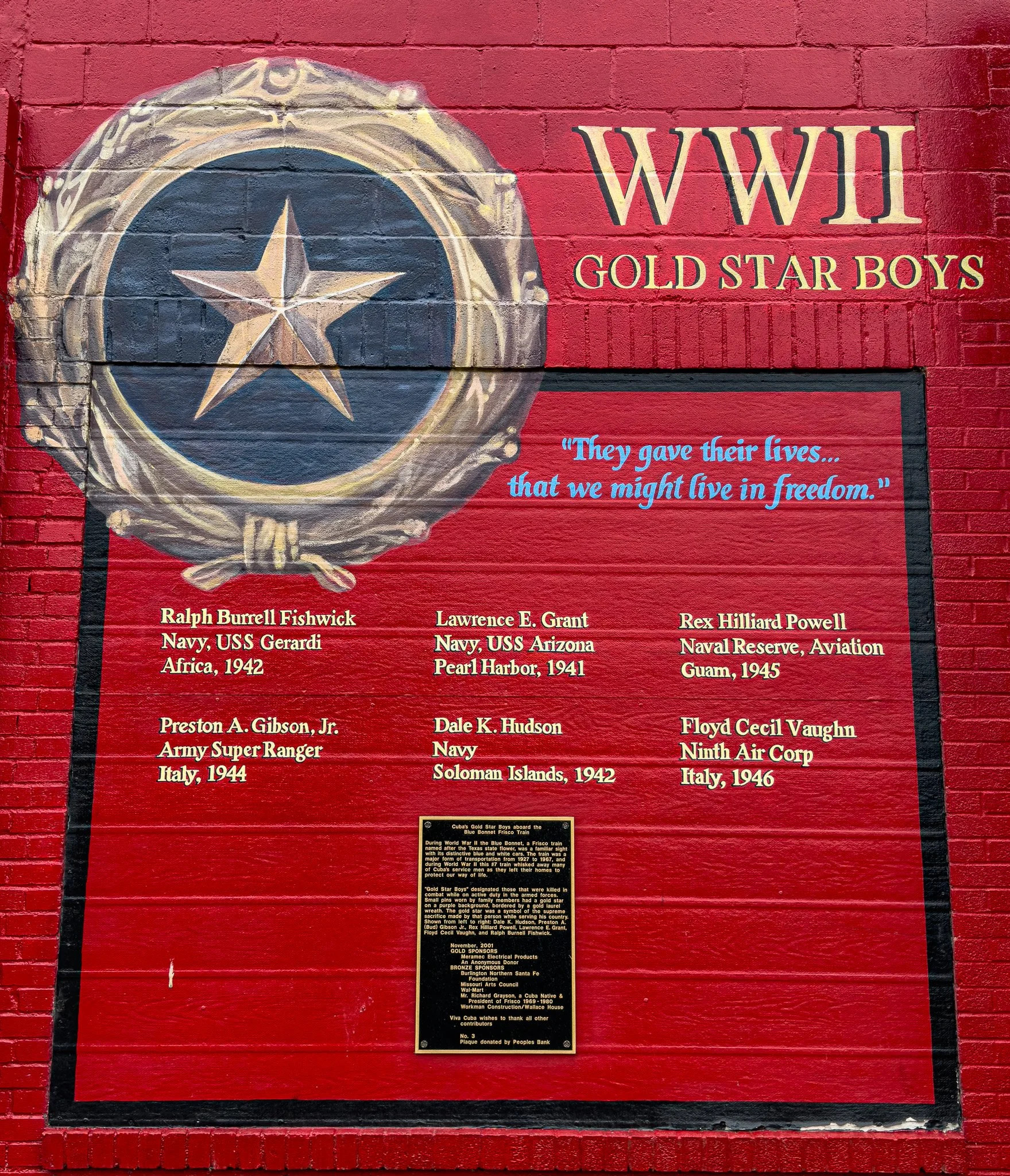
This mural depicts the six Cuba men who boarded a Frisco train to take part in World War II and never returned; all six died in the war. The next image gives their names, where they died and when.
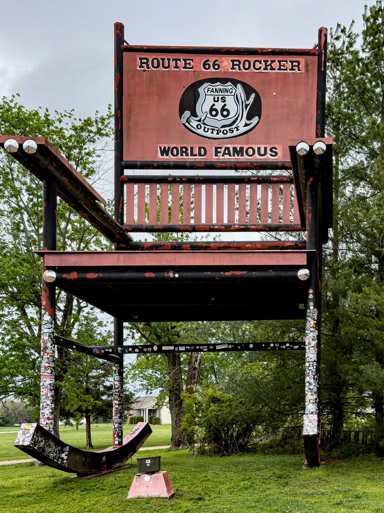
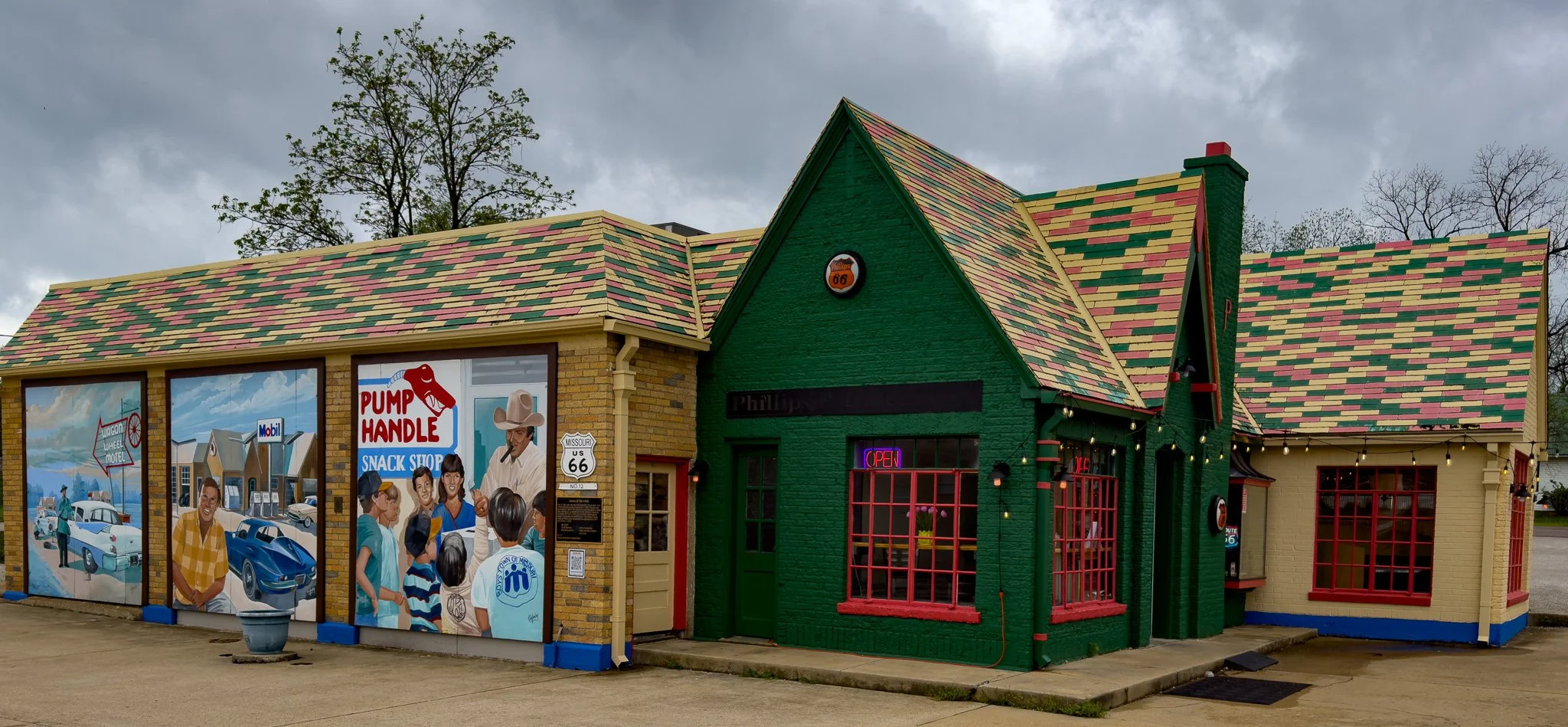
Next, we stopped at the Fanning 66 Outpost to visit this giant rocking chair.
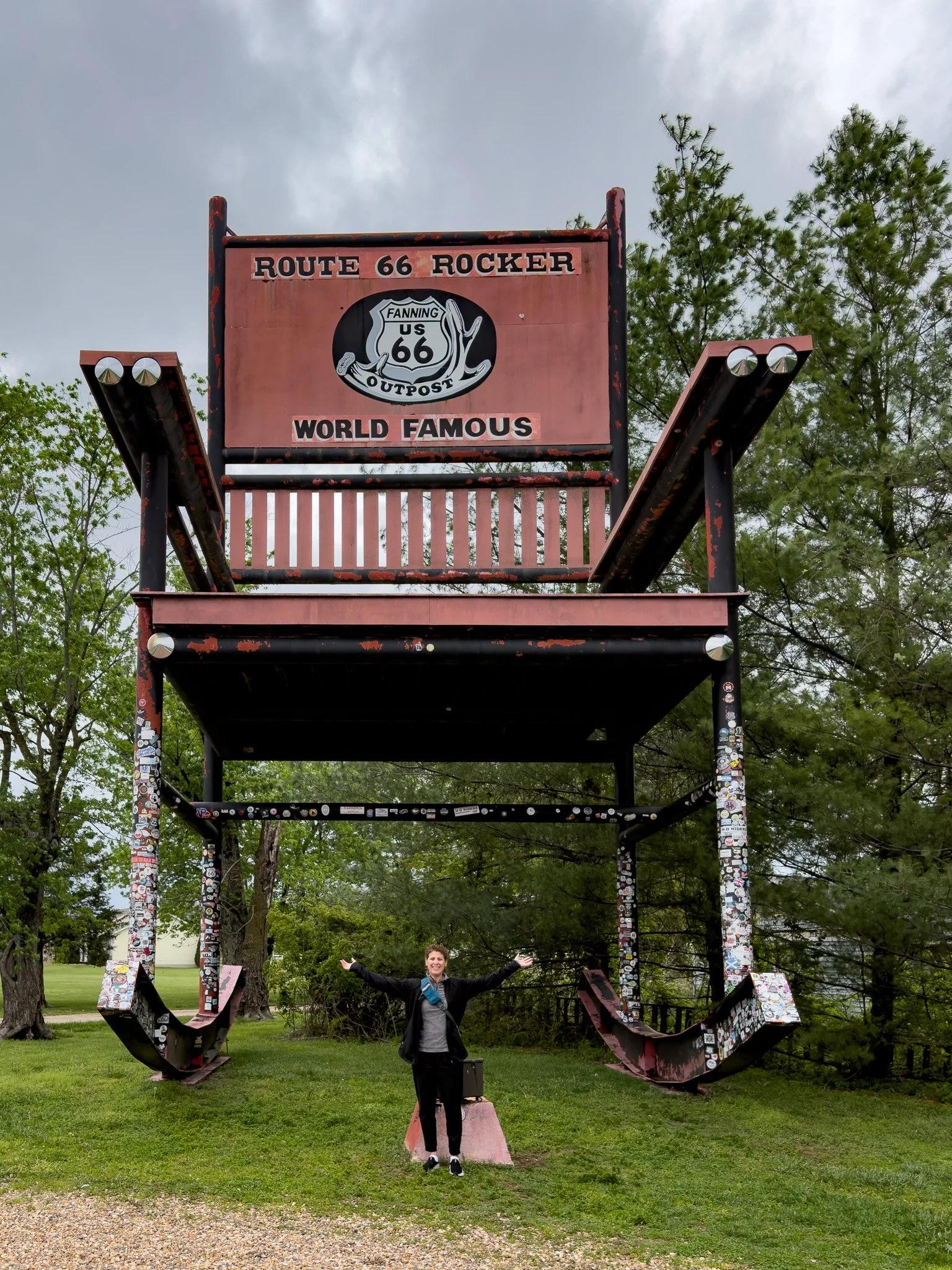
With Lisa in the photo you can get a better idea of scale.
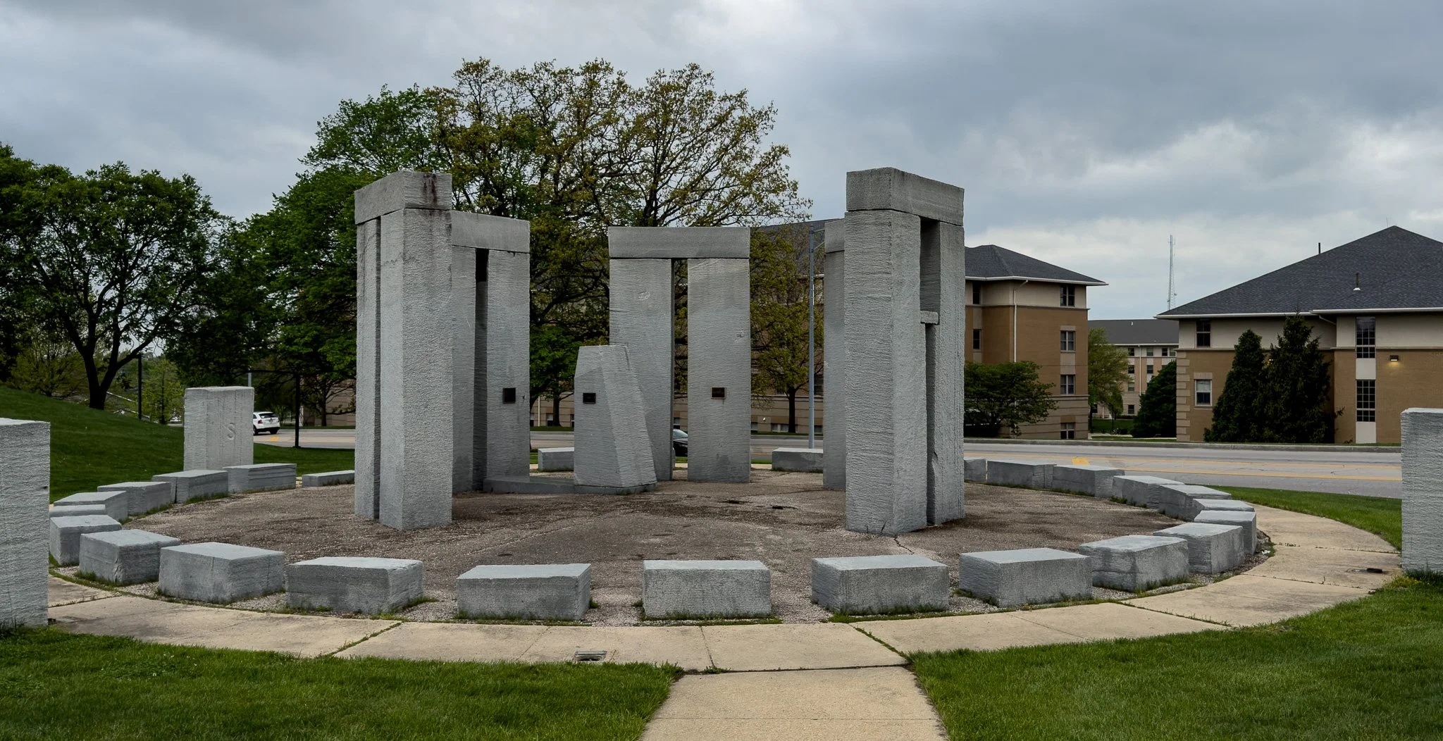
Stonehenge replica built on the campus of Missouri University of Science and Technology in Rolla, MO.
Click on Image for Map.
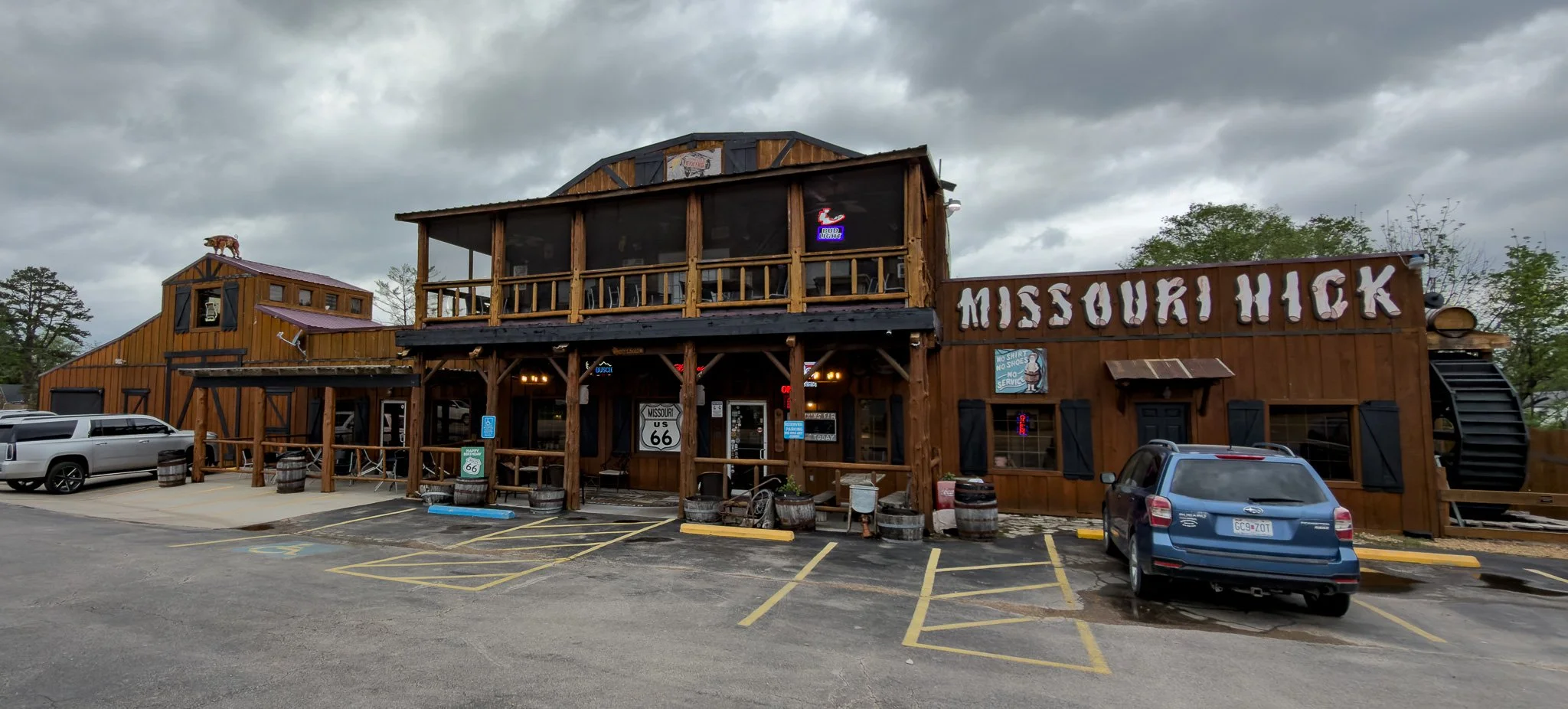
Dinner tonight HAD to be at a place called Missouri Hick BBQ.
Click on Image for Map.
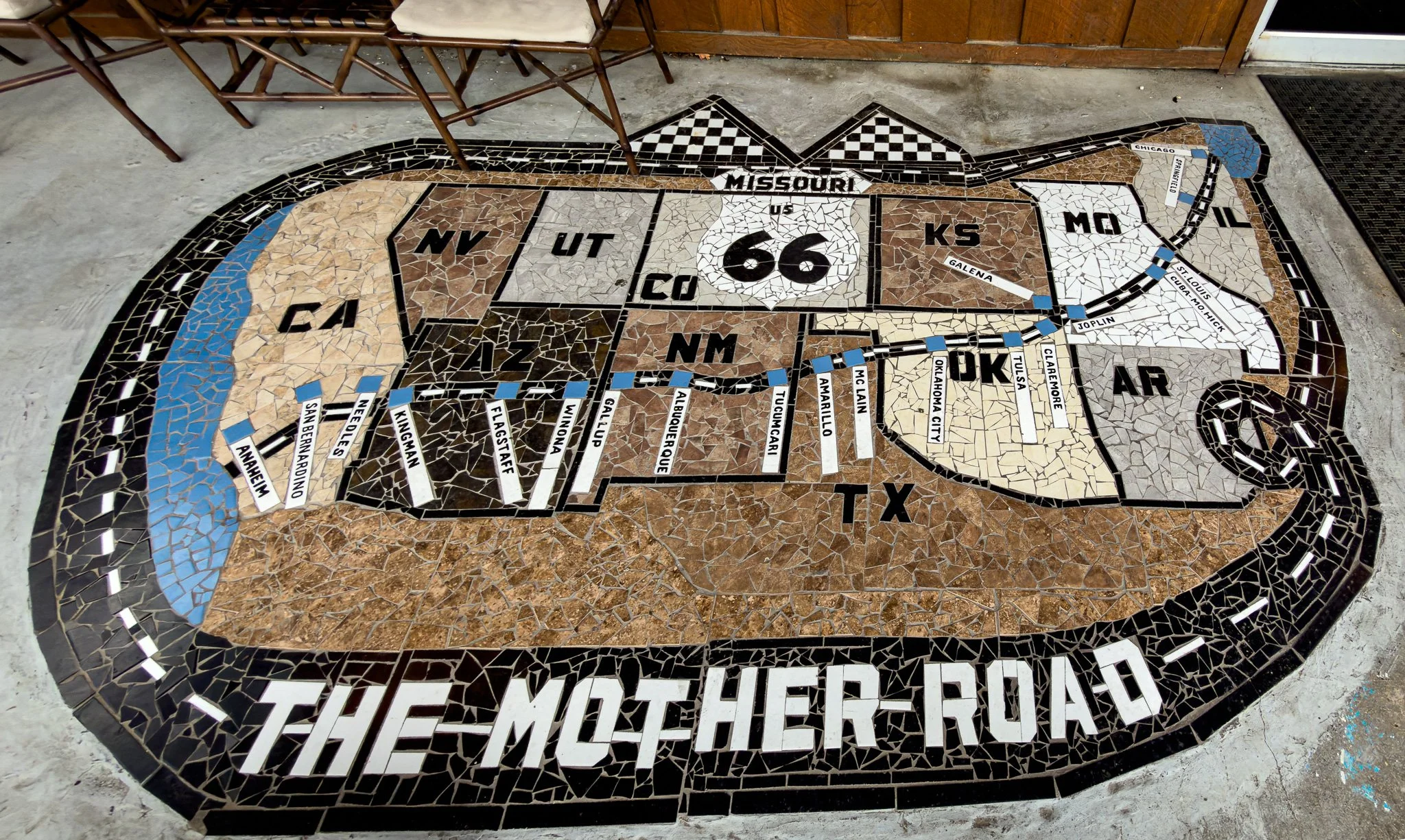
This “map” just outside the entrance to the Missouri Hick shows that despite being on day #5, we are still only way up on the top right.
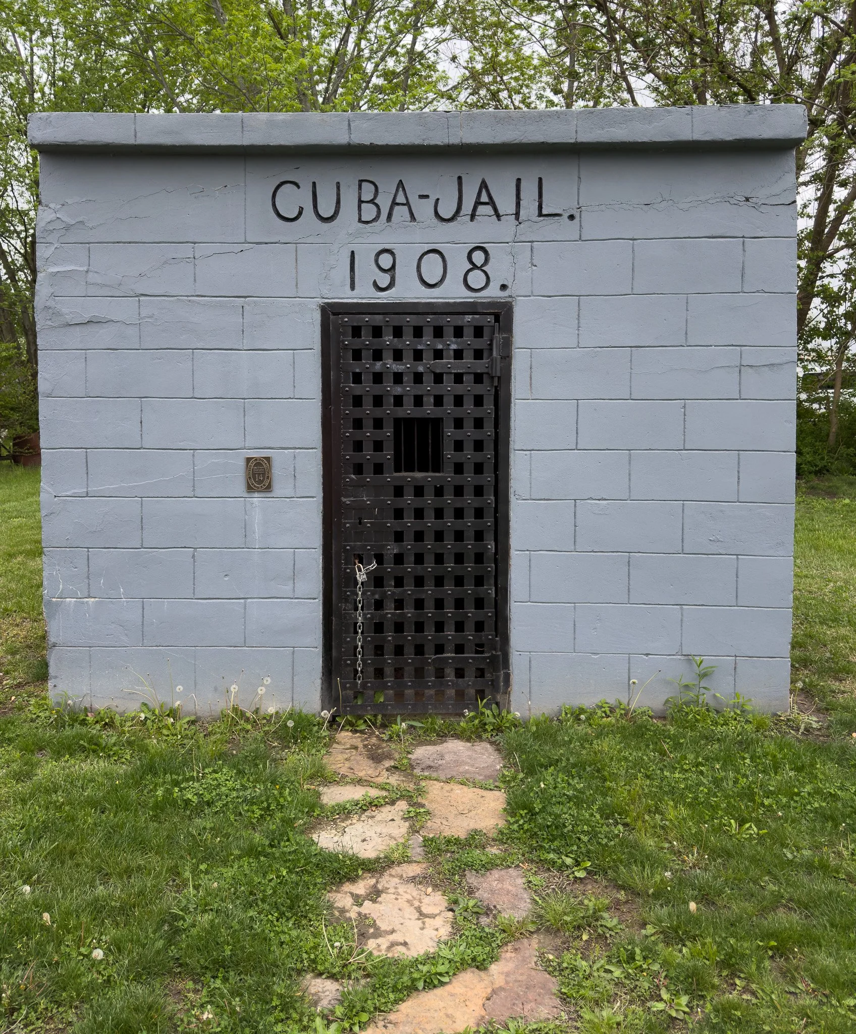
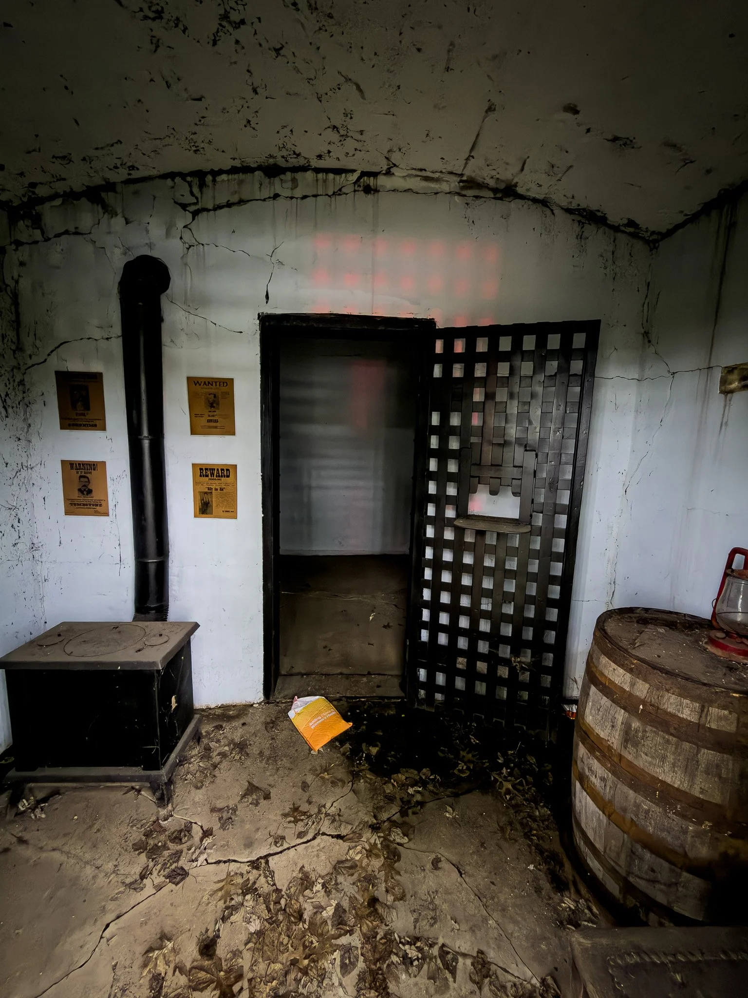
We may no longer be in Illinois, but we can still make time to visit another correctional facility!
Click on Image for map.